Việt Hưng
Việt Hưng Ward
Phường Việt Hưng | |
|---|---|
| Country | |
| Region | Red River Delta |
| Municipality | Hà Nội |
| Establishment | 1948 (commune) November 6, 2003 (ward) |
| Central hall | No.1, Vạn Hạnh Street, Việt Hưng Ward[1] |
| Government | |
| • Type | Ward-level authority |
| • People Committee's Chairman | Vũ Xuân Trường[1] |
| • People Council's Chairman | Đường Hoài Nam[1] |
| • Front Committee's Chairman | Nguyễn Trường Giang[1] |
| • Party Committee's Secretary | Đường Hoài Nam[1] |
| Area | |
• Total | 12.91 km2 (4.98 sq mi) |
| Population (July 1, 2025)[1] | |
• Total | 83,188 |
| • Density | 6,400/km2 (17,000/sq mi) |
| • Ethnicities | Kinh Tanka Others |
| Time zone | UTC+7 (Indochina Time) |
| ZIP code | 10000–11806[note 1] |
| Climate | Cwa |
| Website | Viethung.Hanoi.gov.vn Viethung.Hanoi.dcs.vn |
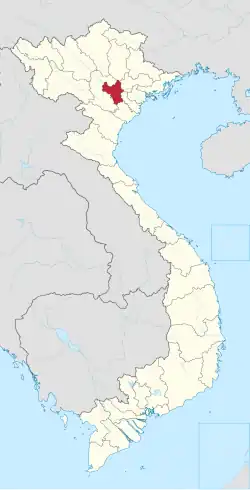
Việt Hưng [viə̰ʔt˨˩:hɨŋ˧˧] is a suburban ward of Hanoi the capital city in the Red River Delta of Vietnam.[2]
Geography
Demography
According to the statistical yearbook of the whole Hanoi, as of 2025 Việt Hưng Ward had a demography of 83,188.[1] Besides, the population of the whole ward is fully registered as Kinh people.
Climate
| Climate data for Việt Hưng Ward | |||||||||||||
|---|---|---|---|---|---|---|---|---|---|---|---|---|---|
| Month | Jan | Feb | Mar | Apr | May | Jun | Jul | Aug | Sep | Oct | Nov | Dec | Year |
| Record high °C (°F) | 33.3 (91.9) |
35.1 (95.2) |
37.2 (99.0) |
41.5 (106.7) |
42.8 (109.0) |
41.8 (107.2) |
40.8 (105.4) |
39.7 (103.5) |
37.4 (99.3) |
36.6 (97.9) |
36.0 (96.8) |
31.9 (89.4) |
42.8 (109.0) |
| Mean daily maximum °C (°F) | 19.8 (67.6) |
20.6 (69.1) |
23.2 (73.8) |
27.7 (81.9) |
31.9 (89.4) |
33.4 (92.1) |
33.4 (92.1) |
32.6 (90.7) |
31.5 (88.7) |
29.2 (84.6) |
25.7 (78.3) |
22.0 (71.6) |
27.6 (81.7) |
| Daily mean °C (°F) | 16.6 (61.9) |
17.7 (63.9) |
20.3 (68.5) |
24.2 (75.6) |
27.6 (81.7) |
29.3 (84.7) |
29.4 (84.9) |
28.7 (83.7) |
27.7 (81.9) |
25.3 (77.5) |
21.9 (71.4) |
18.3 (64.9) |
23.9 (75.0) |
| Mean daily minimum °C (°F) | 14.5 (58.1) |
15.8 (60.4) |
18.4 (65.1) |
21.9 (71.4) |
24.8 (76.6) |
26.4 (79.5) |
26.5 (79.7) |
26.1 (79.0) |
25.2 (77.4) |
22.8 (73.0) |
19.3 (66.7) |
15.8 (60.4) |
21.5 (70.7) |
| Record low °C (°F) | 2.7 (36.9) |
5.0 (41.0) |
7.0 (44.6) |
9.8 (49.6) |
15.4 (59.7) |
20.0 (68.0) |
21.0 (69.8) |
20.9 (69.6) |
16.1 (61.0) |
12.4 (54.3) |
6.8 (44.2) |
5.1 (41.2) |
2.7 (36.9) |
| Average rainfall mm (inches) | 22.5 (0.89) |
24.6 (0.97) |
47.0 (1.85) |
91.8 (3.61) |
185.4 (7.30) |
253.3 (9.97) |
280.1 (11.03) |
309.4 (12.18) |
228.3 (8.99) |
140.7 (5.54) |
66.7 (2.63) |
20.2 (0.80) |
1,670.1 (65.75) |
| Average rainy days | 9.5 | 11.4 | 15.9 | 13.7 | 14.6 | 14.8 | 16.6 | 16.5 | 13.2 | 9.7 | 6.8 | 5.2 | 147.9 |
| Average relative humidity (%) | 79.9 | 82.5 | 84.5 | 84.7 | 81.1 | 80.0 | 80.7 | 82.7 | 81.0 | 78.5 | 77.1 | 76.2 | 80.7 |
| Mean monthly sunshine hours | 68.7 | 48.1 | 45.5 | 87.4 | 173.7 | 167.0 | 181.1 | 163.0 | 162.4 | 150.3 | 131.6 | 113.0 | 1,488.5 |
| Source 1: Vietnam Institute for Building Science and Technology[3] | |||||||||||||
| Source 2: Extremes[a] | |||||||||||||
See also
Wikimedia Commons has media related to Việt Hưng.
Notes and references
Notes
- ^ An official code from December 31, 2023, to present.
References
- ^ a b c d e f g Việt Hưng Ward : Detailed information after arrangement (vi)
- ^ Which old administrative units are Việt Hưng Ward formed through the merger ? (vi)
- ^ "Vietnam Institute for Building Science and Technology" (PDF).
- ^ "Hà Nội nóng kỷ lục 41.5 độ". DanViet.vn (in Vietnamese). Archived from the original on 3 June 2017. Retrieved 4 June 2017.
- ^ "Thông báo và dự báo khí hậu tháng 10–11–12 năm 2019" (PDF). Imh.ac.vn (in Vietnamese). Archived (PDF) from the original on 5 August 2022. Retrieved 6 August 2022.
- ^ "Thì Tiết Hà Nội". Nchmf.gov.vn (in Vietnamese). Archived from the original on 29 September 2018. Retrieved 30 September 2018.
- ^ "Việt Nam niên giám thống kê" (PDF). Southeast Asian Development. Archived from the original (PDF) on 10 May 2021. Retrieved 24 May 2022.
- ^ The Yearbook of Indochina (1932–33)
Further reading
Bibliography
- George Coedes. The Making of South East Asia, 2nd ed. University of California Press, 1983.
- Trần Ngọc Thêm. Cơ sở văn hóa Việt Nam (The Foundation of Vietnamese Culture), 504 pages. Publishing by Nhà xuất bản Đại học Tổng hợp TPHCM. Saigon, Vietnam, 1995.
- Philippe Papin, Histoire de Hanoï, Fayard, Paris, 2001.
- Trần Quốc Vượng, Tô Ngọc Thanh, Nguyễn Chí Bền, Lâm Mỹ Dung, Trần Thúy Anh. Cơ sở văn hóa Việt Nam (The Basis of Vietnamese Culture), 292 pages. Re-publishing by Nhà xuất bản Giáo Dục Việt Nam & Quảng Nam Printing Co-Ltd. Hanoi, Vietnam, 2006.
- Li Tana (2011). Jiaozhi (Giao Chỉ) in the Han period Tongking Gulf. In Cooke, Nola ; Li Tana ; Anderson, James A. (eds.). The Tongking Gulf Through History. University of Pennsylvania Press. pp. 39–44. ISBN 9780812205022.
- Tập bản đồ hành chính Việt Nam (Vietnamese Administrative Maps), Nhà xuất bản Tài nguyên – Môi trường và Bản đồ Việt Nam, Hà Nội, 2013.
- Li Tana, Towards an environmental history of the Eastern Red River Delta, Vietnam, c.900–1400, Journal of Southeast Asian Studies, 2014.
- Samuel Baron, Christoforo Borri, Olga Dror, Keith W. Taylor (2018). Views of Seventeenth-Century Vietnam : Christoforo Borri on Cochinchina and Samuel Baron on Tonkin. Cornell University Press. ISBN 978-1-501-72090-1.
- The Birth of Vietnam : Sino-Vietnamese Relations to the Tenth Century and the Origins of Vietnamese Nationhood. University of Michigan Press. 1976.
- Taylor, Keith Weiler (1983). The Birth of Vietnam. Berkeley, California: University of California Press. doi:10.2307/jj.8501140. ISBN 978-0-52007-417-0. JSTOR jj.8501140. LCCN 81011590. OCLC 1131176955. S2CID 265239427.
- Taylor, K. W.; Whitmore, John K., eds. (1995). Essays Into Vietnamese Pasts. Ithaca, New York: Cornell University Southeast Asia Program. doi:10.7591/9781501718991. ISBN 978-0-87727-718-7. JSTOR 10.7591/j.ctv1nhmtn. OCLC 1091450831.
- Borri, Christoforo; Baron, Samuel (2006). Views of Seventeenth-Century Vietnam : Christoforo Borri on Cochinchina and Samuel Baron on Tonkin. Ithaca, New York: Cornell University Press. doi:10.7591/9781501720901. ISBN 978-0-87727-771-2. JSTOR 10.7591/j.ctv3s8qt9. LCCN 2009280899. OCLC 1262600216. S2CID 160903627.
- Taylor, K. W. (2013). A History of the Vietnamese. Cambridge: Cambridge University Press. doi:10.1017/CBO9781139021210. ISBN 978-1-107-24435-1. LCCN 2012035197. OCLC 843761714. S2CID 161759966.
- Pierre Asselin, Pierre Brocheux, Christopher E. Goscha, Pierre Grosser, Annick Guénel, François Guillemot, Andrew Hardy, Michel Hoàng, Pierre Journoud, Anne Marie Moulin, Philippe Papin, Emmanuel Poisson, Dominique Rolland, Hugues Tertrais, Benoît de Tréglodé..., Le Viêt-Nam depuis 2000 ans, De La Republique Eds, Paris, 2017.
External links
- Hanoi province and its subdivisions
- Dự kiến tên gọi các phường–xã được thành lập ở Hà Nội
- Trao quyết định về công tác cán bộ tại phường Việg Hưng
| Wards (51) |
|  |
|---|---|---|
| Communes (75) |
| |