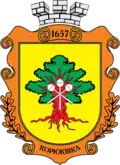
Koriukivka urban hromada
Koriukivka urban hromada
Корюківська міська громада | |
|---|---|
 Coat of arms | |
| Country | |
| Oblast | |
| Raion | |
| Area | |
• Total | 1,172.6 km2 (452.7 sq mi) |
| Population (2023) | |
• Total | 13,604 |
| • Density | 12/km2 (30/sq mi) |
| Settlements | 64 |
| 1 |
| 63 |
| Website | koryukivka-rada |
Koriukivka urban territorial hromada (Ukrainian: Корюківська міська територіальна громада, romanized: Koriukivska miska terytorialna hromada) is one of the hromadas of Ukraine, located within Koriukivka Raion in Chernihiv Oblast. Its administrative centre is the city of Koriukivka.[1]
The total area of the hromada is 1,172.6 km2 (452.7 sq mi),[1] and the population is 13,604 (as of 2023).[2]
The hromada was originally established as an amalgamated hromada on 18 December 2016, before being expanded to its current size in 2020 as part of decentralisation in Ukraine.[3]
Composition
In addition to one city (Koriukivka), the hromada includes 63 villages:[4]
- Andronyky
- Baliasy
- Beshkivka
- Biloshytska Sloboda
- Bohdalivka
- Brech
- Buda
- Budyshche
- Burkivka
- Domashlyn
- Hurynivka
- Hutyshche
- Kostiantynivka
- Kostiuchky
- Kuhuky
- Kyrylivka
- Lebiddia
- Lisove
- Lubenets
- Lukovets
- Lupasove
- Maibutnie
- Makhovyky
- Naumivka
- Nova Buda
- Nova Hurynivka
- Novoselivka
- Okhramiievychi
- Oleksandrivka
- Oliinyky
- Ozeredy
- Parastovske
- Peredil
- Pereliub
- Petrova Sloboda
- Pisky
- Prybyn
- Reimentarivka
- Romanivska Buda
- Rudnia
- Rybynsk
- Sakhutivka
- Samotuhy
- Samsonivka
- Savynky
- Sosnivka
- Spychuvate
- Stopylka
- Siardyne
- Telne
- Trudovyk
- Turivka
- Tiutiunnytsia
- Khovdiivka
- Khotiivka
- Shyshka
- Shyshkivka
- Verkholissia
- Volovyky
- Vysoke
- Zabarivka
- Zaliaddia
- Zhuravleva Buda
And 2 rural-type settlements: Dovha Hreblia and Holubivshchyna.[4]
Geography
Koriukivka urban hromada is located in the northern part of Chernihiv Oblast, occupies the northeastern part of the Koriukivka Raion. It borders with Novgorod-Siverskyi raion of Chernihiv Oblast and in the north with Russia. The total area of the district is 13.60 km2.[5][6]
The area of the raion is located within the Dnieper Lowland. The relief of the surface of the district is a lowland, slightly undulating plain, sometimes dissected by river valleys. All rivers belong to the Dnieper basin. The left tributaries of the Desna River flow through the community, the largest river is Ubid.[7][8]
The climate of Koriukivka urban hromada is moderately continental, with warm summers and relatively mild winters. The average temperature in January is about -7°C, and in July - +19°C. The average annual precipitation ranges from 550 to 660 mm, with the highest precipitation in the summer period.[9][10]
The most common are sod-podzolic and gray forest soils. Koriukivka urban hromada is located in the natural zone of mixed forests, in Polissya. The main species in the forests are pine, oak, alder, ash, birch. Minerals – loam, sand.[5][6]
The hromada is home to the Bretsky botanical reserve.[11]
Economy
The hromadas agriculture specializes in growing grain, oilseed and industrial crops, and producing livestock products - milk, meat, eggs. The Koriukivka urban hromada has a developed woodworking industry and food industry.[12]
Transportation
Regional and state highways pass through the district. Highway H27 passes through the northeast part of the Koriukivka urban hromada. There are bus stations in Koriukivka.[13] A railway has been laid from Koriukivka to Bakhmach (Southwestern Railways), the Koriukivka station is the terminal on the dead-end line.[14]
See also
References
- ^ a b "Ніжинська територіальна громада" [Koriukivka territorial hromada]. decentralization.gov.ua (in Ukrainian). Retrieved 24 August 2023.
- ^ "Корюківська міська громада" [Koriukivka urban hromada]. gromada.info (in Ukrainian). Retrieved 24 August 2023.
- ^ "Корюківська міська об'єднана територіальна громада" [Koriuchkivka urban amalgamated territorial hromada]. decentralization.gov.ua (in Ukrainian). Archived from the original on 23 September 2021. Retrieved 24 August 2023.
- ^ a b "Склад громади" [Hromada composition]. decentralization.gov.ua (in Ukrainian). Retrieved 24 August 2023.
- ^ a b Чернігівська область. Географічний атлас. Серія «Моя мала Батьківщина» – 2003 р. ISBN 966-7620-39-5 Retrieved 13 July 2025.
- ^ a b "Візитна картка громади - Корюківська територіальна громада". koryukivka-rada.gov.ua. Retrieved 13 July 2025.
- ^ Білоус, М. Д. Географія Чернігівської області / М. Д. Білоус. — Чернігів: Ранок, 2010. — 144 с Retrieved 13 July 2025.
- ^ "Корюківський район". maps.visicom.ua (in Ukrainian). Retrieved 13 July 2025.
- ^ "Кліматичні характеристики". Сайт Чернігівського метеоцентра. Retrieved 13 July 2025.
- ^ "Характеристика району". chor.gov.ua (in Ukrainian). Retrieved 13 July 2025.
- ^ Grachev, A. "Природно-заповідний фонд України". pzf.land.kiev.ua (in Ukrainian). Retrieved 13 July 2025.
- ^ "Економічний профіль громади - Корюківська територіальна громада". koryukivka-rada.gov.ua. Retrieved 13 July 2025.
- ^ Потенціал економічного розвитку району Сайт Корюківська районна державна адміністрація Retrieved 13 July 2025.
- ^ "Залізнична станція КОРЮКІВКА". agrarii-razom.com.ua (in Ukrainian). Retrieved 13 July 2025.


