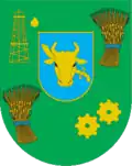
Sukhopolova rural hromada
Sukhopolova rural hromada
Сухополов'янська сільська громада | |
|---|---|
| Country | |
| Oblast | |
| Raion | |
| Area | |
• Total | 887.8 km2 (342.8 sq mi) |
| Population (2020) | |
• Total | 12,598 |
| • Density | 14/km2 (37/sq mi) |
| CATOTTG code | UA74080170000055617 |
| Settlements | 54 |
| 54 |
| Website | shp |
Sukhopolova rural hromada (Ukrainian: Сухополов'янська сільська громада) is a hromada of Ukraine, located in Pryluky Raion, Chernihiv Oblast. The Sukhopolova territorial hromada is located within the Dnieper Lowland. Its administrative center is the village of Sukhopolova.[1]
It has an area of 887.8 square kilometres (342.8 sq mi) and a population of 12,598, as of 2020.[2]
Composition
The hromada contains 54 settlements, which are all villages:[2]
- Bazhanivka
- Bileshchyna
- Bilorichitsa
- Borotba
- Borshna
- Valky
- Vysoke
- Hustinya
- Dymyrivka
- Didivtsi
- Yehorivka
- Zayzd
- Zamistya
- Zarudka
- Zaudaivske
- Znamianka
- Kanivshchyna
- Kapustentsi
- Kolisnyky
- Kroty
- Ladivshchyna
- Levky
- Lisove
- Lisovye Sorochyntsi
- Mazky
- Malkivka
- Manzhosivka
- Masivka
- Mykolaivka
- Milki
- Netiazhyno
- Nova Tarnavshchyna
- Onikiyivka
- Okhinky
- Perevolochna
- Petrivske
- Pirohivtsi
- Piddubivka
- Pohreby
- Pokrivka
- Polova
- Polohy
- Priozerne
- Pruchai
- Rudivka
- Ryashki
- Smosh
- Strelniki
- Sukhopolova
- Sukhostavets
- Sukhoyarivka
- Tarasivka
- Tyche
- Yarova Bileshchyna
Geography
The Sukhopolova territorial hromada is located in the south of Chernihiv Oblast. The territory of the hromada is located within the Dnieper Lowland. The relief of the hromadas surface is a lowland plain, in places dissected by river valleys. The Udai (Sula basin) and its tributaries flow through the Sukhopolova hromada, and there are about 40 ponds.[3][4]
The climate of Sukhopolova settlement hromada is moderately continental, with warm summers and relatively mild winters. The average temperature in January is about -7°C, and in July - +19°C. The average annual precipitation ranges from 550 to 660 mm, with the highest amount of precipitation in the summer period.[5][6]
The soil cover of the Sukhopolova settlement hromada is dominated by chernozem and podzolized soils. The hromada is located the forest steppe, on the Polesia. The forest cover of the community is 11.5%. The main species in the forests are pine, oak, alder, ash, and birch. The Pryluky Dendrological Park with an area of 11.9 hectares is located on the territory of the hromada. Minerals: oil, gas and sand.[7][8][4]
Economy
The leading sectors of the hromadas economy are agriculture, mining and food industry.[4]
Transportation
The national highway H07 Kyiv-Sumy-Yunakivka, the railway line Bakhmach-Pryluky, passes through the hromada.[9][8]
See also
References
- ^ Bida, Olesya (27 July 2020). Новое районирование Украины. Куда теперь ехать за справкой и как будут распределяться деньги [New zoning of Ukraine. Where to go now to get a certificate and how the money will be distributed]. Hromadske (in Russian). Retrieved 2023-10-10.
- ^ a b Децентралізація в Україні [Decentralization in Ukraine]. decentralization.gov.ua. Retrieved 2024-01-17.
- ^ Національний атлас України/НАН України, Інститут географії, Державна служба геодезії, картографії та кадастру; голов. ред. Л. Г. Руденко; голова ред. кол.Б.Є. Патон. — К.: ДНВП «Картографія», 2007. — 435 с. — 5 тис.прим. — ISBN 978-966-475-067-4. Retrieved 2025-07-09
- ^ a b c "Програма соціально-економічного розвитку Сухополов'янської сільської територіальної громади на 2022-2024 роки". shp-gromada.gov.ua (in Ukrainian). Retrieved 2025-07-11.
- ^ "Кліматичні характеристики". Сайт Чернігівського метеоцентра. Retrieved 2025-07-11.
- ^ Чернігівська область. Географічний атлас. Серія «Моя мала Батьківщина» – 2003 р. ISBN 966-7620-39-5 Retrieved 2025-07-09.
- ^ Білоус, М. Д. Географія Чернігівської області / М. Д. Білоус. — Чернігів: Ранок, 2010. — 144 с Retrieved 2025-07-11
- ^ a b Чернігівська область. Географічний атлас. Серія «Моя мала Батьківщина» – 2003 р. ISBN 966-7620-39-5 Retrieved 2025-07-11.
- ^ "Загальні відомості". pladm.cg.gov.ua (Офіційний сайт). Retrieved 2025-07-11.
Chernihiv Oblast hromadas (communities) | ||
|---|---|---|
Administrative center: Chernihiv | ||
| Chernihiv Raion |   | |
| Koriukivka Raion | ||
| Nizhyn Raion | ||
| Novhorod-Siverskyi Raion | ||
| Pryluky Raion | Ichnia · Ladan · Lynovytsia · Mala Divytsia · Parafiivka · Pryluky · Sribne · · Talalaivka · Varva · Yablunivka | |
Urban hromadas are marked in bold script. | ||