Anachów
Anachów
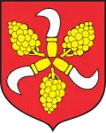
Dwór Anny | |
|---|---|
Village | |
 Anachów in 1937 | |
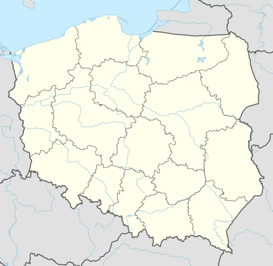 Anachów | |
| Coordinates: 50°17′52″N 17°53′54″E / 50.29778°N 17.89833°E | |
| Country | |
| Voivodeship | Opole |
| County | Prudnik |
| Gmina | Głogówek |
| Established | 19th century |
| Population (2019) | |
• Total | 0 |
| Time zone | UTC+1 (CET) |
| • Summer (DST) | UTC+2 |
| Postal code | 48-250[1] |
| Area code | +4877 |
| Vehicle registration | OPR |
Anachów [aˈnaxuf] (German: Annahof),[2] additional name: Dwór Anny,[3] is a village in the administrative district of Gmina Głogówek, within Prudnik County, Opole Voivodeship, south-western Poland.[4] It is situated in the historical region of Prudnik Land. It lies approximately 6 km (4 mi) south-east of Głogówek, 24 km (15 mi) east of Prudnik, and 42 km (26 mi) south of the regional capital Opole. The village is uninhabited.[5]
Geography
The village is located in the southern part of Opole Voivodeship, close to the Czech Republic–Poland border. It is situated in the historical Prudnik Land region, as well as in Upper Silesia. It lies in the Silesian Lowlands, on a slightly elevated part of the terrain. A road from Kazimierz to Kózki leads through Anachów.[6] The National Register of Geographical Names for 2025 classified Anachów as a hamlet (przysiółek) of Kazimierz.[3]
Etymology
In Topographisches Handbuch von Oberschlesien, published in 1865, Felix Triest noted the village's German name as Annavorwerk.[7] Until 1945, the name of the village was Annahof.[2]
Following the Second World War, the Polish name Kolonia Świętej Anny was introduced by the Commission for the Determination of Place Names. However, the name was not adopted by the local population, who instead called the village Anachów.[8] In August 2001, Gmina Głogówek decided to formally change the village's name to Anachów.[9] The new name was accepted by the government in 2003.[10] The village has an additional name of Dwór Anny.[3]
History
The village was established in the 19th century as a folwark belonging to Kazimierz. Meyers Gazetteer noted that there were 44 people living in Anachów.[11]
Following the Second World War, from March to May 1945, Prudnik County was controlled by the Soviet military commandant's office. On 11 May 1945, it was passed on to the Polish administration.[12] In the early 1950s, ten families lived in Anachów, including autochthonous Silesians, as well as Cracovians who settled here after the war. The residents began gradually leaving the village during the communist era, among other reasons due to the lack of a water supply.[13] In 1966, there were 35 people living in Anachów.[14]
In 2006, due to most houses being abandoned, thieves started frequenting the village.[15] It had 2 inhabitants in 2013.[16] Its last resident passed away in 2019. According to local press, the abandoned village of Anachów has a local reputation as a "haunted" place. Various alleged paranormal phenomena were reported to have occurred here.[6][17]
References
- ^ "Oficjalny Spis Pocztowych Numerów Adresowych" (PDF). Poczta Polska. January 2024. Archived from the original (PDF) on 2024-03-11.
- ^ a b Hanich, Andrzej (2021). Słownik nazw miejscowości diecezji opolskiej w XX i XXI wieku. Opole: Instytut Śląski. p. 93.
- ^ a b c Państwowy Rejestr Nazw Geograficznych – miejscowości – format XLSX, Place Names Register of Poland – PRNG, Head Office of Geodesy and Cartography, 15 August 2025, PRNG identifier: 555
- ^ "Główny Urząd Statystyczny" [Central Statistical Office] (in Polish). To search: Select "Miejscowości (SIMC)" tab, select "fragment (min. 3 znaki)" (minimum 3 characters), enter town name in the field below, click "WYSZUKAJ" (Search).
- ^ "Tych opolskich wsi już nie ma. Niektóre zostały zalane, inne podupadły. Jakie kryją tajemnice te miejscowości?". nto.pl (in Polish). Retrieved 2020-12-14.
- ^ a b "Ludzie mówią, że dzieją się tu dziwne rzeczy. "W tej wsi można kręcić horrory"". Nowa Trybuna Opolska (in Polish). 2025-06-26. Retrieved 2025-08-15.
- ^ Triest, Felix (1864–1865). Topographisches Handbuch von Oberschlesien. Breslau: Wilh. Gottl. Korn. p. 840. OCLC 315739117.
- ^ "Zmiana nazw". Tygodnik Prudnicki. Vol. 11, no. 694. 2004-03-17. p. 9.
- ^ "Formalne zmiany nazw". Tygodnik Prudnicki. Vol. 40, no. 567. 2001-10-11. p. 6.
- ^ Rozporządzenie Ministra Spraw Wewnętrznych i Administracji z dnia 24 grudnia 2003 r. w sprawie ustalenia i zmiany urzędowych nazw niektórych miejscowości (Dz.U. 2003 nr 229 poz. 2288).
- ^ "Kasimir 1)". meyersgaz.org. Retrieved 2025-08-15.
- ^ Dereń, Andrzej (2005-05-11). "Polska Ziemia Prudnicka". Tygodnik Prudnicki. Vol. 19, no. 754. Prudnik: Spółka Wydawnicza "Aneks". p. 8.
- ^ "Ludzie mówią, że dzieją się tu dziwne rzeczy. "W tej wsi można kręcić horrory"". Nowa Trybuna Opolska (in Polish). 2025-06-26. Retrieved 2025-08-15.
- ^ Ludność wiejska. Wyniki badania struktury ludności wsi z dnia 15 X 1966. Opole: Wojewódzki Urząd Statystyczny w Opolu. 1969. p. 34.
- ^ Strauchmann, Krzysztof (2008-10-05). "Przysiółek na sprzedaż". Nowa Trybuna Opolska (in Polish). Retrieved 2025-08-15.
- ^ Dereń, Andrzej (2014-01-08). "Jak wyludniła się Twoja miejscowość: sprzedam wieś pod Prudnikiem". Tygodnik Prudnicki. Vol. 2, no. 1202. Prudnik: Spółka Wydawnicza "Aneks". p. 11.
- ^ "Kiedyś były tu wsie, teraz nikt już tu nie mieszka. Po niektórych miejscowościach na Opolszczyźnie zostały tylko kamienie". Nowa Trybuna Opolska (in Polish). Retrieved 2025-08-15.