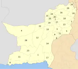
Sherani District
Sherani District
ضلع شیرانی شېراني ولسوالۍ شݔرانی دمگ Sheerani | |
|---|---|
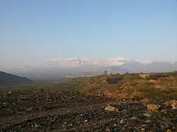 Sulaiman Mountains from Sherani District | |
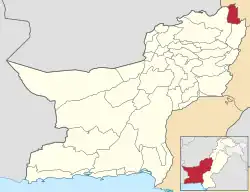 Map of Balochistan with Sherani District highlighted | |
| Country | |
| Province | |
| Division | Zhob |
| Established | 3 January 2006 |
| Headquarters | Sherani (town) |
| Government | |
| • Type | District Administration |
| • Deputy Commissioner | N/A |
| • District Police Officer | N/A |
| • District Health Officer | N/A |
| Area | |
• District of Balochistan | 4,310 km2 (1,660 sq mi) |
| Population (2023)[1] | |
• District of Balochistan | 191,687 |
| • Density | 44/km2 (120/sq mi) |
| • Urban | 0 |
| • Rural | 191,687 |
| Literacy | |
| • Literacy rate |
|
| Time zone | UTC+5 (PST) |
| Total voters | 31,837.(Harifal, 8728; Sherani, 23,109) |
| Number of Tehsils | 1 |
| Website | www.balochistan.gov.pk |
Sherani or Shirani (Urdu: ضلع شیرانی) is a rural district in the Zhob Division of Balochistan province in Pakistan.[3][4] The district lies within the Sulaiman mountain range, and its highest point is the Takht-e-Sulaiman at 3,487 metres (11,440 ft).
According to the 2023 census, it had a population of 191,687.[5] Notable villages in the district include (also known as Dargah), Karama, Zarkai Landawar, Shinghar, Tsappar Kili, and Manikhawa (Mani Kwa).
Administration
Before 2006, Sherani was a subdivision (sub-district) of Zhob district.[6] The new district was created on 3 January 2006.[7]
| Tehsil | Area
(km²)[8] |
Pop.
(2023) |
Density
(ppl/km²) (2023) |
Literacy rate
(2023)[9] |
Union Councils |
|---|---|---|---|---|---|
| Sherani Tehsil | 4,310 | 191,687 | 44.47 | 23.86% | 14 |
History
The Sherani tribe maintained significant autonomy and resisted external domination until the British Empire consolidated authority over the region. In the winter of 1890, the Khiderzai Expedition formally brought Sherani under British rule.[10]
Mountstuart Elphinstone (1779–1859),[11] a Scottish statesman and historian associated with the British government of India, visited the region in the early 19th century and said that the Shiranis were led by a "Neeka" who received an annual tax of one lamb and one calf from those who owned such animals.[12] The Neeka functioned as both a judge and a commander-in-chief, with his authority believed to be derived from the conviction that he was "Under the immediate guidance and protection of providence."
British occupation
The occupation of Apozai by the British Empire took place on 31 October 1890. By 13 November, all the principal points in Sherani were occupied. At Karama, a grand inquest was held into the conduct of the tribe and fines imposed, and the proceedings were terminated by a darbar, at which the submission of the tribe was formally received and rewards conferred upon the deserving.[13]
21st century
On 3 July 2022, a bus traveling from Rawalpindi to Quetta carrying 33 people fell into a ravine, killing at least 20 people and injuring 11 others near Sherani District.[14][15] It was the second major accident in a month. Earlier, on 8 June, a minivan crashed in Killa Saifullah District, killing 22 people. Rescue sources said that the bodies and injured were moved to Zhob and Mughal Kot.[16]
Geography
In the northeast of the Balochistan plateau, Zhob and Sherani Basin form an oval surrounded by mountains. Qais Abdul Rashid (575-661 A.D.),[17] who is believed to be one of the progenitors of the Pushtoons, lived in the Suleiman Mountains. Natives call the place where he is buried "Da Kase Ghar" (the mountain of Qais). In Pushto, "K" is used for "Q".
In 1883, with the consent of the chiefs of the Sherani tribe (the inhabitants of the range), a survey party under Major Holdich, R.E., ascended the mountain, accompanied by a military escort. They found the summit of the ridge to consist of a long valley between two high rims, covered with the Chilgoza, or Edible, Pine (Pinus gerardiana). At the north end of the western rim is the highest peak, known as Kaisa Ghar, 11,300 feet above sea level; at the south end of the eastern rim is the Takht, properly so called, 3,441 metres (11,060 feet) above sea level.[18]
Many legends attach to this place; one legend says Noah's Ark alighted here after the Deluge, while others connect it with King Solomon, whose throne alighted on this peak, which has ever since borne the name of Takht-i-Suleiman. Lofty ranges west of the Takht-i-Suleiman contain strata of the Liassic (lower Jurassic) and middle Jurassic (about 208 to 146 million years ago).[19]
In autumn 1897, a slight shock of an earthquake was felt in Sherani District, in which several houses in Ghurlama, Kacchi, Burkhurdar, and Pasta fell down. No human or livestock loss is on record.[20]
Demographics
| Year | Pop. | ±% p.a. |
|---|---|---|
| 1961 | 10,354 | — |
| 1972 | 25,384 | +8.49% |
| 1981 | 78,625 | +13.39% |
| 1998 | 81,684 | +0.22% |
| 2017 | 152,952 | +3.36% |
| 2023 | 191,687 | +3.83% |
| Sources:[21] | ||
According to the 1998 census, the recorded population of the district was 83,771, with 26,111 residing in Harifal and 57,660 in Sherani. The district is divided into seven union councils: Kapip, Manikwa, Dhanasir, Mughal Kot, Ahmedi Derga, Shinghar Harifal South, and Shinghar Harifal North.
The total number of voters in the district was 31,837, consisting of 17,535 male voters and 14,302 female voters.[22] Within Harifal, there were 8,728 voters, including 4,797 male voters and 3,931 female voters. In Sherani, there were 23,109 voters, with 12,738 male voters and 10,371 female voters.
As of the 2023 census, Sherani district has 36,100 households and a population of 191,687. The district has a sex ratio of 122.02 males to 100 females and a literacy rate of 23.86%: 31.53% for males and 15.02% for females. 75,400 (39.34% of the surveyed population) are under 10 years of age. The entire population lives in rural areas.[23] 636 (0.33% of the surveyed population) are religious minorities, nearly all Christians.[24] Pashto is the predominant language, spoken by 99.87% of the surveyed population.[1]
Villages
According to the 1998 census, there were 186 rural villages in Sherani district, though 16 of these were unpopulated.[25]
| Population of rural villages in Sherani district, according to the 1998 census.[25] | |||
|---|---|---|---|
| Number | Village Name | Population in 1998 | Households in 1998 |
| 1 | Abu Sar | 479 | 75 |
| 2 | Aghberga Ragha | 405 | 37 |
| 3 | Ahmdi Dirgha | 900 | 175 |
| 4 | Astashai | 1265 | 209 |
| 5 | Atatazai | 611 | 98 |
| 6 | China | 87 | 17 |
| 7 | Ghundi Adam Khan | 93 | 22 |
| 8 | Ghund Ser | 82 | 23 |
| 9 | Ghundi Kohna | 463 | 58 |
| 10 | Gurgur Chinah | 184 | 30 |
| 11 | Karim Kachh | 50 | 6 |
| 12 | Kori Wasta Qurieshi | 874 | 136 |
| 13 | Kori Wasta Yasinzai | 795 | 95 |
| 14 | Kothah | 371 | 45 |
| 15 | Kuram Abu Thal | 0 | 0 |
| 16 | Nawab Kot | 216 | 39 |
| 17 | Niazi Kot | 535 | 83 |
| 18 | Sanni Zai | 186 | 36 |
| 19 | Sher Ghali | 1268 | 134 |
| 20 | Shinah Kazhah | 388 | 46 |
| 21 | Surlakai | 1103 | 134 |
| 22 | Turjana | 395 | 61 |
| 23 | Wala Shol | 597 | 120 |
| 24 | Aghburgai | 435 | 50 |
| 25 | Killi Gul Muhammad | 545 | 75 |
| 26 | Killi Khan Alam | 3338 | 347 |
| 27 | Killi Pir Muhammad | 475 | 59 |
| 28 | Mandao | 655 | 84 |
| 29 | Mushken Bund | 118 | 17 |
| 30 | Raghsar Manglazi | 0 | 0 |
| 31 | Sharo | 673 | 67 |
| 32 | Spin Shah | 331 | 49 |
| 33 | Surabah | 0 | 0 |
| 34 | Tangi Perowezan | 785 | 104 |
| 35 | Aghburga Wah | 191 | 19 |
| 36 | Algazzai | 102 | 12 |
| 37 | Anghushtai | 235 | 38 |
| 38 | Besh Lawara | 1098 | 139 |
| 39 | Chashmaragh | 125 | 13 |
| 40 | Daglawara | 547 | 87 |
| 41 | Dahana Sar Post | 154 | 25 |
| 42 | Dori | 26 | 4 |
| 43 | Ghagra | 368 | 64 |
| 44 | Gharing | 421 | 74 |
| 45 | Gharyasa Tarozai | 185 | 38 |
| 46 | Ghazi | 0 | 0 |
| 47 | Ghozai | 0 | 0 |
| 48 | Ghurwandi Zarghovilla | 85 | 11 |
| 49 | Ghuryasa | 85 | 15 |
| 50 | Ghuryasi | 296 | 39 |
| 51 | Hasar | 492 | 62 |
| 52 | Hasarkai Lowara | 137 | 17 |
| 53 | Kazah | 121 | 15 |
| 54 | Khawaja Wahi | 295 | 41 |
| 55 | Lawara | 494 | 67 |
| 56 | Macharogai | 188 | 25 |
| 57 | Mukhwai | 108 | 21 |
| 58 | Pasta,Taki karmanzai | 89 | 20 |
| 59 | Promah | 142 | 21 |
| 60 | Ragha Sar | 354 | 52 |
| 61 | Sara Kohnah | 66 | 13 |
| 62 | Sari Lawara | 340 | 32 |
| 63 | Sera Raiz | 170 | 34 |
| 64 | Shauha | 456 | 71 |
| 65 | Soroi Kani | 441 | 66 |
| 66 | Sozai | 36 | 5 |
| 67 | Spin Lawara | 84 | 13 |
| 68 | Tor Bandanar | 261 | 25 |
| 69 | Torkani | 22 | 6 |
| 70 | Wila Shoi | 52 | 3 |
| 71 | Zar Gawah | 166 | 26 |
| 72 | Zerpan | 0 | 0 |
| 73 | Anzar Khezai | 1029 | 131 |
| 74 | Aspasta Aghburga | 2524 | 380 |
| 75 | Ghurlama | 860 | 132 |
| 76 | Ibrahim Zai/Sozai | 206 | 33 |
| 77 | Ibrahimzai | 280 | 41 |
| 78 | Kachhe | 358 | 35 |
| 79 | Kahol Tirkai Lihkwan | 279 | 62 |
| 80 | Kamal Zai | 568 | 77 |
| 81 | Khanki Jallat | 0 | 0 |
| 82 | Khankai karmanzai | 328 | 42 |
| 83 | Karama karmanzai | 941 | 87 |
| 84 | Lehar Chopper Khail | 1331 | 118 |
| 85 | Lehar Karmanzai | 872 | 101 |
| 86 | Manikhwa | 796 | 106 |
| 87 | Mobi Tjwar Khar | 185 | 16 |
| 88 | Mosai Aziz Khan | 944 | 59 |
| 89 | Pasta karmanzai | 709 | 115 |
| 90 | Ragha Mina | 757 | 75 |
| 91 | Rusta Wusta Wast(Spal) | 168 | 26 |
| 92 | Siratoi Mena | 282 | 43 |
| 93 | Tairi Karmanzai | 342 | 51 |
| 94 | Uzhdan | 391 | 42 |
| 95 | Walmai karmanzai | 513 | 82 |
| 96 | Warghari | 1205 | 123 |
| 97 | Zara Killa | 2344 | 348 |
| 98 | Zarina Monah | 160 | 33 |
| 99 | Ziandi Miloo | 797 | 51 |
| 100 | Bhambrat | 173 | 23 |
| 101 | Chajobi | 2069 | 222 |
| 102 | Chaudai | 90 | 12 |
| 103 | Chur Kandi | 174 | 43 |
| 104 | Daghalo Kazha | 110 | 12 |
| 105 | Domandi | 97 | 11 |
| 106 | Duglor Zor | 0 | 0 |
| 107 | Gahai | 190 | 22 |
| 108 | Hota | 106 | 8 |
| 109 | Ingashai Pan | 528 | 27 |
| 110 | Kachh Mina | 46 | 4 |
| 111 | Kajal Khail | 238 | 23 |
| 112 | Karamachah | 158 | 22 |
| 113 | Karezai | 131 | 24 |
| 114 | Kazha | 583 | 74 |
| 115 | Khawazha | 179 | 22 |
| 116 | Khozai | 60 | 15 |
| 117 | Laghre Kazha | 315 | 48 |
| 118 | Lakai | 0 | 0 |
| 119 | Landai | 191 | 18 |
| 120 | Lio Band | 183 | 18 |
| 121 | Loghai Mena | 0 | 0 |
| 122 | Loi Raghah | 642 | 69 |
| 123 | Manah | 109 | 13 |
| 124 | Mankai | 48 | 8 |
| 125 | Mehrapai | 328 | 50 |
| 126 | Mir Ali Khail | 452 | 63 |
| 127 | Mughal Kot | 705 | 76 |
| 128 | Mughal Kot Malitia | 0 | 0 |
| 129 | Munga | 14 | 4 |
| 130 | Oshe Wasta | 357 | 25 |
| 131 | Ragha Karigran | 910 | 83 |
| 132 | Sarokai | 525 | 74 |
| 133 | Ser Qund | 233 | 28 |
| 134 | Serraggha | 483 | 66 |
| 135 | Sharun | 355 | 54 |
| 136 | Shen Narai | 86 | 13 |
| 137 | Shen Urmezai | 200 | 31 |
| 138 | Shenah Kohnah | 610 | 36 |
| 139 | Shenaki Kohnah | 540 | 108 |
| 140 | Shinah Pounga -I | 878 | 98 |
| 141 | Shinah Pounga-Ii | 0 | 0 |
| 142 | Shinalandai | 1020 | 115 |
| 143 | Tarkha Bayan | 1010 | 89 |
| 144 | Terkey Bayan | 0 | 0 |
| 145 | Tor Ghandi | 1086 | 177 |
| 146 | Tor Ragha | 327 | 41 |
| 147 | Tor Saman Zoi | 406 | 71 |
| 148 | Tora Murgha | 304 | 57 |
| 149 | Tungi Kohnah | 556 | 49 |
| 150 | Turwa Phail | 0 | 0 |
| 151 | Zara Kazha | 359 | 28 |
| 152 | Zebai Sar | 314 | 38 |
| 153 | Abrahim Khail | 917 | 152 |
| 154 | Arund Bund Munglzai | 289 | 62 |
| 155 | Babkow Zai | 466 | 77 |
| 156 | Behlol | 2020 | 205 |
| 157 | Daryakhan Zai | 1361 | 139 |
| 158 | Dwala Garh | 688 | 142 |
| 159 | Haudakai | 522 | 60 |
| 160 | Hurm Zai | 588 | 63 |
| 161 | Kachh Mulanica | 442 | 83 |
| 162 | Kazha Malizai | 1058 | 100 |
| 163 | Kot Mallezai | 480 | 82 |
| 164 | Lalukzai | 275 | 32 |
| 165 | Landai | 161 | 26 |
| 166 | Lor Khadazai | 408 | 85 |
| 167 | Malik Jankaz Khudazai | 641 | 118 |
| 168 | Pahlan | 193 | 30 |
| 169 | Phezai | 357 | 54 |
| 170 | Pustah | 0 | 0 |
| 171 | Ragha Surankan | 566 | 67 |
| 172 | Shah Umarzai | 137 | 20 |
| 173 | Sharn/Pai Mohammad | 139 | 28 |
| 174 | Shin Kowai | 244 | 29 |
| 175 | Shina Landai | 1473 | 154 |
| 176 | Shingar Hassanzai | 308 | 32 |
| 177 | Showangai | 93 | 15 |
| 178 | Shubkai Menzai | 375 | 66 |
| 179 | Shucha | 0 | 0 |
| 180 | Soor Ghar | 74 | 6 |
| 181 | Spinah | 286 | 41 |
| 182 | Sumezai | 829 | 103 |
| 183 | Tora Murgha | 140 | 19 |
| 184 | Trai Malazai | 404 | 55 |
| 185 | Zama | 242 | 33 |
| 186 | Zor Khar | 776 | 119 |
Education
Balochistan is the least literate province of Pakistan, with a literacy rate of 37% (20% for women), compared to 54% nationally. The lack of secular education is more noticeable in Balochistan than in any other province, with 50% of children compelled to attend religious schools. The national budget for the MRA (Ministry of Religious Affairs) is around 1.2 billion rupees, whilst the secular education ministry is allocated 200 million.[26]
There is only one intermediate college in the entire district,[27] with 19 teachers and 70 students, and four high schools with 67 teachers, insufficient for the thousands of boys aspiring to admission. All four high schools and the college are located in the sherani area, none in Harifal. Similarly, only eight middle-standard boys' schools with 263 enrolled students and 102 teachers exist in the whole district.[28]
Though no authentic figures of female literacy rate are available, even rudimentary guesses make the female literacy rate not more than 3%, while the male rate, as reported by the NCHD is about 18%. 76 schools are working with one teacher and one room without any shelter.[29] There are five registered Seminaries and five private Schools. The NCHD is running five feeder Schools. Teachers in these private schools work in a quack fashion and use very crude methods of teaching, including bastinado-type caning on the hands. 83% of schools are without electricity, 45% are without a boundary wall, 50% are without a toilet, and 35% are without drinking water.
Flora
Aak in Urdu, Sodom's Apple or swallow-wort in English, karagh in Balochi, spelmai in Pashto (Calotropis procera), grows prolifically in Shinghar. It is deadly poison if eaten, as Alexander the Great discovered when his starving horses and cattle ate them on their long march back from the Indus through the Mekran.[30]
References
- ^ a b "7th Population and Housing Census: Population by Mother Tongue, Sex and Rural/Urban" (PDF). Pakistan Bureau of Statistics.
- ^ "Literacy rate, enrolments, and out-of-school population by sex and rural/urban, CENSUS-2023, BALOCHISTAN" (PDF).
- ^ "Welcome to Balochistan". Government of Balochistan. Archived from the original on 6 April 2009.
- ^ "Districts". Government of Balochistan. Archived from the original on 1 June 2013.
- ^ "Area, Population by Sex, Sex Ratio, Population Density, Urban Population, Household Size and Annual Growth Rate, Census-2023, Balochistan" (PDF). Pakistan Bureau of Statistics.
- ^ "Map of Subdistricts of Zhor District". Archived from the original on 10 February 2009.
- ^ "Sherani's woes". DAWN.COM. 22 April 2021. Retrieved 9 June 2022.
- ^ "TABLE 1 : AREA, POPULATION BY SEX, SEX RATIO, POPULATION DENSITY, URBAN POPULATION, HOUSEHOLD SIZE AND ANNUAL GROWTH RATE, CENSUS-2023, BALOCHISTAN" (PDF).
- ^ "LITERACY RATE, ENROLMENT AND OUT OF SCHOOL POPULATION BY SEX AND RURAL/URBAN, CENSUS-2023, BALOCHISTAN" (PDF).
- ^ Balochistan through the ages
- ^ Elphinstone, Mountstuart (1815). An Account of the Kingdom of Caubul, and Its Dependencies in Persia, Tartary, and India: Comprising a View of the Afghaun Nation, and a History of the Dooraunee Monarchy. Longman. p. 384 – via Internet Archive.
Hurreepaul.
- ^ Elphinstone, Mountstuart (1839). An Account of the Kingdom of Caubul, and Its Dependencies in Persia, Tartary, and India; Comprising a View of the Affghan Nation, and a History of the Douranee Monarchy.
- ^ Colonel Sir Robert Sandeman: his life and work on our Indian ...
- ^ "Bus falls into ravine in southwest Pakistan killing 19".
- ^ "At least 19 people killed as bus plunges into ravine in Balochistan". 3 July 2022.
- ^ "Bus crash kills 20 in southwest Pakistan". Reuters. Archived from the original on 13 October 2023. Retrieved 28 January 2025.
- ^ Makhzan-i-Afghani by Nemathullah
- ^ A Biography of Sir Robert Samdeman by Thomas Henry Thornton C.S.I., D.C.L., page 220
- ^ Gazetteer
- ^ Gazetteer vol I p82
- ^ "Population by administrative units 1951-1998" (PDF). Pakistan Bureau of Statistics.
- ^ ECP
- ^ "7th Population and Housing Census - Detailed Results: Table 1" (PDF). Pakistan Bureau of Statistics.
- ^ "7th Population and Housing Census - Detailed Results: Table 9" (PDF). www.pbscensus.gov.pk. Pakistan Bureau of Statistics.
- ^ a b "Sherani District Development Profile 2011" (PDF), Planning & Development Department, Government of Balochistan in Collaboration with UNICEF, pp. Annexure G, 18 July 2011, archived from the original (PDF) on 13 September 2014
- ^ "Balochistan: Pakistan's internal war". Green Left Weekly. 6 September 2016.
- ^ Liam, hoof (22 April 2021). "THE Sherani district was separated from Zhob back in 2006. It is home to two tribes – Harifal and Sherani. It has only one tehsil and 14 union councils for administrative purposes. The infrastructure is in a shambles owing to official neglect". Dawn News. p. 1. Retrieved 22 April 2021.
{{cite news}}: CS1 maint: url-status (link) - ^ NCHD Sherani.
- ^ Akbar, Muhammad. "Sherani District". ECE. UNESCO. Retrieved 12 June 2011.
- ^ The Tigers of Balochistan by Sylvia Matheson p65,66