Zhob District
Zhob District
ضلع ژوب ږوب ولسوالۍ | |
|---|---|
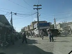  Top: Zhob Bazaar Bottom: Mountains near Zhob | |
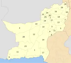
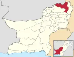 Map of Balochistan with Zhob District highlighted | |
| Country | |
| Province | |
| Division | Zhob |
| Established | 1890 |
| Founded by | British government |
| Headquarters | Zhob (formally Fort Sandeman) |
| Government | |
| • Type | District Administration |
| • Deputy Commissioner | N/A |
| • District Police Officer | N/A |
| • District Health Officer | N/A |
| Area | |
• District of Balochistan | 15,987 km2 (6,173 sq mi) |
| Population (2023)[1] | |
• District of Balochistan | 355,692 |
| • Density | 22/km2 (58/sq mi) |
| • Urban | 46,976 |
| • Rural | 308,716 |
| Literacy | |
| • Literacy rate |
|
| Time zone | PKT |
| Number of Tehsils | 5 |
| Main Language(s) | Pashto |
Zhob District (Pashto: ږوب ولسوالۍ, Urdu: ضلع ژوب) is a district in the northwestern part of Balochistan province of Pakistan. The population of Zhob District was estimated at 355,692 in 2023.[1] Water from Zhob River is used for irrigation in the district.
Administration
The 1998 census report lists two sub-divisions: Lower Zhob (comprising Zhob tehsil and Sambaza sub-tehsil) and Kakar Khurasan (encompassing the tehsil of Qamar Din Karez and the subtehsil of Ashewat).[3] A government webpage lists these as Ashwat, Qamar Din Karez, Sambaza and Zhob, without indicating if any of them are sub-tehsils.[4]
| Tehsil | Area
(km²)[5] |
Pop.
(2023) |
Density
(ppl/km²) (2023) |
Literacy rate
(2023)[6] |
Union Councils |
|---|---|---|---|---|---|
| Qamar Din Karez Tehsil | ... | ... | ... | ... | ... |
| Zhob Tehsil | 9,322 | 284,620 | 30.53 | 41.27% | ... |
| Ashwat Tehsil | 901 | 25,094 | 27.85 | 14.51% | ... |
| Kashatu Tehsil | 1,590 | 5,810 | 3.65 | 9.64% | ... |
| Sambaza Tehsil | 2,888 | 25,150 | 8.71 | 21.65% | ... |
Demographics
| Year | Pop. | ±% p.a. |
|---|---|---|
| 1961 | 39,755 | — |
| 1972 | 74,519 | +5.88% |
| 1981 | 134,660 | +6.80% |
| 1998 | 193,458 | +2.15% |
| 2017 | 310,354 | +2.52% |
| 2023 | 355,692 | +2.30% |
| Sources:[7] | ||
As of the 2023 census, Zhob district has 47,901 households and a population of 355,692. The district has a sex ratio of 117.57 males to 100 females and a literacy rate of 36.62%: 45.24% for males and 26.81% for females.[1][9] 159,100 (44.75% of the surveyed population) are under 10 years of age.[10] 46,976 (13.21%) live in urban areas.[1] 1,732 (0.49% of the surveyed population) are religious minorities, mainly Christians and some Hindus.[8]
At the time of the 2023 census, 97.65% of the population spoke Pashto and 1.49% Saraiki as their first language.[11]
The majority of the population of Zhob district is Pashtun. The tribes of Zhob district include the Mandokhail, Khosti, Sherani, Kakar, Sulaimankhel, Harifal, Lawoon and Babar. A large number of IDPs were settled within the confines of the district as part of the evacuation from Operation Zarb-e-Azb that took place to the north of Zhob.
| Religious group |
1901[12] | 1911[13] | 1921[14] | 1931[15] | 1941[16] | |||||
|---|---|---|---|---|---|---|---|---|---|---|
| Pop. | % | Pop. | % | Pop. | % | Pop. | % | Pop. | % | |
| Islam |
99,599 | 96.3% | 68,088 | 96.76% | 52,302 | 92.3% | 53,844 | 92.89% | 55,987 | 91.04% |
| Hinduism |
3,086 | 2.98% | 1,391 | 1.98% | 3,398 | 6% | 2,839 | 4.9% | 4,286 | 6.97% |
| Sikhism |
610 | 0.59% | 715 | 1.02% | 826 | 1.46% | 1,134 | 1.96% | 1,076 | 1.75% |
| Christianity |
133 | 0.13% | 168 | 0.24% | 141 | 0.25% | 115 | 0.2% | 146 | 0.24% |
| Judaism |
1 | 0% | 1 | 0% | 0 | 0% | 0 | 0% | 0 | 0% |
| Jainism |
0 | 0% | 1 | 0% | 0 | 0% | 0 | 0% | 0 | 0% |
| Zoroastrianism |
0 | 0% | 0 | 0% | 0 | 0% | 0 | 0% | 1 | 0% |
| Buddhism |
— | — | 2 | 0% | 1 | 0% | 27 | 0.05% | 0 | 0% |
| Tribal | — | — | — | — | — | — | 0 | 0% | 3 | 0% |
| Others | 0 | 0% | 0 | 0% | 0 | 0% | 4 | 0.01% | 0 | 0% |
| Total population | 103,429 | 100% | 70,366 | 100% | 56,668 | 100% | 57,963 | 100% | 61,499 | 100% |
| Note: British Baluchistan era district borders are not an exact match in the present-day due to various bifurcations to district borders — which since created new districts — throughout the region during the post-independence era that have taken into account population increases. | ||||||||||
Military activity
On 30 October 2024, Pakistan's security forces killed a member of the TTP and injured another during an intelligence-based operation in Sambaza, recovering weapons and ammunition.[17] The action was followed by a "sanitization operation" in the area.[17] On 10 December, 15 militants and a Pakistan Army soldier were killed during an engagement in the district.[18]
In January 2025, the forces killed an Afghan national in the district having links to terrorism on the 11th[19] and eliminated six TTP militants crossing across the Pakistan-Afghanistan border on the 23rd.[20] On 8 August, 33 members of the TTP, which the ISPR describes as Fitna al Khwarij, were killed by the security forces as they tried to cross into Sambaza across the border.[21][22][23] The forces also recovered a cache of arms, explosives, and ammunition.[21]
See also
Bibliography
- 1998 District Census report of Zhob. Census publication. Vol. 107. Islamabad: Population Census Organization, Statistics Division, Government of Pakistan. 2000.
References
- ^ a b c d "7th Population and Housing Census - Detailed Results: Table 1" (PDF). Pakistan Bureau of Statistics.
- ^ "Literacy rate, enrolments, and out-of-school population by sex and rural/urban, CENSUS-2023, BALOCHISTAN" (PDF).
- ^ PCO 1998, p. 10.
- ^ "List of Tehsils/Talukas with respect to their Districts" Federal Bureau of Statistics, Pakistan Archived 30 December 2010 at the Wayback Machine
- ^ "TABLE 1 : AREA, POPULATION BY SEX, SEX RATIO, POPULATION DENSITY, URBAN POPULATION, HOUSEHOLD SIZE AND ANNUAL GROWTH RATE, CENSUS-2023, BALOCHISTAN" (PDF).
- ^ "LITERACY RATE, ENROLMENT AND OUT OF SCHOOL POPULATION BY SEX AND RURAL/URBAN, CENSUS-2023, BALOCHISTAN" (PDF).
- ^ "Population by administrative units 1951-1998" (PDF). Pakistan Bureau of Statistics.
- ^ a b "7th Population and Housing Census - Detailed Results: Table 9" (PDF). www.pbscensus.gov.pk. Pakistan Bureau of Statistics.
- ^ "7th Population and Housing Census - Detailed Results: Table 12" (PDF). Pakistan Bureau of Statistics.
- ^ "7th Population and Housing Census: Population by Mother Tongue, Sex and Rural/Urban" (PDF). Pakistan Bureau of Statistics.
- ^ "7th Population and Housing Census: Population by Mother Tongue, Sex and Rural/Urban" (PDF). Pakistan Bureau of Statistics.
- ^ "Census of India 1901. Vol. 5A, Baluchistan. Pt. 2, Imperial tables". 1901. p. 5. JSTOR saoa.crl.25352844. Retrieved 8 September 2024.
- ^ "Census of India 1911. Vol. 4, Baluchistan : pt. 1, Report; pt. 2, Tables". 1911. p. 11. JSTOR saoa.crl.25393764. Retrieved 8 September 2024.
- ^ "Census of India 1921. Vol. 4, Baluchistan : part I, Report; part II, Tables". 1921. p. 165. JSTOR saoa.crl.25394124. Retrieved 8 September 2024.
- ^ "Census of India 1931. Vol. 4, Baluchistan. Pts. 1 & 2, Report [and] Imperial and provincial tables". 1931. p. 390. JSTOR saoa.crl.25797115. Retrieved 8 September 2024.
- ^ "Census of India, 1941. Vol. 14, Baluchistan". 1941. p. 17. JSTOR saoa.crl.28215993. Retrieved 8 September 2024.
- ^ a b "One Khwarij terrorist killed other apprehended injured in Zhob operation: ISPR". 30 October 2024. Retrieved 9 August 2025.
- ^ Dawn.com (10 December 2024). "1 soldier martyred, 15 terrorists killed in operation in Balochistan's Zhob district: ISPR". DAWN.COM. Retrieved 9 August 2025.
- ^ Dawn.com (21 January 2025). "Security forces neutralise Afghan national involved in terrorism during Zhob operation: ISPR". DAWN.COM. Retrieved 9 August 2025.
- ^ Dawn.com (23 January 2025). "Security forces neutralise 6 terrorists in Balochistan's Zhob district: ISPR". DAWN.COM. Retrieved 9 August 2025.
- ^ a b Dawn.com (8 August 2025). "Security forces kill 33 terrorists in Balochistan's Zhob district: ISPR". DAWN.COM. Retrieved 9 August 2025.
- ^ "Pakistan says soldiers kill 33 fighters near Afghan border". Al Jazeera. Retrieved 9 August 2025.
- ^ "33 terrorists killed as troops foil border breach attempt". The Express Tribune. 9 August 2025. Retrieved 9 August 2025.
External links
- Zhob District at www.balochistan.gov.pk
- Zhob District Archived 25 April 2018 at the Wayback Machine at www.balochistanpolice.gov.pk Archived 6 November 2018 at the Wayback Machine