Shakujiidai
Shakujiidai
石神井台 | |
|---|---|
Neighborhood (町丁) | |
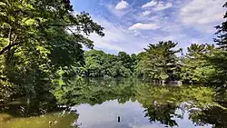 Sambōji Pond | |
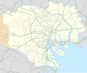 Shakujiidai Location of Shakujiidai within the Wards Area of Tokyo | |
| Coordinates: 35°44′14″N 139°35′20″E / 35.73722°N 139.58889°E | |
| Country | Japan |
| Region | Kantō |
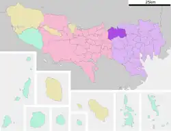
| Metropolis | Tokyo |
| Ward | Nerima |
| Area | |
• Total | 2.241 km2 (0.865 sq mi) |
| Population (March 1, 2007)[2] | |
• Total | 30,779 |
| • Density | 13,734.49/km2 (35,572.2/sq mi) |
| Time zone | UTC+9 (JST) |
| Zip code | 177-0045[3] |
| Area code | 03 |
Shakujiidai (石神井台) is a neighborhood in Nerima Ward, Tokyo. The current administrative names go from Shakujiidai 1st Street to Shakujiidai 8th Street. The residential address system has been implemented.
Geography
It is located in the southwestern part of Nerima Ward. The town borders Higashi-Ōizumi to the north, Shakujiimachi to the east across Igusa Street, Kami-Shakujii to the south across the Shakujii River, and Sekimachi-Kita to the west.
There are no train stations, but Musashi-Seki Station and Shakujii Station on the Seibu Shinjuku Line, and Ōizumi-gakuen Station and Shakujii-kōen Station on the Seibu Ikebukuro Line are accessible.
References
- ^ "土地面積(町丁目別)" (in Japanese). 練馬区. 2014-10-01. Retrieved 2025-04-26.(CC-BY-4.0)
- ^ "世帯と人口(人口統計) - 町丁目別". 練馬区. 2025-07-08. Retrieved 2018-01-04.
- ^ "郵便番号簿 2024年度版" (PDF) (in Japanese). 日本郵便. Retrieved 2025-03-09.
| Areas |
| ||||||||
|---|---|---|---|---|---|---|---|---|---|
| Major Stations | |||||||||
| Education |
| ||||||||
| Landmarks |
| ||||||||
 | |||||||||