Saskatchewan Highway 45
.svg.png) Highway 45 | ||||
|---|---|---|---|---|
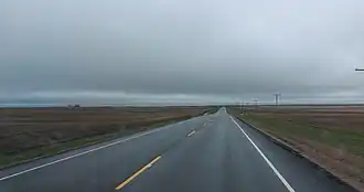 Highway 45 near Macrorie | ||||
| Route information | ||||
| Maintained by Ministry of Highways and Infrastructure | ||||
| Length | 115.5 km[1] (71.8 mi) | |||
| Major junctions | ||||
| South end | ||||
| North end | ||||
| Location | ||||
| Country | Canada | |||
| Province | Saskatchewan | |||
| Rural municipalities | Canaan, Coteau, Fertile Valley, Montrose, Vanscoy | |||
| Highway system | ||||
|
| ||||
| ||||
Highway 45 is a north–south provincial highway in the Canadian province of Saskatchewan. It runs from Highway 42 at Lucky Lake to Highway 7 near Delisle. The highway is about 116 kilometres (72 mi) long.[1]
Highway 45 passes near the communities of Lucky Lake, Tullis, Birsay, Lyons, Macrorie, Swanson, Donavon, and Delisle.
Route description
Hwy 45 begins in the Rural Municipality of Canaan No. 225 in the village of Lucky Lake at an intersection with Hwy 42, just across the railway tracks from that highway's intersection with Hwy 646. It heads north along the west side of town, passing along the edge of its business district, before curving northeast to pass through neighbourhoods and by the Lucky Lake Airport. The highway then leaves Lucky Lake, running parallel to a rail line as it enters the Rural Municipality of Coteau No. 255, travelling through the hamlets of Tullis and Birsay, where it has intersections with Hwy 646, Township Road 250 (provides access to Hitchcock Bay), and Hwy 373 as it curves due north and crosses the railway. Hwy 45 travels through rural farmland for the next several kilometres, having an intersection with Township Road 262 (provides access to both Dunblane and Coteau Beach) before becoming concurrent (overlapped) with westbound Hwy 44 just west of Gardiner Dam, with the pair crossing into the Rural Municipality of Fertile Valley No. 285.
Hwy 44 / Hwy 45 curve northwest past Tichfield and Coteau Lake to reach the village of Macrorie, where Hwy 44 splits off and heads west while Hwy 45 continues north, paralleling the west bank of the South Saskatchewan River as it travels past Bratton (accessed via Township Road 284) to share a very short concurrency with Hwy 15, just across the river from the town of Outlook. It now travels just to the east of Conquest (accessed via Township Road 300) and Ardath (accessed via Township Road 310, former Hwy 654) to cross into the Rural Municipality of Montrose No. 315 by way of a switchback. The highway passes through Swanson before having an intersection with O'Malley Road (provides access to Gledhow, Valley Park, and Pike Lake / Pike Lake Provincial Park) and travelling just to the west of Donavon (can accessed via either Township Road 330 or Second Street N). Now travelling through several kilometres of rural farmland, Hwy 45 enters both the Rural Municipality of Vanscoy No. 345 and the town of Delisle, where it comes to an end on the town's south side at an intersection with Hwy 7 shortly after crossing a railway. The entire length of Hwy 45 is a paved, two-lane highway.[2]
Major intersections
From south to north:[3]
| Rural municipality | Location | km[1] | mi | Destinations | Notes |
|---|---|---|---|---|---|
| Canaan No. 225 | Lucky Lake | 0.0 | 0.0 | Adjacent to Hwy 646 intersection | |
| Coteau No. 255 | Birsay | 17.6 | 10.9 | Township Road 250 – Birsay, Hitchcock Bay | |
| 18.4 | 11.4 | ||||
| | 30.5 | 19.0 | Township Road 262 – Dunblane, Coteau Beach | ||
| | 37.3 | 23.2 | South end of Hwy 44 concurrency | ||
| Fertile Valley No. 285 | Macrorie | 47.6 | 29.6 | North end of Hwy 44 concurrency | |
| | 60.1 | 37.3 | Bratton Road (Township Road 284) – Bratton | ||
| | 64.5 | 40.1 | South end of Hwy 15 concurrency | ||
| | 66.1 | 41.1 | North end of Hwy 15 concurrency | ||
| | 72.6 | 45.1 | Township Road 300 – Conquest | ||
| ↑ / ↓ | | 82.2 | 51.1 | Township Road 310 – Ardath | Former Hwy 654 south |
| Montrose No. 315 | Swanson | 90.5 | 56.2 | Main Street – Swanson | |
| | 91.9 | 57.1 | O'Malley Road (Township Road 320) – Gledhow, Valley Park, Pike Lake Provincial Park | ||
| | 101.6 | 63.1 | W Government Road (Township Road 330) – Donavon | ||
| | 102.4 | 63.6 | Second Street N – Donavon | ||
| Vanscoy No. 345 | Delisle | 115.5 | 71.8 | ||
1.000 mi = 1.609 km; 1.000 km = 0.621 mi
| |||||
See also
References
- ^ a b c "Highway 45 in Saskatchewan" (Map). Google Maps. Retrieved 16 February 2018.
- ^ Government of Saskatchewan. "Official Saskatchewan Highway Map" (PDF). Retrieved 22 July 2025.
- ^ MapArt (2007). Saskatchewan Road Atlas (Map) (2007 ed.). 1:540,000. Oshawa, ON: Peter Heiler Ltd. pp. 32, 40. ISBN 1-55368-020-0.
External links
![]() Media related to Saskatchewan Highway 45 at Wikimedia Commons
Media related to Saskatchewan Highway 45 at Wikimedia Commons