Saskatchewan Highway 229
.svg.png) Highway 229 | ||||
|---|---|---|---|---|
 Highway 229 | ||||
| Route information | ||||
| Maintained by Ministry of Highways and Infrastructure | ||||
| Length | 22.5 km[1] (14.0 mi) | |||
| Major junctions | ||||
| West end | ||||
| East end | ||||
| Location | ||||
| Country | Canada | |||
| Province | Saskatchewan | |||
| Rural municipalities | Good Lake | |||
| Highway system | ||||
|
| ||||
| ||||
Highway 229 is a provincial highway in the Canadian province of Saskatchewan. Saskatchewan's 200-series highways primarily service its recreational areas. It runs from Highway 47 to Good Spirit Lake Provincial Park and to Highway 9 and is about 23 kilometres (14 mi) long.[1]
Route description
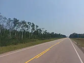
Hwy 229 begins at a junction with roughly halfway between Springside and Buchanan, with the road heading due east for around 4.8 kilometres (3 mi), passing by the Good Spirit Woods Campground before curving northward to enter Good Spirit Acres. It travels past a golf course along the eastern edge of the hamlet before making a sharp right at the junction between Keewatin Avenue (leads north to Good Spirit Lake Provincial Park) and Capalano Drive (leads west into the centre of the hamlet).[2] The highway now leaves Good Spirit Acres, heading due east past the Horseshoe Lake Wildlife Refuge (and the lake of the same name), where it has an intersection with Tiny Road (leads north to Burgis Beach and Tiny) before traveling through rural farmland for the next few kilometres. Hwy 229 now crosses a bridge over the Whitesand River, coming to an end shortly thereafter at an intersection with Hwy 9 (Saskota Flyway) just north of Gorlitz. The entire length of Hwy 229 is a paved, two-lane highway.[3]
Major intersections
From west to east:
| Rural municipality | Location | km | mi | Destinations | Notes |
|---|---|---|---|---|---|
| Good Lake No. 274 | | 0.0 | 0.0 | Western terminus; road continues west as northbound Hwy 47 | |
| Good Spirit Acres | 6.4 | 4.0 | Keewatin Avenue – Good Spirit Lake Provincial Park Capalano Drive – Good Spirit Acres | ||
| | 10.6 | 6.6 | Tiny Road – Burgis Beach, Tiny | ||
| | 20.9– 21.0 | 13.0– 13.0 | Bridge over the Whitesand River | ||
| | 22.5 | 14.0 | Eastern terminus | ||
| 1.000 mi = 1.609 km; 1.000 km = 0.621 mi | |||||
See also
References
- ^ a b "Highway 229 in Saskatchewan" (Map). Google Maps. Retrieved 8 February 2018.
- ^ "Road Improvements in the Good Spirit Lake Area Complete". Saskatchewan. Government of Saskatchewan. 29 October 2021. Retrieved 31 July 2024.
- ^ Government of Saskatchewan. "Official Saskatchewan Highway Map" (PDF). Retrieved 19 August 2025.