Rockford metropolitan area, Illinois
Rockford metropolitan area | |
|---|---|
| Rockford–Freeport–Rochelle, IL | |
 East State Street corridor | |
| Country | |
| State | |
| Area | |
• Total | 2,130 sq mi (5,510 km2) |
| Population (2020)[1] | |
• Total | 338,798 |
| GDP | |
| • Total | $18.129 billion (2022) |
| Time zone | UTC−6 (CST) |
| • Summer (DST) | UTC−5 (CDT) |
The Rockford metropolitan area is a metropolitan area consisting of two counties in north-central Illinois anchored by the city of Rockford, as defined by the United States Census Bureau. The population was 338,798 at the 2020 census.[1] The Rockford MSA abuts the Janesville-Beloit metropolitan area to the north and Chicago metropolitan area to the east. It forms the main part of the larger Rockford–Freeport–Rochelle combined statistical area, a four-county region with 435,216 residents in 2020.[1]
Counties
- Boone
- Ogle (combined statistical area)
- Stephenson (combined statistical area)
- Winnebago
Communities
- Places with more than 150,000 inhabitants
- Rockford (Principal City)
- Places with 20,000 to 30,000 inhabitants
- Places with 5,000 to 20,000 inhabitants
- Places with 1,000 to 5,000 inhabitants
- Places with less than 1,000 inhabitants
- Adeline
- Baileyville (census designated place)
- Caledonia
- Cedarville
- Creston
- Dakota
- Davis
- Garden Prairie (census designated place)
- German Valley
- Grand Detour (census designated place)
- Holcomb (census designated place)
- Kings (census designated place)
- Leaf River
- Lost Nation (census designated place)
- Monroe Center
- New Milford
- Orangeville
- Pearl City
- Ridott
- Rock City
- Timberlane
- Winslow
- Unincorporated places
- Afolkey
- Alworth
- Argyle
- Beaverton Crossroads
- Blaine
- Bolton
- Brookville
- Buckhorn Corners
- Buena Vista
- Chana
- Damascus
- Daysville
- Egan
- Eleroy
- Evarts
- Flagg
- Florence
- Haldane
- Harlem
- Harper
- Harrison
- Hazelhurst
- Herbert
- Hunter
- Irene
- Kent
- Kishwaukee
- Latham Park
- Lindenwood
- Loran
- McConnell
- Oneco
- Paynes Point
- Red Oak
- Rock Grove
- Russellville
- Scioto Mills
- Seward
- Shirland
- Stratford
- Waddams Grove
- Wempletown
- Westfield Corners
- White Rock
- Winneshiek
- Woosung
- Yellow Creek
Townships
|
|
Demographics
| Census | Pop. | Note | %± |
|---|---|---|---|
| 1900 | 47,845 | — | |
| 1910 | 63,153 | 32.0% | |
| 1920 | 90,929 | 44.0% | |
| 1930 | 117,373 | 29.1% | |
| 1940 | 121,178 | 3.2% | |
| 1950 | 152,385 | 25.8% | |
| 1960 | 230,091 | 51.0% | |
| 1970 | 272,063 | 18.2% | |
| 1980 | 279,514 | 2.7% | |
| 1990 | 283,719 | 1.5% | |
| 2000 | 320,204 | 12.9% | |
| 2010 | 349,431 | 9.1% | |
| 2020 | 338,798 | −3.0% | |
| U.S. Decennial Census[3][1] | |||
As of the census[4] of 2000, there were 320,204 people, 122,577 households, and 84,896 families residing within the MSA. The racial makeup of the MSA was 83.46% White, 9.27% African American, 0.29% Native American, 1.56% Asian, 0.03% Pacific Islander, 3.57% from other races, and 1.82% from two or more races. Hispanic or Latino of any race were 7.63% of the population.
The median income for a household in the MSA was $48,142, and the median income for a family was $55,881. Males had a median income of $41,141 versus $25,819 for females. The per capita income for the MSA was $21,392.
Combined statistical area
The Rockford–Freeport–Rochelle combined statistical area is made up of four counties in north-central Illinois. The statistical area includes one metropolitan area and two micropolitan areas. It had a population of at the 2020 census.[1]
- Metropolitan statistical areas (MSAs)
- Rockford (Winnebago and Boone counties)
- Micropolitan statistical areas (μSAs)
- Freeport (Stephenson County)
- Rochelle (Ogle County)
See also
References
- ^ a b c d e "Metropolitan and Micropolitan Statistical Areas Population Totals: 2020-2024". United States Census Bureau, Population Division. March 13, 2025. Retrieved March 13, 2025.
- ^ "Total Gross Domestic Product for Rockford, IL (MSA)". Federal Reserve Economic Data. Federal Reserve Bank of St. Louis.
- ^ "U.S. Decennial Census". United States Census Bureau. Archived from the original on May 7, 2015. Retrieved April 12, 2020.
- ^ "U.S. Census website". United States Census Bureau. Retrieved 2008-01-31.
Great Lakes megalopolis as defined by the RPA | ||
|---|---|---|
Includes all metropolitan areas that have a population of 150,000 or greater according to the most recent national census. | ||
| Great Lakes region cities | 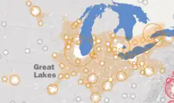 | |
| Surrounding cities |
| |
| Cities of states south of region | ||
| Other metro-regions | ||