Planning areas of Singapore
| Planning areas of Singapore Kawasan Perancangan (Malay) 规划区 (Chinese) திட்டமிடல் பகுதி (Tamil) | |
|---|---|
 | |
| Category | First-level census division |
| Location | Republic of Singapore |
| Created by | Urban Redevelopment Authority |
| Created | |
| Number | 55 (as of 2019) |
| Populations | 10 (Western Islands) – 284,560 (Tampines)[3] |
| Areas | 0.77 km2 (0.30 sq mi) (Straits View) – 69.46 km2 (26.82 sq mi) (Western Water Catchment)[3] |
| Government | |
| Subdivisions |
|
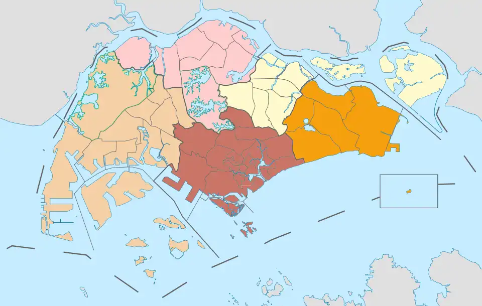
The planning areas of Singapore, also known as Development Guide Plan (DGP) areas, are the main urban planning and census divisions of Singapore delineated by the Urban Redevelopment Authority (URA). There are currently 55 such areas, grouped into five regions: Central, East, North, North-East and West. Each planning area is further subdivided into subzones for more detailed planning purposes. A DGP is prepared for each planning area, providing detailed land use and development guidelines down to the individual plot level.[4][2]
Planning areas were introduced in the early 1990s following the release of the 1991 Concept Plan, which marked a shift toward a long-term and strategic urban development.[5] Since their implementation, planning area boundaries have been adopted by various government agencies for administrative and statistical purposes. For instance, the Department of Statistics of the Ministry of Trade and Industry (MTI) first used planning areas in its reporting of the 2000 census, replacing earlier divisions based on electoral boundaries.[6] The Singapore Police Force (SPF) similarly aligned its Neighbourhood Police Centres jurisdictions with planning areas in 1999, moving away from the electoral division-based boundaries of the former Neighbourhood Police Post system.[7]
List of planning areas
.svg.png)
Planning areas are further subdivided into 332 subzones for statistical purposes.[8][3]
|
| Region |
|---|
| Central |
| English • Malay[a] | Chinese | Tamil | Region | Area (km2) | Population (2024)[9] | Population density (/km2) | Subzones |
|---|---|---|---|---|---|---|---|
| Ang Mo Kio | 宏茂桥 | ஆங் மோ கியோ | North-East | 13.94 | 159,340 | 11,430 | 12 |
| Bedok | 勿洛 | பிடோக் | East | 21.69 | 276,840 | 12,763 | 8 |
| Bishan | 碧山 | பீஷான் | Central | 7.62 | 87,930 | 11,539 | 3 |
| Boon Lay | 文礼 | பூன் லே | West | 8.23 | 20 | 2 | 4 |
| Bukit Batok | 武吉巴督 | புக்கிட் பாத்தோக் | West | 11.13 | 167,750 | 15,072 | 9 |
| Bukit Merah | 红山 | புக்கிட் மேரா | Central | 14.34 | 148,270 | 10,340 | 17 |
| Bukit Panjang | 武吉班让 | புக்கிட் பாஞ்சாங் | West | 8.99 | 138,050 | 15,356 | 7 |
| Bukit Timah | 武吉知马 | புக்கிட் திமா | Central | 17.53 | 83,570 | 4,767 | 8 |
| Central Water Catchment • Kawasan Tadahan Air Tengah | 中央集水区 | மத்திய நீர் நீர்ப்பிடிப்பு | North | 37.15 | – | – | N/A |
| Changi | 樟宜 | சாங்கி | East | 40.61 | 1,950 | 48 | 3 |
| Changi Bay • Teluk Changi | 樟宜湾 | சாங்கி பே | East | 1.7 | – | – | N/A |
| Choa Chu Kang | 蔡厝港 | சுவா சூ காங் | West | 6.11 | 190,180 | 31,126 | 7 |
| Clementi | 金文泰 | கிளிமெண்டி | West | 9.49 | 102,390 | 10,789 | 9 |
| Downtown Core • Pusat Bandar | 市中心 | சிங்கப்பூர் நகர மையத்தில் | Central | 4.34 | 4,660 | 1,074 | 8 |
| Geylang | 芽笼 | கேலாங் | Central | 9.64 | 116,610 | 12,096 | 5 |
| Hougang | 后港 | ஹவ்காங் | North-East | 13.93 | 228,140 | 16,378 | 10 |
| Jurong East • Jurong Timur | 裕廊东 | ஜூரோங் கிழக்கு | West | 17.83 | 74,530 | 4,180 | 10 |
| Jurong West • Jurong Barat | 裕廊西 | ஜூரோங் மேற்கு | West | 14.69 | 257,470 | 17,527 | 9 |
| Kallang | 加冷 | காலாங் | Central | 9.17 | 100,560 | 10,966 | 9 |
| Lim Chu Kang | 林厝港 | லிம் சூ காங் | North | 17.3 | 40 | 2 | N/A |
| Mandai | 万礼 | மண்டாய் | North | 11.77 | 2,110 | 179 | 3 |
| Marina East • Marina Timur | 滨海东 | மெரினா கிழக்கு | Central | 1.82 | – | – | N/A |
| Marina South • Marina Selatan | 滨海南 | மெரினா தென் | Central | 1.62 | – | – | N/A |
| Marine Parade | 马林百列 | மரின் பரேட் | Central | 6.12 | 46,690 | 7,629 | 5 |
| Museum • Muzium | 博物馆 | அருங்காட்சியகம் | Central | 0.83 | 760 | 916 | 3 |
| Newton | 纽顿 | நியூட்டன் | Central | 2.07 | 9,730 | 4,700 | 6 |
| North-Eastern Islands • Kepulauan Timur Laut | 东北群岛 | வடகிழக்கு தீவுகள் | North-East | 42.88 | 40 | 1 | N/A |
| Novena | 诺维娜 | நொவீனா | Central | 8.98 | 51,850 | 5,774 | 5 |
| Orchard | 乌节 | ஆர்ச்சர்ட் | Central | 0.96 | 1,290 | 1,344 | 3 |
| Outram | 欧南 | ஊட்ரம் | Central | 1.37 | 16,790 | 12,255 | 4 |
| Pasir Ris | 巴西立 | பாசிர் ரிஸ் | East | 15.02 | 145,150 | 9,664 | 8 |
| Paya Lebar | 巴耶利峇 | பாய லேபார் | East | 11.69 | 20 | 2 | 5 |
| Pioneer | 先驱 | பயனியர் | West | 12.1 | 50 | 4 | 5 |
| Punggol | 榜鹅 | பொங்கோல் | North-East | 9.34 | 199,400 | 21,349 | 7 |
| Queenstown | 女皇镇 | குவீன்ஸ்டவுன் | Central | 20.43 | 101,930 | 4,989 | 16 |
| River Valley | 里峇峇利 | நதி பள்ளத்தாக்கு | Central | 1.48 | 11,880 | 8,027 | 5 |
| Rochor | 梧槽 | ரோச்சோர் | Central | 1.62 | 12,920 | 7,975 | 10 |
| Seletar | 实里达 | சிலேத்தார் | North-East | 10.25 | 300 | 29 | 4 |
| Sembawang | 三巴旺 | செம்பவாங் | North | 12.34 | 110,090 | 8,921 | 9 |
| Sengkang | 盛港 | செங்காங் | North-East | 10.59 | 265,060 | 25,029 | 7 |
| Serangoon | 实龙岗 | சிராங்கூன் | North-East | 10.1 | 117,630 | 11,647 | 7 |
| Simpang | 新邦 | சிம்பாங் | North | 5.13 | – | – | 4 |
| Singapore River • Sungai Singapura | 新加坡河 | சிங்கப்பூர் நதி | Central | 0.96 | 4,380 | 4,563 | 3 |
| Southern Islands • Kepulauan Selatan | 南部群岛 | தெற்கு தீவுகள் | Central | 6.07 | 2,480 | 409 | 2 |
| Straits View • Pemandangan Selat | 海峡景 | ஸ்ட்ரெய்ட்ஸ் காண்க | Central | 0.77 | – | – | N/A |
| Sungei Kadut • Sungai Kadut | 双溪加株 | சுங்கை காடுட் | North | 15.99 | 750 | 47 | 5 |
| Tampines | 淡滨尼 | தெம்பினிஸ் | East | 20.89 | 284,560 | 13,622 | 5 |
| Tanglin | 东陵 | டங்லின் | Central | 7.63 | 24,030 | 3,149 | 4 |
| Tengah | 登加 | தெங்கா | West | 7.4 | 7,980 | 1,078 | N/A |
| Toa Payoh | 大巴窑 | தோ பாயோ | Central | 8.17 | 139,310 | 17,051 | 12 |
| Tuas | 大士 | துவாஸ் | West | 30.04 | 70 | 2 | 6 |
| Western Islands • Kepulauan Barat | 西部群岛 | மேற்கத்திய தீவுகள் | West | 39.47 | 10 | 0 | 3 |
| Western Water Catchment • Kawasan Tadahan Air Barat | 西部集水区 | மேற்கத்திய நீர் நீர்ப்பிடிப்பு | West | 69.46 | 600 | 9 | N/A |
| Woodlands | 兀兰 | ஊட்லண்ட்ஸ் | North | 13.59 | 255,180 | 18,777 | 9 |
| Yishun | 义顺 | யீஷூன் | North | 21.24 | 229,520 | 10,806 | 9 |
See also
Notes
- ^ Most place names are attested to be of Malay origin and referred to similarly in the Malay language.
References
- ^ "HistorySG - 1991 Concept Plan is unveiled". National Library Board.
- ^ a b "Singapore Infopedia - Development guide plan". National Library Board.
- ^ a b c City Population - statistics, maps and charts | SINGAPORE: Subdivision
- ^ "Master Plan 2019". Urban Redevelopment Authority. 2019. Retrieved 6 June 2025.
- ^ "Urban Redevelopment Authourity". Archived from the original on 12 June 2007. Retrieved 2 June 2007.
- ^ Arumainathan, P. (1970). REPORT ON THE CENSUS OF POPULATION 1970 SINGAPORE - Volume II. Singapore Department of Statistics.
- ^ Yuen, Belinda K. P. (1998). Planning Singapore: From Plan to Implementation. Singapore Institute of Planners. ISBN 9789810405731.
- ^ "Statistics Singapore - Geographic Distribution - 2018 Latest Data". Retrieved 11 February 2019.
- ^ "Geographical Distribution Dashboard – Resident Population". Department of Statistics Singapore. June 2024.