National Route 438 (N438) or the Batangas–Lobo Road is a 33.78-kilometer (20.99 mi)[2][3] secondary national road in the province of Batangas, Philippines that forms part of the Philippine highway network.
Route description
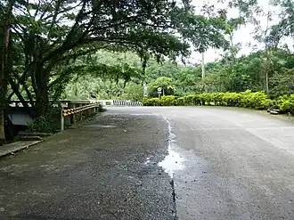
The road starts at the junction with Pres. Jose P. Laurel Highway in Batangas City as a segment of Tolentino Road and turns east toward the outskirts of the city as Gov. Antonio A. Carpio Road[a]. It then curves gently southward across the Calumpang River and passes by the high school campus of Lyceum of the Philippines University Batangas, where it meets with Ferry Road and the Batangas–Tabangao–Lobo Road at Brgy. Gulod Labac. The route heads southeast-ward at this junction, passes by the entrance to the Philippine Science High School Calabarzon campus and crosses with the STAR Tollway–Pinamucan Bypass Roadin barangay Sampaga, then gradually slopes upon reaching the boundary of the city with the municipality of Taysan, where the road assumes the alternative name of Taysan–Lobo Road and turns slopier, curvier, and riddled with tight turns as it passes the proximity of Mounts Calo and Liguayen at the border with the municipality of Lobo. Finally, the route, locally known as P. Burgos Street, turns west towards the town proper before crossing nearby Lobo River and intersects with Batangas–Tabangao–Lobo Road (which continues P. Burgos Street) and Lobo–Malabrigo–San Juan Road (Mabini Street) just beside the town's public market.
Intersections
The entire route is located in Batangas. Intersections are numbered by kilometer posts, with Rizal Park in Manila designated as kilometer zero.
Notes
- a. ^ Former Governor of Batangas province from January 1 to February 17, 1972, serving a total of only 47 days.
References
- ^ "Road and Bridge Inventory". Department of Public Works and Highways. Retrieved September 22, 2024.
- ^ "Batangas 2nd DEO, DPWH Road Data Atlas, 2023 edition". Department of Public Works and Highways. September 22, 2024. Retrieved September 22, 2024.
- ^ "Batangas 4th DEO, DPWH Road Data Atlas, 2023 edition". Department of Public Works and Highways. September 22, 2024. Retrieved September 22, 2024.
- ^ "Road and Bridge Inventory". www.dpwh.gov.ph. Retrieved September 22, 2024.
External links
|
|---|
| National primary roads |
| |
|---|
| National secondary roads | | Luzon | |
|---|
| Visayas | |
|---|
| Mindanao |
- N870
- N871
- N872
- N873
- N874
- N875
- N876
- N877
- N878
- N879
- N880
- N881
- N890
- N891
- N900
- N901
- N902
- N903
- N904
- N905
- N906
- N907
- N908
- N909
- N910
- N911
- N912
- N913
- N914
- N915
- N916
- N917
- N918
- N919
- N920
- N921
- N922
- N923
- N924
- N926
- N930
- N931
- N932
- N933
- N935
- N936
- N937
- N939
- N940
- N941
- N942
- N943
- N944
- N945
- N946
- N947
- N948
- N949
- N950
- N951
- N952
- N953
- N954
- N955
- N956
- N957
- N958
- N959
- N960
- N961
- N962
- N963
- N964
- N965
- N966
- N968
- N969
- N970
- N980
- N981
- N982
- N985
- N986
- N987
- N988
- N989
- N990
- N991
- N992
|
|---|
|
|---|
|
|
|---|
| Expressways | | Existing | |
|---|
| Proposed/under construction | |
|---|
| |
|---|
| National roads | | Primary | |
|---|
| Secondary |
- N407
- N408
- Nasugbu–Lian–Calatagan Road
- N409
- N410
- N421
- Mabini Avenue
- Tanauan–Talisay–Tagaytay Road (Tanauan to Talisay segment)
- Ligaya Drive
- N422
- N431
- Morada Avenue
- General Luna Street
- Claro M. Recto Avenue
- P. Torres Street
- Lipa–Rosario Road (Lipa–Padre Garcia segment)
- N432
- N433
- N434
- Batangas Port Diversion Road
- Bolboc Access Road
- N435
- N436
- N437
- Manila–Batangas Pier Road
- N438
- N439
- Batangas–Tabangao–Lobo Road
- Lobo–Malabrigo–San Juan Road (Lobo segment)
- N656
- Sta. Teresita–Alitagtag Diversion Road
|
|---|
| Tertiary |
- Governor Feliciano Leviste Highway (Balete Road)
- Talisay–Laurel–Agoncillo–Lemery Road
|
|---|
|
|---|
.svg.png)