Earthquakes in 2001 Approximate epicenters of the earthquakes in 2001
Strongest magnitude 8.4 Mw Peru Deadliest 7.7 Mw India Total fatalities 21,465 9.0+ 0 8.0–8.9 1 7.0–7.9 14 6.0–6.9 122 5.0–5.9 1,212 4.0–4.9 7,968
This is a list of earthquakes in 2000 . Only earthquakes of magnitude 6 or above are included, unless they result in significant damage and/or casualties. All dates are listed according to UTC time. The maximum intensities are based on the Modified Mercalli intensity scale . Earthquake magnitudes are based on data from the USGS . Fourteen earthquakes ≥M7 occurred within the year, along with one ≥M8 event.
Throughout the year, earthquakes killed 21,465 people; the vast majority of the fatalities were attributed to an unusually powerful Mw 7.7 earthquake intraplate earthquake that struck the Indian state of Gujarat . Early in the year, two earthquakes struck El Salvador , killing nearly 1,300 people and causing damage across the entire country. The largest event of the year, a Mw 8.4 earthquake , struck off Peru's southern coast and triggered a large tsunami . Other notable earthquakes struck Japan, the United States and China.
Compared to other years
Number of Earthquakes Worldwide for 1999–2009 []
Magnitude Ranging Between 1999 2000 2001 2002 2003 2004 2005 2006 2007 2008 2009 2010 2011 2012 2013 2014 2015 8−9.9 0 1 1 0 1 2 1 2 4 1 1 1 1 2 2 1 1 7−7.9 18 14 15 13 14 14 10 9 13 12 16 21 19 15 17 11 18 6−6.9 118 145 121 126 140 141 140 142 178 168 144 151 204 129 125 144 124 5−5.9 1057 1335 1215 1171 1203 1515 1693 1712 2074 1768 1896 1963 2271 1412 1402 1577 1413 Total 1193 1495 1352 1310 1358 1672 1844 1865 2270 1948 2057 2136 2495 1558 1546 1733 1556
Note that an increase in detected earthquake numbers does not necessarily represent an increase in earthquakes per se. Population increase, habitation spread, and advances in earthquake detection technology all contribute to higher earthquake numbers being recorded over time. USGS's Website has more information.
For exact dates and live earthquakes please visit USGS's Global Earthquake Search Page and Real-time Earthquake Map or EMSC's Real-time Seismicity .
Overall
By death toll
Note : At least 10 fatalities
By magnitude
Rank
Magnitude
Death toll
Location
MMI
Depth (km)
Date
1
8.4
145
Peru , Arequipa offshore
XII (Extreme )
33.0
June 23
2
7.8
0
China , Qinghai
X (Extreme )
10.0
November 14
3
7.7
952
El Salvador , La Libertad offshore
VIII (Severe )
60.0
January 13
3
7.7
20,023
India , Gujarat
XII (Extreme )
16.0
January 26
4
7.6
1
Peru , Arequipa offshore
IX (Violent )
33.0
July 7
5
7.5
0
Indonesia , Southeast Sulawesi offshore
VII (Very strong )
33.0
October 19
5
7.5
0
Philippines , Davao offshore
VIII (Severe )
33.0
January 1
6
7.4
0
Indonesia , Bengkulu offshore
VII (Very strong )
36.0
February 13
7
7.2
0
New Zealand , Kermadec Islands offshore
I (Not felt )
178.1
June 3
8
7.1
0
New Zealand , Gisborne offshore
I (Not felt )
33.0
August 21
8
7.1
0
Vanuatu , Sanma offshore
VII (Very strong )
103.0
January 9
8
7.1
0
Australia
I (Not felt )
10.0
December 12
8
7.1
0
Indonesia , North Maluku offshore
VII (Very strong )
36.0
February 24
9
7.0
0
Guam offshore
VII (Very strong )
37.0
October 12
9
7.0
0
Papua New Guinea , West New Britain
VIII (Severe )
33.0
October 31
Note : At least 7.0 magnitude
By month
January
January Strongest magnitude 7.7 India El Salvador Deadliest 7.7 Mw India Total fatalities 20,975 9.0+ 0 8.0–8.9 0 7.0–7.9 4 6.0–6.9 12 5.0–5.9 137 4.0–4.9 568
Collapsed buildings in Bhuj , Gujarat
Date
Country and location
Mw
Depth (km)
MMI Notes
Casualties
Dead
Injured
1[ 1]
Philippines , Davao offshore, 21 km (13 mi) southeast of Lukatan
7.5
33.0
VIII[ 2]
-
-
-
1[ 3]
Philippines , Davao offshore, 67 km (42 mi) southeast of Lukatan
6.8
33.0
VII[ 2]
Aftershock of the 7.5 event nearly two hours earlier.
-
-
2[ 4]
Philippines , Davao offshore, 51 km (32 mi) southeast of Lukatan
6.4
33.0
VII[ 2]
Aftershock of the 7.5 event a day prior.
-
-
2[ 5]
Solomon Islands , Malkira-Ulawa offshore, 96 km (60 mi) southeast of Kirakira
6.0
33.0
VII[ 2]
-
-
-
9[ 6]
Vanuatu , Sanma offshore, 16 km (9.9 mi) northeast of Port Olry
7.1
103.0
VII
-
-
-
10[ 7]
United States , Alaska offshore, 47 km (29 mi) south of Old Harbor
6.9
36.4
VIII[ 2]
-
-
-
11[ 8]
Canada , British Columbia offshore, 247 km (153 mi) southwest of Port McNeill
6.0
10.0
-
-
-
-
13[ 9]
El Salvador , La Libertad offshore, 28 km (17 mi) south-southwest of Puerto El Triunfo
7.7
60.0
VIII
952
5,565
15[ 10]
Mid-Indian Ridge
6.4
10.0
-
-
-
-
16[ 11]
Indonesia , Bengkulu offshore, 60 km (37 mi) west-southwest of Bengkulu
6.0
33.0
V
Foreshock of the 6.9 event eight seconds later.
-
-
16[ 12]
Indonesia , Bengkulu offshore, 59 km (37 mi) west-southwest of Bengkulu
6.9
28.0
VI
-
-
-
19[ 13]
Mexico , Chiapas , 6 km (3.7 mi) north-northeast of Hidalgo
6.0
93.2
V
-
-
-
19[ 14]
Mexico , Temotu , 121 km (75 mi) south-southeast of Lata
6.3
50.0
VII[ 2]
-
-
-
19[ 15]
South Sandwich Islands
6.0
33.0
-
-
-
-
26[ 16]
India , Gujarat , 17 km (11 mi) northwest of Bhachau
7.7
16.0
XII[ 17]
20,023
166,951
29[ 18]
Indonesia , West Papua offshore, 83 km (52 mi) west-northwest of Manokwari
6.2
33.0
IX[ 2]
-
-
-
February
February Strongest magnitude 7.4 Mw Indonesia Deadliest 6.6 Mw El Salvador Total fatalities 320 9.0+ 0 8.0–8.9 0 7.0–7.9 2 6.0–6.9 14 5.0–5.9 104 4.0–4.9 593
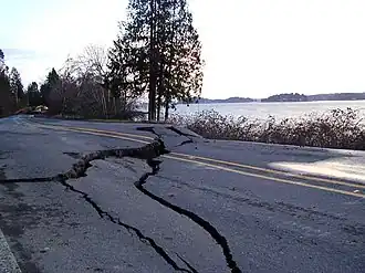
A stretch of Washington State Route 302 near Allyn, Washington , damaged after the earthquake.
Date
Country and location
Mw
Depth (km)
MMI Notes
Casualties
Dead
Injured
1[ 19]
United States , Alaska offshore, 94 km (58 mi) west-southwest of Adak
6.0
33.0
I
-
-
-
8[ 20]
India , Gujarat , 24 km (15 mi) west-northwest of Rapar
5.1
10.0
VII
Aftershock of the 2001 Gujarat earthquake . At least 40 people injured in the epicentral area.
-
40
13[ 21]
El Salvador , Cuscatlán , 5 km (3.1 mi) south of Cojutepeque
6.6
10.0
IX[ 2]
315
3,399
13[ 22]
Indonesia , Bengkulu offshore, 102 km (63 mi) south-southeast of Bengkulu
7.4
36.0
VII[ 2]
-
-
-
14[ 23]
Fiji , Eastern offshore, 187 km (116 mi) south of Nadi
6.1
10.0
V[ 2]
-
-
-
14[ 24]
Fiji , Eastern offshore, 204 km (127 mi) south-southwest of Suva
6.2
10.0
V[ 2]
-
-
-
16[ 25]
Indonesia , West Nusa Tenggara offshore, 138 km (86 mi) north of Pototano
6.1
521.0
IV
-
-
-
17[ 26]
Canada , British Columbia offshore, 151 km (94 mi) south-southwest of Hydaburg , United States
6.2
20.0
V
Objects knocked from shelves in the Massett -Daajing Giids -Skidegate area.
-
-
17[ 27]
El Salvador , San Salvador , 1 km (0.62 mi) east-northeast of Tonacatepeque
4.1
10.0
VI[ 2]
One person killed, three others injured, additional damage and landslides in the epicentral area.
1
3
18[ 28]
South Africa , Prince Edward Islands region offshore
6.0
10.0
-
-
-
-
19[ 29]
Laos , Phongsaly , 31 km (19 mi) west of Điện Biên Phủ , Vietnam
4.9
10.0
VII[ 2]
Several people injured and many buildings damaged in the Điện Biên Phủ area, Vietnam.
-
Several
23[ 30]
China , Sichuan , 96 km (60 mi) southwest of Kangding
5.6
33.0
VIII[ 2]
Three people killed, 109 injured and 60,000 homes destroyed in Kangding and Yajiang counties.
3
109
24[ 31]
Indonesia , North Maluku offshore, 137 km (85 mi) west-northwest of Ternate
7.1
35.0
VII
-
-
-
24[ 32]
Indonesia , North Maluku offshore, 135 km (84 mi) northwest of Ternate
6.2
35.0
-
Aftershock of the 7.1 event almost seven hours prior.
-
-
25[ 33]
Afghanistan , Badakhshan , 49 km (30 mi) south of Jurm
6.2
202.5
V
-
-
-
26[ 34]
Russia , Sakhalin offshore, 135 km (84 mi) east of Korsakov
6.1
392.0
I
-
-
-
28[ 35]
Vanuatu , Tafea offshore, 245 km (152 mi) east of Tadine
6.7
10.0
-
-
-
-
28[ 36]
Vanuatu , Tafea offshore, 235 km (146 mi) east-southeast of Tadine
6.3
10.0
-
Aftershock of the 6.7 event 35 minutes earlier.
-
-
28[ 37]
El Salvador , Usulután , 24 km (15 mi) south of Zacatecoluca
6.1
65.3
V
Landslides occurred in central and western El Salvador.
-
-
28[ 38]
United States , Washington , 7 km (4.3 mi) south-southeast of Longbranch
6.8
51.8
VIII
1
400
March
March Strongest magnitude 6.8 Mw Japan Deadliest 6.8 Mw Japan Total fatalities 2 9.0+ 0 8.0–8.9 0 7.0–7.9 0 6.0–6.9 8 5.0–5.9 88 4.0–4.9 612
Date
Country and location
Mw
Depth (km)
MMI Notes
Casualties
Dead
Injured
6[ 39]
Macquarie Island region offshore
6.4
10.0
-
-
-
-
7[ 40]
Ascension Island offshore, 206 km (128 mi) northeast of Georgetown
6.0
10.0
-
-
-
-
14[ 41]
Indonesia , Gorontalo , 130 km (81 mi) west of Gorontalo
6.0
109.4
V
-
-
-
15[ 42]
India , Nicobar Islands offshore
6.0
33.0
VII[ 2]
-
-
-
15[ 43]
Chile , Valparaíso offshore, 28 km (17 mi) west-northwest of La Ligua
6.0
37.0
VII[ 2]
-
-
-
19[ 44]
Indonesia , Maluku offshore, 41 km (25 mi) south-southwest of Ambon
6.5
33.0
VII[ 2]
-
-
-
23[ 45]
Russia , Sakhalin Oblast offshore, 111 km (69 mi) east-northeast of Shikotan
6.0
33.0
III
-
-
-
24[ 46]
Japan , Hiroshima offshore, 16 km (9.9 mi) south-southwest of Kure
6.8
50.0
IX[ 47]
2
288
April
April Strongest magnitude 6.9 Fiji Deadliest 5.6 China Total fatalities 2 9.0+ 0 8.0–8.9 0 7.0–7.9 0 6.0–6.9 11 5.0–5.9 92 4.0–4.9 713
Date
Country and location
Mw
Depth (km)
MMI Notes
Casualties
Dead
Injured
3[ 48]
Japan , Shizuoka , 10 km (6.2 mi) northeast of Mori
5.4
33.0
VII[ 2]
Eight people injured, furniture overturned and windows and water pipes broken in Shizuoka Prefecture.
-
8
4[ 49]
Indonesia , Maluku offshore, 65 km (40 mi) northwest of Tual
6.4
33.0
VII[ 2]
-
-
-
7[ 50]
New Zealand , Kermadec Islands offshore
6.2
33.0
-
-
-
-
9[ 51]
Chile , Valparaíso offshore, 144 km (89 mi) west-northwest of Valparaíso
6.7
11.0
V[ 2]
-
-
-
12[ 52]
China , Yunnan , 147 km (91 mi) southwest of Dali
5.6
10.0
VIII[ 2]
Two people killed, 190 injured, 30,000 houses destroyed and landslides blocked roads in Shidian County .
2
190
13[ 53]
South Georgia and the South Sandwich Islands , South Sandwich Islands offshore
6.2
26.0
-
-
-
-
14[ 54]
Japan , Izu Islands offshore
6.0
10.0
-
-
-
-
19[ 55]
Solomon Islands , Western offshore, 126 km (78 mi) northwest of Gizo
6.0
12.0
VI[ 2]
Foreshocks of the 6.7 event later that day.
-
-
19[ 56]
Solomon Islands , Western offshore, 121 km (75 mi) south-southeast of Panguna , Papua New Guinea
6.2
20.0
VI
-
-
19[ 57]
Solomon Islands , Western offshore, 128 km (80 mi) south-southeast of Panguna , Papua New Guinea
6.7
17.0
VII[ 2]
-
-
-
26[ 58]
Japan , Hokkaido offshore, 37 km (23 mi) southeast of Nemuro
6.0
86.0
VI
-
-
-
28[ 59]
Fiji region offshore
6.9
351.8
I
-
-
-
29[ 60]
Mexico , Colima offshore, 45 km (28 mi) south-southwest of El Naranjo
6.2
10.0
VI[ 2]
-
-
-
May
May Strongest magnitude 6.7 Russia Deadliest 5.6 China Total fatalities 3 9.0+ 0 8.0–8.9 0 7.0–7.9 0 6.0–6.9 9 5.0–5.9 84 4.0–4.9 639
Date
Country and location
Mw
Depth (km)
MMI Notes
Casualties
Dead
Injured
7[ 61]
Pacific-Antarctic Ridge
6.2
10.0
-
-
-
-
8[ 62]
El Salvador , San Vicente , 3 km (1.9 mi) south of San Vicente
5.7
10.0
VIII[ 2]
One person killed at Conchagua , La Unión . At least 84 homes destroyed, 70 damaged and landslides in the epicentral area.
1
-
9[ 63]
Solomon Islands , Makira-Ulawa offshore, 76 km (47 mi) west-northewest of Kirakira
6.3
67.9
V
-
-
-
19[ 64]
Fiji , Eastern offshore, 277 km (172 mi) west-northwest of Haveluloto , Tonga
6.0
386.7
-
-
-
-
20[ 65]
Mexico , Colima offshore, 33 km (21 mi) southwest of El Colomo
6.3
33.0
VIII[ 2]
-
-
-
23[ 66]
China , Sichuan , 119 km (74 mi) northeast of Lijiang
5.5
33.0
VII[ 2]
One person killed and 39 injured in Yanyuan County , Sichuan. One person killed and 566 others injured, 27 of them serious, in Ninglang Yi Autonomous County , Yunnan . Eleven reservoirs, four power plants and six bridges damaged in the epicentral area.
2
605
25[ 67]
Russia , Sakhalin offshore, 114 km (71 mi) south-southeast of Kuril’sk
6.7
33.0
VI[ 2]
-
-
-
25[ 68]
Indonesia , Special Region of Yogyakarta , 11 km (6.8 mi) northwest of Srandakan
6.3
143.1
V
Several people injured in Surakarta and minor damage in Yogyakarta .
-
Several
26[ 69]
Fiji region offshore
6.4
406.5
-
-
-
-
28[ 70]
Indonesia , Maluku offshore, 117 km (73 mi) south-southwest of Tual
6.0
33.0
VI[ 2]
-
-
-
29[ 71]
Turkey , Erzurum , 20 km (12 mi) south of Pasinler
4.8
33.0
V[ 2]
Two people injured and three buildings damaged in the Erzurum area.
-
2
29[ 72]
Papua New Guinea , Autonomous Region of Bougainville offshore, 92 km (57 mi) south-southwest of Panguna
6.4
14.0
VI[ 2]
-
-
-
June
June Strongest magnitude 8.4 Peru Deadliest 8.4 Peru Total fatalities 150 8.0–8.9 1 7.0–7.9 1 6.0–6.9 12 5.0–5.9 140 4.0–4.9 726
Date
Country and location
Mw
Depth (km)
MMI Notes
Casualties
Dead
Injured
1[ 73]
Afghanistan , Parwan , 14 km (8.7 mi) east-northeast of Jabal os Saraj
5.0
62.1
VI[ 2]
Four people killed, 20 injured and several houses destroyed in Parwan Province.
4
20
3[ 74]
New Zealand , Kermadec Islands offshore
7.2
178.1
I
-
-
-
5[ 75]
Papua New Guinea , Morobe , 45 km (28 mi) northwest of Bulolo
6.4
10.0
IX[ 2]
One person injured, 40 houses damaged or destroyed and landslides occurred in the epicentral area.
-
1
5[ 76]
Papua New Guinea , Morobe , 49 km (30 mi) north-northwest of Bulolo
6.0
10.0
VIII[ 2]
Aftershock of the 6.4 event six hours earlier.
-
-
7[ 77]
China , Yunnan , 147 km (91 mi) southwest of Dali
4.6
33.0
VI[ 2]
Thirteen people injured and several houses destroyed in Shidian County .
-
13
14[ 78]
Taiwan , Yilan offshore, 39 km (24 mi) southeast of Yilan
5.9
32.1
VII[ 2]
Four people injured in Taipei and another in Yilan. Some damage occurred in Taipei and in other parts of northeastern Taiwan.
-
5
14[ 79]
United States , Alaska offshore, 235 km (146 mi) west-southwest of Adak
6.5
18.0
V
-
-
-
15[ 80]
Northern Mariana Islands , Pagan region offshore
6.0
33.0
-
-
-
-
15[ 81]
Yemen , Al Mahrah offshore, 199 km (124 mi) north-northwest of Kilmia
6.0
10.0
-
-
-
-
16[ 82]
Tonga , Niua offshore, 127 km (79 mi) north-northeast of Hihifo
6.0
10.0
-
-
-
-
19[ 83]
Chile , Antofagasta , 38 km (24 mi) east-northeast of San Pedro de Atacama
6.0
146.6
V
-
-
-
21[ 84]
France , Grand Est , 1 km (0.62 mi) east-northeast of Cocheren
4.2
1.0
V
One person killed in a mining incident in Lorraine .
1
-
23[ 85]
Peru , Arequipa offshore, 6 km (3.7 mi) south-southwest of Atico
8.4
33.0
XII[ 86]
145
3,812
23[ 87]
Peru , Arequipa offshore, 56 km (35 mi) south-southwest of Quilca
6.1
33.0
VII[ 2]
Aftershock of the 2001 southern Peru earthquake .
-
-
24[ 88]
Russia , Sakhalin offshore, 125 km (78 mi) south-southeast of Kuril’sk
6.0
33.0
III
-
-
-
25[ 89]
Turkey , Osmaniye , 17 km (11 mi) south-southeast of Kadirli
5.5
5.0
VII
At least 130 people injured and 66 buildings damaged in Osmaniye Province.
-
130
26[ 90]
Peru , Arequipa offshore, 34 km (21 mi) west-southwest of Pacocha
6.7
24.0
VIII[ 2]
Aftershock of the 2001 southern Peru earthquake .
-
-
26[ 91]
Central East Pacific Rise
6.1
10.0
-
-
-
-
28[ 92]
Indonesia , West Java , 17 km (11 mi) south-southeast of Majalengka
5.0
36.9
VII[ 2]
Dozens of people injured and 2,500 buildings damaged in West Java Province.
-
Dozens
29[ 93]
Bolivia , Potosí , 53 km (33 mi) west of Potosí
6.1
273.9
III
-
-
-
July
July Strongest magnitude 7.6 Peru Deadliest 4.7 Italy Total fatalities 6 7.0–7.9 1 6.0–6.9 10 5.0–5.9 102 4.0–4.9 677
Date
Country and location
Mw
Depth (km)
MMI Notes
Casualties
Dead
Injured
1[ 94]
Papua New Guinea , New Ireland , 76 km (47 mi) east of Kokopo
6.1
28.0
VIII[ 2]
-
-
-
4[ 95]
Northern Mariana Islands offshore
6.5
290.0
I
-
-
-
4[ 96]
Tonga , Tongatapu offshore, 167 km (104 mi) west-southwest of Haveluloto
6.5
184.6
-
-
-
-
4[ 97]
Bolivia , Cochabamba , 41 km (25 mi) east-northeast of Colomi
6.2
33.0
IX[ 2]
-
-
-
5[ 98]
Peru , Arequipa offshore, 31 km (19 mi) south of Achanizo
6.6
62.0
VII
Aftershock of the 2001 southern Peru earthquake . About 300 previously-weakened buildings destroyed in the epicentral area.
-
-
7[ 99]
Peru , Arequipa offshore, 51 km (32 mi) southwest of Punta de Bombón
7.6
33.0
IX[ 2]
Aftershock of the 2001 southern Peru earthquake . One person killed and 30 injured in Arequipa . Hundreds of buildings weakened by the previous earthquakes collapsed. A large boulder fell and blocked the Pan-American Highway . Some power outages in the epicentral area and in Arica , Chile .
1
30
8[ 100]
Papua New Guinea , East New Britain offshore, 250 km (160 mi) east-southeast of Kimbe
6.2
10.0
-
-
-
-
10[ 101]
Turkey , Erzurum , 16 km (9.9 mi) south-southwest of Pasinler
5.4
33.0
VII[ 2]
At least 46 people injured and 17 buildings damaged in the Erzurum area.
-
46
14[ 102]
China , Yunnan , 16 km (9.9 mi) northeast of Yuxi
4.6
33.0
VI[ 2]
Two people injured, 150 houses and some schools damaged or destroyed in Jiangchuan County .
-
2
16[ 103]
Nepal , Bagmati , 31 km (19 mi) north-northwest of Kathmandu
5.0
33.0
VII[ 2]
One person injured and one house collapsed in Dhading District .
-
1
17[ 104]
Italy , South Tyrol , 3 km (1.9 mi) north-northeast of Rifiano
4.7
10.0
VI
Three people killed by landslides near Gargazon and the Ulten Valley , and one person died of a heart attack at Bolzano . Three people injured and minor damage in the Merano area.
4
3
22[ 105]
Indonesia , Maluku offshore, 70 km (43 mi) northwest of Tual
6.0
33.0
VII[ 2]
-
-
-
24[ 106]
Chile , Tarapacá , 126 km (78 mi) northeast of Iquique
6.4
33.0
IX[ 2]
One person killed and another injured in Huara ; two injured in Chiapa . Power interrupted and water lines broken at Cerro Colorado mine.
1
3
24[ 107]
Chile , Valparaíso offshore, 19 km (12 mi) north of Viña del Mar
5.4
33.0
VI[ 2]
Four people injured in Viña del Mar, two in Valparaíso and another in Quintero .
-
7
26[ 108]
Greece , Central Greece offshore, 32 km (20 mi) west-northwest of Skyros
6.5
10.0
VIII
At least 100 buildings damaged in Skyros, including the Monastery of Saint George . The main water supply system was damaged and falling debris from a castle destroyed 30 cars.
-
-
28[ 109]
United States , Alaska , 74 km (46 mi) south of Kokhanok
6.6
131.8
VI
-
-
-
August
August Strongest magnitude 7.1 New Zealand Deadliest 5.8 Peru Total fatalities 4 9.0+ 0 8.0–8.9 0 7.0–7.9 1 6.0–6.9 6 5.0–5.9 117 4.0–4.9 739
Date
Country and location
Mw
Depth (km)
MMI Notes
Casualties
Dead
Injured
2[ 110]
Russia , Kamchatka Krai offshore, 81 km (50 mi) east of Ust’-Kamchatsk Staryy
6.3
14.0
IV
-
-
-
6[ 111]
Southern East Pacific Rise
6.7
10.0
-
-
-
-
9[ 112]
Peru , Apurímac , 7 km (4.3 mi) west-southwest of Turpay
5.8
33.0
VIII[ 2]
Four people killed, 15 seriously injured and 70% of homes destroyed in Antabamba .
4
15
13[ 113]
Japan , Aomori offshore, 87 km (54 mi) east-northeast of Misawa
6.4
38.0
VI[ 2]
-
-
-
21[ 114]
New Zealand , Gisborne offshore, 295 km (183 mi) northeast of Gisborne
7.1
33.0
I
Power outages in northeastern areas of the North Island .
-
-
23[ 115]
Papua New Guinea , Manus offshore, 182 km (113 mi) southwest of Lorengau
6.2
10.0
-
-
-
-
25[ 116]
Panama , Chiriquí offshore, 45 km (28 mi) south-southeast of Punta de Burica
6.1
24.5
V
-
-
-
26[ 117]
Turkey , Düzce , 24 km (15 mi) north of Bolu
5.0
7.8
VII[ 2]
Aftershock of the 1999 İzmit earthquake . Two people injured in Bolu.
-
2
27[ 118]
Indonesia , North Maluku offshore, 118 km (73 mi) west-northwest of Ternate
6.1
33.0
IV
Aftershock of the 7.1 event on February 24.
-
-
September
September Strongest magnitude 6.5 Indonesia Fiji Total fatalities 0 9.0+ 0 8.0–8.9 0 7.0–7.9 0 6.0–6.9 9 5.0–5.9 77 4.0–4.9 676
Date
Country and location
Mw
Depth (km)
MMI Notes
Casualties
Dead
Injured
2[ 119]
North Indian Ocean
6.1
10.0
I
-
-
-
2[ 120]
Pacific-Antarctic Ridge
6.3
10.0
-
-
-
-
11[ 121]
Indonesia , West Papua , 108 km (67 mi) west-northwest of Manokwari
6.5
33.0
VIII[ 2]
-
-
-
12[ 122]
Fiji region offshore
6.5
608.1
-
-
-
-
14[ 123]
Canada , British Columbia offshore, 211 km (131 mi) west-southwest of Tofino
6.0
10.0
-
-
-
-
15[ 124]
Tonga , ʻEua offshore, 117 km (73 mi) south of ʻOhonua
6.0
10.0
-
-
-
-
18[ 125]
Indonesia , Maluku offshore, 138 km (86 mi) northeast of Lospalos , Timor-Leste
6.0
131.8
IV
-
-
-
29[ 126]
Vanuatu , Shefa offshore, 86 km (53 mi) south of Port Vila
6.4
33.0
V[ 2]
-
-
-
30[ 127]
Vanuatu , Shefa offshore, 78 km (48 mi) south-southwest of Port Vila
6.2
33.0
V[ 2]
Aftershock of the 6.4 event more than a day prior.
-
-
October
October Strongest magnitude 7.5 Indonesia Deadliest 5.6 China Total fatalities 1 9.0+ 0 8.0–8.9 0 7.0–7.9 3 6.0–6.9 9 5.0–5.9 110 4.0–4.9 710
Date
Country and location
Mw
Depth (km)
MMI Notes
Casualties
Dead
Injured
2[ 128]
Tonga , Niua offshore, 25 km (16 mi) south of Hihifo
6.2
106.9
-
-
-
-
7[ 129]
Papua New Guinea , Sandaun offshore, 67 km (42 mi) east-southeast of Aitape
6.2
10.0
VIII[ 2]
-
-
-
8[ 130]
Iran , South Khorasan , 99 km (62 mi) east of Bīrjand
4.9
33.0
VII[ 2]
One person injured and about 200 houses damaged in the epicentral area.
-
1
8[ 131]
Russia , Kamchatka Krai offshore, 123 km (76 mi) east-southeast of Petropavlovsk-Kamchatsky
6.5
48.5
IV
Doublet earthquake .
-
-
8[ 132]
Russia , Kamchatka Krai offshore, 114 km (71 mi) east-southeast of Petropavlovsk-Kamchatsky
6.4
33.0
IV
12[ 133]
Canada , British Columbia offshore, 225 km (140 mi) south-southwest of Prince Rupert
6.1
20.0
VI[ 2]
-
-
-
12[ 134]
Guam offshore, 69 km (43 mi) south-southeast of Inarajan Village
7.0
37.0
VII
One person injured, many buildings damaged and utilities disrupted in Guam.
-
1
13[ 135]
Indonesia , North Sulawesi offshore, 129 km (80 mi) east-southeast of Tondano
6.0
33.0
-
-
-
-
17[ 136]
British Virgin Islands , Anegada offshore, 112 km (70 mi) north of Charlotte Amalie , U.S. Virgin Islands
6.0
33.0
IV
-
-
-
19[ 137]
Indonesia , Southeast Sulawesi offshore, 155 km (96 mi) east of Kendari
7.5
33.0
VII[ 2]
-
-
-
21[ 138]
New Zealand , Gisborne offshore, 178 km (111 mi) east-northeast of Ōpōtiki
6.7
18.0
V[ 2]
-
-
-
26[ 139]
Vanuatu , Shefa offshore, 86 km (53 mi) south-southwest of Port Vila
6.1
33.0
V[ 2]
Aftershock of the 6.4 event of September 29.
-
-
27[ 140]
China , Yunnan , 74 km (46 mi) southeast of Lijiang
5.6
10.0
VIII[ 2]
One person killed, 220 injured and 3,400 buildings destroyed in Yongsheng County .
1
220
31[ 141]
Papua New Guinea , West New Britain , 40 km (25 mi) south of Kimbe
7.0
33.0
VIII[ 2]
Minor damage in Kimbe.
-
-
31[ 142]
Turkey , Osmaniye , 14 km (8.7 mi) south-southeast of Kadirli
5.1
10.0
VI
Five people injured and some homes damaged in the Adana -Osmaniye area.
-
5
November
November Strongest magnitude 7.8 China Total fatalities 0 9.0+ 0 8.0–8.9 0 7.0–7.9 1 6.0–6.9 11 5.0–5.9 104 4.0–4.9 675
Date
Country and location
Mw
Depth (km)
MMI Notes
Casualties
Dead
Injured
5[ 143]
Fiji , Eastern offshore, 174 km (108 mi) east-northeast of Levuka
6.3
564.1
-
-
-
-
9[ 144]
Panama , Bocas del Toro offshore, 33 km (21 mi) northeast of Changuinola
6.1
10.0
VI
-
-
-
13[ 145]
Mexico , Sinaloa offshore, 109 km (68 mi) southwest of Barrón
6.1
33.0
-
-
-
-
13[ 146]
United States , Alaska offshore, 196 km (122 mi) west-northwest of Attu Station
6.0
33.0
-
-
-
-
14[ 147]
China , Qinghai , 394 km (245 mi) south-southeast of Bingtuan Sanshiliu Tuan
7.8
10.0
X[ 2]
-
-
15[ 148]
Ascension Island
6.3
10.0
-
-
-
-
20[ 149]
Indonesia , Maluku offshore, 279 km (173 mi) northeast of Lospalos , Timor-Leste
6.2
33.0
VII[ 2]
-
-
-
22[ 150]
Fiji , Western offshore, 145 km (90 mi) west of Labasa
6.3
10.0
V[ 2]
Doublet earthquake .
-
-
22[ 151]
Fiji , Western offshore, 141 km (88 mi) west of Labasa
6.2
10.0
VI[ 2]
-
-
23[ 152]
Afghanistan , Badakhshan , 32 km (20 mi) south of Ashkāsham
6.1
106.5
IV
-
-
-
27[ 153]
New Zealand offshore, south of the Kermadec Islands
6.0
10.0
-
-
-
-
28[ 154]
Mexico , Chiapas , 2 km (1.2 mi) east-southeast of El Carmen
6.4
84.9
VI
Minor damage in the Tuxtla Gutiérrez area.
-
-
December
December Strongest magnitude 7.1 Mw Australia Deadliest 5.8 Mw Peru Total fatalities 2 9.0+ 0 8.0–8.9 0 7.0–7.9 1 6.0–6.9 11 5.0–5.9 77 4.0–4.9 676
Date
Country and location
Mw
Depth (km)
MMI Notes
Casualties
Dead
Injured
2[ 155]
Vanuatu , Torba offshore, 158 km (98 mi) northwest of Sola
6.0
100.5
-
-
-
-
2[ 156]
Japan , Iwate , 3 km (1.9 mi) northwest of Hanamaki
6.5
123.8
V
-
-
-
3[ 157]
Fiji , Eastern offshore, 249 km (155 mi) south-southeast of Alo , Wallis and Futuna
6.4
10.0
-
-
-
-
4[ 158]
Peru , Arequipa , 20 km (12 mi) west-southwest of Orcopampa
5.8
33.0
VII[ 2]
Two people killed in Cayarani District , five injured in Chuquibamba and 30 homes damaged in Condesuyos province .
2
5
8[ 159]
Japan , Kagoshima offshore, 15 km (9.3 mi) southeast of Naze
6.2
33.0
VIII[ 2]
-
-
-
9[ 160]
Indonesia , Gorontalo offshore, 63 km (39 mi) south-southwest of Gorontalo
6.1
156.3
V
-
-
-
12[ 161]
Vanuatu , Shefa offshore, 87 km (54 mi) northwest of Port Vila
6.1
33.0
VI[ 2]
-
-
-
12[ 162]
Australia
7.1
10.0
I
-
-
-
18[ 163]
Japan , Okinawa offshore, 62 km (39 mi) south-southwest of Yonakuni
6.8
14.0
VI[ 2]
A tsunami was generated with recorded wave heights of 20 cm (0.66 ft) at Iriomote Island , 13 cm (0.43 ft) at Yonaguni and 13 cm (0.43 ft) at Uehara.
-
-
19[ 164]
Bangladesh , Dhaka , 9 km (5.6 mi) south-southwest of Dhaka
4.5
10.0
VI
At least 100 people injured and some older buildings damaged in the Dhaka area.
-
100
22[ 165]
Solomon Islands , Temotu offshore, 21 km (13 mi) south-southeast of Lata
6.0
74.2
-
-
-
-
23[ 166]
Solomon Islands , Guadalcanal offshore, 22 km (14 mi) west-northwest of Malango
6.8
16.0
X[ 2]
-
-
-
27[ 167]
Vanuatu , Sanma offshore, 48 km (30 mi) north-northeast of Port Olry
6.2
153.2
IV
-
-
-
28[ 168]
Peru , Ucayali , 35 km (22 mi) east of San Fernando
6.0
160.6
-
-
-
-
References
^ ANSS . "M 7.5 - 21 km SE of Lukatan, Philippines 2001" . Comprehensive Catalog . U.S. Geological Survey.^ a b c d e f g h i j k l m n o p q r s t u v w x y z aa ab ac ad ae af ag ah ai aj ak al am an ao ap aq ar as at au av aw ax ay az ba bb bc bd be bf bg bh bi bj bk bl bm bn bo bp bq br bs "EXPO-CAT Earthquake Catalog" . Version 2007-12. United States Geological Survey. December 1, 2008. Retrieved 25 February 2025 .^ ANSS . "M 6.8 - Mindanao, Philippines 2001" . Comprehensive Catalog . U.S. Geological Survey.^ ANSS . "M 6.4 - 51 km SE of Lukatan, Philippines 2001" . Comprehensive Catalog . U.S. Geological Survey.^ ANSS . "M 6.0 - 96 km SE of Kirakira, Solomon Islands 2001" . Comprehensive Catalog . U.S. Geological Survey.^ ANSS . "M 7.1 - 16 km NE of Port-Olry, Vanuatu 2001" . Comprehensive Catalog . U.S. Geological Survey.^ ANSS . "M 6.9 - 47 km S of Old Harbor, Alaska 2001" . Comprehensive Catalog . U.S. Geological Survey.^ ANSS . "M 6.0 - 247 km SW of Port McNeill, Canada 2001" . Comprehensive Catalog . U.S. Geological Survey.^ ANSS . "M 7.7 - 28 km SSW of Puerto El Triunfo, El Salvador 2001" . Comprehensive Catalog . U.S. Geological Survey.^ ANSS . "M 6.4 - Mid-Indian Ridge 2001" . Comprehensive Catalog . U.S. Geological Survey.^ ANSS . "M 6.0 - 60 km WSW of Bengkulu, Indonesia 2001" . Comprehensive Catalog . U.S. Geological Survey.^ ANSS . "M 6.9 - 59 km WSW of Bengkulu, Indonesia 2001" . Comprehensive Catalog . U.S. Geological Survey.^ ANSS . "M 6.0 - 6 km NNE of Hidalgo, Mexico 2001" . Comprehensive Catalog . U.S. Geological Survey.^ ANSS . "M 6.3 - 121 km SSE of Lata, Solomon Islands 2001" . Comprehensive Catalog . U.S. Geological Survey.^ ANSS . "M 6.0 - east of the South Sandwich Islands 2001" . Comprehensive Catalog . U.S. Geological Survey.^ ANSS . "M 7.7 - 17 km NW of Bhachāu, India 2001" . Comprehensive Catalog . U.S. Geological Survey.^ Eidinger, John (April 1, 2001). "Gujarat (Kutch) India Earthquake of January 26, 2001 Lifeline Performance" (PDF) . American Society of Civil Engineers . ^ ANSS . "M 6.2 - 83 km WNW of Manokwari, Indonesia 2001" . Comprehensive Catalog . U.S. Geological Survey.^ ANSS . "M 6.0 - 94 km WSW of Adak, Alaska 2001" . Comprehensive Catalog . U.S. Geological Survey.^ ANSS . "M 5.1 - 24 km WNW of Rāpar, India 2001" . Comprehensive Catalog . U.S. Geological Survey.^ ANSS . "M 6.6 - 5 km S of Cojutepeque, El Salvador 2001" . Comprehensive Catalog . U.S. Geological Survey.^ ANSS . "M 7.4 - 102 km SSE of Bengkulu, Indonesia 2001" . Comprehensive Catalog . U.S. Geological Survey.^ ANSS . "M 6.1 - 187 km S of Nadi, Fiji 2001" . Comprehensive Catalog . U.S. Geological Survey.^ ANSS . "M 6.2 - 204 km SSW of Suva, Fiji 2001" . Comprehensive Catalog . U.S. Geological Survey.^ ANSS . "M 6.1 - 138 km N of Pototano, Indonesia 2001" . Comprehensive Catalog . U.S. Geological Survey.^ ANSS . "M 6.2 - 151 km SSW of Hydaburg, Alaska 2001" . Comprehensive Catalog . U.S. Geological Survey.^ ANSS . "M 4.1 - 1 km ENE of Tonacatepeque, El Salvador 2001" . Comprehensive Catalog . U.S. Geological Survey.^ ANSS . "M 6.0 - Prince Edward Islands region 2001" . Comprehensive Catalog . U.S. Geological Survey.^ ANSS . "M 4.9 - 31 km W of Dien Bien Phu, Vietnam 2001" . Comprehensive Catalog . U.S. Geological Survey.^ ANSS . "M 5.6 - 96 km SW of Kangding, China 2001" . Comprehensive Catalog . U.S. Geological Survey.^ ANSS . "M 7.1 - 137 km WNW of Ternate, Indonesia 2001" . Comprehensive Catalog . U.S. Geological Survey.^ ANSS . "M 6.2 - 135 km NW of Ternate, Indonesia 2001" . Comprehensive Catalog . U.S. Geological Survey.^ ANSS . "M 6.2 - 49 km S of Jurm, Afghanistan 2001" . Comprehensive Catalog . U.S. Geological Survey.^ ANSS . "M 6.1 - 135 km E of Korsakov, Russia 2001" . Comprehensive Catalog . U.S. Geological Survey.^ ANSS . "M 6.7 - 245 km E of Tadine, New Caledonia 2001" . Comprehensive Catalog . U.S. Geological Survey.^ ANSS . "M 6.3 - 235 km ESE of Tadine, New Caledonia 2001" . Comprehensive Catalog . U.S. Geological Survey.^ ANSS . "M 6.1 - 24 km S of Zacatecoluca, El Salvador 2001" . Comprehensive Catalog . U.S. Geological Survey.^ ANSS . "M 6.8 - 7 km SSE of Longbranch, Washington 2001" . Comprehensive Catalog . U.S. Geological Survey.^ ANSS . "M 6.4 - Macquarie Island region 2001" . Comprehensive Catalog . U.S. Geological Survey.^ ANSS . "M 6.0 - 206 km NE of Georgetown, Saint Helena 2001" . Comprehensive Catalog . U.S. Geological Survey.^ ANSS . "M 6.0 - 130 km W of Gorontalo, Indonesia 2001" . Comprehensive Catalog . U.S. Geological Survey.^ ANSS . "M 6.0 - Nicobar Islands, India region 2001" . Comprehensive Catalog . U.S. Geological Survey.^ ANSS . "M 6.0 - Nicobar Islands, India region 2001" . Comprehensive Catalog . U.S. Geological Survey.^ ANSS . "M 6.5 - 41 km SSW of Ambon, Indonesia 2001" . Comprehensive Catalog . U.S. Geological Survey.^ ANSS . "M 6.0 - 111 km ENE of Shikotan, Russia 2001" . Comprehensive Catalog . U.S. Geological Survey.^ ANSS . "M 6.8 - 16 km SSW of Kure, Japan 2001" . Comprehensive Catalog . U.S. Geological Survey.^ NOAA (1972). "National Geophysical Data Center / World Data Service (NGDC/WDS): NCEI/WDS Global Significant Earthquake Database" . NOAA National Centers for Environmental Information. doi :10.7289/V5TD9V7K . Retrieved 1 February 2025 . ^ ANSS . "M 5.4 - 10 km NE of Mori, Japan 2001" . Comprehensive Catalog . U.S. Geological Survey.^ ANSS . "M 6.4 - 65 km NW of Tual, Indonesia 2001" . Comprehensive Catalog . U.S. Geological Survey.^ ANSS . "M 6.2 - Kermadec Islands region 2001" . Comprehensive Catalog . U.S. Geological Survey.^ ANSS . "M 6.7 - 144 km WNW of Valparaíso, Chile 2001" . Comprehensive Catalog . U.S. Geological Survey.^ ANSS . "M 5.6 - 147 km SW of Dali, China 2001" . Comprehensive Catalog . U.S. Geological Survey.^ ANSS . "M 6.2 - South Sandwich Islands region 2001" . Comprehensive Catalog . U.S. Geological Survey.^ ANSS . "M 6.0 - Izu Islands, Japan region 2001" . Comprehensive Catalog . U.S. Geological Survey.^ ANSS . "M 6.0 - 126 km NW of Gizo, Solomon Islands 2001" . Comprehensive Catalog . U.S. Geological Survey.^ ANSS . "M 6.2 - 121 km SSE of Panguna, Papua New Guinea 2001" . Comprehensive Catalog . U.S. Geological Survey.^ ANSS . "M 6.7 - 128 km SSE of Panguna, Papua New Guinea 2001" . Comprehensive Catalog . U.S. Geological Survey.^ ANSS . "M 6.0 - 37 km SE of Nemuro, Japan 2001" . Comprehensive Catalog . U.S. Geological Survey.^ ANSS . "M 6.9 - Fiji region 2001" . Comprehensive Catalog . U.S. Geological Survey.^ ANSS . "M 6.2 - 45 km SSW of El Naranjo, Mexico 2001" . Comprehensive Catalog . U.S. Geological Survey.^ ANSS . "M 6.2 - Pacific-Antarctic Ridge 2001" . Comprehensive Catalog . U.S. Geological Survey.^ ANSS . "M 5.7 - 3 km S of San Vicente, El Salvador 2001" . Comprehensive Catalog . U.S. Geological Survey.^ ANSS . "M 6.3 - 76 km WNW of Kirakira, Solomon Islands 2001" . Comprehensive Catalog . U.S. Geological Survey.^ ANSS . "M 6.0 - 277 km WNW of Haveluloto, Tonga 2001" . Comprehensive Catalog . U.S. Geological Survey.^ ANSS . "M 6.3 - 33 km SW of El Colomo, Mexico 2001" . Comprehensive Catalog . U.S. Geological Survey.^ ANSS . "M 5.5 - 119 km NE of Lijiang, China 2001" . Comprehensive Catalog . U.S. Geological Survey.^ ANSS . "M 6.7 - 114 km SSE of Kuril'sk, Russia 2001" . Comprehensive Catalog . U.S. Geological Survey.^ ANSS . "M 6.3 - 11 km NW of Srandakan, Indonesia 2001" . Comprehensive Catalog . U.S. Geological Survey.^ ANSS . "M 6.4 - Fiji region 2001" . Comprehensive Catalog . U.S. Geological Survey.^ ANSS . "M 6.0 - 117 km SSW of Tual, Indonesia 2001" . Comprehensive Catalog . U.S. Geological Survey.^ ANSS . "M 4.8 - 20 km S of Pasinler, Turkey 2001" . Comprehensive Catalog . U.S. Geological Survey.^ ANSS . "M 6.4 - 92 km SSW of Panguna, Papua New Guinea 2001" . Comprehensive Catalog . U.S. Geological Survey.^ ANSS . "M 5.0 - 14 km ENE of Jabal os Saraj, Afghanistan 2001" . Comprehensive Catalog . U.S. Geological Survey.^ ANSS . "M 7.2 - Kermadec Islands, New Zealand 2001" . Comprehensive Catalog . U.S. Geological Survey.^ ANSS . "M 6.4 - 45 km NW of Bulolo, Papua New Guinea 2001" . Comprehensive Catalog . U.S. Geological Survey.^ ANSS . "M 6.0 - 49 km NNW of Bulolo, Papua New Guinea 2001" . Comprehensive Catalog . U.S. Geological Survey.^ ANSS . "M 4.6 - 147 km SW of Dali, China 2001" . Comprehensive Catalog . U.S. Geological Survey.^ ANSS . "M 5.9 - 39 km SE of Yilan, Taiwan 2001" . Comprehensive Catalog . U.S. Geological Survey.^ ANSS . "M 6.5 - 235 km WSW of Adak, Alaska 2001" . Comprehensive Catalog . U.S. Geological Survey.^ ANSS . "M 6.0 - Pagan region, Northern Mariana Islands 2001" . Comprehensive Catalog . U.S. Geological Survey.^ ANSS . "M 6.0 - 199 km NNW of Kilmia, Yemen 2001" . Comprehensive Catalog . U.S. Geological Survey.^ ANSS . "M 6.0 - 127 km NNE of Hihifo, Tonga 2001" . Comprehensive Catalog . U.S. Geological Survey.^ ANSS . "M 6.0 - 38 km ENE of San Pedro de Atacama, Chile 2001" . Comprehensive Catalog . U.S. Geological Survey.^ ANSS . "M 4.2 - Germany 2001" . Comprehensive Catalog . U.S. Geological Survey.^ ANSS . "M 8.4 - 6 km SSW of Atico, Peru 2001" . Comprehensive Catalog . U.S. Geological Survey.^ Panjamani Anbazhagan; Sushma Srinivas; Deepu Chandran (2011). "Classification of road damage due to earthquakes" Nat Hazards . 60 (2). Springer Science: 425– 460. doi :10.1007/s11069-011-0025-0 . Retrieved 16 June 2024 . ^ ANSS . "M 6.1 - 56 km SSW of Quilca, Peru 2001" . Comprehensive Catalog . U.S. Geological Survey.^ ANSS . "M 6.0 - 125 km SSE of Kuril'sk, Russia 2001" . Comprehensive Catalog . U.S. Geological Survey.^ ANSS . "M 5.5 - 17 km SSE of Kadirli, Turkey 2001" . Comprehensive Catalog . U.S. Geological Survey.^ ANSS . "M 6.7 - 34 km WSW of Pacocha, Peru 2001" . Comprehensive Catalog . U.S. Geological Survey.^ ANSS . "M 6.1 - central East Pacific Rise 2001" . Comprehensive Catalog . U.S. Geological Survey.^ ANSS . "M 5.0 - 17 km SSE of Majalengka, Indonesia 2001" . Comprehensive Catalog . U.S. Geological Survey.^ ANSS . "M 6.1 - 53 km W of Potosí, Bolivia 2001" . Comprehensive Catalog . U.S. Geological Survey.^ ANSS . "M 6.1 - 76 km E of Kokopo, Papua New Guinea 2001" . Comprehensive Catalog . U.S. Geological Survey.^ ANSS . "M 6.5 - Mariana Islands region 2001" . Comprehensive Catalog . U.S. Geological Survey.^ ANSS . "M 6.5 - 167 km WSW of Haveluloto, Tonga 2001" . Comprehensive Catalog . U.S. Geological Survey.^ ANSS . "M 6.2 - 41 km NNE of Colomi, Bolivia 2001" . Comprehensive Catalog . U.S. Geological Survey.^ ANSS . "M 6.6 - 31 km S of Achanizo, Peru 2001" . Comprehensive Catalog . U.S. Geological Survey.^ ANSS . "M 7.6 - 51 km SW of Punta de Bombón, Peru 2001" . Comprehensive Catalog . U.S. Geological Survey.^ ANSS . "M 6.2 - 250 km ESE of Kimbe, Papua New Guinea 2001" . Comprehensive Catalog . U.S. Geological Survey.^ ANSS . "M 5.4 - 16 km SSW of Pasinler, Turkey 2001" . Comprehensive Catalog . U.S. Geological Survey.^ ANSS . "M 4.6 - 16 km NE of Yuxi, China 2001" . Comprehensive Catalog . U.S. Geological Survey.^ ANSS . "M 5.0 - 31 km NNW of Kathmandu, Nepal 2001" . Comprehensive Catalog . U.S. Geological Survey.^ ANSS . "M 4.7 - 3 km NNE of Rifiano, Italy 2001" . Comprehensive Catalog . U.S. Geological Survey.^ ANSS . "M 6.0 - 70 km NW of Tual, Indonesia 2001" . Comprehensive Catalog . U.S. Geological Survey.^ ANSS . "M 6.4 - 126 km NE of Iquique, Chile 2001" . Comprehensive Catalog . U.S. Geological Survey.^ ANSS . "M 5.4 - 19 km N of Viña del Mar, Chile 2001" . Comprehensive Catalog . U.S. Geological Survey.^ ANSS . "M 6.5 - 32 km WNW of Skýros, Greece 2001" . Comprehensive Catalog . U.S. Geological Survey.^ ANSS . "M 6.6 - 74 km S of Kokhanok, Alaska 2001" . Comprehensive Catalog . U.S. Geological Survey.^ ANSS . "M 6.3 - 81 km E of Ust'-Kamchatsk Staryy, Russia 2001" . Comprehensive Catalog . U.S. Geological Survey.^ ANSS . "M 6.7 - southern East Pacific Rise 2001" . Comprehensive Catalog . U.S. Geological Survey.^ ANSS . "M 5.8 - 7 km WSW of Turpay, Peru 2001" . Comprehensive Catalog . U.S. Geological Survey.^ ANSS . "M 6.4 - 87 km ENE of Misawa, Japan 2001" . Comprehensive Catalog . U.S. Geological Survey.^ ANSS . "M 7.1 - 295 km NE of Gisborne, New Zealand 2001" . Comprehensive Catalog . U.S. Geological Survey.^ ANSS . "M 6.2 - 182 km SW of Lorengau, Papua New Guinea 2001" . Comprehensive Catalog . U.S. Geological Survey.^ ANSS . "M 6.1 - 45 km SSE of Punta de Burica, Panama 2001" . Comprehensive Catalog . U.S. Geological Survey.^ ANSS . "M 5.0 - 24 km N of Bolu, Turkey 2001" . Comprehensive Catalog . U.S. Geological Survey.^ ANSS . "M 6.1 - 118 km WNW of Ternate, Indonesia 2001" . Comprehensive Catalog . U.S. Geological Survey.^ ANSS . "M 6.1 - North Indian Ocean 2001" . Comprehensive Catalog . U.S. Geological Survey.^ ANSS . "M 6.3 - Pacific-Antarctic Ridge 2001" . Comprehensive Catalog . U.S. Geological Survey.^ ANSS . "M 6.5 - 108 km WNW of Manokwari, Indonesia 2001" . Comprehensive Catalog . U.S. Geological Survey.^ ANSS . "M 6.5 - Fiji region 2001" . Comprehensive Catalog . U.S. Geological Survey.^ ANSS . "M 6.0 - 211 km WSW of Tofino, Canada 2001" . Comprehensive Catalog . U.S. Geological Survey.^ ANSS . "M 6.0 - 117 km S of 'Ohonua, Tonga 2001" . Comprehensive Catalog . U.S. Geological Survey.^ ANSS . "M 6.0 - 138 km NE of Lospalos, Timor Leste 2000" . Comprehensive Catalog . U.S. Geological Survey.^ ANSS . "M 6.4 - 86 km S of Port-Vila, Vanuatu 2000" . Comprehensive Catalog . U.S. Geological Survey.^ ANSS . "M 6.2 - 78 km SSW of Port-Vila, Vanuatu 2000" . Comprehensive Catalog . U.S. Geological Survey.^ ANSS . "M 6.2 - 25 km S of Hihifo, Tonga 2001" . Comprehensive Catalog . U.S. Geological Survey.^ ANSS . "M 6.2 - 67 km ESE of Aitape, Papua New Guinea 2001" . Comprehensive Catalog . U.S. Geological Survey.^ ANSS . "M 4.9 - 99 km E of Bīrjand, Iran 2001" . Comprehensive Catalog . U.S. Geological Survey.^ ANSS . "M 6.5 - 123 km ESE of Petropavlovsk-Kamchatsky, Russia 2001" . Comprehensive Catalog . U.S. Geological Survey.^ ANSS . "M 6.5 - 114 km ESE of Petropavlovsk-Kamchatsky, Russia 2001" . Comprehensive Catalog . U.S. Geological Survey.^ ANSS . "M 6.1 - 225 km SSW of Prince Rupert, Canada 2001" . Comprehensive Catalog . U.S. Geological Survey.^ ANSS . "M 7.0 - 69 km SSE of Inarajan Village, Guam 2001" . Comprehensive Catalog . U.S. Geological Survey.^ ANSS . "M 6.0 - 129 km ESE of Tondano, Indonesia 2001" . Comprehensive Catalog . U.S. Geological Survey.^ ANSS . "M 6.0 - 112 km N of Charlotte Amalie, U.S. Virgin Islands 2001" . Comprehensive Catalog . U.S. Geological Survey.^ ANSS . "M 7.5 - 155 km E of Kendari, Indonesia 2001" . Comprehensive Catalog . U.S. Geological Survey.^ ANSS . "M 6.7 - 178 km ENE of Opotiki, New Zealand 2001" . Comprehensive Catalog . U.S. Geological Survey.^ ANSS . "M 6.1 - 86 km SSW of Port-Vila, Vanuatu 2001" . Comprehensive Catalog . U.S. Geological Survey.^ ANSS . "M 5.6 - 74 km SE of Lijiang, China 2001" . Comprehensive Catalog . U.S. Geological Survey.^ ANSS . "M 7.0 - 40 km S of Kimbe, Papua New Guinea 2001" . Comprehensive Catalog . U.S. Geological Survey.^ ANSS . "M 5.1 - 14 km SSE of Kadirli, Turkey 2001" . Comprehensive Catalog . U.S. Geological Survey.^ ANSS . "M 6.3 - 174 km ENE of Levuka, Fiji 2001" . Comprehensive Catalog . U.S. Geological Survey.^ ANSS . "M 6.1 - 33 km NE of Changuinola, Panama 2001" . Comprehensive Catalog . U.S. Geological Survey.^ ANSS . "M 6.1 - 109 km SW of Barrón, Mexico 2001" . Comprehensive Catalog . U.S. Geological Survey.^ ANSS . "M 6.0 - 196 km WNW of Attu Station, Alaska 2001" . Comprehensive Catalog . U.S. Geological Survey.^ ANSS . "M 7.8 - Southern Qinghai, China 2001" . Comprehensive Catalog . U.S. Geological Survey.^ ANSS . "M 6.3 - north of Ascension Island 2001" . Comprehensive Catalog . U.S. Geological Survey.^ ANSS . "M 6.2 - 279 km NE of Lospalos, Timor Leste 2001" . Comprehensive Catalog . U.S. Geological Survey.^ ANSS . "M 6.3 - 145 km W of Labasa, Fiji 2001" . Comprehensive Catalog . U.S. Geological Survey.^ ANSS . "M 6.2 - 141 km W of Labasa, Fiji 2001" . Comprehensive Catalog . U.S. Geological Survey.^ ANSS . "M 6.1 - 32 km S of Ashkāsham, Afghanistan 2001" . Comprehensive Catalog . U.S. Geological Survey.^ ANSS . "M 6.0 - south of the Kermadec Islands 2001" . Comprehensive Catalog . U.S. Geological Survey.^ ANSS . "M 6.4 - 2 km ESE of El Carmen, Mexico 2001" . Comprehensive Catalog . U.S. Geological Survey.^ ANSS . "M 6.0 - 158 km NW of Sola, Vanuatu 2001" . Comprehensive Catalog . U.S. Geological Survey.^ ANSS . "M 6.5 - 3 km NW of Hanamaki, Japan 2001" . Comprehensive Catalog . U.S. Geological Survey.^ ANSS . "M 6.4 - 249 km SSE of Alo, Wallis and Futuna 2001" . Comprehensive Catalog . U.S. Geological Survey.^ ANSS . "M 5.8 - 20 km WSW of Orcopampa, Peru 2001" . Comprehensive Catalog . U.S. Geological Survey.^ ANSS . "M 6.2 - 15 km SE of Naze, Japan 2001" . Comprehensive Catalog . U.S. Geological Survey.^ ANSS . "M 6.1 - 63 km SSW of Gorontalo, Indonesia 2001" . Comprehensive Catalog . U.S. Geological Survey.^ ANSS . "M 6.1 - 87 km NW of Port-Vila, Vanuatu 2001" . Comprehensive Catalog . U.S. Geological Survey.^ ANSS . "M 7.1 - south of Australia 2001" . Comprehensive Catalog . U.S. Geological Survey.^ ANSS . "M 6.8 - 62 km SSW of Yonakuni, Japan 2001" . Comprehensive Catalog . U.S. Geological Survey.^ ANSS . "M 4.5 - 9 km SSW of Dhaka, Bangladesh 2001" . Comprehensive Catalog . U.S. Geological Survey.^ ANSS . "M 6.0 - 21 km SSE of Lata, Solomon Islands 2001" . Comprehensive Catalog . U.S. Geological Survey.^ ANSS . "M 6.8 - 22 km WNW of Malango, Solomon Islands 2001" . Comprehensive Catalog . U.S. Geological Survey.^ ANSS . "M 6.2 - 48 km NNE of Port-Olry, Vanuatu 2001" . Comprehensive Catalog . U.S. Geological Survey.^ ANSS . "M 6.0 - 35 km E of San Fernando, Peru 2001" . Comprehensive Catalog . U.S. Geological Survey.
January February March June November † indicates earthquake resulting in at least 30 deaths‡ indicates the deadliest earthquake of the year
.svg.png)