Uono River
Uono River | |
---|---|
![]() | |
| |
Native name | 魚野川 (Japanese) |
Location | |
Country | Japan |
Prefectures | Niigata |
Physical characteristics | |
Source | |
• coordinates | 36°50′14″N 138°54′50″E / 36.8372°N 138.9138°E |
Mouth | Shinano River |
• location | Nagaoka |
• coordinates | 37°16′17″N 138°51′19″E / 37.2715°N 138.8552°E |
Length | 66.7 km (41.4 mi) |
Basin size | 1,519 km2 (586 sq mi) |
Discharge | |
• location | Horinouchi |
• average | 157 m3/s |

The Uono River (魚野川, Uono-gawa) is a river in Niigata Prefecture in Japan. It flows into the Shinano River, which is the longest in Japan.[1][2][3]
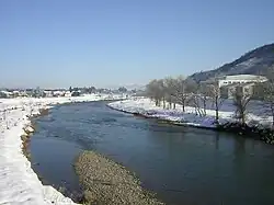
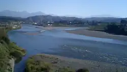
The river is 66.7 km long, its basin size is 1519 km².[2] The average stream slope is 1/49.[4] The average discharge at Horinouchi is 157 m3/s.[1]
References
- ^ a b "Shinano River" (PDF). www.japanriver.or.jp. Foundation of River and Basin Integrated Communications. 2002. Archived (PDF) from the original on 2022-01-12. Retrieved 2022-01-12.
- ^ a b "信濃川水系 魚野川圏域河川整備計画" (PDF). www.pref.niigata.lg.jp. Archived (PDF) from the original on 2020-05-15. Retrieved 2023-01-04.
- ^ "魚野川". kotobank.jp (in Japanese). Archived from the original on 2023-01-04. Retrieved 2023-01-04.
- ^ "Outline of drainage area". www.hrr.mlit.go.jp. Archived from the original on 2008-01-01. Retrieved 2023-02-15.