Talalaivka
Talalaivka
Талалаївка | |
|---|---|
 | |
 Coat of arms | |
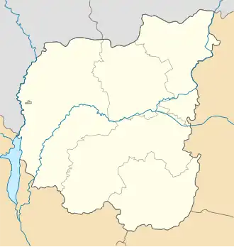 Talalaivka Location of Talalayivka 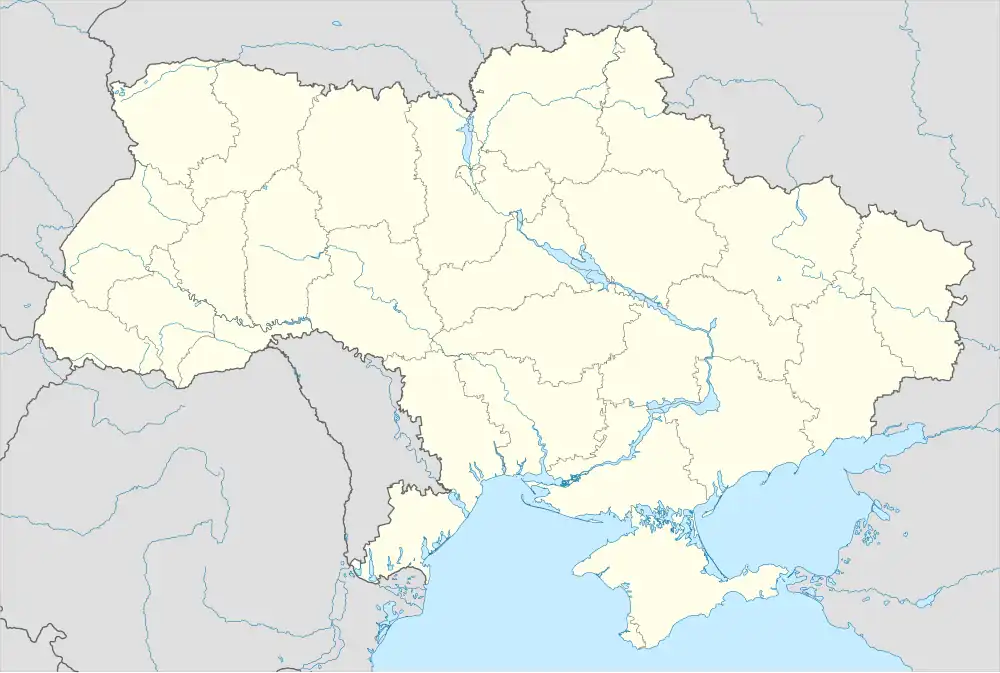 Talalaivka Talalaivka (Ukraine) | |
| Coordinates: 50°50′14″N 33°8′27″E / 50.83722°N 33.14083°E | |
| Country | Ukraine |
| Oblast | Chernihiv Oblast |
| Raions | Pryluky Raion |
| Area | |
• Total | 8.96 km2 (3.46 sq mi) |
| Population (2022) | |
• Total | 4,562 |
| • Density | 510/km2 (1,300/sq mi) |
| Area code | +380 4634 |
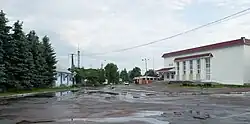
Talalaivka (Ukrainian: Талалáївка, Russian: Талалáевка) is a rural settlement in Pryluky Raion, Chernihiv Oblast (province) of northern Ukraine. The Talalaivka is located within the Dnieper Lowland, in the Sula basin, on the Polesia. It hosts the administration of Talalaivka settlement hromada, one of the hromadas of Ukraine.[1] Population: 4,562 (2022 estimate).[2]
History
Until 18 July 2020, Talalaivka was the administrative center of Talalaivka Raion. The raion was abolished in July 2020 as part of the administrative reform of Ukraine, which reduced the number of raions of Chernihiv Oblast to five. The area of Talalaivka Raion was merged into Pryluky Raion.[3][4]
Until 26 January 2024, Talalaivka was designated urban-type settlement. On this day, a new law entered into force which abolished this status, and Talalaivka became a rural settlement.[5]
Geography
The Talalaivka is located in the northeast of Pryluky Raion, on the border with the Romensky Raion of Sumy Oblast. The settlement is located 210 km from Chernihiv and 70 km from Pryluky. [6]The territory of the Talalaivka is located within the Dnieper Lowland, in the Sula basin. The relief surface is a lowland plain, in places dissected by river valleys.[7][8]
The climate of Talalaivka is moderately continental, with warm summers and relatively mild winters. The average temperature in January is about -7°C, and in July - +19°C. The average annual precipitation ranges from 550 to 660 mm, with the highest amount of precipitation in the summer period.[9][10]
The soil cover of the Talalaivka is dominated by chernozem and podzolized soils. The settlement is located the forest steppe, on the Polesia. There are swamps and ponds in and around Talalaivka. Minerals: oil, gas and sand.[11][12][8]
Economy
The leading sectors of the hromadas economy are agriculture, mining and food industry.[8]
Transportation
Regional roads and a railway pass through the village.[12][6]
References
- ^ "Талалаевская громада" (in Russian). Портал об'єднаних громад України. Retrieved 2020-10-03.
- ^ Чисельність наявного населення України на 1 січня 2022 [Number of Present Population of Ukraine, as of January 1, 2022] (PDF) (in Ukrainian and English). Kyiv: State Statistics Service of Ukraine. Archived (PDF) from the original on 4 July 2022.
- ^ "Про утворення та ліквідацію районів. Постанова Верховної Ради України № 807-ІХ". Голос України (in Ukrainian). 2020-07-18. Retrieved 2020-10-03.
- ^ "Нові райони: карти + склад" (in Ukrainian). Міністерство розвитку громад та територій України. Retrieved 2020-10-03.
- ^ "Что изменится в Украине с 1 января". glavnoe.in.ua (in Russian). Retrieved 2024-04-28.
- ^ a b ПРОФІЛЬ ТАЛАЛАЇВСЬКОЇ СЕЛИЩНОЇ ТЕРИТОРІАЛЬНОЇ ГРОМАДИ 04.02.2025 Офіційний сайт громади Retrieved 2025-07-11.
- ^ Національний атлас України/НАН України, Інститут географії, Державна служба геодезії, картографії та кадастру; голов. ред. Л. Г. Руденко; голова ред. кол.Б.Є. Патон. — К.: ДНВП «Картографія», 2007. — 435 с. — 5 тис.прим. — ISBN 978-966-475-067-4. Retrieved 2025-07-11
- ^ a b c "Програма соціально-економічного розвитку Сухополов'янської сільської територіальної громади на 2022-2024 роки". shp-gromada.gov.ua (in Ukrainian). Retrieved 2025-07-11.
- ^ "Кліматичні характеристики". Сайт Чернігівського метеоцентра. Retrieved 2025-07-11.
- ^ Чернігівська область. Географічний атлас. Серія «Моя мала Батьківщина» – 2003 р. ISBN 966-7620-39-5 Retrieved 2025-07-11.
- ^ Білоус, М. Д. Географія Чернігівської області / М. Д. Білоус. — Чернігів: Ранок, 2010. — 144 с Retrieved 2025-07-11
- ^ a b Чернігівська область. Географічний атлас. Серія «Моя мала Батьківщина» – 2003 р. ISBN 966-7620-39-5 Retrieved 2025-07-11.