Třebovice (Ostrava)
Třebovice | |
|---|---|
 Church of the Assumption of the Virgin Mary | |
 Flag  Coat of arms | |
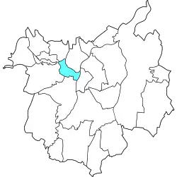 Location of Třebovice in Ostrava | |
| Coordinates: 49°50′5″N 18°11′41″E / 49.83472°N 18.19472°E | |
| Country | |
| Region | Moravian-Silesian |
| Municipality | Ostrava |
| Area | |
• Total | 2.82 km2 (1.09 sq mi) |
| Population (2021)[1] | |
• Total | 1,828 |
| • Density | 650/km2 (1,700/sq mi) |
| Time zone | UTC+1 (CET) |
| • Summer (DST) | UTC+2 (CEST) |
| Postal code | 722 00 |
| Website | trebovice |
Třebovice is a borough and municiapl part of the city of Ostrava in the Czech Republic. It is situated in the north-central part of the city, on the right bank of the Opava River. Originally a separate municipality, it was incorporated into Ostrava in 1958, as a part of the Poruba borough. On 24 November 1990, it was separated from Poruba and became one of the 23 self-governing boroughs of Ostrava.[2] The confluence of the Opava and Oder rivers is located in the borough, on the border with Hošťálkovice.[3]
Etymology
The name Třebovice is presumably derived from the Old Czech verb třiebiti, which means 'to clear the forest'.[4]
Gallery
-
-
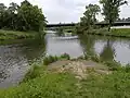 Confluence of Oder and Opava rivers
 -
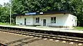 Train station
References
- ^ "Results of the 2021 Census - Open data". Public Database (in Czech). Czech Statistical Office. 27 March 2021.
- ^ "Ostravské městské obvody". eOstrava.cz (in Czech). Retrieved 7 July 2025.
- ^ "Soutok Odry a Opavy". tourismato.cz. Retrieved 9 July 2025.
- ^ David, Jaroslav (2012). Paměť města - názvy míst Ostrava (in Czech) (1st ed.). Ostrava: University of Ostrava. p. 33. ISBN 978-80-7464-141-1.