Hošťálkovice
Hošťálkovice | |
|---|---|
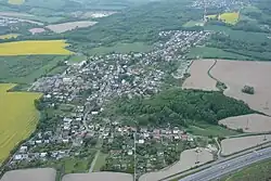 Areal view of Hošťálkovice | |
 Flag  Coat of arms | |
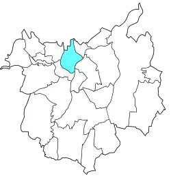 Location of Hošťálkovice in Ostrava | |
| Coordinates: 49°50′49″N 18°12′54″E / 49.84694°N 18.21500°E | |
| Country | |
| Region | Moravian-Silesian |
| Municipality | Ostrava |
| Area | |
• Total | 5.30 km2 (2.05 sq mi) |
| Population (2021)[1] | |
• Total | 1,683 |
| • Density | 320/km2 (820/sq mi) |
| Time zone | UTC+1 (CET) |
| • Summer (DST) | UTC+2 (CEST) |
| Postal code | 725 28 |
| Website | hostalkovice |
Hošťálkovice is a borough and municipal part of the city of Ostrava in the Czech Republic. It is situated in the northern part of the city, above the confluence of Oder and Opava rivers, on their left bank. Originally, it was a separate municipality, until it merged with Ostrava in April 1976.[2] On 24 November 1990, it became one of the 23 self-governing boroughs of Ostrava.[3]
Etymology
The name is derived from the German given name Gottschalk, meaning 'God's servant'. The name was later adapted into Czech as Hoščálek or Hošťálek, and by adding the possessive suffix -ovice, it became Hošťálkovice, meaning "Hošťálek's settlement".[4]
Gallery
-
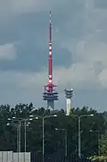 Hošťálkovice television and radio tower
 -
 Hošťálkovice observation tower
 -
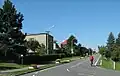 Main street
 -
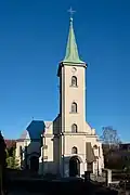 Church of All Saints
References
- ^ "Results of the 2021 Census - Open data". Public Database (in Czech). Czech Statistical Office. 27 March 2021.
- ^ "Obec v období let 1945 až 1976" (in Czech). City of Ostrava. Retrieved 6 July 2025.
- ^ "Ostravské městské obvody". eOstrava.cz (in Czech). Retrieved 7 July 2025.
- ^ David, Jaroslav (2012). Paměť města - názvy míst Ostrava (in Czech) (1st ed.). Ostrava: University of Ostrava. p. 35. ISBN 978-80-7464-141-1.