Qerveh, Zanjan
Qerveh
Persian: قروه | |
|---|---|
Village | |
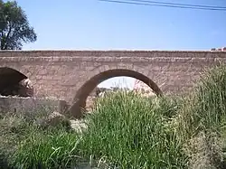 The Old Qerveh Bridge | |
 Qerveh | |
| Coordinates: 36°03′40″N 49°23′06″E / 36.06111°N 49.38500°E[1] | |
| Country | Iran |
| Province | Zanjan |
| County | Abhar |
| District | Central |
| Rural District | Howmeh |
| Population (2016)[2] | |
• Total | 2,686 |
| Time zone | UTC+3:30 (IRST) |
| Area code | 0242536 |
Qerveh (Persian: قروه)[a] is a village in Howmeh Rural District[4] of the Central District in Abhar County, Zanjan province, Iran.
Demographics
Population
At the time of the 2006 National Census, the village's population was 2,772 in 720 households.[5] The following census in 2011 counted 2,640 people in 781 households.[6] The 2016 census measured the population of the village as 2,686 people in 871 households. It was the most populous village in its rural district.[2]
Overview
Qerveh is one of the oldest villages in Abhar County. This area has more than three thousand years of history, leaving some remains: the old house built on cliff, the Imam Zadeh abol kheirebne mosabne jafar (امامزاده ابوالخیر بن موسی بن جعفر) and the old Sadat cemetery which has two young martyrs (Who has died in war against enemy): Seyed Abdol Karim ebne Saeed (سید عبد الکریم ین سعید) and Hossein ebne Rostam (حسین بن رستم). The Gherveh Spacious Mosque is here and the entrance bridge which has the Ahura Mazda logo on it.
Economy
The main source of income for villagers is through agriculture, farming and horticulture. Agricultural products include grapes, walnuts, almonds and tomatoes.
See also
Notes
References
- ^ OpenStreetMap contributors (28 April 2025). "Qerveh, Abhar Howmeh RD, Abhar Central District, Abhar County, Zanjan Province, Iran" (Map). OpenStreetMap (in Persian). Retrieved 28 April 2025.
- ^ a b سرشماري عمومي نفوس و مسكن 1395 : استان زنجان [General Population and Housing Census 2016: Zanjan Province]. مرکز آمار ایران [Statistical Centre of Iran] (in Persian). Archived from the original (Excel) on 27 April 2022. Retrieved 19 December 2022.
- ^ Qerveh can be found at GEOnet Names Server, at this link, by opening the Advanced Search box, entering "-3080101" in the "Unique Feature Id" form, and clicking on "Search Database".
- ^ Mousavi, Mir-Hossein (22 April 1987) [تاریخ تصویب (Approval date) 1366/02/02 (Iranian Jalali calendar)]. ایجاد و تشکیل تعداد 9 دهستان شامل روستاها، مزارع و مکانها واقع در شهرستان ابهر تابع استان زنجان [Creation and formation of nine rural districts including villages, farms and places located in Abhar County under Zanjan province]. لام تا کام [Lam ta Kam] (in Persian). وزارت کشور [Ministry of the Interior]. هیات وزیران [Council of Ministers]. شناسه [ID] 10E8D2EA-34D4-4263-9C5A-723F410138CB. شماره دوره [Course number] 66, شماره جلد [Volume number] 2. Archived from the original on 25 June 2025. Retrieved 25 June 2025.
- ^ سرشماري عمومي نفوس و مسكن 1385 : استان زنجان [General Population and Housing Census 2006: Zanjan Province]. مرکز آمار ایران [Statistical Centre of Iran] (in Persian). Archived from the original (Excel) on 20 September 2011. Retrieved 25 September 2022.
- ^ سرشماري عمومي نفوس و مسكن 1390 : استان زنجان [General Population and Housing Census 2011: Zanjan Province]. Iran Data Portal—Syracuse University (in Persian). مرکز آمار ایران [Statistical Centre of Iran]. Archived from the original (Excel) on 21 January 2023. Retrieved 19 December 2022.
Zanjan province, Iran | ||||||||||||||||
|---|---|---|---|---|---|---|---|---|---|---|---|---|---|---|---|---|
Capital: Zanjan | ||||||||||||||||
| Counties and cities |
|  | ||||||||||||||
| Sights |
| |||||||||||||||
| populated places | ||||||||||||||||