This portal's subpages have been checked by an editor, and are needed.
Additional notes: This portal was updated and expanded in September 2019.
Please take care when editing, especially if using automated editing software. Learn how to update the maintenance information here.
The Zambia Portal
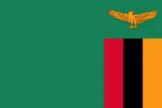
Flag of Zambia
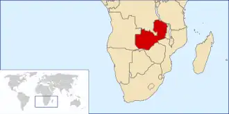
Zambia, officially the Republic of Zambia, is a landlocked country at the crossroads of Central, Southern and East Africa. It is typically referred to being in South-Central Africa or Southern Africa. It is bordered to the north by the Democratic Republic of the Congo, Tanzania to the north-east, Malawi to the east, Mozambique to the southeast, Zimbabwe and Botswana to the south, Namibia to the southwest, and Angola to the west. The capital city of Zambia is Lusaka, located in the south-central part of Zambia. The population is concentrated mainly around Lusaka in the south and the Copperbelt Province to the north, the core economic hubs of the country.
On 24 October 1964, Zambia became independent of the United Kingdom as a republic in the Commonwealth, and prime minister Kenneth Kaunda became the inaugural president. Kaunda's socialistUnited National Independence Party (UNIP) maintained power from 1964 until 1991 with him playing a key role in regional diplomacy, cooperating closely with the United States in search of solutions to conflicts in Southern Rhodesia (Zimbabwe), Angola, and Namibia. From 1972 to 1991, Zambia was a one-party state with UNIP as the sole legal political party under the motto "One Zambia, One Nation" coined by Kaunda. Kaunda was succeeded by Frederick Chiluba of the social-democraticMovement for Multi-Party Democracy in 1991, beginning a period of socio-economic development and government decentralisation. Zambia has since become a multi-party state and has experienced several peaceful transitions of power.
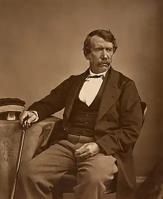
Feira was probably the first European settlement in Zambia, but the dates are not well documented. What is documented is that the Portuguese first settled on the opposite bank of the Luangwa at Zumbo in Mozambique in the early 18th century, and by 1720 some had settled in Feira. The town was abandoned again by 1856, when it was visited by the explorer David Livingstone and described as completely ruined. It was resettled in 1887 by John Harrison Clark, who lived there until 1895. (Full article...)
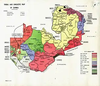
Image 5Tribal and linguistic map of Zambia (from Zambia)
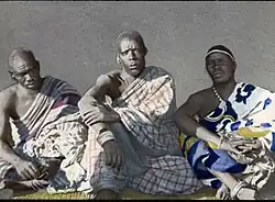
Image 6Three young Ngoni chiefs. The Ngoni made their way into Eastern Zambia from KwaZulu in South Africa. They eventually assimilated into the local ethnic groups. (from Zambia)
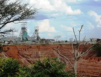
Image 7The major Nkana open copper mine, Kitwe. (from Zambia)
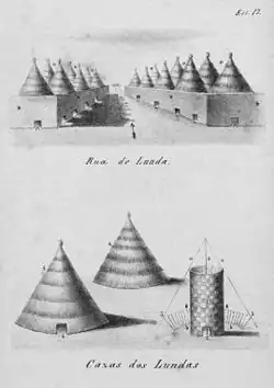
Image 16A drawing of Lunda houses by a Portuguese. The size of the doorways relative to the building emphasizes the scale of the buildings. (from History of Zambia)
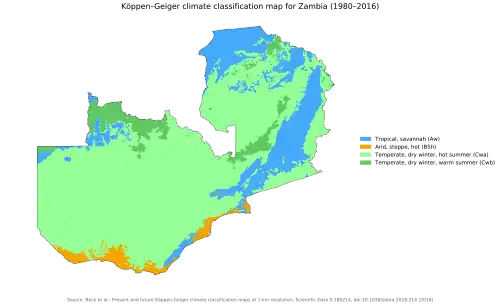
Image 17Zambia map of Köppen climate classification (from Zambia)
Image 18The kalonga (ruler) of the Chewa today descends from the kalonga of the Maravi Empire (from Zambia)
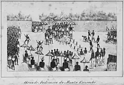
Image 19Drawing of the ruler of Lunda, Mwata Kazembe, receiving Portuguese in the royal courtyard in the 1800s (from History of Zambia)
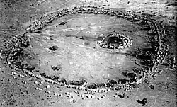
Image 24Enormous Ba-Ila settlement. These communities have been of interest to mathematicians due to their fractal pattern design. (from History of Zambia)
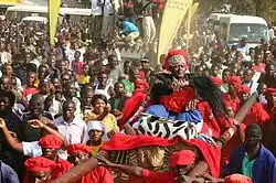
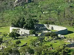
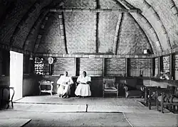
Image 32Inside the palace of the Litunga, ruler of the Lozi. Due to the flooding on the Zambezi, the Litunga has two palaces one of which is on higher ground. The movement of Litunga to higher land is celebrated at the Kuomboka Ceremony (from History of Zambia)
Image 33Inside the palace of the Litunga, ruler of the Lozi. Due to the flooding on the Zambezi, the Litunga has two palaces one of which is on higher ground. The movement of Litunga to higher land is celebrated at the Kuomboka Ceremony (from Zambia)
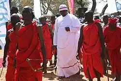
Image 37S.M Chisembele, Cabinet Minister, Western Province (from History of Zambia)
Image 38The kalonga (ruler) of the Chewa today descends from the kalonga of the Maravi Empire (from Zambia)
Image 39Three young Ngoni chiefs. The Ngoni made their way into Eastern Zambia from KwaZulu in South Africa. They eventually assimilated into the local ethnic groups. (from History of Zambia)
Image 40Density map of dominant regional languages
Image 41A drawing of Lunda houses by a Portuguese visitor. The size of the doorways relative to the building emphasizes the scale of the buildings (from Zambia)
Image 42An 1864 photograph of the Scottish explorer and missionary David Livingstone (from Zambia)
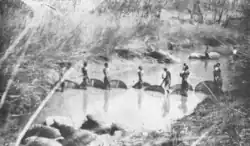
Image 43Batonga fisherwomen in Southern Zambia. Women have and continue to play important roles in many African societies. (from History of Zambia)
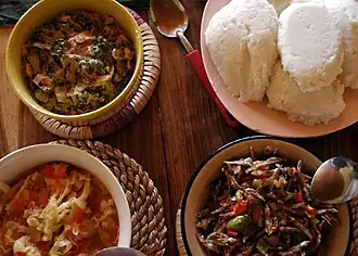
Image 44Nsima (top right corner) with three types of relish. (from Zambia)
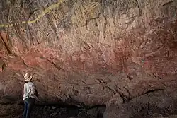
Image 45Ancient (but graffitied) Rock Art in Nsalu Cave, Kasanka National Park in North-Central Zambia (from Zambia)
Image 50GDP per capita (current), compared to neighbouring countries (world average = 100) (from Zambia)
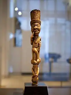
Image 51Seated female Staffs of office (Kibango), were displayed by Luba kings. In Luba society, women's bodies were considered the ultimate vessels of spiritual power. (from History of Zambia)
Image 52A drawing of Lunda houses by a Portuguese visitor. The size of the doorways relative to the building emphasizes the scale of the buildings (from Zambia)
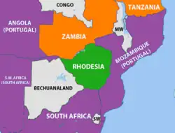
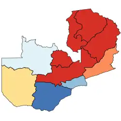
Image 53The geopolitical situation during the Rhodesian Bush War in 1965 – countries friendly to the nationalists are coloured orange (from Zambia)
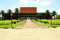
Image 54Zambia National Assembly building in Lusaka (from Zambia)
Image 55Inside the palace of the Litunga, ruler of the Lozi. Due to the flooding on the Zambezi, the Litunga has two palaces one of which is on higher ground. The movement of Litunga to higher land is celebrated at the Kuomboka Ceremony (from Zambia)
Image 56Batonga fisherwomen in Southern Zambia. Women have played and continue to play pivotal roles in many African societies (from Zambia)
Image 63Zambia National Assembly building in Lusaka (from Zambia)
Image 64Nsima (top right corner) with three types of relish. (from Zambia)
Image 65Three young Ngoni chiefs. The Ngoni made their way into Eastern Zambia from KwaZulu in South Africa. They eventually assimilated into the local ethnic groups. (from Zambia)
Image 66Zambia map of Köppen climate classification (from Zambia)
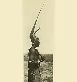
Image 67Ila Headman's son in Southern Zambia, Cattle formed an important part of their society. (from History of Zambia)
The chacma baboon (Papio ursinus), also known as the Cape baboon, is, like all other baboons, from the Old World monkey family. It is one of the largest of all monkeys. Located primarily in southern Africa, the chacma baboon has a wide variety of social behaviours, including a dominance hierarchy, collective foraging, adoption of young by females, and friendship pairings. These behaviors form parts of a complex evolutionary ecology. In general, the species is not threatened, but human population pressure has increased contact between humans and baboons. Hunting, trapping, and accidents kill or remove many baboons from the wild, thereby reducing baboon numbers and disrupting their social structure. (Full article...)

.jpg)

.jpg)
%252C_%25_of_world_average%252C_1960-2012%253B_Zimbabwe%252C_South_Africa%252C_Botswana%252C_Zambia%252C_Mozambique.png)

_Luba_peoples_The_Metropolitan_Museum_of_Art.png)
.svg.png)
_(16824823063).jpg)