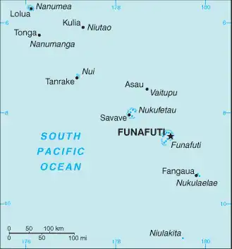
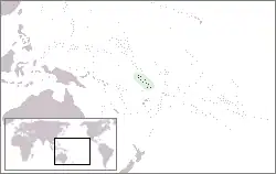
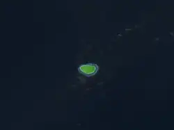
Map of Tuvalu The 2011 Tuvalu drought was a period of severe drought afflicting Tuvalu, a South Pacific island country of approximately 10,500 people, in the latter half of 2011. A state of emergency was declared on September 28, 2011; with rationing of available fresh-water. The La Niña event that caused the drought ended in April–May 2012. By August 2012 the El Niño-Southern Oscillation (ENSO) Conditions indicated that the tropical Pacific Ocean was on the brink of an El Niño event. (Full article...)
Image 3
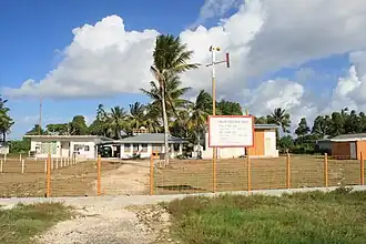
Motufoua Secondary School is a boarding school for children on Vaitupu atoll, Tuvalu. As of 2000 it is the largest high school in Tuvalu. As Tuvalu consists of nine islands, the students reside on Vaitupu during the school year and return to their home islands during the school vacations.
The school received worldwide attention in March 2000, when a fire in a dormitory at the school killed 19 girls and an adult supervisor. It was later discovered that the fire was caused by a student using a candle to read during the night. The school celebrated 100 years of education in 2005. (Full article...)
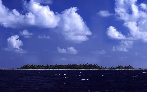
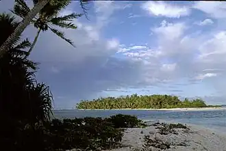
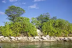
Tuvalu, previously known as the Ellice Islands, is an island country in Polynesia in the Pacific Ocean. It consists of six atolls and three reef islands (islands made of rocks from coral skeletons), with a total land area of 26 km2 (10 sq mi). Its climate is hot and humid, with annual rainfall varying from 2,500–3,500 mm (98–138 in). The soil is very weakly developed, consisting mostly of coral sand and calcium carbonate-rich regosols. Vegetation on the islands predominantly consists of coconuts, screw palms, Casuarina, creepers, and grass, although some native forest exists. Previously, the islands were likely covered with Pisonia woodland.
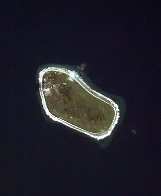
Vaitupu is the largest atoll of the nation of Tuvalu. It is located at 7.48 degrees south and 178.83 degrees east. There are 1,077 people (2022 Census) living on 5.6 square kilometres (2.2 square miles) with the main village being Asau. (Full article...)
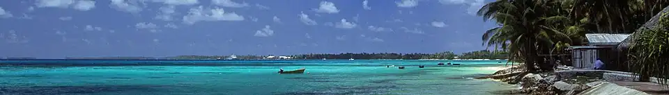
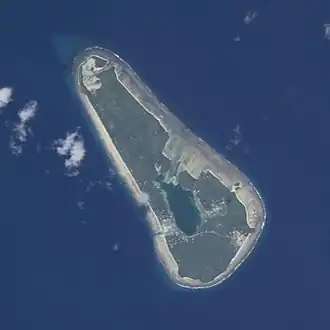
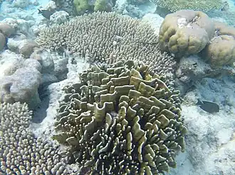
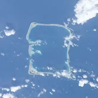
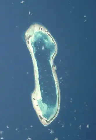
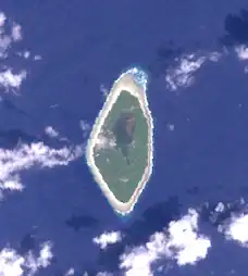
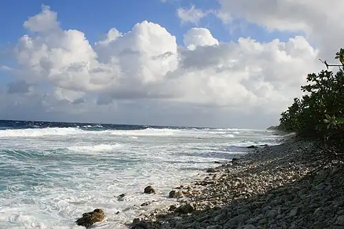
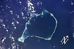
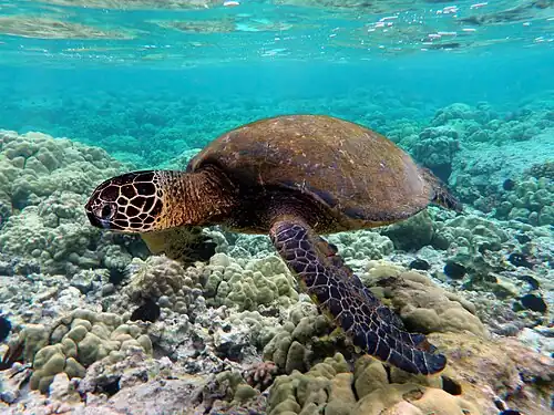
The coral reefs of Tuvalu consist of three reef islands and six atolls, containing approximately 710 km2 (270 sq mi) of reef platforms. The islands of the Tuvalu archipelago are spread out between the latitude of 5° to 10° south and longitude of 176° to 180°, west of the International Date Line. The islands of Tuvalu are volcanic in origin. On the atolls, an annular reef rim surrounds the lagoon, and may include natural reef channels. The reef islands have a different structure to the atolls, and are described as reef platforms as they are smaller tabular reef platforms that do not have a salt-water lagoon, although they may have a completely closed rim of dry land, with the remnants of a lagoon that has no direct connection to the open sea or that may be drying up. (Full article...)
Lesbian, gay, bisexual, transgender and queer (LGBTQ) people in Tuvalu face legal difficulties not experienced by non-LGBTQ residents. Sections 153, 154 and 155 of the Penal Code outlaw male homosexual intercourse with a penalty of up to 14 years in prison, but the law is not enforced. Employment discrimination on the basis of sexual orientation has been banned since 2017. Since 2023, the Constitution of Tuvalu has banned same-sex marriage.
Tuvaluannationality law is regulated by the 1986 Constitution of Tuvalu, as amended; the 1979 Citizenship Ordinance, and its revisions; and various British Nationality laws. These laws determine who is, or is eligible to be, a national of Tuvalu. Tuvaluan nationality is typically obtained either on the principle of jus soli, i.e. by birth in Tuvalu or under the rules of jus sanguinis, i.e. by birth abroad to parents with Tuvaluan nationality. It can be granted to persons with an affiliation to the country, or to a permanent resident who has lived in the country for a given period of time through naturalisation. Nationality establishes one's international identity as a member of a sovereign nation. Though it is not synonymous with citizenship, for rights granted under domestic law for domestic purposes, the United Kingdom, and thus the Commonwealth, have traditionally used the words interchangeably. (Full article...)
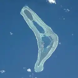
Nui is an atoll and one of nine districts of the Pacific Ocean state of Tuvalu. It has a land area of 3.37 km2 and a population of 514 (2022 Census).
Traditionally Nuian culture is organised in three family circles – Tekaubaonga, Tekaunimala and Tekaunibiti families. Most people live on the western end of Fenua Tapu. In the 2012 census, 321 people live in Alamoni – Maiaki and 221 people live in Manutalake – Meang (Tanrake). The junior school is Vaipuna Primary School. (Full article...)
Image 15
The National Bank of Tuvalu (NBT) is the sole provider of banking services in Tuvalu. These services include taking deposits, making loans, and engaging in foreign exchange transactions. In 2020, its assets were AUD$128 million, or 160% of the country's GDP.
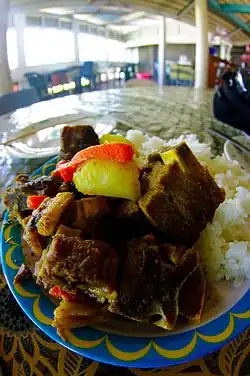
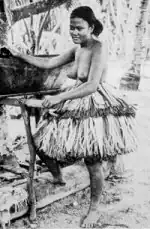
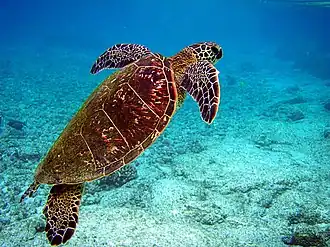
The cuisine of Tuvalu is based on the staple of coconut and the many species of fish found in the ocean and the lagoons of the atolls of Tuvalu. Pulaka, (cyrtosperma merkusii), or swamp taro, is an important source of carbohydrates. Rice now forms an important part of the diet. Coconut is used in different forms with coconut water, coconut milk and the flesh of the coconut being used to flavour dishes. Various desserts made on the islands include coconut and coconut milk, instead of animal milk.
Categories
Tuvalu · Island countries ·
Polynesia ·
Category puzzle
Tuvalu
Tuvalu-related lists
Buildings and structures in Tuvalu
Culture of Tuvalu
Economy of Tuvalu
Education in Tuvalu
Environment of Tuvalu
Geography of Tuvalu
Government of Tuvalu
Health in Tuvalu
History of Tuvalu
Organizations based in Tuvalu
Tuvaluan people
Politics of Tuvalu
Society of Tuvalu
Tuvalu stubs
General images -
The following are images from various Tuvalu-related articles on Wikipedia.
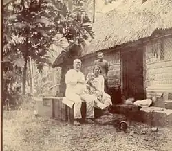
Image 1Interior of a maneapa on Funafuti, Tuvalu (from History of Tuvalu)
Image 2Interior of a maneapa on Funafuti, Tuvalu. (from History of Tuvalu)
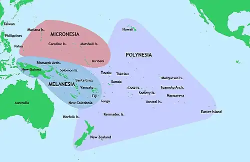
Image 10Polynesia is the largest of three major cultural areas in the Pacific Ocean. Polynesia is generally defined as the islands within the Polynesian triangle. (from History of Tuvalu)
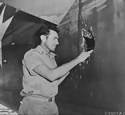
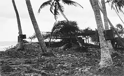
Image 171st Lt. Louis Zamperini, peers through a hole in his B-24D Liberator 'Super Man' made by a 20mm shell over Nauru, 20 April 1943. (from History of Tuvalu)
Image 40The atoll of Funafuti; borings into a coral reef and the results, being the report of the Coral Reef Committee of the Royal Society (1904). (from History of Tuvalu)


.svg.png)


.jpg)

_(14765813295).jpg)