Portal:South Australia
 The South Australia Portal
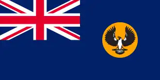
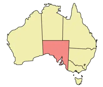
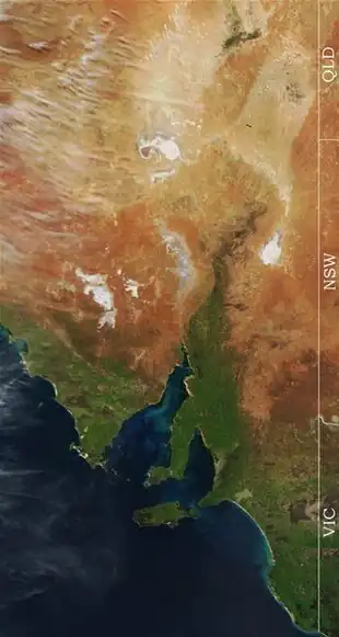
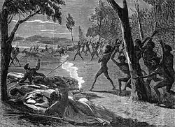
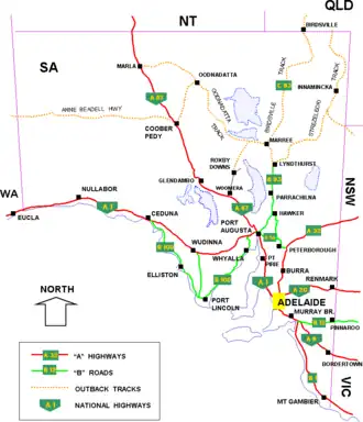
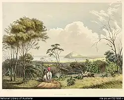
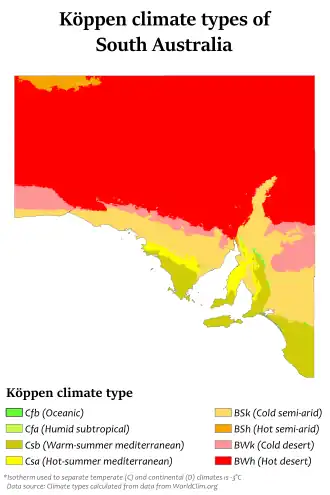
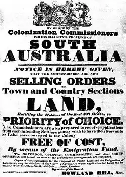
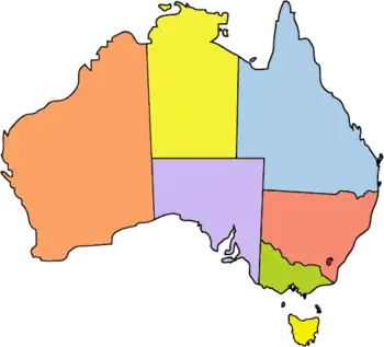
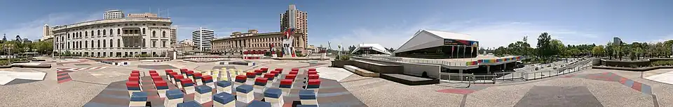
South Australia (commonly abbreviated as SA) is a state in the southern central part of Australia. With a total land area of 984,321 square kilometres (380,048 sq mi), it is the fourth-largest of Australia's states and territories by area, which includes some of the most arid parts of the continent, and with 1.8 million people, it is the fifth-largest of the states and territories by population. This population is the second-most highly centralised in the nation after Western Australia, with more than 77% of South Australians living in the capital Adelaide or its environs. Other population centres in the state are relatively small; Mount Gambier, the second-largest centre, has a population of 26,878. South Australia shares borders with all the other mainland states. It is bordered to the west by Western Australia, to the north by the Northern Territory, to the north-east by Queensland, to the east by New South Wales, and to the south-east by Victoria. To the south, its border is the ocean, the Great Australian Bight. The state comprises less than 8% of the Australian population and ranks fifth in population among the six states and two territories. The majority of its people reside in greater Metropolitan Adelaide. Most of the remainder are settled in fertile areas along the south-eastern coast and River Murray. The state's colonial origins are unique in Australia as a freely settled, planned British province, rather than as a convict settlement. Colonial government commenced on 28 December 1836, when the members of the council were sworn in near the Old Gum Tree. As with the rest of the continent, the region has a long history of human occupation by numerous tribes and languages. The South Australian Company established a temporary settlement at Kingscote, Kangaroo Island, on 26 July 1836, five months before Adelaide was founded. The guiding principle behind settlement was that of systematic colonisation, a theory espoused by Edward Gibbon Wakefield that was later employed by the New Zealand Company. The goal was to establish the province as a centre of civilisation for free immigrants, promising civil liberties and religious tolerance. Although its history has been marked by periods of economic hardship, South Australia has remained politically innovative and culturally vibrant. Today, it is known for its fine wine and numerous cultural festivals. The state's economy is dominated by the agricultural, manufacturing and mining industries. (Full article...) Selected article -Waterfall Gully is an eastern suburb of the South Australian capital city of Adelaide. It is located in the foothills of the Mount Lofty Ranges around 5 km (3.1 mi) east-south-east of the Adelaide city centre. For the most part, the suburb encompasses one long gully with First Creek at its centre and Waterfall Gully Road running adjacent to the creek. At the southern end of the gully is First Falls, the waterfall for which the suburb was named. Part of the City of Burnside, Waterfall Gully is bounded to the north by the suburb of Burnside, from the north-east to south-east by Cleland National Park (part of the suburb of Cleland), to the south by Crafers West, and to the west by Leawood Gardens and Mount Osmond. Historically, Waterfall Gully was first explored by European settlers in the early-to-mid-19th century, and quickly became a popular location for tourists and picnickers. The government chose to retain control over portions of Waterfall Gully until 1884, when they agreed to place the land under the auspices of the City of Burnside. 28 years later the government took back the management of the southern part of Waterfall Gully, designating it as South Australia's first National Pleasure Resort. Today this area remains under State Government control, and in 1972 the Waterfall Gully Reserve, as it was then known, became part of the larger Cleland Conservation Park (from November 2021 a national park). (Full article...) Selected Picture -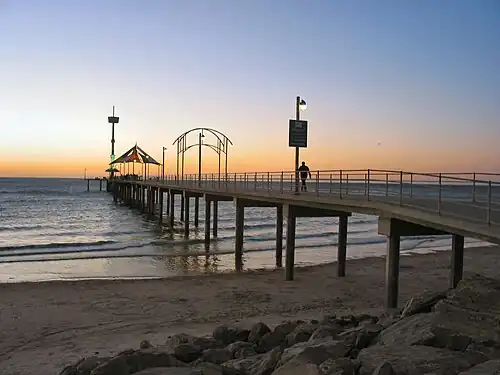 Brighton is a coastal suburb of Adelaide, South Australia, situated between Seacliff and Glenelg and aside Holdfast Bay. Some notable features of the area are the Brighton-Seacliff Yacht Club, the Brighton Surf Lifesaving Club, the Brighton Jetty, and its excellent beach. General imagesThe following are images from various South Australia-related articles on Wikipedia.
Did You Know... -
Categories Select [►] to view subcategories
South Australia South Australia-related lists Buildings and structures in South Australia Burials in South Australia Culture of South Australia Economy of South Australia Education in South Australia Environment of South Australia Geography of South Australia Health in South Australia History of South Australia Images of South Australia People from South Australia Politics of South Australia Society in South Australia South Australia portal Sport in South Australia Tourist attractions in South Australia Transport in South Australia South Australia stubs South Australia articles missing geocoordinate data Related Portals
WikiProjects
Major TopicsGeography – Adelaide Hills • Adelaide Plains • Barossa Valley • Clare Valley • Coonawarra • Eyre Peninsula • Fleurieu Peninsula • Flinders Ranges • Kangaroo Island • Limestone Coast • Mid North • Nullarbor Plain • Riverland • Yorke Peninsula History – Kaurna Indigenous people • European settlement • History of Adelaide • Proclamation Day • Australian Overland Telegraph Line • Timeline of South Australian history Towns and Cities – Adelaide • Coober Pedy • Mount Gambier • Murray Bridge| Port Augusta • Port Lincoln • Port Pirie • Victor Harbor • Whyalla Economy and Politics – Premiers • Governors • Parliament • House of Assembly • Electoral districts • Legislative Council • State elections Culture – Croweater • Pie floater • Wine • The Advertiser • Adelaide Festival Centre • Adelaide Entertainment Centre • WOMADelaide • Adelaide Fringe • Elder Park • The Crows • The Power • The Reds • Redbacks • Hindmarsh Stadium • AAMI Stadium • Rundle Mall People – Kaurna Indigenous people • Matthew Flinders • William Light • Charles Sturt • Edward Gibbon Wakefield • John Hindmarsh • George Gawler • Playford family • Don Dunstan More portalsThings you can doHere are some tasks you can do to help with WikiProject Adelaide:
 Associated WikimediaThe following Wikimedia Foundation sister projects provide more on this subject:
Discover Wikipedia using portals
| ||||||||||||||||||||