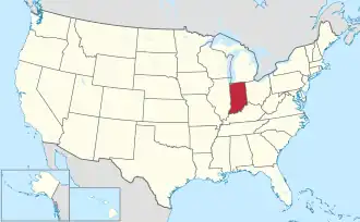
Portal:Indiana
The Indiana Portal
Indigenous resistance to American settlement was broken with defeat of the Tecumseh's confederacy in 1813. The new settlers were primarily Americans of British ancestry from the eastern seaboard and the Upland South, and Germans. After the Civil War, in which the state fought for the Union, natural gas attracted heavy industry and new European immigrants to its northern counties. In the first half of the 20th century, northern and central sections experienced a boom in goods manufacture and automobile production. Southern Indiana remained largely rural. After the rise and fall of the Klan in the 1920s, the state swung politically from the Republican to Democratic Party in the New Deal 1930s. Today, with a decades-long record of returning Republican majorities, Indiana is counted a "Red state".
Indiana has a diverse economy with a gross state product in 2023 of 404.3 billion. Indianapolis is at the center of the state's largest metropolitan area, with a population of over two million. The Fort Wayne metro area follows with a population of 645,000. (Full article...)
Selected article -
The U.S. state of Indiana has 17 official state emblems, as well as other designated official and unofficial items. The majority of the symbols in the list are officially recognized and created by an act of the Indiana General Assembly and signed into law by the governor. They are listed in Indiana Code Title 1, Article 2, State Emblems which also regulates the appearance and applicable use of the items.
Compared to other states, Indiana has few official symbols. The first symbol was the Seal of Indiana, which was made official in 1801 for the Indiana Territory and again in 1816 by the state of Indiana. It served as the state's only emblem for nearly a century until the adoption of the state song in 1913. For many years, Indiana was the only state without a flag. The official state banner was adopted in 1917, and renamed the state flag in 1955. The newest symbol of Indiana is the state fossil, mastodon, which was declared in 2022. (Full article...)
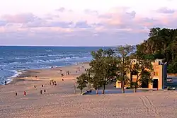
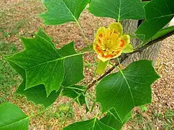
Selected image -
 |
Did you know -
- ... that an Indiana university recently argued in court that The Silver Veil and the Golden Gate, a 1914 painting, was too modern for their art collection?
- ... that William N. Salin was twice decorated with the Sagamore of the Wabash?
- ... that an Indiana TV station promised to begin broadcasting New Year's Eve — but only made it in time for Chinese New Year's Eve?
- ... that three years prior to this month's massive plastics fire in Indiana, a court determined that the site was a fire hazard "unsafe to people and property"?
- ... that an annual festival attracts fans of a defunct car company to its former manufacturing complex in Fort Wayne, Indiana?
- ... that Indianapolis's 2023 gun control ordinance – which bans assault weapons, among other measures – is a trigger law that only goes into effect if Indiana's state preemption law is repealed or struck down?
Related portals
Selected geographic article -

Corydon is a town in Harrison Township and the county seat of Harrison County, Indiana, located north of the Ohio River in the extreme southern part of the state. Corydon was founded in 1808 and served as the capital of the Indiana Territory from 1813 to 1816. It was the site of Indiana's first constitutional convention, which was held June 10–29, 1816. Forty-three delegates convened to consider statehood for Indiana and drafted its first state constitution. Under Article XI, Section 11, of the Indiana 1816 constitution, Corydon was designated as the capital of the state, which it remained until 1825, when the seat of state government was moved to Indianapolis. In 1863, during the American Civil War, Corydon was the site of the Battle of Corydon, the only official pitched battle waged in Indiana during the war. More recently, the town's numerous historic sites have helped it become a tourist destination. A portion of its downtown area is listed in the National Register of Historic Places as the Corydon Historic District. As of the 2010 census, Corydon had a population of 3,122. (Full article...)
Selected biography -
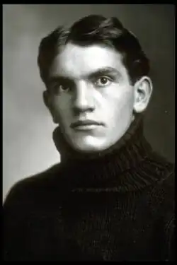
Adolph George "Germany" Schulz (April 19, 1883 – April 14, 1951) was an All-American American football center for the University of Michigan Wolverines from 1904 to 1905 and from 1907 to 1908. While playing at Michigan, Schulz is credited with having invented the spiral snap and with developing the practice of standing behind the defensive line. As the first lineman to play in back of the line on defense, he is credited as football's first linebacker.
During his time at Michigan, Schulz also became involved in one of college football's earliest recruiting controversies, as some suggested that he was a "ringer" recruited by Michigan coach Fielding H. Yost. Schulz was 21 years old when he enrolled at Michigan and had worked in an Indiana steel mill and reportedly played for either amateur or professional teams. Michigan was refused re-entry into the Western Conference in 1908 when it insisted on playing the 25-year-old Schulz for a fourth season in violation of conference eligibility rules. (Full article...)
Selected quote
General images
-
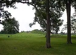 View of Mound A at Angel Mounds (from History of Indiana)
 -
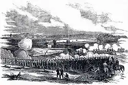 80th Indiana Infantry Regiment and the 19th Indiana Light Artillery defending against the Confederates at the Battle of Perryville by H. Mosler (from History of Indiana)
 -
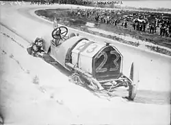 Driver Mel Marquette's wrecked McFarlan racing car at the 1912 Indianapolis 500 (from History of Indiana)
 -
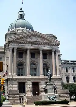 The fifth Indiana Statehouse in Indianapolis built in 1888 on the site of the third statehouse (from History of Indiana)
 -
 William Henry Harrison, the 1st Governor of Indiana Territory from 1801 to 1812, and the 9th President of the United States (from History of Indiana)
 -

-
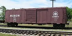 A restored Monon boxcar at the Linden Railroad Museum in Linden, Indiana (from History of Indiana)
 -
 The Circle in Indianapolis, circa 1898 (from History of Indiana)
 -
-
 Oliver Hazard Perry Morton, governor 1861 to 1867 (from History of Indiana)
 -
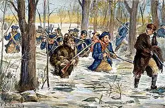 Clark's march to Vincennes, by F. C. Yohn (from History of Indiana)
 -
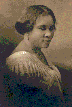 Madame C. J. Walker, Indianapolis entrepreneur and philanthropist (from History of Indiana)
 -
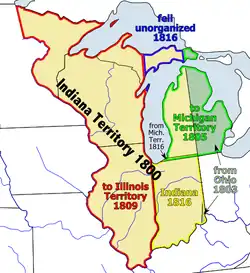 Map of the Indiana Territory (from History of Indiana)
 -
 A labor leader rallies striking steelworkers in Gary, Indiana (from History of Indiana)
 -
.jpg)
-
 Native Americans guide French explorers through Indiana as depicted by Maurice Thompson in Stories of Indiana. (from History of Indiana)
 -
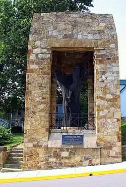 The Constitution Elm in Corydon (from History of Indiana)
Topics
- Economy: AM General - ATA Airlines - Casinos - Cummins - Delta - ITT - JayC - Lilly - Limestone - Manufacturing - NiSource - Shoe Carnival - Simon Property Group - Soybeans - Studebaker - Vectren - WellPoint
- Education: Elementary schools - Middle schools - High schools - Private schools - School districts - Colleges and universities - E-Learning - ISTEP
- Geography: Caves - Lakes - Rivers - State forests - Watersheds
| Executive |  | |
|---|---|---|
| Legislature | ||
| Judiciary |
| |
| Departments | ||
| Local government | ||
| Law | ||
Categories

Attractions


 |
Recognized content
| This is a list of recognized content, updated weekly by JL-Bot (talk · contribs) (typically on Saturdays). There is no need to edit the list yourself. If an article is missing from the list, make sure it is tagged or categorized (e.g. Category:WikiProject Indiana articles) correctly and wait for the next update. See WP:RECOG for configuration options. |
Featured articles
- 2005 United States Grand Prix
- Frank Borman
- William M. Branham
- Broad Ripple Park Carousel
- William Hayden English
- Benjamin Harrison
- John Hay
- USS Indiana (BB-1)
- Indiana-class battleship
- Janet Jackson
- Michael Jackson
- Harmon Killebrew
- Kenesaw Mountain Landis
- Lochry's Defeat
- Thomas R. Marshall
- On the Banks of the Wabash, Far Away
- Parks and Recreation season 1
- Pilot (Parks and Recreation)
- Ezra Pound
- Wiley Rutledge
- William S. Sadler
- Red Skelton
- John Gould Stephenson
- Tecumseh
- Battle of Tippecanoe
- WSNS-TV
- Warren County, Indiana
- Ryan White
- Wendell Willkie
Good articles
- 1925 tri-state tornado
- 1963 Indiana State Fairgrounds Coliseum gas explosion
- 2006 Brickyard 400
- 2008 Super Tuesday tornado outbreak
- Tornado outbreak sequence of June 3–11, 2008
- 2011 Brickyard 400
- 2011 South Bend mayoral election
- 2015 South Bend mayoral election
- 2019 South Bend mayoral election
- 2021 NCAA Division I men's basketball championship game
- 2022 College Football Playoff National Championship
- 2023 Robinson–Sullivan tornado
- Marcus Adams (Canadian football)
- Vic Aldridge
- Jeff Allen (defensive back, born 1958)
- Paul Bako
- Sean Bennett (gridiron football)
- Max Bielfeldt
- Blackford County Courthouse
- Blackford County, Indiana
- Donald Brashear
- Brown County State Park
- Sergio Brown
- Willa Brown
- Eric Bruntlett
- Pete Buttigieg
- Canvassing (Parks and Recreation)
- Castleton Square
- Hélio Castroneves
- George Rogers Clark
- Clark State Forest
- Levi Coffin
- Duesenberg
- Keith Elias
- Evan Bayh 2008 presidential campaign
- The Fault in Our Stars (film)
- Fort Wayne, Indiana
- Dario Franchitti
- Janie Fricke
- Crystal Gayle
- Hurley Goodall
- Governor of Indiana
- Gus Grissom
- Rex Grossman
- Caroline Harrison
- Harrison County, Indiana
- William Henry Harrison III
- Hartford City Courthouse Square Historic District
- Hartford City Glass Company
- Gabby Hartnett
- LaTroy Hawkins
- Howard Hawks
- Kelly Hecking
- Chris Hill (basketball)
- Thomas S. Hinde
- History of slavery in Indiana
- Lauren Holiday
- Hoosier cabinet
- Sam Hornish Jr.
- Otto Frederick Hunziker
- USS Indiana (BB-58)
- Indiana General Assembly
- Indiana Glass Company
- Indiana Governor's Residence
- Indiana in the American Civil War
- Indiana State Road 930
- Indiana Statehouse
- Indiana Territory
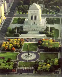
- Indiana World War Memorial Plaza
- Indianapolis Museum of Art
- Indianapolis in the American Civil War
- Indianapolis streetcar strike of 1913
- Inland Steel Company
- Interstate 469
- Rebbie Jackson
- Jonathan Jennings
- Tommy John
- Ezra Johnson
- James Jones (basketball, born 1980)
- Jim Jones
- Cato June
- Bob Kercher
- Ed Konopasek
- Lake James (Indiana)
- Earl Landgrebe
- Lieutenant Governor of Indiana
- Little Orphant Annie
- Kenny Lofton
- Carole Lombard
- Rami Malek
- Peyton Manning
- Mayoralty of Pete Buttigieg
- Karen McDougal
- Mary Harrison McKee
- Bo McMillin
- R. Ames Montgomery
- E'Twaun Moore
- Steve Morrison (American football)
- Oliver P. Morton
- Adrian Moss (basketball, born 1988)
- New Harmony Toll Bridge
- Northern cardinal
- Old Jeffersonville Historic District
- Joel Palmer
- Emma Reaney
- Tony Renna
- Richmond, Indiana, facility fire
- James Whitcomb Riley
- Oscar Robertson
- Ned Rorem
- Axl Rose
- Gunther E. Rothenberg
- Lou Rymkus
- Lou Saban
- Salesforce Marketing Cloud
- Germany Schulz
- Everett Scott
- Seal of Indiana
- Connie Smith
- Walter Bedell Smith
- South Shore Line Airport Realignment
- Brad Stevens
- Super Bowl XLVI halftime show
- Indiana Supreme Court
- Caleb Swanigan
- William S. Taylor (Kentucky politician)
- Thomas Trueblood
- U.S. Route 30 in Indiana
- University Park Mall
- Harold Urey
- Jacques Villeneuve
- WBAA
- WCAE
- Steve Wariner
- WDRB
- WFYI (TV)
- WGBO-DT
- Dan Wheldon
- WSJV
- WXIN
- WXIX-TV
Featured pictures
-
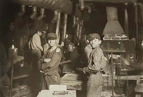
 Baseball glass workers2
 -
 Carl Van Vechten - Shirley Graham Du Bois
 -
.jpg) GRESHAM, Walter Q-Treasury (BEP engraved portrait)
GRESHAM, Walter Q-Treasury (BEP engraved portrait) -
.jpg) HARRISON, Benjamin-President (BEP engraved portrait)
HARRISON, Benjamin-President (BEP engraved portrait) -
.jpg) HARRISON, William H-President (BEP engraved portrait)
HARRISON, William H-President (BEP engraved portrait) -
 Ida Husted Harper photograph by Aime Dupont
 -
.jpg) Indiana state coat of arms (illustrated, 1876)
Indiana state coat of arms (illustrated, 1876) -
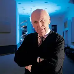 James D Watson
 -
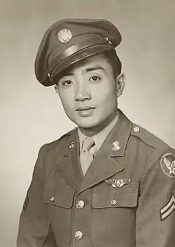 Kenje Ogata 1943
 -
.jpg) Kurt Vonnegut by Bernard Gotfryd (1965)
Kurt Vonnegut by Bernard Gotfryd (1965) -
.jpg) McCULLOCH, Hugh-Treasury (BEP engraved portrait)
McCULLOCH, Hugh-Treasury (BEP engraved portrait) -
 Midnight at the glassworks2b
 -
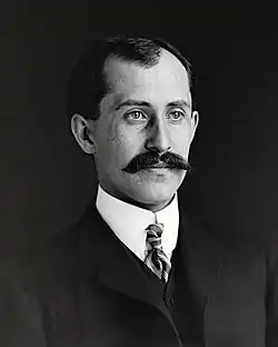 Orville Wright 1905-crop
 -
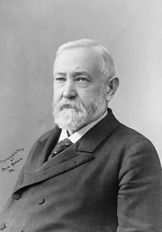 Pach Brothers - Benjamin Harrison
 -
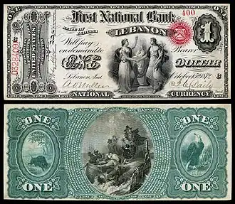 US-NBN-IL-Lebanon-2057-Orig-1-400-C
 -
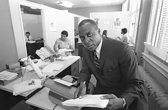 Vernon E. Jordan working on a voter education project
 -
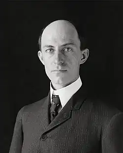 Wilbur Wright-crop
WikiProjects
![]()
- US-related WikiProjects
- Indiana
- Indiana State Roads
- Indianapolis
- Indiana
State facts
Indiana | |
|---|---|
| Country | United States |
| Admitted to the Union | December 11, 1816 (19th) |
| Capital | Indianapolis |
| Largest city | Indianapolis |
| Largest metro and urban areas | Indianapolis-Carmel MSA |
| Government | |
| • Governor | Eric Holcomb (R) (2017) |
| • Lieutenant Governor | Suzanne Crouch (R) (2017) |
| Legislature | Indiana General Assembly |
| • Upper house | Senate |
| • Lower house | House of Representatives |
| U.S. senators | Todd Young (R) Mike Braun (R) |
| Population | |
• Total | 6,080,485 |
| • Density | 169.5/sq mi (65.46/km2) |
| Language | |
| • Official language | English |
| Latitude | 37° 46′ N to 41° 46′ N |
| Longitude | 84° 47′ W to 88° 6′ W |
.JPG)

Things you can do
 |
Here are some tasks awaiting attention:
|
Associated Wikimedia
The following Wikimedia Foundation sister projects provide more on this subject:
-
 Commons
Free media repository -
 Wikibooks
Free textbooks and manuals -
 Wikidata
Free knowledge base -
 Wikinews
Free-content news -
 Wikiquote
Collection of quotations -
 Wikisource
Free-content library -
 Wikiversity
Free learning tools -
 Wikivoyage
Free travel guide -
 Wiktionary
Dictionary and thesaurus
-
 List of all portals
 -

-

-

-
-

-

-

-

-

-
 Random portal
 -
 WikiProject Portals
- ^ a b "Elevations and Distances in the United States". U.S Geological Survey. 29 April 2005. Retrieved 2006-11-06.
{{cite web}}: CS1 maint: year (link)