Cumbria is predominantly rural, with an area of 6,769 km2 (2,614 sq mi) and a population of 500,012; this makes it the third-largest ceremonial county in England by area but the eighth-smallest by population. Carlisle is located in the north; the towns of Workington and Whitehaven lie on the west coast, Barrow-in-Furness on the south coast, and Penrith and Kendal in the east of the county. For local government purposes the county comprises two unitary authority areas, Westmorland and Furness and Cumberland. Cumbria was created in 1974 from the historic counties of Cumberland and Westmorland, the Furness area of Lancashire, and a small part of Yorkshire.
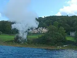
Gilsland is a village in northern England about 20 miles (32 km) west of Hexham, and about 18 miles (29 km) east of Carlisle, which straddles the border between Cumbria and Northumberland. The village provides an amenity centre for visitors touring Hadrian's Wall and other features of historical interest in this area of rugged Border country, popularised by the Romantic novelist Sir Walter Scott.
Its unusual arrangement of incorporating two unitary councils and three civil parish councils is due to the gradual amalgamation of hamlets during the 19th century. It has a population of about 400, most of whom live on the Northumberland side of the River Irthing and Poltross Burn. (Full article...)
Image 4Carlisle Castle – begun by William Rufus in 1092; rebuilt in stone under Henry I, 1122–35, and David I of Scotland, 1136–1153 (from History of Cumbria)
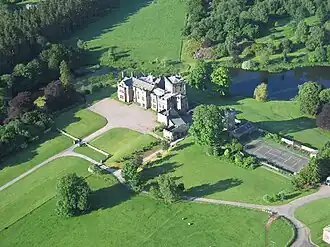
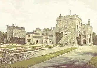
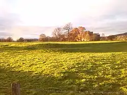
Image 5Greystoke Castle. Held by the Greystoke family, then by the Dacres and inherited by the Howard family during Elizabeth I's reign. Photo:Simon Ledingham (from History of Cumbria)
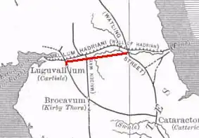
Image 7The Stanegate line is marked in red, to the south of the later Hadrian's Wall. (n.b. Brocavum is Brougham, not Kirkby Thore as given in the map) (from History of Cumbria)
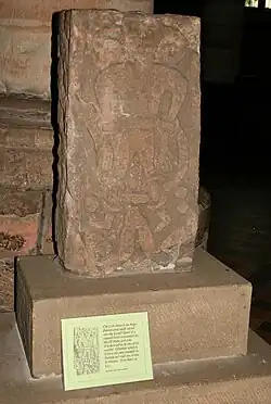
Image 8Loki stone, Kirkby Stephen parish church, part of a 10th-century Viking-age cross-shaft. But does it show Loki or Satan? (from History of Cumbria)
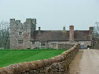
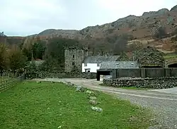
Image 9Yanwath hall – a semi-fortified house near Penrith (from History of Cumbria)
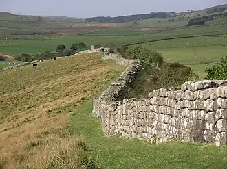
Image 10Birdoswald – showing partial blockage of main (east) gateway (from History of Cumbria)
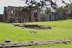
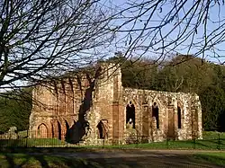
Image 11Wetheral Priory Gatehouse – all that remains of Wetheral Priory, founded by Ranulf le Meschin in 1106 (from History of Cumbria)
Image 23St Mary's Church, Abbeytown : all that is left of Holmcultram Abbey, founded by David I, King of Scots, and his son, Earl Henry, in 1150 (from History of Cumbria)
Image 27Claife Station on the western shore of Windermere – built in the 1790s with tinted windows angled to take in all the aesthetically pleasing views (from History of Cumbria)
Image 28Swarthy Hill, near Crosscanonby on the Solway coast – possible site of Iron Age hillfort, later the site of mile-fortlet 21 in Roman times (from History of Cumbria)
Image 39Neolithic stone axe with handle from Ehenside Tarn (now in the British Museum) (from History of Cumbria)
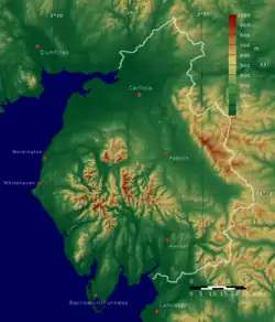
Image 40This map of cities and towns of Northern England shows the relative lack of urbanisation in Cumbria (shown here as the historic counties of Cumberland and Westmorland) compared to the rest of the region (from Cumbria)
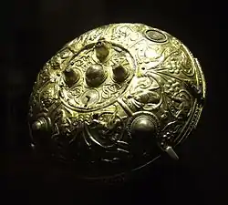
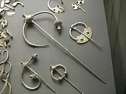
Image 42The Ormside bowl, probably late 8th century and made in Northumbria; possibly looted from York by a Viking warrior and buried with him at Great Ormside (from History of Cumbria)
Image 43Dove Cottage (Town End, Grasmere) – home of William and Dorothy Wordsworth, 1799–1808; home of Thomas De Quincey, 1809–1820 (from History of Cumbria)
Image 50Wray Castle – built by a Liverpool doctor who had married a rich wife. Constructed in 1840 at the head of Windermere. Associated with two key players of the National Trust : Canon Rawnsley and Beatrix Potter (from History of Cumbria)
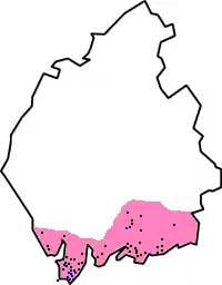
Image 51Approximate extent of Domesday coverage : the district of Hougun, if indeed it was a district, may have covered the three peninsulas at the left of the pink area (from History of Cumbria)
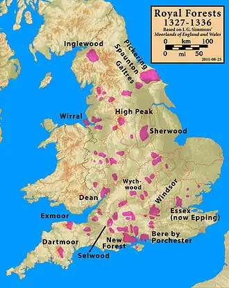
Image 52Location of Inglewood Forest, stretching from Carlisle to Penrith; it was the most northerly of the Royal forests (from History of Cumbria)
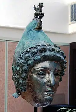
Image 53The Staffordshire Moorlands Pan – an enamelled cooking and serving vessel, engraved with the names of four Hadrian's Wall forts sited in Cumbria (2nd century AD). See also the article on the Rudge Cup and Amiens skillet. (from History of Cumbria)
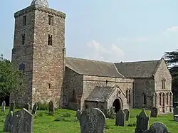
Image 54St Laurence's Church, Morland : with "the only tower of Anglo-Saxon character in the NW counties", according to Pevsner. Tower possibly built by order of Siward, Earl of Northumbria, sometime between 1042 and 1055; nave possibly later (1120) (from History of Cumbria)
Image 55Rydal Mount – home to Wordsworth 1813–1850. Hundreds of visitors came here to see him over the years (from History of Cumbria)
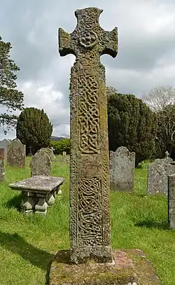
Image 65The Gosforth Cross, 10th-century Viking-age sculpture. (A replica of 1887, with clearer depictions of the decoration, may be found in the churchyard at Aspatria, along with a replica of another cross, the original of which is at Dearham) (from History of Cumbria)
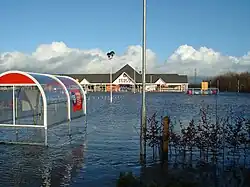
Image 66A Tesco store underwater in Carlisle during the January 2005 floods (from History of Cumbria)
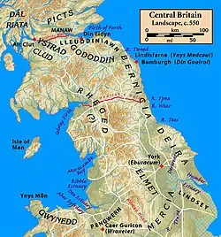
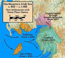
Image 67The northeastern Irish Sea, showing new settlements with Norse place names. (from History of Cumbria)
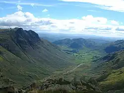
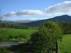
Image 68The Eden Valley between Appleby and Penrith, an area referred to affectionately as the heartland of Rheged in the praise poems of Taliesin (from History of Cumbria)
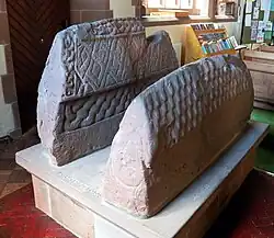
Image 70So-called "Saint's tomb" (left), and "Warrior's tomb" (right), two hogbacks in St. Mary's church, Gosforth. Typically high and narrow Cumbrian style, in the shape of a building with a roof, eaves and walls. The Saint's tomb has a crucifixion on the end, the Warrior's tomb has a procession of armed men (from History of Cumbria)
Image 73Brantwood, overlooking Coniston Water, viewed from the steam yacht 'Gondola' – note the angled, corner windows designed to take in the views (from History of Cumbria)
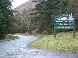
Image 74The entrance to Whinlatter Forest Park (from Cumbria)
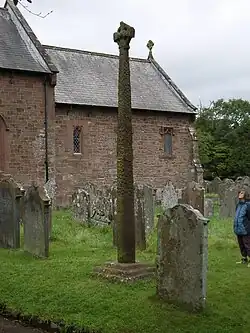
Image 79'Giants Grave', St. Andrew's churchyard, Penrith, an unusual arrangement of two Viking-age cross-shafts with four hogbacks (in the foreground). In addition, there is a smaller, Viking-age, wheel-headed cross just visible in the background (from History of Cumbria)
File:Derwent Water, Keswick - June 2009.jpg • File:Helvellyn Striding Edge 360 Panorama, Lake District - June 09.jpg • File:Keswick, Cumbria Panorama 1 - June 2009.jpg • File:Keswick Panorama - Oct 2009.jpg • File:Catbells Northern Ascent, Lake District - June 2009.jpg • File:Glenridding, Cumbria, England - June 2009.jpg
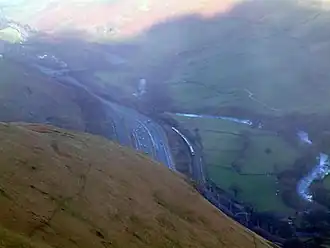
A 360 degree view from the middle of Striding Edge near the summit of Helvellyn in the Lake District. Helvellyn is the tallest summit just to the right of centre. Red Tarn is the small lake on the right, Catstye Cam is the fell directly behind Red Tarn, and Ullswater and the village of Glenridding are visible on the horizon along the far left corner.
A 360 degree view from the middle of Striding Edge near the summit of Helvellyn in the Lake District. Helvellyn is the tallest summit just to the right of centre. Red Tarn is the small lake on the right, Catstye Cam is the fell directly behind Red Tarn, and Ullswater and the village of Glenridding are visible on the horizon along the far left corner.
Related portals
Tasks
Here are some tasks awaiting attention:
Stubs : Expand Cumbria geography stub articles
Associated Wikimedia
The following Wikimedia Foundation sister projects provide more on this subject:


.jpg)


.jpg)

.jpg)


.svg.png)