Partizánska Ľupča
Partizánska Ľupča | |
|---|---|
_-_evanjelick%C3%BD_kostol.JPG) | |
 Flag  Coat of arms | |
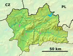 Partizánska Ľupča Location of Partizánska Ľupča in the Žilina Region  Partizánska Ľupča Location of Partizánska Ľupča in Slovakia | |
| Coordinates: 49°04′N 19°26′E / 49.06°N 19.44°E | |
| Country | |
| Region | |
| District | Liptovský Mikuláš District |
| First mentioned | 1252 |
| Area | |
• Total | 92.41 km2 (35.68 sq mi) |
| Elevation | 863 m (2,831 ft) |
| Population (2021)[3] | |
• Total | 1,318 |
| Time zone | UTC+1 (CET) |
| • Summer (DST) | UTC+2 (CEST) |
| Postal code | 321 5[2] |
| Area code | +421 44[2] |
| Car plate | LM |
| Website | www |
Partizánska Ľupča (until 1945 Nemecká Ľupča, Hungarian: Németlipcse, German: Deutschliptsch) is a large village and municipality in Liptovský Mikuláš District in the Žilina Region of northern Slovakia.
Etymology
The name Ľupča is derived from Slavic personal name with a root Ľub.[4] Lipche/Lypche (Lipcse) are already Hungarized forms because of contemporary practice of the Royal Estate, however also these forms were sometimes again Slovakized in medieval documents (e.g. Lipcza). The etymological adjective "Nemecká" (German) Ľupča referenced to the ethnic composition of the town in the Middle Ages. After World War II it was changed to "Partizánska" (Partisan) Ľupča thanks to its active participation in the Slovak National Uprising.
History
In historical records the village was first mentioned in 1252. Before the establishment of independent Czechoslovakia in 1918, it was part of Liptó County within the Kingdom of Hungary. From 1939 to 1945, it was part of the Slovak Republic.
Geography
The municipality lies at an altitude of 568 metres (1,864 ft) and covers an area of 92.403 km2 (35.677 sq mi). It has a population of about 1200 people.
References
- ^ "Hustota obyvateľstva - obce [om7014rr_ukaz: Rozloha (Štvorcový meter)]". www.statistics.sk (in Slovak). Statistical Office of the Slovak Republic. 2022-03-31. Retrieved 2022-03-31.
- ^ a b c "Základná charakteristika". www.statistics.sk (in Slovak). Statistical Office of the Slovak Republic. 2015-04-17. Retrieved 2022-03-31.
- ^ "Počet obyvateľov podľa pohlavia - obce (ročne)". www.statistics.sk (in Slovak). Statistical Office of the Slovak Republic. 2022-03-31. Retrieved 2022-03-31.
- ^ Štefánik, Martin; Lukačka, Ján, eds. (2010). Lexikón stredovekých miest na Slovensku [Lexicon of Medieval Towns in Slovakia] (PDF) (in Slovak). Bratislava: Historický ústav SAV. p. 312. ISBN 978-80-89396-11-5. Archived from the original (PDF) on 2014-03-02. Retrieved 2016-10-28.