Nowy Chrzanów
Nowy Chrzanów | |
|---|---|
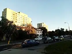 Houses at Drzeworytników Street in 2020. | |
| Coordinates: 52°13′22″N 20°54′12″E / 52.222856°N 20.903360°E | |
| Country | |
| Voivodeship | Masovian |
| City and county | Warsaw |
| District | Bemowo |
| City Information System area | Jelonki Południowe |
| Incorporation into Warsaw | 14 May 1951 |
| Time zone | UTC+1 (CET) |
| • Summer (DST) | UTC+2 (CEST) |
| Area code | +48 22 |
Nowy Chrzanów is a neighbourhood in Warsaw, Poland, within the Bemowo district. It is a residential area with low-rise single-family housing, located alongside Okrętowa and Drzeworytników Streets, within the City Information System area of Jelonki Południowe. It was founded around 1877, as a small hamlet, settled by Germans, and was incorporated into the city in 1951.
History
Around 1877, fifteen German settlers founded a small hamlet of Nowy Chrzanów (formerly known as Chrzanów Nowy), located along the current Okrętowa Street.[1]
Nowy Chrzanów and Jelonki were captured by German forces in early September 1939 during the siege of Warsaw in the Second World War. On 18 September 1939, they were recaptured in a counter-offensive by the 360th Infantry Regiment of the Polish Armed Forces, commanded by lieutenant colonel Leopold Okulicki. Their forces included four infantry companies, with heavy machine gun platoons, and one mortar platoon.[2][3] They were also supported by a artillery batteries, a platoon of 7TP light tanks, as well as a company of the Capital Battalion, with the latter being pushed back during the attacks.[3][4][5] The motorized platoon suffered heavy loses in an encounter against German Panzer 35(t) light tanks.[4] The villages were captured with severe losses suffered by the Polish infantry, and remained under Polish control until the capitulation of Warsaw on 28 September 1939.[2][3]
On 14 May 1951, it was incorporated into Warsaw, becoming part of the Wola district.[6][7] On 29 December 1989, following an administrative reform in the city, it became part of the municipality of Warsaw-Wola, and on 25 March 1994, of the municipality of Warsaw-Bemowo, which, on 27 October 2002, was restructured into the city district of Bemowo.[7] In 1997, the neighbourhood became part of the City Information System of Jelonki Południowe.[8]
Overview
Nowy Chrzanów is a residential area with low-rise single-family housing, located alongside Okrętowa and Drzeworytników Streets.[1][9]
References
- ^ a b Barbara Petrozolin-Skowrońska (editor): Encyklopedia Warszawy. Warsaw: Wydawnictwo Naukowe PWN, 1994, ISBN 83-01-08836-2. (in Polish)
- ^ a b Wacław Stanisław Godzemba-Wysocki, Marian Domagała-Zamorski: Historia Kaniowszczyków, czyli dzieje 30 Pułku Piechoty Strzelców Kaniowskich. Warsaw: Wydawnictwo M. M., 2006, pp. 124–125. ISBN 83-89710-28-5. (in Polish)
- ^ a b c Ludwik Głowacki: Obrona Warszawy i Modlina na tle kampanii wrześniowej 1939. Warsaw: Wydawnictwo Ministerstwa Obrony Narodowej wydanie V, 1985, pp. 236–237. ISBN 83-11-07109-8. (in Polish)
- ^ a b Dariusz Kaliński: Twierdza Warszawa. Pierwsza wielka bitwa miejska II wojny światowej. Kraków: Znak Horyzont, 2022, pp. 394–395. ISBN 978-83-240-8785-3. (in Polish)
- ^ Artur Szczepaniak: Batalion Stołeczny 1936–1939. Wielka Księga Piechoty Polskiej 1918–1939. T. 32. Warsaw: Edipresse Polska S.A., 2018, pp. 71–72. ISBN 978-83-7945-413-6. (in Polish)
- ^ "Rozporządzenie Rady Ministrów z dnia 5 maja 1951 r. w sprawie zmiany granic miasta stołecznego Warszawy". isap.sejm.gov.pl (in Polish).
- ^ a b Andrzej Gawryszewski: Ludność Warszawy w XX wieku. Warsaw: Instytut Geografii i Przestrzennego Zagospodarowania PAN, 2009, pp. 44–50. ISBN 978-83-61590-96-5. (in Polish)
- ^ "Dzielnica Bemowo". zdm.waw.pl (in Polish).
- ^ Studium uwarunkowań i kierunków zagospodarowania przestrzennego miasta stołecznego Warszawy ze zmianami. Warsaw: Warsaw City Council, 1 March 2018, pp. 10–14. (in Polish)
Neighbourhoods of Bemowo | ||
|---|---|---|
| Inner city districts |
|  | |||||||||||||||||||||
|---|---|---|---|---|---|---|---|---|---|---|---|---|---|---|---|---|---|---|---|---|---|---|---|
| Outer city districts |
| ||||||||||||||||||||||
| Related |
| ||||||||||||||||||||||