Mōtū
Mōtū | |
|---|---|
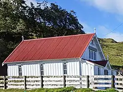 St Paul's Anglican Church | |
| Coordinates: 38°15′22″S 177°32′53″E / 38.256°S 177.548°E | |
| Country | New Zealand |
| District | Gisborne District |
| Ward | Tairāwhiti General Ward |
| Electorates | |
| Māori electorate | Ikaroa-Rāwhiti |
| Government | |
| • MP | Dana Kirkpatrick[1] |
| • MP (Māori Seat) | Cushla Tangaere-Manuel[2] |
| • Mayor | Rehette Stoltz[3] |
| Area | |
• Total | 986.00 km2 (380.70 sq mi) |
| Population (2023 Census)[5] | |
• Total | 132 |
| • Density | 0.13/km2 (0.35/sq mi) |
Mōtū is a rural community in the Gisborne District of New Zealand's North Island. It is located north of Matawai and State Highway 2. The community is centred around Mōtū River and Mōtū Falls.[6]
Demographics
Mōtū locality covers 986.00 km2 (380.70 sq mi).[4] It is part of the Waipaoa statistical area.[7]
| Year | Pop. | ±% p.a. |
|---|---|---|
| 2006 | 180 | — |
| 2013 | 150 | −2.57% |
| 2018 | 129 | −2.97% |
| 2023 | 132 | +0.46% |
| Source: [5][8] | ||
Mōtū had a population of 132 in the 2023 New Zealand census, an increase of 3 people (2.3%) since the 2018 census, and a decrease of 18 people (−12.0%) since the 2013 census. There were 78 males and 57 females in 60 dwellings.[9] The median age was 34.5 years (compared with 38.1 years nationally). There were 24 people (18.2%) aged under 15 years, 30 (22.7%) aged 15 to 29, 63 (47.7%) aged 30 to 64, and 12 (9.1%) aged 65 or older.[5]
People could identify as more than one ethnicity. The results were 79.5% European (Pākehā), and 36.4% Māori. English was spoken by 97.7%, and Māori by 4.5%. No language could be spoken by 4.5% (e.g. too young to talk). The percentage of people born overseas was 6.8, compared with 28.8% nationally.[5]
Religious affiliations were 27.3% Christian, and 2.3% Māori religious beliefs. People who answered that they had no religion were 65.9%, and 9.1% of people did not answer the census question.[5]
Of those at least 15 years old, 15 (13.9%) people had a bachelor's or higher degree, 75 (69.4%) had a post-high school certificate or diploma, and 21 (19.4%) people exclusively held high school qualifications. The median income was $38,400, compared with $41,500 nationally. The employment status of those at least 15 was 63 (58.3%) full-time and 15 (13.9%) part-time.[5]
Education
Motu School is a Year 1–8 co-educational state primary school[10] with a roll of 7 students as of July 2025.[11][12] The school opened in 1895 in the kitchen of an accommodation house. It moved to its own premises in 1902, and moved again to its current location in 1955.[13]
Climate
Mōtū has mild summers and frosty winters, with an average of 8 days rising above 25 °C (77 °F) and 43 nights dropping below 0 °C (32 °F).[14]
| Climate data for Motu, elevation 488 m (1,601 ft), (1991–2020 normals, extremes 1990–present) | |||||||||||||
|---|---|---|---|---|---|---|---|---|---|---|---|---|---|
| Month | Jan | Feb | Mar | Apr | May | Jun | Jul | Aug | Sep | Oct | Nov | Dec | Year |
| Record high °C (°F) | 31.1 (88.0) |
32.5 (90.5) |
27.6 (81.7) |
25.7 (78.3) |
21.9 (71.4) |
19.6 (67.3) |
17.7 (63.9) |
20.9 (69.6) |
25.8 (78.4) |
26.9 (80.4) |
28.4 (83.1) |
28.7 (83.7) |
32.5 (90.5) |
| Mean maximum °C (°F) | 26.5 (79.7) |
26.4 (79.5) |
24.1 (75.4) |
21.5 (70.7) |
18.5 (65.3) |
15.5 (59.9) |
14.5 (58.1) |
15.9 (60.6) |
18.7 (65.7) |
21.1 (70.0) |
22.9 (73.2) |
24.6 (76.3) |
27.5 (81.5) |
| Mean daily maximum °C (°F) | 21.2 (70.2) |
21.2 (70.2) |
19.1 (66.4) |
16.6 (61.9) |
13.8 (56.8) |
11.4 (52.5) |
10.6 (51.1) |
11.6 (52.9) |
13.2 (55.8) |
15.2 (59.4) |
17.0 (62.6) |
19.3 (66.7) |
15.9 (60.5) |
| Daily mean °C (°F) | 15.9 (60.6) |
16.1 (61.0) |
14.1 (57.4) |
11.6 (52.9) |
9.2 (48.6) |
6.8 (44.2) |
6.4 (43.5) |
6.9 (44.4) |
8.7 (47.7) |
10.5 (50.9) |
12.1 (53.8) |
14.4 (57.9) |
11.1 (51.9) |
| Mean daily minimum °C (°F) | 10.6 (51.1) |
11.1 (52.0) |
9.0 (48.2) |
6.6 (43.9) |
4.5 (40.1) |
2.3 (36.1) |
2.2 (36.0) |
2.3 (36.1) |
4.2 (39.6) |
5.8 (42.4) |
7.2 (45.0) |
9.5 (49.1) |
6.3 (43.3) |
| Mean minimum °C (°F) | 3.2 (37.8) |
3.9 (39.0) |
1.4 (34.5) |
−2.3 (27.9) |
−3.5 (25.7) |
−4.9 (23.2) |
−5.0 (23.0) |
−4.6 (23.7) |
−3.5 (25.7) |
−1.8 (28.8) |
−0.3 (31.5) |
2.5 (36.5) |
−6.1 (21.0) |
| Record low °C (°F) | −1.0 (30.2) |
−0.9 (30.4) |
−2.7 (27.1) |
−6.1 (21.0) |
−7.8 (18.0) |
−7.5 (18.5) |
−8.4 (16.9) |
−7.8 (18.0) |
−6.6 (20.1) |
−5.8 (21.6) |
−4.6 (23.7) |
−1.2 (29.8) |
−8.4 (16.9) |
| Average rainfall mm (inches) | 134.2 (5.28) |
118.8 (4.68) |
134.8 (5.31) |
154.9 (6.10) |
200.5 (7.89) |
230.8 (9.09) |
197.4 (7.77) |
194.4 (7.65) |
199.3 (7.85) |
182.1 (7.17) |
164.9 (6.49) |
171.4 (6.75) |
2,083.5 (82.03) |
| Source: NIWA[15][16] | |||||||||||||
References
- ^ "East Coast - Official Result". Electoral Commission. Retrieved 1 June 2025.
- ^ "Ikaroa-Rāwhiti – Official Result". New Zealand Electoral Commission. Retrieved 28 July 2025.
- ^ "Councillor contact details". Gisborne District Council. Retrieved 28 July 2025.
- ^ a b "Stats NZ Geographic Data Service". Statistical Area 1 2023 (generalised). Retrieved 16 August 2025.
- ^ a b c d e f "Totals by topic for individuals, (RC, TALB, UR, SA3, SA2, Ward, Health), 2013, 2018, and 2023 Censuses". Stats NZ – Tatauranga Aotearoa – Aotearoa Data Explorer. 7015487. Retrieved 3 October 2024.
- ^ Hariss, Gavin. "Motu, Gisborne". topomap.co.nz. NZ Topo Map.
- ^ "Geographic Boundary Viewer". Stats NZ. Statistical Area 1 – 2023 and Statistical Area 2 – 2023.
- ^ "Statistical area 1 dataset for 2018 Census". Statistics New Zealand. March 2020. 7015487.
- ^ "Totals by topic for dwellings, (RC, TALB, UR, SA3, SA2, Ward, Health), 2013, 2018, and 2023 Censuses". Stats NZ – Tatauranga Aotearoa – Aotearoa Data Explorer. Retrieved 3 October 2024.
- ^ "Education Review Office Report". ero.govt.nz. Education Review Office.
- ^ "New Zealand Schools Directory". New Zealand Ministry of Education. Retrieved 1 July 2025.
- ^ "Ministry of Education School Profile". educationcounts.govt.nz. Ministry of Education.
- ^ "Motu School". Living Heritage. Retrieved 16 August 2025.
- ^ "CliFlo -The National Climate Database (Agent number: 1905, date range: 1991–2020)". NIWA. Retrieved 18 August 2024.
- ^ "CliFlo – National Climate Database : Motu Ews". NIWA. Retrieved 20 May 2024.
- ^ "CliFlo -The National Climate Database (Agent number: 1905)". NIWA. Retrieved 27 August 2024.
External links
 Data related to Mōtū at Wikidata