Hyōtanjima
Native name: 瓢箪島 | |
|---|---|
 | |
 Hyōtanjima 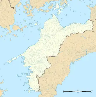 Hyōtanjima 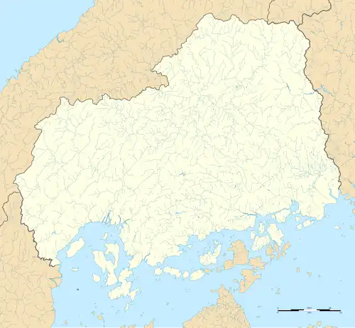 Hyōtanjima | |
| Geography | |
| Location | Seto Inland Sea |
| Coordinates | 34°17′06″N 133°03′01″E / 34.2849°N 133.0503°E |
| Archipelago | Geiyo Islands |
| Total islands | 1 |
| Area | 17,576 m2 (189,190 sq ft) |
| Coastline | 700 m (2300 ft) |
| Highest elevation | 35.2 m (115.5 ft) |
| Administration | |
| Prefecture | Hiroshima Prefecture |
| City | Onomichi |
| District | Setoda-cho |
| Prefecture | Ehime Prefecture |
| City | Imabari |
| District | Kamiura-cho |
| Demographics | |
| Population | 0 |
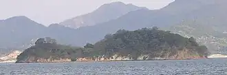
Hyōtanjima (Japanese: 瓢箪島) is an uninhabited island in the Geiyo Islands chain in the Seto Inland Sea. The island is split between Hiroshima Prefecture and Ehime Prefecture for 74 metres (243 ft) making it the shortest prefectural border in Japan.
Etymology
The name Hyōtanjima (瓢箪島), which literally translates to "calabash island", which is taken from its calabash-like shape.[1]
Geography
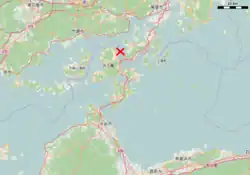
Hyōtanjima is a calabash shaped island located in Seto Inland Sea and is part of the Geiyo Islands chain. It sits 2 kilometres (1.2 mi) west of Ōmishima Island in Ehime and east of Ikuchijima Island in Hiroshima. It has a circumference of 700 metres (2,300 ft) and has an area of 17,576 square metres (4.343 acres), and there are two hills on the island, one in the north and one in the south. The highest point in the island is 35.2 metres (115 ft) above sea level.[2][3][1]
The island is one of the five islands in the Seto Inland Sea that are split between two prefectures. It is split north and south by Hiroshima Prefecture and Ehime Prefecture. The north of the island is part of Tarumi, Setoda-cho in Onomichi, Hiroshima, while the south of the Island belongs to Iguchi, Kamiura-cho in Imabari, Ehime.[2] The border length is around 74 metres (243 ft) making it the shortest border between prefectures in Japan beating both the Tochigi-Saitama border, and the Okayama-Kagawa border which are 3.5 kilometres (2.2 mi) and 3.2 kilometres (2.0 mi) respectively.[4]
Legend
According to a local legend, the kami of Ikuguchijima and the kami of Ōmishima Island engaged in a tug of war to capture the island, and the people of both islands were worried about the shape of the island being narrower, and they were reconciled. The legend was believed to have originated from a conflict over fishing rights in the island, and as evidence of the numerous boundary conflicts, boundary stones from the Meiji era remain on the island.[5][6][7]
History
The island was one of the known islands that the Murakami pirates once roamed.[6] It was designated as a National Monument as a Place of Scenic Beauty on November 16, 2012.[7][8]
In popular culture
The island was one of the model for the 1964 NHK drama Hyokkori Hyotanjima.[7][6]
See also
References
Citations
- ^ a b "<瓢箪島>時に思い出ひょっこり". Yomiuri Shimbun. May 11, 2015. Archived from the original on July 23, 2015. Retrieved July 27, 2025.
- ^ a b Matsumoto, Naoya. "全国最短の県境は愛媛にある!? 県境の石碑 数々の歴史に出合う". Ehime Shimbun (in Japanese). Retrieved July 26, 2025.
- ^ TBS 2025, pp. 2.
- ^ TBS 2025, pp. 2, 4.
- ^ "広島県の文化財 - 瓢箪島". Hiroshima Prefectural Board of Education. Archived from the original on October 1, 2013. Retrieved July 27, 2025.
- ^ a b c TBS 2025, pp. 1.
- ^ "東温の「上林の風穴」 国の登録記念物に". NHK (in Japanese). January 27, 2025. Retrieved July 27, 2025.
Bibliography
- "愛媛県~広島県の"隠れ県境"がまさかの日本最短!? 最長県境も愛媛県!? 意外と知らない県境の"魅力"と"可能性" | 愛媛のニュース - Nスタえひめ|あいテレビは6チャンネル". TBS News (in Japanese). February 17, 2025. Retrieved July 26, 2025.