Gate to Belmore Trail
| Gate to Belmore Trail | |
|---|---|
| Length | 14.5 miles (23.3 km), planned |
| Location | Thurston County |
| Began construction | 1996 |
| Completed | 2025 (partial) |
| Use | Hiking, biking |
| Grade | Flat |
| Surface | Gravel base |
| Maintained by | Thurston County Public Works Department |
The Gate to Belmore Trail, also known as the Gate–Belmore Trail, is a rail trail in Thurston County, Washington connecting the communities of Gate, Littlerock, and Belmore near Black Lake. The planned 14.5-mile (23.3 km) trail remained closed since its acquisition in 1996 but a portion of the pathway was formally opened in July 2025.
History
The trail is a former railroad line of BNSF constructed in the 1890s and located in southwestern Thurston County.[1][2] The county obtained a 12.5-mile (20.1 km) section of the railway in 1996 with the intent to convert it into a walking trail. The path is to be part of a connected system within the county, including access to the Chehalis Western Trail and the Yelm–Rainier–Tenino Trail.[3]
The Gate to Belmore Trail remained undeveloped into the 21st century, with limited public access.[3][4] Before it was officially opened, and due to its inchoate nature and concerns of liability, the route was closed though the path was used by people in the surrounding community without impediment by the county.[5]
A 2.7 miles (4.3 km) portion of the trail near the Glacial Heritage Wildlife Area Unit was officially opened on July 25, 2025.[2] The paved extension and trailhead was part of a $2 million initiative through the county's Trail Connectivity Program.[3]
Route
Starting at the northern trailhead, the trail begins in Kenneydale Park at Black Lake in the community of Belmore, located south of Tumwater. The course meanders south and passes through or near several local parks and preserves including the Mima Mounds Natural Area Preserve, Glacial Heritage Preserve, the Black River Habitat Management Area and Capitol State Forest. The trail journeys through Littlerock and then heads southwest, ending in Gate.[4]
The trail has remained true to the original path and grade of the railroad line. The effort was planned so as to minimize any environmental disturbances, to preserve "the natural character" of the area, and to be respectful of the cultures and history of indigenous people who once lived and traveled through south Thurston County.[2]
Ecology and environment
The path crosses through several terrains and environment including prairie, forested areas, and wetlands. Before the rail line was converted to a trail, invasive vegetation overran the tracks. Since renovations began, the path has seen a return of alligator lizards as well as native birds such as bluebirds, California quail, osprey, and turkey vultures. Construction of the trail was coordinated to lessen any impacts on the natural ecology necessary for the survival of the endangered Taylor's checkerspot butterfly.[2]
Future plans
Several stages have been scheduled to officially open the entirety of the trail. Plans have included 4.0 miles (6.4 km) of improvement to the Littlerock to Gate section, consisting of an updated trailhead and picnic area. A similar stretch of 0.25 miles (0.40 km) is outlined for the northern terminus in Belmore.[5] The trail program is also seeking further funding for a 0.5-mile (0.80 km) addition to the existing course.[3] Access to the trail for residents of Chehalis Village, part of the Confederated Tribes of the Chehalis Reservation, is planned via a broader scope of connecting the entire trail system in the county.[1]
After the 2025 opening, the county announced plans to increase the length of the Gate to Belmore Trail to 14.5 miles (23.3 km).[2]
References
- ^ a b "Thurston County Regional Trails Plan (2007)". Thurston Regional Planning Council. pp. 33–34, 106–107.
- ^ a b c d e Marquez, Kameko (August 4, 2025). "Gate-Belmore Trail debuts in Thurston County". The Journal of Olympia, Lacey & Tumwater (JOLT). Retrieved August 7, 2025.
- ^ a b c d Bilbao, Martin (May 30, 2023). "Thurston County is designing trail extensions near Tenino, Glacial Heritage Preserve". The Olympian. Retrieved July 1, 2023.
- ^ a b "Southwest Thurston County Trail Feasibility Study (2021)". Thurston Regional Planning Council. p. 13.
- ^ a b Bilbao, Martin (September 20, 2022). "Thurston County Officials Consider Developing, Extending Trails". The Chronicle. The Olympian. Retrieved July 2, 2023.
External links
Municipalities and communities of Thurston County, Washington, United States | ||
|---|---|---|
| Cities |  | |
| Town | ||
| CDPs | ||
| Unincorporated communities | ||
| Indian reservation | ||
| Ghost town | ||
| Footnotes | ‡This populated place also has portions in an adjacent county or counties | |
| King | 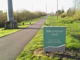 | |
|---|---|---|
| Klickitat | ||
| Pierce | ||
| Snohomish | ||
| Thurston | ||
| Whatcom | ||
| Multiple counties |
| |