Dharavandhoo
Dharavandhoo
ދަރަވަންދޫ | |
|---|---|
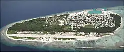 Dharavandhoo Aerial View (Recent) | |
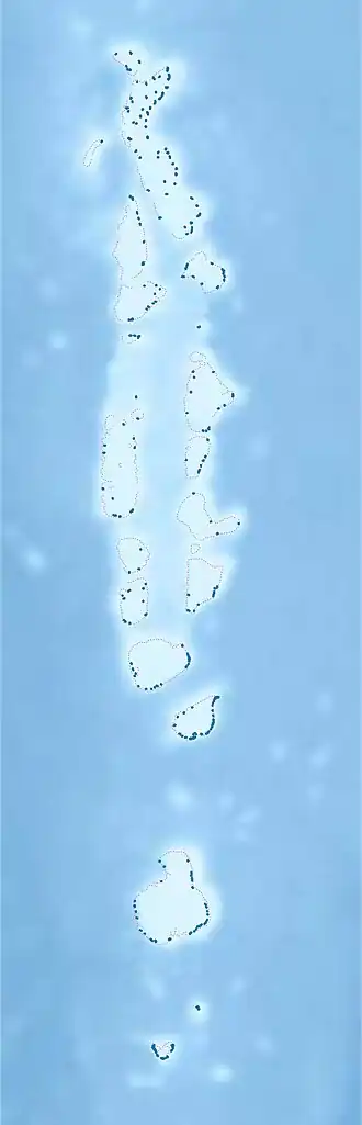 Dharavandhoo Location in Maldives | |
| Coordinates: 05°09′30″N 73°07′50″E / 5.15833°N 73.13056°E | |
| Country | Maldives |
| Administrative atoll | Baa Atoll |
| Distance to Malé | 116.53 km (72.41 mi) |
| Government | |
| • Body | Dharavandhoo Council |
| • President | Ali Samih[1] |
| Area | |
• Total | 0.4550 km2 (0.1757 sq mi) |
| Dimensions | |
| • Length | 1.330 km (0.826 mi) |
| • Width | 0.480 km (0.298 mi) |
| Population (2022)[2] | |
• Total | 997 |
| • Density | 2,200/km2 (5,700/sq mi) |
| Time zone | UTC+05:00 (MST) |
Dharavandhoo (Dhivehi: ދަރަވަންދޫ) is one of the inhabited islands of Baa Atoll.
Geography
The island is 116.53 km (72 mi; 63 nmi) north of the country's capital, Malé.[3]
Ecology
This island is surrounded by clear waters known as Dharavandhoo Thila and Hanifaru Bay; which are famous amongst divers around the world, for it is a sanctuary for a variety of marine life, including manta rays and whale sharks. This globally renowned eco-life zone is now strictly protected by law.
Demography
| Year | Pop. | ±% |
|---|---|---|
| 2006 | 740 | — |
| 2014 | 744 | +0.5% |
| 2022 | 997 | +34.0% |
| 2006-2014-2022: Census populations Source: [4][2] | ||
Governance
The island is administered by an Island Council consisting of five councillors elected by the people of the island.
Transportation
Dharavandhoo Airport was opened on 17 October 2012. Inner harbour was first dredged by MTCC, in the last four months of 1997. There is also a breakwater jetty.
Gallery
-
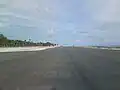 Dharavandhoo Airport runway, nearing completion
 -
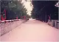 The Dharavandhoo main road, pictured in the 1990s from near Baa Atoll school
 -
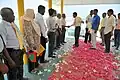 President of Maldives Mohamed Nasheed visits Dharavandhoo in 2010.
 -
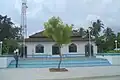 Dharavandhoo Friday Mosque
 -
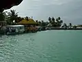 The Dharavandhoo break-water harbour jetty in 2012, prior to renovation
References
- ^ "ކައުންސިލް މެމްބަރުން" [Council Members]. Dharavandhoo Council (in Divehi). Retrieved 31 July 2025.
- ^ a b "Table P5: Resident Population by island and sex, 2022" (PDF). Maldives Census. Retrieved 31 July 2025.
- ^ "Coordinate Distance Calculator". Boulter.com. Retrieved 12 August 2018.
- ^ "Table 3.3: Total Maldivian Population by Islands" (PDF). National Bureau of Statistics. Retrieved 12 August 2018.
External links
- https://maps.google.com/maps?ll=5.168566,73.144484&spn=0.062573,0.090895&t=h&z=14&lci=com.panoramio.all
- https://web.archive.org/web/20081121040725/http://www.baa.gov.mv/contents/islands/dharavandhoo.html
- https://www.facebook.com/groups/231176730273332/