Dan Makham Tia district
Dan Makham Tia
ด่านมะขามเตี้ย | |
|---|---|
 Dan Makham Tia main street | |
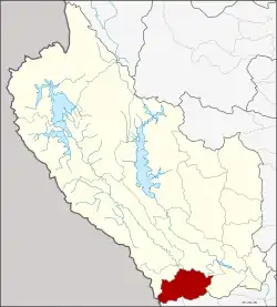 District location in Kanchanaburi province | |
| Coordinates: 13°51′13″N 99°24′38″E / 13.85361°N 99.41056°E | |
| Country | |
| Province | |
| Seat | Dan Makham Tia |
| Area | |
• Total | 807 km2 (312 sq mi) |
| Population (2024)[2] | |
• Total | 33,736 |
| • Density | 42/km2 (110/sq mi) |
| Time zone | UTC+7 (ICT) |
| Postal code | 71260 |
| Calling code | 034 |
| ISO 3166 code | TH-7111 |
Dan Makham Tia (ด่านมะขามเตี้ย, pronounced [dàːn mā.kʰǎːm tîa]) is a district (amphoe) in the southern part of Kanchanaburi province, western Thailand.
History
The area of Dan Makham Tia was settled more than 200 years. It was a border village of Mueang Kanchanaburi adjacent to Burma.
The area had a short Makham tree (Tamarindus indica), so people called the village Ban Nong Makham Tia. Later was changed to be Dan Makham Tia.
The minor district (king amphoe) was created on 1 April 1990 by splitting off the three tambons Dan Makham Tia, Klondo, and Chorakhe Phueak from Mueang Kanchanaburi district.[3] It was upgraded to a full district on 8 September 1995.[4]
Geography
Neighboring districts are (from the north clockwise) Mueang Kanchanaburi, Tha Muang of Kanchanaburi Province, Chom Bueng and Suan Phueng of Ratchaburi province.
The most important water resources in the area are the Khwae Noi and Phachi River.
Administration
Provincial administration
The district is divided into four subdistricts (tambons), which are further subdivided into 41 administrative villages (mubans).[2]
| No. | Subdistrict | Thai | Villages | Pop. |
|---|---|---|---|---|
| 1. | Dan Makham Tia | ด่านมะขามเตี้ย | 12 | 10,426 |
| 2. | Klondo | กลอนโด | 11 | 8,095 |
| 3. | Chorakhe Phueak | จรเข้เผือก | 12 | 11,192 |
| 4. | Nong Phai | หนองไผ่ | 6 | 4,023 |
| Total | 41 | 33,736 |
Local government
Municipality
As of December 2024 there is one municipal (thesaban) area in the district: Dan Makham Tia subdistrict municipality (thesaban tambon) covers parts of the same-named subdistrict.[5]
| Subdistrict municipality | Pop. | LAO code | website |
|---|---|---|---|
| Dan Makham Tia | 2,433 | 05711101 | danmakhamtia |
Subdistrict administrative organizations
The non-municipal areas are administered by four subdistrict administrative organizations - SAO (ongkan borihan suan tambon - o bo toh).[5]
| Subdistrict adm.org - SAO | Pop. | LAO code | website |
|---|---|---|---|
| Chorakhe Phueak SAO | 11,192 | 06711103 | chorakhephuak |
| Klondo SAO | 8,095 | 06711102 | klondo-sao |
| Dan Makham Tia SAO | 7,993 | 06711104 | danmakhamtia-sao |
| Nong Phai SAO | 4,023 | 06711105 | nongphai-kan |
Education
- 26 primary schools
- 1 secondary school[6]
Healthcare
Hospitals
Dan Makham Tia district is served by one hospital
- Dan Makham Tia Hospital with 56 beds.
Health promoting hospitals
In the district there are six health-promoting hospitals in total.[7]
| 1 Nong Phai | 2 Klondo | 3 Chorakhe Phueak |
Religion
There are thirty-two Theravada Buddhist temples in the district.[8][9]
| 3 Nong Phai | 7 Klondo | 10 Chorakhe Phueak | 11 Dan Makham Tia |
References
- ^ "Administrative Subdivisions of Countries". Retrieved 17 July 2025.
- ^ a b
"Official statistics registration systems". Department of Provincial Administration (DOPA). Retrieved 17 July 2025, year 2024 >subdistrict level >Excel File >no.71110100-71110400, 7174 >Excel line 8971-8975, 8999-9000
{{cite web}}: CS1 maint: postscript (link) - ^ "ประกาศกระทรวงมหาดไทย เรึ่อง แบ่งท้องที่อำเภอเมึองกาญจนบุรี จังหวัดกาญจนบุรี ตั้งเป็นกิ่งอำเภอด่านมะขามเดี้ย" [Announcement of the Ministry of Interior on the division of Mueang Kanchanaburi district, Kanchanaburi province, to establish Dan Makham Tia minor district.] (PDF). Royal Gazette (in Thai). 107 (25 ง): 1347. 13 February 1990. Retrieved 17 July 2025.
- ^ "พระราชกฤษฎีกา ตั้งอำเภอด่านมะขามเดี้ย อำเภอแก่งหางแมวๆ พ.ศ.๒๕๓๘" [Royal Decree on Establishing of Dan Makham Tia district, Kaeng Hang Maeo district, etc. B.E.2538 (1995)] (PDF). Royal Gazette (in Thai). 112 (32 ก): 1–3. 8 August 1995. Retrieved 17 July 2025.
- ^ a b "Local Government Organization Code". DLA. Retrieved 17 July 2025.
- ^
"Education". Kanchanaburi Provincial Statistical Report 2567-2024. Kanchanaburi Provincial Statistical Office (Report). National Statistical Office (NSO). 2024. ISSN 1905-8314, Education Statistics tabel 3.2 Schools by Level of Education and District: Academic Year 2023
{{cite report}}: CS1 maint: postscript (link) - ^
"Name-of-the-hospital-service-unit". Ministry of Public Health. Retrieved 17 July 2025, >health zone 5 no.08131-08137
{{cite web}}: CS1 maint: postscript (link) - ^
"list of temples (1)". Retrieved 17 July 2025, Sect Maha Nikai 31 temples no.271110101-271110403
{{cite web}}: CS1 maint: postscript (link) - ^
"list of temples (2)". Retrieved 17 July 2025, Sect Dhammayut 1 temple no.671110201
{{cite web}}: CS1 maint: postscript (link)