Cowley Creek, Queensland
| Cowley Creek Queensland | |||||||||||||||
|---|---|---|---|---|---|---|---|---|---|---|---|---|---|---|---|
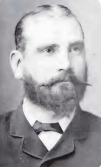 Ebenezer Cowley, 1890 | |||||||||||||||
 Cowley Creek | |||||||||||||||
| Coordinates | 17°41′45″S 146°01′58″E / 17.6958°S 146.0327°E | ||||||||||||||
| Population | 0 (2021 census)[1] | ||||||||||||||
| • Density | 0.00/km2 (0.00/sq mi) | ||||||||||||||
| Postcode(s) | 4871 | ||||||||||||||
| Area | 7.7 km2 (3.0 sq mi) | ||||||||||||||
| Time zone | AEST (UTC+10:00) | ||||||||||||||
| Location |
| ||||||||||||||
| LGA(s) | Cassowary Coast Region | ||||||||||||||
| State electorate(s) | Hill | ||||||||||||||
| Federal division(s) | Kennedy | ||||||||||||||
| |||||||||||||||
Cowley Creek is a rural locality in the Cassowary Coast Region, Queensland, Australia.[2] In the 2021 census, Cowley Creek had "no people or a very low population".[1]
Geography
Liverpool Creek forms the southern boundary of the locality, entering from the south-west (Warrubullen / Goolboo) and exiting to the south-east (Goolboo / Cowley).[3][4]
The watercourse Cowley Creek enters the locality from the west (Warrubullen) and flows south-east through the locality becoming a tributary of Liverpool Creek on the south-eastern boundary of the locality (17°42′31″S 146°02′24″E / 17.70864°S 146.04000°E).[5]
The land use is predominantly crop growing and aquaculture.[6] The Cowley Aquaculture Farm is a freshwater barramundi farm with 38 ponds with a surface area of approximately 55 hectares (140 acres), producing 1,150 tonnes of whole fish annually.[7]
History
The name Cowley refers to Ebenezer Cowley (1849?-1899), who was a horticulturalist and overseer at Kamerunga State Nursery.[5]
Demographics
In the 2016 census, Cowley Creek had a population of 13 people.[8]
In the 2021 census, Cowley Creek had "no people or a very low population".[1]
Education
There are no schools in Cowley Creek. The nearest government primary school is Silkwood State School in Silkwood to the south-west. The nearest government secondary school is Innisfail State College in Innisfail Estate to the north. There are also non-government schools in Silkwood and in Innisfail and its suburbs.[9]
References
- ^ a b c Australian Bureau of Statistics (28 June 2022). "Cowley Creek (SAL)". 2021 Census QuickStats. Retrieved 28 February 2023.
- ^ "Cowley Creek – locality in Cassowary Coast Region (entry 47866)". Queensland Place Names. Queensland Government. Retrieved 29 October 2019.
- ^ "Layers: Locality; Mountains and ranges; Contours; Watercourses". Queensland Globe. Queensland Government. Archived from the original on 19 December 2017. Retrieved 25 July 2025.
- ^ "Liverpool Creek – watercourse in the Cassowary Coast Region (entry 19791)". Queensland Place Names. Queensland Government. Retrieved 26 July 2025.
- ^ a b "Cowley Creek – watercourse in the Cassowary Coast Region (entry 8610)". Queensland Place Names. Queensland Government. Retrieved 26 July 2025.
- ^ "Layers: Locality; Protected areas and forests; Land use". Queensland Globe. Queensland Government. Archived from the original on 19 December 2017. Retrieved 25 July 2025.
- ^ "Cowley Aquaculture Farm". Queensland Farmers' Federation. Archived from the original on 14 June 2024. Retrieved 26 July 2025.
- ^ Australian Bureau of Statistics (27 June 2017). "Cowley Creek (SSC)". 2016 Census QuickStats. Retrieved 20 October 2018.
- ^ "Layers: Locality; Schools and school catchments". Queensland Globe. Queensland Government. Archived from the original on 19 December 2017. Retrieved 25 July 2025.