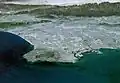
East Pasadena, California
East Pasadena, California | |
|---|---|
 Location of East Pasadena in Los Angeles County, California. | |
 East Pasadena, California Location in the United States | |
| Coordinates: 34°8′24″N 118°4′40″W / 34.14000°N 118.07778°W | |
| Country | |
| State | |
| County | Los Angeles |
| Area | |
• Total | 1.32 sq mi (3.43 km2) |
| • Land | 1.32 sq mi (3.41 km2) |
| • Water | 0.01 sq mi (0.01 km2) 0.39% |
| Elevation | 725 ft (221 m) |
| Population (2020) | |
• Total | 6,021 |
| • Density | 4,571.75/sq mi (1,764.74/km2) |
| Time zone | UTC-8 (PST) |
| • Summer (DST) | UTC-7 (PDT) |
| ZIP code | 91107 |
| Area code | 626 |
| FIPS code | 06-20984 |
| GNIS feature ID | 1660585 |
East Pasadena (ⓘ) is an unincorporated community and census-designated place (CDP) in Los Angeles County, California, United States. The population was 6,021 at the 2020 census, down from 6,144 at the 2010 census. For statistical purposes, the United States Census Bureau has defined East Pasadena as a census-designated place (CDP).
Geography
The land area of East Pasadena is separated into two non-contiguous segments:
- The main portion, bordered by Pasadena city limits on the north, California Boulevard on the south, Michillinda Avenue (Arcadia city limits) on the east, and San Gabriel Boulevard on the west.
- A smaller district to the west, bordered by Del Mar Boulevard to the north, San Marino city limits to the south, Berkeley Avenue to the west and San Gabriel Boulevard to the east.
The community has become considerably smaller as the city of Pasadena has expanded its boundaries to include more of the unincorporated area of East Pasadena.[2]
According to the United States Census Bureau, the CDP has a total area of 1.3 square miles (3.4 km2), all land. The definition of the area was created by the Census Bureau for statistical purposes and may not precisely correspond to local understanding of the area with the same name.
Much of the Chapman Woods development is located in unincorporated East Pasadena, though portions are in the City of Pasadena. Chapman Woods is bordered by Del Mar Boulevard to the north, Huntington Drive to the south, the Eaton Wash to the west, and Highway 19 (Rosemead Boulevard) to the east. Chapman Woods is named after Alfred Chapman who purchased the surrounding land and built his home on the corner of present-day California Boulevard and Ivydale Court.[3] All entrances into the neighborhood are marked with signs that say "Chapman Woods".
There is heavy commercial development on Foothill Boulevard, Colorado Boulevard, and Highway 19. The central feature of the neighborhood is Willard Elementary School and Wilson Middle School, which face each other across Madre Street.
Demographics
| Census | Pop. | Note | %± |
|---|---|---|---|
| 1990 | 5,910 | — | |
| 2000 | 6,045 | 2.3% | |
| 2010 | 6,144 | 1.6% | |
| 2020 | 6,021 | −2.0% | |
| U.S. Decennial Census[4] 1850–1870[5][6] 1880-1890[7] 1900[8] 1910[9] 1920[10] 1930[11] 1940[12] 1950[13] 1960[14] 1970[15] 1980[16] 1990[17] 2000[18] 2010[19] 2020[20] | |||
East Pasadena first appeared as a census-designated place in the 1990 U.S. Census[17] part of the Pasadena Census Community Division (CCD).[17]
| Race / Ethnicity (NH = Non-Hispanic) | Pop 2000[21] | Pop 2010[22] | Pop 2020[20] | % 2000 | % 2010 | % 2020 |
|---|---|---|---|---|---|---|
| White alone (NH) | 2,302 | 2,082 | 1,502 | 38.08% | 33.89% | 24.95% |
| Black or African American alone (NH) | 144 | 153 | 159 | 2.38% | 2.49% | 2.64% |
| Native American or Alaska Native alone (NH) | 20 | 19 | 7 | 0.33% | 0.31% | 0.12% |
| Asian alone (NH) | 1,207 | 1,575 | 1,928 | 19.97% | 25.63% | 32.02% |
| Native Hawaiian or Pacific Islander alone (NH) | 3 | 2 | 12 | 0.05% | 0.03% | 0.20% |
| Other race alone (NH) | 6 | 14 | 38 | 0.10% | 0.23% | 0.63% |
| Mixed race or Multiracial (NH) | 233 | 160 | 201 | 3.85% | 2.60% | 3.34% |
| Hispanic or Latino (any race) | 2,130 | 2,139 | 2,174 | 35.24% | 34.81% | 36.11% |
| Total | 6,045 | 6,144 | 6,021 | 100.00% | 100.00% | 100.00% |
2020
The 2020 United States census reported that East Pasadena had a population of 6,021. The population density was 4,571.8 inhabitants per square mile (1,765.2/km2). The racial makeup was 30.0% White, 2.8% African American, 1.0% Native American, 32.4% Asian, 0.2% Pacific Islander, 17.6% from other races, and 15.9% from two or more races. Hispanic or Latino of any race were 36.1% of the population.[23]
The census reported that 99.6% of the population lived in households, 0.2% lived in non-institutionalized group quarters, and 0.2% were institutionalized.[23]
There were 2,082 households, out of which 29.3% included children under the age of 18, 51.5% were married-couple households, 6.0% were cohabiting couple households, 25.5% had a female householder with no partner present, and 17.1% had a male householder with no partner present. 22.1% of households were one person, and 9.2% were one person aged 65 or older. The average household size was 2.88.[23] There were 1,484 families (71.3% of all households).[24]
The age distribution was 17.7% under the age of 18, 8.7% aged 18 to 24, 27.4% aged 25 to 44, 26.7% aged 45 to 64, and 19.5% who were 65 years of age or older. The median age was 42.0 years. For every 100 females, there were 94.8 males.[23]
There were 2,227 housing units at an average density of 1,691.0 units per square mile (652.9 units/km2), of which 2,082 (93.5%) were occupied. Of these, 64.0% were owner-occupied, and 36.0% were occupied by renters.[23]
In 2023, the US Census Bureau estimated that the median household income was $105,714, and the per capita income was $55,047. About 4.4% of families and 6.4% of the population were below the poverty line.[25]
Wildlife
Feral peafowl are common in East Pasadena, Arcadia, San Marino and other west San Gabriel Valley communities.[26] In 2021, the Los Angeles County Board of Supervisors moved to ban the feeding of peafowl due to the increasing population in recent decades.[27] The municipal codes of the cities of Pasadena and Arcadia already prohibit feeding peafowl.[28]
Government
County
The Los Angeles County Sheriff's Department (LASD) operates the Temple Station in Temple City, serving East Pasadena.[29]
State and federal
In the state legislature East Pasadena is located in the 25th senatorial district, represented by Democrat Sasha Renée Pérez and in the 49th Assembly district, represented by Democrat Mike Fong.[30] Federally, East Pasadena is located in California's 28th congressional district, represented by Democrat Judy Chu.[31]
Education
East Pasadena is served by the San Marino Unified School District serving the southwest portion and Pasadena Unified School District serving the Rosemead Boulevard corridor.
Transportation
The Metro A Line has a station on Sierra Madre Villa Avenue and Foothill Boulevard. The neighborhood overall is served by Metro Local lines 266 and 267; Pasadena Transit routes 31, 32, 40 and 60; and Foothill Transit Route 187.
In popular culture
A fictionalized City of "East Pasadena" is depicted in the TV series Law & Order: LA.[32]
References
- ^ "2020 U.S. Gazetteer Files". United States Census Bureau. Retrieved October 30, 2021.
- ^ "City of Pasadena, California". cityofpasadena.net. 2014. Retrieved July 29, 2014.
- ^ "History – Chapman Woods". Retrieved November 3, 2020.
- ^ "Decennial Census by Decade". United States Census Bureau.
- ^ "1870 Census of Population - Population of Civil Divisions less than Counties - California - Almeda County to Sutter County" (PDF). United States Census Bureau.
- ^ "1870 Census of Population - Population of Civil Divisions less than Counties - California - Tehama County to Yuba County" (PDF). United States Census Bureau.
- ^ "1890 Census of Population - Population of California by Minor Civil Divisions" (PDF). United States Census Bureau.
- ^ "1900 Census of Population - Population of California by Counties and Minor Civil Divisions" (PDF). United States Census Bureau.
- ^ "1910 Census of Population - Supplement for California" (PDF). United States Census Bureau. Archived from the original (PDF) on August 23, 2024. Retrieved January 3, 2025.
- ^ "1920 Census of Population - Number of Inhabitants - California" (PDF). United States Census Bureau.
- ^ "1930 Census of Population - Number and Distribution of Inhabitants - California" (PDF). United States Census Bureau.
- ^ "1940 Census of Population - Number of Inhabitants - California" (PDF). United States Census Bureau.
- ^ "1950 Census of Population - Number of Inhabitants - California" (PDF). United States Census Bureau.
- ^ "1960 Census of Population - General population Characteristics - California" (PDF). United States Census Bureau.
- ^ "1970 Census of Population - Number of Inhabitants - California" (PDF). United States Census Bureau.
- ^ "1980 Census of Population - Number of Inhabitants - California" (PDF). United States Census Bureau.
- ^ a b c "1990 Census of Population - Population and Housing Unit Counts - California" (PDF). United States Census Bureau.
- ^ "2000 Census of Population - Population and Housing Unit Counts - California" (PDF). United States Census Bureau.
- ^ "2010 Census of Population - Population and Housing Unit Counts - California" (PDF). United States Census Bureau.
- ^ a b "P2: Hispanic or Latino, and Not Hispanic or Latino by Race – 2020: DEC Redistricting Data (PL 94-171) – East Pasadena CDP, California". United States Census Bureau.
- ^ "P004: Hispanic or Latino, and Not Hispanic or Latino by Race – 2000: DEC Summary File 1 – East Pasadena CDP, California". United States Census Bureau.
- ^ "P2: Hispanic or Latino, and Not Hispanic or Latino by Race – 2010: DEC Redistricting Data (PL 94-171) – East Pasadena CDP, California". United States Census Bureau.
- ^ a b c d e "East Pasadena CDP, California; DP1: Profile of General Population and Housing Characteristics - 2020 Census of Population and Housing". US Census Bureau. Retrieved August 19, 2025.
- ^ "East Pasadena CDP, California; P16: Household Type - 2020 Census of Population and Housing". US Census Bureau. Retrieved August 19, 2025.
- ^ "East Pasadena CDP, California; DP03: Selected Economic Characteristics - 2023 ACS 5-Year Estimates Comparison Profiles". US Census Bureau. Retrieved August 19, 2025.
- ^ "L.A. County Set to Crackdown on the Feeding Peacocks". Pasadena Now. June 7, 2021. Retrieved June 22, 2021.
- ^ King, Noel (June 21, 2021). "California County Bans The Feeding Of Peacocks In East Pasadena". NPR News. Retrieved June 22, 2021.
- ^ Cosgrove, Jaclyn (June 17, 2021). "L.A. County ready to flip peacocks the bird". Los Angeles Times. Retrieved June 22, 2021.
- ^ "Temple Station Archived 2010-01-30 at the Wayback Machine." Los Angeles County Sheriff's Department. Retrieved on January 21, 2010.
- ^ "Final Maps | California Citizens Redistricting Commission". Retrieved August 18, 2025.
- ^ "California's 28th Congressional District - Representatives & District Map". Civic Impulse, LLC.
- ^ Schneider, Michael (April 18, 2011). "Scouring the Headlines, Law & Order: LA Takes on Two Big L.A. Scandals". TV Guide. Archived from the original on April 21, 2011. Retrieved March 15, 2020.