Atashgah-e Jadid
Atashgah-e Jadid
Persian: اتشگاه جديد | |
|---|---|
Village | |
 Atashgah-e Jadid | |
| Coordinates: 38°21′58″N 47°28′30″E / 38.36611°N 47.47500°E[1][2] | |
| Country | Iran |
| Province | Ardabil |
| County | Meshgin Shahr |
| District | Qosabeh |
| Rural District | Shaban |
| Population (2016)[3] | |
• Total | 134 |
| Time zone | UTC+3:30 (IRST) |
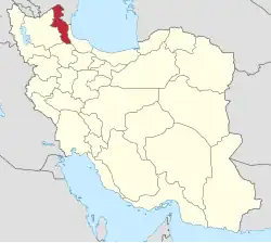
Atashgah-e Jadid (Persian: اتشگاه جديد)[a] is a village in Shaban Rural District[5] of Qosabeh District in Meshgin Shahr County, Ardabil province, Iran.
Demographics
Population
At the time of the 2006 National Census, the village's population was 185 in 41 households, when it was in the Central District.[6] The following census in 2011 counted 146 people in 35 households.[7] The 2016 census measured the population of the village as 134 people in 41 households,[3] by which time the rural district had been separated from the district in the formation of Qosabeh District.[8]
See also
Notes
References
- ^ OpenStreetMap contributors (28 May 2025). "Shabanlu, دهستان شعبان, بخش قصابه [Shaban Rural District, Qosabeh District], Meshkinshahr County, Iran" (Map). OpenStreetMap (in Persian). Retrieved 28 May 2025.
- ^ "9F8F+CXX آتیشگاه جدید [Atashgah-e Jadid], Ardabil Province, Iran" (Map). Google Maps. Retrieved 17 August 2025.
- ^ a b سرشماري عمومي نفوس و مسكن 1395 : استان اردبیل [General Population and Housing Census 2016: Ardabil Province]. مرکز آمار ایران [Statistical Centre of Iran] (in Persian). Archived from the original (Excel) on 22 March 2019. Retrieved 19 June 2025.
- ^ "INCSGN Search". Iranian National Committee for Standardization of Geographical Names (in Persian). Tehran: National Cartographic Center of Iran. Archived from the original on 2 May 2019.
- ^ Mousavi, Mir-Hossein (9 August 1987) [تاریخ تصویب (Approval date) 1366/05/18 (Iranian Jalali calendar)]. ایجاد و تشکیل 10 دهستان شامل روستاها، مزارع و مکانهای در شهرستان مشکین شهر تابع استان آذربایجان شرقی [Creation and formation of 10 rural districts including villages, farms and places in Meshgin Shahr County under East Azerbaijan province]. لام تا کام [Lam ta Kam] (in Persian). وزارت کشور [Ministry of the Interior]. هیات وزیران [Council of Ministers]. شناسه [ID] C18B26BE-7AB6-4FA9-AB16-B3D821034797. شماره دوره [Course number] 66, شماره جلد [Volume number] 11. Archived from the original on 19 June 2025. Retrieved 19 June 2025.
- ^ سرشماري عمومي نفوس و مسكن 1385 : استان اردبیل [General Population and Housing Census 2006: Ardabil Province]. مرکز آمار ایران [Statistical Centre of Iran] (in Persian). Archived from the original (Excel) on 20 September 2011. Retrieved 19 June 2025.
- ^ سرشماري عمومي نفوس و مسكن 1390 : استان اردبیل [General Population and Housing Census 2011: Ardabil Province]. Iran Data Portal—Syracuse University (in Persian). مرکز آمار ایران [Statistical Centre of Iran]. Archived from the original (Excel) on 15 January 2023. Retrieved 19 June 2025.
- ^ Rahimi, Mohammad Reza (6 March 2012) [16 اسفند 1390 (Iranian Jalali calendar)]. سه شهر جدید به نقشه تقسیمات کشورى اضافه شد [Three new cities were added to the map of the country's divisions]. Government of the Islamic Republic of Iran (in Persian). وزارت کشور [Ministry of the Interior]. کمیسیون سیاسی دفاعی هیأت دولت [Political Defense Commission of the Government Board]. Archived from the original on 10 February 2018. Retrieved 18 June 2025.
