Šēdere parish
Šēdere parish | |
|---|---|
 | |
| Country | Latvia |
| Area | |
• Total | 114.78 km2 (44.32 sq mi) |
| • Land | 112.88 km2 (43.58 sq mi) |
| • Water | 1.9 km2 (0.7 sq mi) |
| Population (1 January 2025)[2] | |
• Total | 695 |
| • Density | 6.1/km2 (16/sq mi) |
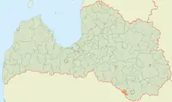
Šēdere Parish is an administrative territory of Augšdaugava Municipality in the Selonia region of Latvia. It was established under the 1920 land reform, and was previously known as Laši parish. It is situated on the southern border with Lithuania.
- Šēdere - parish administrative center
See also
- Pašulienes mežs Nature Reserve
- Raudas meži Nature Reserve
References
- ^ "Reģionu, novadu, pilsētu un pagastu kopējā un sauszemes platība gada sākumā". Central Statistical Bureau of Latvia. Retrieved 7 January 2025.
- ^ "Iedzīvotāju skaits pēc tautības reģionos, pilsētās, novados, pagastos, apkaimēs un blīvi apdzīvotās teritorijās gada sākumā (pēc administratīvi teritoriālās reformas 2021. gadā)". Central Statistical Bureau of Latvia. Retrieved 22 August 2025.
External links
Wikimedia Commons has media related to Šēdere parish.
| Towns | |
|---|---|
| Parishes | |