Zhelyava
Zhelyava | |
|---|---|
Village | |
 | |
 Zhelyava | |
| Coordinates: 42°45′0″N 23°36′0″E / 42.75000°N 23.60000°E | |
| Country | |
| Province | Sofia City |
| Municipality | Stolichna Municipality |
| Elevation | 709 m (2,326 ft) |
| Population (2024)[1] | |
• Total | 439 |
| Time zone | UTC+2 (EET) |
| • Summer (DST) | UTC+3 (EEST) |
| Postal code | 1807 |
Zhelyava (Bulgarian: Желява) is a village in Kremikovtsi district of the Bulgarian capital Sofia. As of 2024 it has 439 inhabitants.[1][2]
Geography
The village is situated at an altitude of 709 m on the southern slopes of the Balkan Mountains facing the Sofia Valley and is the starting point of trails leading to the summit of Murgash (1,687 m). It lies 29 km northeast of Sofia.[2][3]
Administratively, Zhelyava is part of the Kremikovtsi district of Stolichna Municipality in the northeastern part of the Sofia City Province. It has a territory of 44.967 km2.[4] Situated adjacent to the former Kremikovtsi steel plant, the closest settlements are the villages of Eleshnitsa to the east and Yana to the southwest. It is situated about a kilometer north of the Hemus motorway (A2) and the first class I-1 road Vidin–Sofia–Blagoevgrad–Kulata. Zhelyava is served by a bus line of the Sofia Public Transport.[5]
History and culture
The area around the village has been populated since antiquity. There are remains of an ancient Thracian mound, a medieval settlement, and monasteries. It fell to the Ottomans in the aftermath of the Bulgarian–Ottoman wars of the 14th century and was mentioned in an Ottoman document of 1420. During the Bulgarian National Revival of the 18th–19th centuries Zhelyava was a center of economic, cultural and political activity. A revolutionary committee was established there in 1872.[3]
The Church of St Nicolas was constructed in 1844. There are two chapels, named after St Petka of Tarnovo and Virgin Mary. The local cultural center, known in Bulgarian as a chitalishte, was founded in 1929, and named after the summit of Murgash.[3][6]
People
- Todoraki Peshov, first elected mayor of Sofia
Gallery
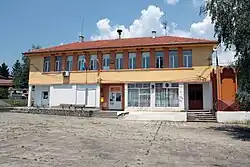
-
 Chitalishte Murgash
 -
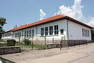 The school
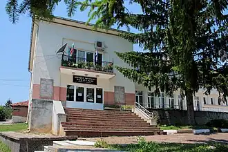
 -
 War monument
Citations
- ^ a b "Tables of Persons Registered by Permanent Address and by Current Address". Official Site of the Civil Registration and Administrative Services (GRAO). Retrieved 29 July 2025.
- ^ a b Geographic Dictionary of Bulgaria 1980, p. 205
- ^ a b c "Zhelyava". Official Site of Kremikovtsi District. Retrieved 29 July 2025.
- ^ "Bulgaria Guide, Zhelyava". Retrieved 29 July 2025.
- ^ "A Map of the Republican Road Network of Bulgaria". Official Site of the Road Infrastructure Agency. Archived from the original on 11 January 2025. Retrieved 29 July 2025.
- ^ "Murgas-1929, Zhelyava". Register of the Chitalishta of Bulgaria. Retrieved 29 July 2025.
References
- Мичев (Michev), Николай (Nikolay); Михайлов (Mihaylov), Цветко (Tsvetko); Вапцаров (Vaptsarov), Иван (Ivan); Кираджиев (Kiradzhiev), Светлин (Svetlin) (1980). Географски речник на България [Geographic Dictionary of Bulgaria] (in Bulgarian). София (Sofia): Наука и култура (Nauka i kultura).