Yarra Track
Yarra Track | |
|---|---|
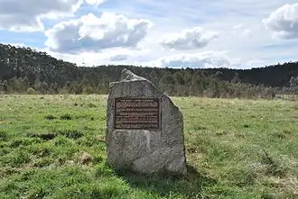 | |
| A monument marking the site of The Oaks, a former shanty on the Yarra Track | |
| Yarra Valley | |
 West end East end | |
| Coordinates | |
| General information | |
| Type | Track |
| Length | 193 km (120 mi) |
| Opened | September 1862 |
| Major junctions | |
| West end | Healesville |
| East end | Woods Point |
| Location(s) | |
| LGA(s) | Yarra Ranges Shire |
| via | |
| Highway system | |
The Yarra Track is the former name of the gold fields road from Healesville to the Woods Point and Jordan Goldfields, in Victoria, Australia.
The Beginnings of the Yarra Track
In March 1862 Mr. J. Sullivan, deputised by the miners at the Jordon Diggings, approached the Victorian Government about the need for a road or track to the Jordan gold fields.[1] The Victorian Government sent Mr. J. Murphy, civil engineer and Government mining surveyor, with a party of men, to survey and mark a track.[2] Murphy and Sullivan at first travelled together however after a difference of opinion on the best route to explore, they separated and marked different tracks.[3][4][notes 1]
Murphy explored a track from New Chum to near what would become the Marysville Woods Point Road. He surveyed a route along the Watts River to its upper reaches,[5] from there he ascended the spurs and ridges of Mt Dismal and explored a route running eastwards, south of Mt Observation, to beyond Donavan's Creek.[6] He did not complete the survey of that explored section before being called back to Melbourne.[7] His plan of that route is dated 23rd July 1862.[8]
Mr. Reick and Mr. Stockman, who were in Murphy’s surveying party, believing that the direct road had been struck, resolved to follow it up.[9] They followed Murphy’s route from New Chum to the end of his line of exploration.[10] Reick describes their efforts:
far from having "left Murphy's track," we were actually members of that surveyor's party, engaged in Melbourne, to which place we returned when that officer, for reasons unknown to us, was recalled, and the party broken up, but not until the general lie of the country had been reconnoitred, and some fifteen miles actually surveyed, opened, and blazed. My companion and I then volunteered to explore and mark the remainder of this line into Jericho, upon the Jordan; and upon this difficult service we started on the 5th July from the settled country at the Melbourne end, and arrived on the diggings, two miles above Jericho township, upon the claim of Lapraig and party, on the 30th July.[11]
They both suffered great hardships, narrowly escaping death by starvation and exposure. With a swag on their backs and using tomahawks they had cut through to the Jordan diggings, where they remained for ten days to recover their strength.[12][13][14]
Upon Reick and Stockman returning from the gold fields, a meeting was held at Eltham and a sum of money subscribed by residents of the district to cut a bridle path along the route.[15]
Blazing their marks over some of the previously made government survey marks, they cut a track along the surveyed section of Murphy's route.[16] After ascending the spur to Mt Dismal, they deviated from Murphy's explored route that they had followed earlier, and cut a track through the Dividing Ranges. First heading northwards and then easterly across Paradise Plains until they joined Guerin's Track,[notes 2][17] north of Mount Observation, which in turn joined the upper reaches of Sullivan's Track to the Jordan.[notes 3][18][19]
In late September 1862, Reick and Stockman had cut the track about 20 miles from New Chum into the Dividing Ranges and were camped at head of the Acheron River. They expected to cut a further 25-30 miles and have the track open in three weeks.[20] Given the different blazed and cut tracks they placed notices along their route; Reick's to Melbourne via Eltham and Notice: Any persons wishing to follow Reick's track to the Jordan, must keep the longest and freshest looking tracks where the tracks differ or branch off along the route.[21]
By the 25th October 1862, Reick and Stockman [notes 4] had cut the bridle track through to Jordan and called it the New Jordan Road, others called it Reick's Track[22][23][24] This early track from New Chum to the Jordan, and subsequent deviations and surveyed routes, ultimately became known as the Yarra Track.
History
At first New Chum was at the furthest point coaches could travel along the route from Melbourne. From there, a packhorse track climbed through the mountains to the diggings. After the discovery of the direct route, the Victorian Government decided in early 1863 to construct a 193-kilometre (120 mi) road along the route. Its original width varied between 4 and 6 metres (12 and 20 ft), and was designed to accommodate horse-drawn vehicles. This Track involved the climbing of the Black Spur, descent into the Acheron Valley, and then through Marysville to the Cumberland where it followed the existing route. The old route through Paradise Plains subsequently dropped out of vogue.
Two main construction camps were established in new localities on the Yarra Track at Healesville and Marysville. These were surveyed as towns to serve as base camps for construction teams and as staging towns when the coach route was completed. Marysville was founded and surveyed in August, 1864. Healesville was surveyed in September 1864, which resulted in the deviation of the settlement at New Chum. Shanties were built every five or six miles from Healesville to the diggings. Accommodation houses and stores were strung along the rest of the road.
As construction of the road progressed, smaller allotments, settlements and rural land was surveyed and the land auctioned in Crown land sales. The Glenwatts Store, Hit or Miss Restaurant, Jefferson's Store, Healesville, Fernshaw, Maytown, Mt Arnold, Granton and Marysville were progressively surveyed from 1864 to 1865.[25]
In 1865, the first drays and wagons reached Woods Point via the Yarra Track, but they could only get through during the summer months. The Yarra Track shortened the trip to Woods Point from Melbourne to a little over 161 kilometres (100 mi), compared with 354 kilometres (220 mi) via Jamieson.
Clement Wilks, an engineer with the Victorian Department of Roads and Bridges, was a member of the Yarra Track Committee responsible for building this coach and dray road, designing a number or small bridges and culverts including the Wilks Creek Bridge,[26][27] on the Marysville Road, and the Big Culvert.[28][29]
The Black Spur section became a popular tourist destination and sought after location for notable early photographers in Victoria, such as Nicholas Caire and J. W. Lindt. In 1916 a bus service was introduced, taking travellers over the route in two twelve-seater Buick charabancs. The journey from Melbourne took four and a half hours.
See also
Notes and References
Notes
- ^ Sullivan went on to cut a track further south along the Warburton Valley of the Yarra River and into the Dividing Ranges.This track became known as Sullivan's Track as described in "The Herald" Sat 21 Feb 1863 Page 6 THE ROUTE TO THE JORDAN GOLD FIELDS.
- ^ Thomas Guerin was exploring and blazing a route from the south in mid September 1862. Source: The Age Mon 29 Sept 1862 Page 6 ROUTE FROM MELBOURNE TO THE JORDAN Guerin wrote on the 1st November 1862 that he had cut a track for pack horses to Jordan. He was also aware of two private parties cutting tracks. Source: The Herald Mon 24 Nov 1862 Page 5 THE ROUTE TO THE JORDAN.
- ^ Sullivan began cutting a track in April 1862. Source:The Age Fri 30 May 1862 Page 5 UPPER YARRA AND JORDAN GOLD FIELDS. He announced completion of his track on the 16th October. Source: The Argus Thu 16 Oct 1862 Page 7 RIVER JORDAN GOLD-FIELD.
- ^ "The Age" in April 1863 reported that both Reick and Stockman were amongst people that received a reward for opening up practicable tracks between Melbourne and the Jordan gold fields. The complete list includes: Sullivan, £75 ; Connell, £60; McEvoy, £40; Walsh, £30; Ganley, £50; Ryan, £30; Rucke [sic], £10; Storkman [sic], £38; James, £28; Butcher, £28 ; Strickland £28; M'Cormack, £28 ; Robley, £25 Source: "The Age" Wed 29 Apr 1863 Page 6 LEGISLATIVE ASSEMBLY.
References
- ^ The Age Mon 17 Mar 1862 Page 5 THE NEW JORDAN DIGGINGS
- ^ The Age Thu 20 Mar 1862 Page 5 THE NEWS OF THE DAY.
- ^ The Age Tue 17 June 1862 Page 5 NEW ROUTE TO THE JORDAN DIGGINGS.
- ^ The Age Fri 30 May 1862 Page 5 UPPER YARRA AND JORDAN GOLD FIELDS.
- ^ Murphy J., Jul 1862, SURVEY OF A PORTION OF THE DRAY ROAD TO CONNECT MELBOURNE AND THE JORDAN GOLD-FIELD, VPRS 8168/P0004, Plan: 306: Melbourne - Jordan Gold Field Sheet 2
- ^ The Age Tue 17 June 1862 Page 5 NEW ROUTE TO THE JORDAN DIGGINGS
- ^ The Age Fri 29 Aug 1862 Page 4 THE NEWS OF THE DAY.
- ^ Murphy J. Jul 1862 PLAN compiled from various Surveys, Sketches & ACCOMPANYING REPORT UPON THE ROAD FROM MELBOURNE TO THE JORDAN GOLD-FIELD VPRS 8168/P0004, Plan: 302: Jordan Gold Fields - Melbourne Sheet 1
- ^ The Age, 29 August 1862, Page 4, "THE NEWS OF THE DAY".
- ^ The Age Thu 9 Oct 1862 Page 6 GUERIN AND THE JORDAN ROAD.
- ^ The Argus Fri 22 Aug 1862 Page 6 THE NEW ROAD TO THE JORDAN.
- ^ The Argus Fri 22 Aug 1862 Page 6 THE NEW ROAD TO THE JORDAN.
- ^ The Age Fri 29 Aug 1862 Page 4 THE NEWS OF THE DAY.
- ^ The Argus Tue 19 Aug 1862 Page 6 NEAR TRACK TO THE JORDAN DIGGINGS.
- ^ The Age Fri 29 Aug 1862 pp. 4- 5 THE NEWS OF THE DAY.
- ^ The Age Mon 10 Nov 1862 Page 5 NEW ROAD TO THE JORDAN.
- ^ Dickers Mining Record, April 1864, p.59, A Visit to the Australian Alps
- ^ The Herald, 21 February 1863, Page 6, "THE ROUTE TO THE JORDAN GOLD FIELDS".
- ^ Edwards Rev. E. George, 2013 "Making Tracks" - In the Beginning, p.8 Marysville & District Historical Society
- ^ The Argus Tue 30 Sept 1862 Page 6 ROUTE TO THE JORDAN DIGGINGS.
- ^ The Age, Mon 10 Nov 1862, Page 5, "NEW ROAD TO THE JORDAN".
- ^ The Argus Tue 30 Sept 1862 Page 6 ROUTE TO THE JORDAN DIGGINGS.
- ^ The Argus Fri 31 Oct 1862 Page 5 NEW TRACK TO THE JORDAN.
- ^ The Herald Sat 21 Feb 1863 Page 6 THE ROUTE TO THE JORDAN GOLD FIELDS.
- ^ Edwards Rev. G. 2013 Making Tracks – In the Beginning Marysville & District Historical Society
- ^ National Trust of Australia (Victoria) Register: B6439
- ^ "Wilks Creek Bridge, Triangle Rd, Marysville, VIC, Australia (Place ID 102643)". Australian Heritage Database. Australian Government. Retrieved 20 March 2020.
- ^ National Trust of Australia (Victoria) Register: B5804
- ^ "The Big Culvert, Marysville - Woods Point Rd, Cambarville via Marysville, VIC, Australia (Place ID 5720)". Australian Heritage Database. Australian Government. Retrieved 20 March 2020.
Bibliography
- Thomas, Ann. The last of the Yarra Track stopping place. Marysville, 1983.
- Thomas, Ann. Wilks Creek Bridge at Marysville, Victoria. 1993.
External links
- Padula OAM, Robert J. (April 2011). "The Yarra Track". Maroondah Reservoir Pictorial Heritage 1862 to 2011.
- "Yarra Track (Yarra Glen-Healesville section)". Yarra Range Heritage Database. Yarra Ranges Council. n.d.
- "Yarra Ranges National Park Management Plan" (PDF). Parks Victoria. June 2002. ISBN 0-7311-3134-7.
- "Cambarville Trails". Marysville Tourism. Marysville Triangle Business and Tourism Inc. 2020.