Wuchuan Gelao and Miao Autonomous County
Wuchuan County
务川县 Wuchwan | |
|---|---|
| 务川仡佬族苗族自治县 Wuchuan Gelao and Miao Autonomous County | |
 Wuchuan Location of the seat in Guizhou 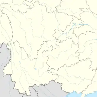 Wuchuan Wuchuan (Southwest China) | |
| Coordinates (Wuchuan County government): 28°33′46″N 107°53′58″E / 28.5629°N 107.8994°E | |
| Country | China |
| Province | Guizhou |
| Prefecture-level city | Zunyi |
| County seat | Duru Subdistrict |
| Area | |
• Total | 2,777.59 km2 (1,072.43 sq mi) |
| Population (2020 census)[1] | |
• Total | 308,466 |
| • Density | 110/km2 (290/sq mi) |
| Time zone | UTC+8 (China Standard) |
| Website | www |
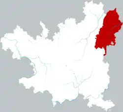
Wuchuan Gelao and Miao Autonomous County (simplified Chinese: 务川仡佬族苗族自治县; traditional Chinese: 務川仡佬族苗族自治縣; pinyin: Wùchuān Gēlǎozú Miáozú Zìzhìxiàn; alternatively 婺川) is a county in the northeast of Guizhou province, China, bordering Chongqing to the north. It is under the administration of Zunyi city.
Administrative divisions
Wuchuan is divided into 3 subdistricts, 11 towns, and 2 townships:[2]
- Duru Subdistrict (都濡街道)
- Dansha Subdistrict (丹砂街道)
- Daping Subdistrict (大坪街道)
- Fengle Town (丰乐镇)
- Huangdu Town (黄都镇)
- Fuyang Town (涪洋镇)
- Zhennan Town (镇南镇)
- Yanshan Town (砚山镇)
- Zhuoshui Town (濯水镇)
- Maotian Town (茅天镇)
- Baicun Town (柏村镇)
- Nigao Town (泥高镇)
- Fenshui Town (分水镇)
- Jiaoba Town (蕉坝镇)
- Hongsi Township (红丝乡)
- Shichao Township (石朝乡)
Climate
| Climate data for Wuchuan, elevation 660 m (2,170 ft), (1991–2020 normals, extremes 1981–2010) | |||||||||||||
|---|---|---|---|---|---|---|---|---|---|---|---|---|---|
| Month | Jan | Feb | Mar | Apr | May | Jun | Jul | Aug | Sep | Oct | Nov | Dec | Year |
| Record high °C (°F) | 22.8 (73.0) |
30.0 (86.0) |
32.8 (91.0) |
33.2 (91.8) |
35.5 (95.9) |
35.7 (96.3) |
38.6 (101.5) |
38.7 (101.7) |
38.7 (101.7) |
33.1 (91.6) |
28.2 (82.8) |
20.1 (68.2) |
38.7 (101.7) |
| Mean daily maximum °C (°F) | 8.2 (46.8) |
10.7 (51.3) |
15.6 (60.1) |
21.2 (70.2) |
25.1 (77.2) |
27.8 (82.0) |
31.1 (88.0) |
31.5 (88.7) |
27.0 (80.6) |
20.7 (69.3) |
15.9 (60.6) |
10.2 (50.4) |
20.4 (68.8) |
| Daily mean °C (°F) | 5.2 (41.4) |
7.2 (45.0) |
11.3 (52.3) |
16.4 (61.5) |
20.2 (68.4) |
23.3 (73.9) |
26.1 (79.0) |
25.8 (78.4) |
22.1 (71.8) |
16.7 (62.1) |
12.1 (53.8) |
7.0 (44.6) |
16.1 (61.0) |
| Mean daily minimum °C (°F) | 3.2 (37.8) |
4.9 (40.8) |
8.5 (47.3) |
13.1 (55.6) |
16.9 (62.4) |
20.3 (68.5) |
22.6 (72.7) |
22.1 (71.8) |
18.9 (66.0) |
14.3 (57.7) |
9.7 (49.5) |
4.9 (40.8) |
13.3 (55.9) |
| Record low °C (°F) | −3.5 (25.7) |
−3.0 (26.6) |
−2.0 (28.4) |
3.6 (38.5) |
9.1 (48.4) |
12.8 (55.0) |
14.8 (58.6) |
15.5 (59.9) |
11.7 (53.1) |
5.1 (41.2) |
−0.9 (30.4) |
−4.0 (24.8) |
−4.0 (24.8) |
| Average precipitation mm (inches) | 25.7 (1.01) |
26.4 (1.04) |
52.0 (2.05) |
105.9 (4.17) |
169.6 (6.68) |
227.3 (8.95) |
165.6 (6.52) |
150.2 (5.91) |
105.5 (4.15) |
105.1 (4.14) |
51.2 (2.02) |
19.3 (0.76) |
1,203.8 (47.4) |
| Average precipitation days (≥ 0.1 mm) | 13.1 | 12.5 | 15.3 | 16.7 | 18.0 | 17.1 | 13.8 | 12.4 | 11.6 | 16.5 | 12.9 | 11.4 | 171.3 |
| Average snowy days | 3.3 | 1.3 | 0.3 | 0 | 0 | 0 | 0 | 0 | 0 | 0 | 0 | 1.1 | 6 |
| Average relative humidity (%) | 79 | 78 | 77 | 78 | 79 | 82 | 78 | 76 | 79 | 84 | 82 | 79 | 79 |
| Mean monthly sunshine hours | 29.2 | 31.5 | 57.8 | 79.9 | 93.1 | 87.4 | 150.8 | 167.9 | 108.9 | 63.5 | 56.0 | 35.5 | 961.5 |
| Percentage possible sunshine | 9 | 10 | 15 | 21 | 22 | 21 | 36 | 42 | 30 | 18 | 17 | 11 | 21 |
| Source: China Meteorological Administration[3][4] | |||||||||||||
References
- ^ "遵义市第七次全国人口普查公报" (in Chinese). Government of Zunyi. May 31, 2021.
- ^ 2023年统计用区划代码和城乡划分代码:务川仡佬族苗族自治县 (in Simplified Chinese). National Bureau of Statistics of China. Archived from the original on January 23, 2024.
- ^ 中国气象数据网 – WeatherBk Data (in Simplified Chinese). China Meteorological Administration. Retrieved April 28, 2023.
- ^ 中国气象数据网 (in Simplified Chinese). China Meteorological Administration. Retrieved April 28, 2023.