Watervale, South Australia
| Watervale South Australia | |||||||||||||||
|---|---|---|---|---|---|---|---|---|---|---|---|---|---|---|---|
 The Institute and War Memorial in Watervale | |||||||||||||||
 Watervale | |||||||||||||||
| Coordinates | 33°57′0″S 138°38′0″E / 33.95000°S 138.63333°E | ||||||||||||||
| Population | 338 (SAL 2021)[1] | ||||||||||||||
| Established | 1847 | ||||||||||||||
| Postcode(s) | 5452 | ||||||||||||||
| Location | |||||||||||||||
| LGA(s) | District Council of Clare and Gilbert Valleys | ||||||||||||||
| Region | Mid North | ||||||||||||||
| State electorate(s) | Frome | ||||||||||||||
| Federal division(s) | Grey[2] | ||||||||||||||
| |||||||||||||||
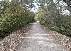
Watervale is a town on the Horrocks Highway in the Clare Valley, South Australia, approximately 9 kilometres north of Auburn and 15 kilometres south of Clare. It is surrounded by a number of small wineries and several B&Bs. The Riesling Trail runs past the town to the west, between the highway and the Skilly Hills.
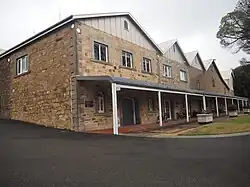
The town has a number of 19th-century heritage buildings, including the former Stanley Grammar School, which now provides private bed and breakfast accommodation.[3]

Mount Horrocks to the East is the highest point in the Clare Valley at 609 metres elevation and can be accessed via the Lavender Federation Trail. The walk from Watervale township to the top of Mt. Horrocks and back takes about 3 hours (at a distance of 11 km return) and is rated at a Grade 3 (moderate) difficulty. The spectacular views are 360° and are well worth the effort, particularly looking back at the township. https://www.walkingsa.org.au/walk/find-a-place-to-walk/collection/clare-valley-short-walks/


History
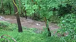
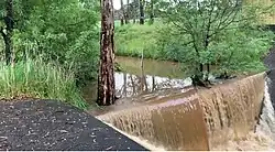
Watervale is located on Eyre Creek, which is a tributary of the Wakefield River.
The area on which the town was settled was originally granted to a pioneer named David Davies in 1847 by Governor Robe, and he named this section of land Watervale.[4]
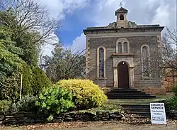
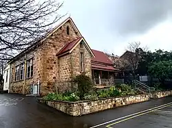
The area was settled by a number of Protestant families who founded a Bible Methodist Church in the township. The current Uniting Church and accompanying hall are examples of such colonial constructions in the area.
The second vineyard in the Clare Valley was planted by Valentine Mayr, who planted four acres at 'Pomona', Watervale in 1852, and made his first wine in 1856. He had thirty acres planted with shiraz and verdelho, which is now the site of Crabtree Watervale Wines, located on Main North Road north of Watervale.[5]
The heritage listed Quelltaler Estate dates back to 1865. Francis Treloar, formerly a miner at Burra, bought 117 acres of land near Watervale in 1851, for a winery which he named Spring Vale. Treloar established the Springvale wine cellars in 1868: sections of these stone cellars, dug into the hillside (as was typical of cellars at that time) survive. In 1890 T. G. H. Buring and Carl Sobels joined forces and purchased the Spring Vale vineyard and plant. This winery subsequently was developed as Quelltaler, known more recently, as Annie's Lane. In 2017 this winery and vineyards were bought by Seppeltsfield.[5]

Hughes Park Estate, extending over 3,000 hectares, is three km from Watervale in the Skilly valley, where the first stone homestead was completed in 1860. It was built by Sir Walter Watson Hughes, who owned the Walleroo and Moonta copper mines and founded Adelaide University from his profits. Still owned by the Duncan family, over the years many Watervale residents have found work there. At present the restored two-story homestead caters for weddings and the restored 1845 worker's cottages are now rented as a B&B.[6]

Railway
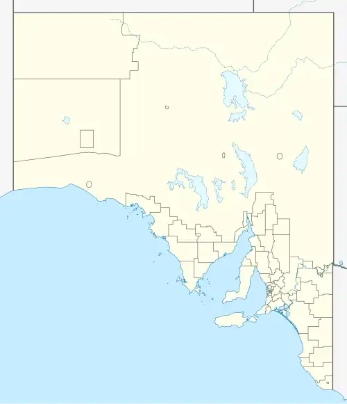
The Spalding railway line was built from Riverton to Clare in July 1918. The Ash Wednesday bushfires caused severe track damage between Sevehill and Penwortham causing the demise of the railway. The line closed in April 1984 and was dismantled in 1989. The alignment now carries the Riesling Trail.

The town today
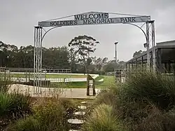
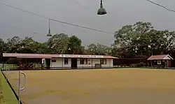
The township boasts a general store and post office, hotel, primary school, CFS unit, and Uniting church, a small number of local businesses, a winery and a variety of recreational facilities at the "Watervale Soldiers' Memorial Park" (tennis club, tennis courts, the Watervale Redbacks Cricket Club and a bowling green). In recent times "The Vale" was completed and provides a community hub for the Town.

Several bed and breakfast and holiday cottages are available for rent, including Watervale Retreat, Battunga B&B and Mulberry House. The town can be readily accessed from the Riesling Trail.
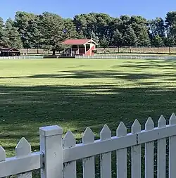
The historic Grandstand overlooking the town oval was renovated in 2010.
As part of the Clare Valley, the area is known for Riesling. Cabernet and Shiraz wines are also produced. The local winery is Crabtree Watervale Wines.
A local artist of note is Harry Sherwin.[7] Some of his work can be seen inside the Watervale Hotel.
Watervale once hosted an annual 'Day on the Green' concert at Annie's Lane, attracting up to 6,000 concert-goers.
The Watervale Foresters Hall, which in more recent years had been used by the community for meetings, art classes and a children's playgroup, had by 2009 fallen into disrepair. It was subsequently sold by the Watervale Community Association following considerable controversy and is now in private ownership.[8]
Governance
Watervale is in the District Council of Clare and Gilbert Valleys, the state electoral district of Frome, and the Australian House of Representatives Division of Grey.[2]
.jpg)
See also
References
- ^ Australian Bureau of Statistics (28 June 2022). "Watervale (suburb and locality)". Australian Census 2021 QuickStats. Retrieved 28 June 2022.
- ^ a b "Federal electoral division of Grey, boundary gazetted 20 July 2018". Australian Electoral Commission. Retrieved 12 April 2019.
- ^ Accommodation, Clare Valley. "Clare Valley Accommodation". oldstanleygrammar.com.au. Retrieved 18 January 2017.
- ^ Rodney Cockburn (1984) [1908]. What's in a name? Nomenclature of South Australia. Fergusson Publications.
- ^ a b Ruwolt, Jon. "The Story of Clare's Wineries". Clare Museum, S.A. Clare Museum of the National Trust. Retrieved 8 December 2021.
- ^ McKenzie, Kirsty (9 December 2021). "Australian Country – Restoration Spectacular".
- ^ "Harry Sherwin b. 1954". Design & Art of Australia Online. Retrieved 18 July 2025.
- ^ Media, Australian Community Media – Fairfax (2 July 2014). "Community hall sold". Northern Argus. Retrieved 18 January 2017.