Wadi al-Fara
Wadi al-Fara
وادي الفرع Wadi al-Far' | |
|---|---|
 Wadi al-Fara | |
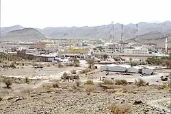
 Location of Wadi al-Fara in Medina Province | |
| Coordinates: 23°30′N 39°30′E / 23.5°N 39.5°E | |
| Country | |
| Province | Medina |
| Established | 30 December 2013 |
| Area | |
• Total | 8,099 km2 (3,127 sq mi) |
| Population (2022 Census)[1] | |
• Total | 23,120 |
| • Density | 2.9/km2 (7.4/sq mi) |
| Time zone | UTC+03:00 (SAST) |
Wadi al-Fara[2][3] or Wadi al-Far'[4] (Arabic: وادي الفرع) is a governorate in the Medina Province of Saudi Arabia. It covers an area of 8,099 kilometres (5,032 mi) and recorded a population of 23,120 in the 2022 Saudi census.[1]
Geography
Wadi al-Fara is located in the Harrat Rahat volcanic field in the Hijaz Mountains south of the city of Medina. It borders the governorates of Badr to the northwest, Medina to the north, and Mahd adh Dhahab to the east, all of these also being part of the province of Medina.[5] Wadi al-Fara also borders two governorates in the province of Mecca, Khulays to the southeast and Rabigh to the southwest.
The governorate of Wadi al-Fara is located in the watersheds of Wadi Masturah,[6][7] Wadi Rabigh,[6][8] and Wadi al-Aqiq,[9] a tributary of Wadi al-Hamd. Of the numerous springs that historically flowed in Wadi al-Fara, three remain active today at Abu Daba', al-Madiq, and Umm al-Ayal.[10]
Frederick Fraser Hunter's 1908 Map of Arabia and the Persian Gulf[11] mistakenly connected the northern end of Wadi al-Fara to Wadi as-Safra, which flows southwest past Badr into the Red Sea.[12] The 1917 Gazetteer of Arabia reflected this error in its description of the course of Wadi al-Fara, which includes that of Wadi as-Safra.[13] The Wadi al-Fara south of Medina should also not be confused with the Wadi Far'[4] or Wadi Fara'a[6] located west of Medina, also known as Wadi Yanbu An-Nakhl,[7][14] which drains into the Red Sea near Yanbu. The Gazetteer of Arabia reported that the upper reaches of Wadi Jizal, a tributary of Wadi al-Hamd, has also been called Wadi al-Fara.[15]
Under the Köppen climate classification, Wadi al-Fara experiences a hot desert climate. Annual rainfall in the area is about 75 to 85 millimetres (3.0 to 3.3 in).[3][8]
History
In the works of Yaqut al-Hamawi, Al-Bakri, and Nur al-Din al-Samhudi, Wadi al-Fara is recorded as a prosperous date-producing oasis. The place was previously known as al-Fara without the "Wadi".[16]
Charles M. Doughty recorded in Travels in Arabia Deserta that Wadi al-Fara, which lay on the middle route between Medina and Mecca, had once belonged to the Awazim, but was at the time inhabited by the Banu Amr, Banu Salim, and al-Ubbeda groups of the Harb tribe.[17][13] The Banu Amr still inhabit the region today.[16][18]
Wadi al-Fara was separated from the governorate of Medina and inaugurated as a category B governorate on 30 December 2013.[5][19]
Demographics
Wadi al-Fara recorded a population of 23,120 in the 2022 Saudi census.[1] According to the census, Wadi al-Fara's population had a sex ratio of 109 males per 100 females compared to the province-wide sex ratio of 149 males per 100 females, and 90.4% of the population were Saudi citizens, compared to 63.4% for the province of Medina as a whole. The average household size in Wadi al-Fara was 4.2 and the total fertility rate was 3.6.[20]
The 2022 census recorded two settlements having a population greater than 2500, al-Yutmah (population 3561), and al-Faqir (population 3349).[21]
Wadi al-Fara contains a population of indigenous Twelver Shiites known generally as the Nakhawila, although locally they are called the Jahami. In 1996, the Nakhawila population of Wadi al-Fara was estimated at 8000.[22]
Economy and infrastructure
Date palm, henna, and various vegetables are grown in the area, mostly through the use of groundwater irrigation.[23]
Highway 15 and the Haramain High Speed Railway, both of which connect Medina and Mecca, run north to south through Wadi al-Fara.[5]
See also
References
- ^ a b c d Brinkhoff, Thomas (1 August 2025). "Saudi Arabia: Administrative Division". City Population. Retrieved 6 August 2025.
- ^ "An introduction to Medina". Medina Urban Observatory. Al Madinah Region Development Authority. Archived from the original on 21 June 2025.
- ^ a b Bazuhair, Abdulghaffar S.; Wood, Warren W. (15 November 1996). "Chloride mass-balance method for estimating ground water recharge in arid areas: examples from western Saudi Arabia". Journal of Hydrology. 186: 153–159.
- ^ a b Gazetteer No. 54: Arabian Peninsula. U.S. Board on Geographic Names. 1961. p. 174. Retrieved 6 August 2025.
- ^ a b c "محافظة وادي الفرع" [Wadi al-Fara Governorate]. Saudipedia. Retrieved 6 August 2025.
- ^ a b c Subyani, Ali M.; Qari, Mohammed H.; Matsah, Mohamed I. (11 May 2010). "Digital elevation model and multivariate statistical analysis of morphometric parameters of some wadis, western Saudi Arabia". Arabian Journal of Geosciences. 5: 147–157. doi:10.1007/s12517-010-0149-7.
- ^ a b Sultan, Mohamed; Sefry, Saleh; AbuAbdallah, Mazen (2015). "Impacts of Climate Change on the Red Sea Region and its Watersheds, Saudi Arabia". The Red Sea. Springer Nature. doi:10.1007/978-3-662-45201-1_22.
- ^ a b Masoud, Milad (2015). "Rainfall-runoff modeling of ungauged Wadis in arid environments (case study Wadi Rabigh—Saudi Arabia)". Arabian Journal of Geosciences. 8: 2587–2606. doi:10.1007/s12517-014-1404-0.
- ^ El Maghraby, Magdy; Masoud, Milad; Niyazi, Burhan (27 March 2014). "Assessment of surface runoff in arid, data scarce regions; an approach applied in Wadi Al Hamd, Al Madinah Al Munawarah, Saudi Arabia" (PDF). Life Science Journal. 11 (4): 271–289. Retrieved 6 August 2025.
- ^ Al-Badrani, Abdul Mutalib Mubarak (10 September 2021). "وادي الفرع أهم محافظات المدينة المنورة" [Wadi al-Fara is one of the most important governorates of Medina]. Al Jazirah. Retrieved 6 August 2025.
- ^ Hunter, Frederick Fraser (1908). Map of Arabia and the Persian Gulf (Map). Survey of India. Retrieved 6 August 2025 – via Qatar Digital Library.
- ^ Al-Ahmedi, Masoud Eid; Şen, Zekâi (1989). "The Depletion of the Groundwater Resources in Wadi As-Safra, Saudi Arabia" (PDF). Journal of King Abdulaziz University: Earth Sciences. 2: 1–15. Retrieved 6 August 2025.
- ^ a b "FAR'A (Wādi)". Gazetteer of Arabia. Vol. 1. Simla: Government of British India. 1917. p. 609. Retrieved 6 August 2025.
- ^ Alqarawy, Abdulaziz (2023). "Characterization of groundwater in Quaternary aquifer of the Yanbu Al-Nakhl Basin, Al-Madinah Al-Munawarah Province using pumping tests and hydrochemical techniques". Arabian Journal of Chemistry. 16. doi:10.1016/j.arabjc.2023.105327.
- ^ "JIZAL (Wādi)". Gazetteer of Arabia. Vol. 1. Simla: Government of British India. 1917. p. 965. Retrieved 6 August 2025.
- ^ a b Al-Badrani, Faiz (2004). وشائق تاريخية من منطقةالمدينة المنورة : القسم الأول وثائق وادي الفلراع [Historical documents from the Medina region, part 1: Documents from Wadi al-Fara]. Kuwait. pp. 25–27.
{{cite book}}: CS1 maint: location missing publisher (link) - ^ Doughty, Charles Montagu (1921). Travels in Arabia Deserta. Vol. 2. London: Philip Lee Warner. pp. 85, 174, 512–513.
- ^ Hamzah, Fu'ad (11 August 1983). "Arab tribes in the Kingdom of Saudi Arabia". Near East/South Asia Report (2798). Foreign Broadcast Information Service: 12. Retrieved 6 August 2025.
- ^ "الأمير فيصل بن سلمان يؤكد أن القيادة السعودية حريصة على أن يعم الخير المحافظات والمراكز كافة". Asharq Al-Awsat (in Arabic). 31 December 2013. Retrieved 6 August 2025.
- ^ "Display Regions Information Dashboard Statistics". GASTAT. Retrieved 6 August 2025.
- ^ Brinkhoff, Thomas (4 July 2023). "Saudi Arabia: Medina Region". City Population. Retrieved 6 August 2025.
- ^ Ende, Werner (November 1997). "The Nakhāwila, a Shite Community in Medina Past and Present". Die Welt des Islams. 37 (3): 263–348. JSTOR 1570656.
- ^ Abd El-Ghani, Monier M. (1996). "Vegetation along a transect in the Hijaz mountains (Saudi Arabia)". Journal of Arid Environments. 32: 289–304.