Villers-la-Ville
Villers-la-Ville | |
|---|---|
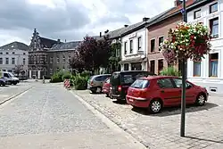 Marbais | |
 Flag  Coat of arms | |
Location of Villers-la-Ville | |
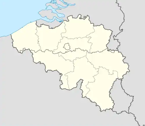 Villers-la-Ville Location in Belgium
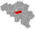
The municipality of Villers-la-Ville in Walloon Brabant 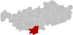 | |
| Coordinates: 50°35′N 04°32′E / 50.583°N 4.533°E | |
| Country | Belgium |
| Community | French Community |
| Region | |
| Province | Walloon Brabant |
| Arrondissement | Nivelles |
| Government | |
| • Mayor | Emmanuel Burton (MR) |
| • Governing party/ies | MR |
| Area | |
• Total | 48.03 km2 (18.54 sq mi) |
| Population (2018-01-01)[1] | |
• Total | 10,713 |
| • Density | 220/km2 (580/sq mi) |
| Postal codes | 1495 |
| NIS code | 25107 |
| Area codes | 071 |
| Website | www.villers-la-ville.be |
Villers-la-Ville (French pronunciation: [vilɛʁs la vil] ⓘ; Walloon: L' Abeye) is a municipality of Wallonia located in the Belgian province of Walloon Brabant. On January 1, 2006, Villers-la-Ville had a total population of 9,572. The total area is 47.45 km2, giving a population density of 202 inhabitants per km2. The municipality also includes the villages of Marbais, Mellery, Sart-Dames-Avelines and Tilly.
History
Early History and Founding
The most notable historical site in Villers-la-Ville is the Villers Abbey, a Cistercian abbey founded in 1146 by twelve monks and three lay brothers from Clairvaux. Gauthier de Marbais granted the land for the abbey. Initially, the monks established several preliminary sites before finally settling on the current location in the 13th century.[2]
Architectural Development
The construction of the abbey was a monumental task that spanned several decades. The choir was completed by 1217, the crypt by 1240, and the refectory by 1267. The church took 70 years to build and was completed by the end of the 13th century. During this period, the abbey reached the height of its fame and importance, with contemporary accounts suggesting that roughly 100 monks and 300 lay brothers resided within its walls. The abbey’s lands expanded to approximately 100 km² of woods, fields, and pasturage.
Decline and Challenges
The abbey began to face challenges in the 16th century, tied to the larger troubles of the Low Countries. Spanish tercios caused considerable damage to the church and cloister during the campaign of 1544. Although partially restored in 1587, the abbey’s fortunes diminished in the 17th and 18th centuries1. The number of monks and the abbey’s wealth dwindled, and it was finally abandoned in 1796 following the French Revolution.
Post-Abandonment and Restoration
After its abandonment, the abbey fell into disrepair. Further degradation occurred in 1855 when a railway line was constructed through the old abbatial grounds1. In 1893, the Belgian state purchased the site and launched a conservation effort1. The abbey was classified as an official historic site in 1973, and since then, it has undergone considerable restoration1. The abbey's remains, including the cloister, refectory, kitchens, dormitories, and brewing house, can still be seen today.
Modern Significance
Today, Villers Abbey is a significant cultural and historical site. It hosts an annual choir festival, La Nuit des Chœurs, where various choirs perform different genres of music1. The site is maintained by the Association pour la Promotion Touristique et Culturelle de Villers (APTCV). Although in ruins, the church is an outstanding example of Cistercian architecture, with imposing vaulting, arches, and rose windows.[3][4]
Sites
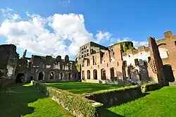
To the north of the village lie the ruins of the Villers Abbey, one of Europe's most important Cistercian abbeys. It was founded in 1147 and destroyed by the French republicans in 1795. In the ruined church attached to the abbey, the tombstones of several dukes of Brabant of the 13th and 14th centuries are still to be found.[5]
The ruins also appear in the final episode of season 2 of sense8.
Postal history
The MARBAIS post office opened on 1 June 1838. It used postal distribution code 33 with bars (before 1864), and code 235 with points before 1874. The VILLERS-LA-VILLE post office opened on 10 February 1865. SART-DAMES-AVELINES on 15 October 1877, TILLY on 8 November 1906.[6]
Postal codes in 1969:[7]
- 6318 Marbais
- 6320 Villers-la-Ville
- 6321 Tilly
- 6322 Mellery
- 6328 Sart-Dames-Avelines
Code 1495 since at least October 1990.
Transport
- Villers-la-Ville railway station
- Tilly railway station, in the sub-municipality of Tilly
References
- ^ "Wettelijke Bevolking per gemeente op 1 januari 2018". Statbel. Retrieved 9 March 2019.
- ^ "Visiting the Villers Abbey: Location, History and Guide!". wonderfulwanderings.com. 2023-11-17. Retrieved 2024-09-06.
- ^ "Villers Abbey". Villers Abbey. Retrieved 2024-09-06.
- ^ laurewanderscom (2019-08-28). "The Villers Abbey in Belgium: A Guide for 2024 - Laure Wanders". Retrieved 2024-09-06.
- ^ One or more of the preceding sentences incorporates text from a publication now in the public domain: Chisholm, Hugh, ed. (1911). "Villers la Ville". Encyclopædia Britannica. Vol. 28 (11th ed.). Cambridge University Press. p. 86.
- ^ Catalogue Spécialisé des Oblitérations Belges, 1849-1910, Nationale en Internationale Postzegelmanifestaties Antwerpen (NIPA), Antwerp, 1999.
- ^ Liste des Numéros Postaux, Administration des Postes, Bruxelles 1969.
External links
 Media related to Villers-la-Ville (Belgium) at Wikimedia Commons
- Official website (in French)
Places adjacent to Villers-la-Ville | ||||||||||||||||
|---|---|---|---|---|---|---|---|---|---|---|---|---|---|---|---|---|
| ||||||||||||||||