Uplawmoor railway station
Uplawmoor | |||||
|---|---|---|---|---|---|
 Uplawmoor station site in 2007 | |||||
| General information | |||||
| Location | Uplawmoor, Renfrewshire Scotland | ||||
| Coordinates | 55°45′49″N 4°29′28″W / 55.7635°N 4.4910°W | ||||
| Grid reference | NS437550 | ||||
| Platforms | 2 | ||||
| Other information | |||||
| Status | Disused | ||||
| History | |||||
| Original company | Lanarkshire and Ayrshire Railway | ||||
| Pre-grouping | Caledonian Railway | ||||
| Post-grouping | LMS | ||||
| Key dates | |||||
| 1 May 1903 | Opened[1] | ||||
| 1 January 1917 | Closed | ||||
| 2 March 1919 | Reopened | ||||
| 2 April 1962 | Closed to regular services | ||||
| |||||
Uplawmoor railway station was a railway station serving the village of Uplawmoor, East Renfrewshire, Scotland as part of the Lanarkshire and Ayrshire Railway.
History
The station opened on 1 May 1903.[1] It closed between 1 January 1917 and 2 March 1919 due to wartime economy,[1] and closed permanently to passengers and freight on 2 April 1962.[1][2] Upon closure, the nearby station Caldwell took on the name 'Uplawmoor'.
Although the station was closed to regular passengers, in 1964 the Royal Train was stabled here overnight during a visit to the area by the Queen Mother.[3]
Sidings ran to the Shillford Quarry that was located to the east of the station within Uplawmoor Wood.
| Preceding station | Historical railways | Following station | ||
|---|---|---|---|---|
| Lugton High Line and station closed |
Caledonian Railway Lanarkshire and Ayrshire Railway |
Neilston Line closed; station open | ||
-
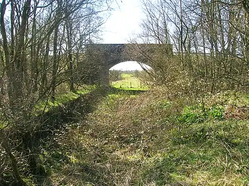
 Station site in 2007, looking towards Neilston
 -
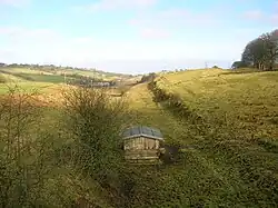
 Station site in 2009, looking towards Lugton High
 -
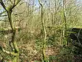
 The railway alignment looking towards Neilston
References
Notes
Sources
- Butt, R. V. J. (October 1995). The Directory of Railway Stations: details every public and private passenger station, halt, platform and stopping place, past and present (1st ed.). Sparkford: Patrick Stephens Ltd. ISBN 978-1-85260-508-7. OCLC 60251199. OL 11956311M.
- Jowett, Alan (March 1989). Jowett's Railway Atlas of Great Britain and Ireland: From Pre-Grouping to the Present Day (1st ed.). Sparkford: Patrick Stephens Ltd. ISBN 978-1-85260-086-0. OCLC 22311137.
- Jowett, Alan (2000). Jowett's Nationalised Railway Atlas (1st ed.). Penryn, Cornwall: Atlantic Transport Publishers. ISBN 978-0-906899-99-1. OCLC 228266687.
- Stansfield, G. (1999). Ayrshire & Renfrewshire's Lost Railways. Ochiltree: Stenlake Publishing. ISBN 1-8403-3077-5.