Tsentralny Administrative District, Kaliningrad
Tsentralny Administrative District
Центральный район | |
|---|---|
 Coat of arms | |
Location of Tsentralny Administrative District on the map of Kaliningrad | |
| Coordinates: 54°43′30″N 20°28′15″E / 54.72500°N 20.47083°E | |
| Country | Russia |
| Federal subject | Kaliningrad Oblast |
| Established | January 7, 1952 |
| Administrative center | Kaliningrad |
| Area | |
• Total | 79.8 km2 (30.8 sq mi) |
Central District or Tsentralny District (Russian: Центральный район) is a district (raion) of the city of Kaliningrad, Kaliningrad Oblast, Russia. Population: 119,966 (2010 Census);[1] 80,039 (2002 Census);[2] 84,892 (1989 Soviet census).[3]. It's the largest district of Kaliningrad and 3rd largest by the population.
Located north-west from the city's historical center, nowadays it includes the former districts of Amalienau, Ratshof and Hufen, which became part of Konigsberg in early 20th century and was a part of former Oktyabrsky District until it was merged with Tsentralny.
History
Tsentralny District was established on January 7, 1952 as former part of Stalingradsky District of Kaliningrad. Being seated on the north-west part of the city, the District inherited it's name from a mid 20th century project of a city's new administrative center, which was planned to be established on a Komsomolskaya and Karl Marx streets intersection in former Hufen as a result of the destruction of Königsberg Castle, which was former seat of city's government.
Sightseeing
Tsentralny District is the least damaged part of former Konigsberg, caused by Allied and Soviet bombardment during WW2. The most notable places of interest in this district are:
- Kaliningrad Zoo
- Drama Theatre, former Luisentheater
- Buildings of Baltic Federal University, located on Chernyshevskogo, 56A and intersection of Sovietsky ave. and Mira ave.
- Mira avenue and Pobedy avenue, located mostly in Amalienau and Hufen districts.
-
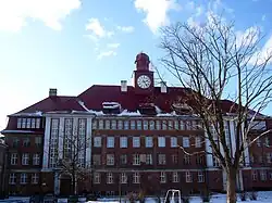 Building of Baltic Federal University on Chernyshevskogo, 56A
 -
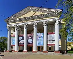 Drama theatre
References
- ^ Russian Federal State Statistics Service (2011). Всероссийская перепись населения 2010 года. Том 1 [2010 All-Russian Population Census, vol. 1]. Всероссийская перепись населения 2010 года [2010 All-Russia Population Census] (in Russian). Federal State Statistics Service.
- ^ Federal State Statistics Service (May 21, 2004). Численность населения России, субъектов Российской Федерации в составе федеральных округов, районов, городских поселений, сельских населённых пунктов – районных центров и сельских населённых пунктов с населением 3 тысячи и более человек [Population of Russia, Its Federal Districts, Federal Subjects, Districts, Urban Localities, Rural Localities—Administrative Centers, and Rural Localities with Population of Over 3,000] (XLS). Всероссийская перепись населения 2002 года [All-Russia Population Census of 2002] (in Russian).
- ^ Всесоюзная перепись населения 1989 г. Численность наличного населения союзных и автономных республик, автономных областей и округов, краёв, областей, районов, городских поселений и сёл-райцентров [All Union Population Census of 1989: Present Population of Union and Autonomous Republics, Autonomous Oblasts and Okrugs, Krais, Oblasts, Districts, Urban Settlements, and Villages Serving as District Administrative Centers]. Всесоюзная перепись населения 1989 года [All-Union Population Census of 1989] (in Russian). Институт демографии Национального исследовательского университета: Высшая школа экономики [Institute of Demography at the National Research University: Higher School of Economics]. 1989 – via Demoscope Weekly.