Travis County, Texas
Travis County | |
|---|---|
County | |
 | |
 Flag  Seal | |
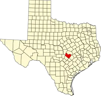 Location within the U.S. state of Texas | |
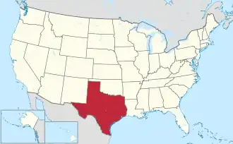 Texas's location within the U.S. | |
| Coordinates: 30°20′N 97°47′W / 30.33°N 97.78°W | |
| Country | |
| State | |
| Founded | 1840 |
| Named after | William B. Travis |
| Seat | Austin |
| Largest city | Austin |
| Area | |
• Total | 1,023 sq mi (2,650 km2) |
| • Land | 990 sq mi (2,600 km2) |
| • Water | 33 sq mi (90 km2) 3.2% |
| Population (2020) | |
• Total | 1,290,188 |
• Estimate (2023) | 1,334,961 |
| • Density | 1,300/sq mi (490/km2) |
| Time zone | UTC−6 (Central) |
| • Summer (DST) | UTC−5 (CDT) |
| Congressional districts | 10th, 17th, 21st, 35th, 37th |
| Website | traviscountytx |
Travis County is located in Central Texas. As of the 2020 census, the population was 1,290,188. It is the fifth-most populous county in Texas. Its county seat and most populous city is Austin,[1] the state's capital. The county was established in 1840 and is named in honor of William Barret Travis, the commander of the Republic of Texas forces at the Battle of the Alamo. Travis County is part of the Austin–Round Rock–Georgetown Metropolitan Statistical Area. It is located along the Balcones Fault, the boundary between the Edwards Plateau to the west and the Blackland Prairie to the east.
History
Prehistoric Texas
Early inhabitants of Central Texas date to between 12,000 to 22,000 years ago as evidenced by the discovery of sites like Leanderthal Lady ("Leanne") at the Wilson-Leonard site near Leander, Texas.[2][3]
Another two of the oldest Paleo-Indian archeological sites in Texas, the Levi Rock Shelter and Smith Rock Shelter, are in southwest and southeast Travis County, respectively.[4]
In downtown Austin, archeological excavations have revealed that the hilltop where the French Legation now sits was utilized during the Archaic period (North America), possibly 5,000 years ago. Even earlier artifacts dating to the Paleo-Indians period show that humans may have used the area as early as 9,000 years ago.[5]
Continuous occupation of Travis County continues into the Toyah Phase represented by sites like the Toyah Bluff Site in southeast Travis County along Onion Creek. The Toyah Phase is the last widespread prehistoric pattern prior to the arrival of Europeans.[6]
Spanish Period
The region (along with all of modern Texas) was claimed by the Spanish Empire in the 1600s, but at the time no attempt was made to settle the area (or even to explore it fully).[7]
In 1691 Domingo Terán de los Ríos was instructed to make a tour of Spanish Texas with the goal of establishing missions among the Tejas (Hasinai), keep records of "geography, natives, and products" and investigate rumors of foreign settlements on the coast (the French). Terán's entrada took them through Travis County crossing the Colorado River near what would later be called the Montopolis ford, which today is part of El Camino Real de los Tejas National Historic Trail.[8]
In 1709 Captain Pedro de Aguirre led an expedition with Fathers Antonio de Olivares and Isidro de Espinosa (Espinosa-Olivares-Aguirre Expedition) from San Juan Bautista Mission along the Rio Grande River in Mexico into Travis County hoping to meet with the Tejas Indians (Hasinai). They reached the south bank the Colorado River in or near Austin in April, but found the Tejas were not there. They were however visited by members of a number of Indigenous Peoples: Yojuan (AKA Yojuane), Simomo, and Tusonibi. Guides for the Spanish included Indigenous Peoples they had encountered just previously living near San Pedro Springs: Chaularame, Payaya, Sana, Sijame, and Siupan. With orders not to cross the Colorado the expedition returned to Mexico.[9][10][11][12]
In 1730 Franciscan friars, who were given responsibility for all the Texas missions, made the decision to relocate three missions, La Purísima Concepción, San Francisco de los Neches, and San José de los Nazonis, to a site by the Colorado River near Barton Springs.[13] The friars found conditions undesirable and relocated to the San Antonio River within a year of their arrival.[14]
El Camino Real de los Tejas National Historic Trail runs through Travis County crossing the Colorado River just east of the Montopolis Bridge.
Mexican Period
In 1821 Mexico won its independence from Spain, and the new government enacted laws encouraging colonists to settle the Texas frontier by granting them land and reduced taxation. Over the next decade, thousands of foreign immigrants (primarily from the United States) moved into Texas; in particular, American empresario Stephen F. Austin established one of his colonies, known as Austin's "Little Colony", consisting of 100 families near what is now Bastrop, Texas in 1827.[15][16] Josiah and Mathias Wilbarger,[17][18] Reuben Hornsby (namesake of Hornsby Bend, Travis County, Texas),[19] Jacob M. Harrell,[20] Noah Smithwick,[21][22] and John F. Webber (namesake of Webberville, Travis County, Texas)[23] were early settlers who moved to the Bastrop area in the early 1830s. Webber and Reubon Hornsby would later move west and form the settlements of Webberville and Hornsby Bend respectively.
Republic of Texas Period
In 1836 Texas declared and won its independence from Mexico, forming the Republic of Texas. That same year, 1836, before Austin was founded, Fort Colorado, AKA Fort Coleman, was established in then Bastrop County, later to be Travis County, to secure and expand the Republic of Texas’ control over Native American territory.[24] It was strategically located on the main road to what would later be Austin from Bastrop, Texas, Webberville, Texas and Hornsby Bend, Texas, what Barkley called the "Path of the Pioneers", today's Webberville Road, also known as FM 969. It was this path Vice President Lamar would later take to Waterloo in 1838 for the buffalo hunt which eventually led to Austin as the capital of Texas. Lamar stopped at the fort to procure an escort of rangers.[25][22] Fort Colorado was also strategically placed near a trade route utilized by Native Americans since prehistory that the Spanish would later adopt, El Camino Real de los Tejas National Historic Trail. The site of Fort Colorado is located on today's Travis Audubon Blair Woods Preserve and is a part of the historic trail.[26]
While there were skirmishes between Anglo-Texans and Native Americans, there were also attempts at peace. In 1837 a band of Penateka Comanche (Nʉmʉnʉʉ) approached Fort Colorado to seek a treaty of peace. Texas Ranger and historian Noah Smithwick, stationed at the fort, lived with the Comanche as emissary for many months where he “was made the recipient of every attention known to their code of hospitality”. This is the only known peace treaty initiated from inside Travis County. The treaty was unfortunately never ratified by Texas.[27][22]
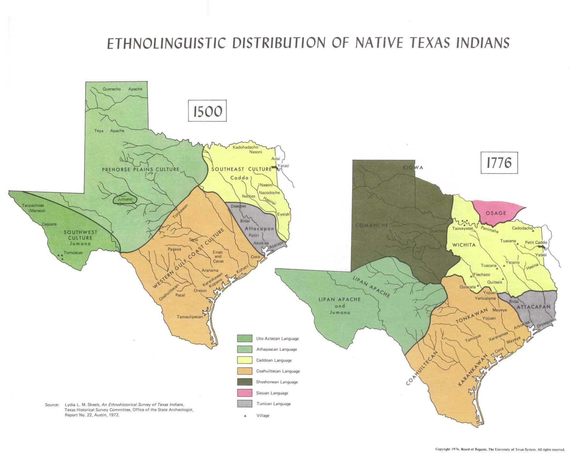
Historically recorded tribes in Travis County at this time were Comanche, Lipan Apache, Tonkawa, Waco (a branch of the Wichita), and others.[28][27][29][30][31] Tribes such as the ethnographically well-known Comanche, Lipan Apache, Waco (Wichita branch), and even the Tonkawa migrated into Texas, of which Travis County is a part, just before or during the early European contact period.[32][33][34][35] The expansion of the Spanish into what is now Travis County, establishing missions, traveling El Camino Real de los Tejas, and introducing European diseases, along with the migration of other Native American tribes to the area, particularly the Lipan Apache who in turn were retreating from Comanche expansion, displaced tribes that were indigenous to the area since before European contact, like the Coahuiltecans.[36][37][38]
After Texas Vice President Mirabeau B. Lamar visited central Texas during a buffalo-hunting expedition between 1837 and 1838, he proposed that the republic's capital (then located in Houston) be relocated to a site on the north bank of the Colorado River. Edward Burleson had surveyed the planned townsite of Waterloo, near the mouth of Shoal Creek on the Colorado River, in 1838; it was incorporated January 1839. By April of that year the site selection commission had selected Waterloo to be the new capital. A bill previously passed by Congress in May, 1838, specified that any site selected as the new capital would be named Austin, after the late Stephen F. Austin; hence Waterloo upon selection as the capital was renamed Austin.[39]
A new county was also established the following year, of which Austin would be the seat; the county was named Travis County, after William B. Travis, commander of the Alamo. Travis County was originally a part of Bastrop County; many old land records from the time of Mexican Texas for Travis County were originally filed with the Bastrop County Clerk's Office. Later a number of other counties were carved from the original boundaries of Travis County: Callahan (1858), Coleman (1858), Comal (1846), Gillespie (1848), Hays (1848), Burnet (1852), Brown (1856), Lampasas (1856), Eastland (1858), Runnels (1858), and Taylor (1858).[40][41]
In the years following the battle of San Jacinto in 1836, Mexican leaders periodically threatened to renew hostilities against Texas. March 5, 1842, at the direction of Antonio López de Santa Anna, a force of 700 men under Ráfael Vásquez (general) marched into Texas and seized San Antonio. Forewarned of the Mexican advance, most residents had already evacuated allowing Vasquez to enter the town unopposed. Fearing a subsequent attack on Austin (which never came), many residents left Austin and President Houston moved the capital to Houston on March 13, 1842; it was then moved to Washington-on-the-Brazos, Texas September of that same year. It was during this period the Texas Archive War took place. The capital was moved once more, back to Austin, in 1845.[42][43]
Civil War and Reconstruction
In 1861 Travis County was one of the few Texas counties to vote against secession from the Union. Since the majority of the state did favor secession, Travis County then became a part of the Confederacy for the duration of the Civil War.
After secession, life became difficult for those in Travis County that continued to support the Union. Governor Sam Houston refused to take the oath of loyalty to the Confederate States of America and was forced to step-down as Governor.[44] Some, like prominent lawyer and businessman, Josiah Fisk, namesake of Fiskville and brother of Greenleaf Fisk, opted to leave Texas when threatened with conscription.[45][46] Others like former Texas Ranger Richard Lincoln Preece mounted guerilla resistance against the Confederacy from inside Travis County, eventually being forced to leave Texas via Mexico to join the U.S. Army. Barkley describes hangings and attempted hangings in Travis County of persons remaining loyal to the Union.[47][25][48]
During the Civil War a number of forts, or fortifications, were built in Austin anticipating Union attack (which never occurred). One of the better documented of these located on South Congress was Fort Magruder.[49][50]
Among shortages experienced in Travis County during the Civil War was timely news from newspapers. Some newspapermen closed shop and enlisted when the war began. Other newspapers were forced to close due to lack of ink and paper available only through Mexico or the Gulf Coast which was blockaded by Union forces. In Travis County the "State Gazette" (Austin) kept a pony express rider at the Brenham, Texas railhead to bring in Houston papers with news only 18 hours old.[51]
Following the end of the Civil War Texas opened two facilities in Austin, one intended to care for disabled and indigent Confederate Veterans (men), opened in 1884, and a Confederate women's home for wives and widows of Confederate Veterans opened in 1908. In addition, Texas opened the Confederate section of the Texas State Cemetery to accommodate the burial of both Veterans, and wives and widows of Veterans.[52][53][54]
Reconstruction began with the end of the Civil War lasting from 1865 to 1870. As the capital of Texas, Austin played a central role in administration of Reconstruction policies and programs. U.S. Army troops were stationed in Austin to enforce new laws and protect African Americans.[55]
The Bureau of Refugees, Freedmen, and Abandoned Lands, better known as The Freedmen’s Bureau, was administered from Austin helping formerly enslaved people with labor contracts, education, and legal disputes.[56]
During Reconstruction Travis County saw the formation of many Freedom colonies by enslaved African Americans.[57]
March 30, 1870, President Grant signed the act that readmitted Texas to the Union and ended Reconstruction.
After Reconstruction the first Railroad to enter Travis County was the Houston and Texas Central Railway arriving in Austin December 25th, 1871 making the city the westernmost rail terminus in Texas. With the arrival of the railroad materials like milled lumber became readily available ushering in a building boom and making Austin a trading center. A second railroad soon followed, the International–Great Northern, reaching Austin in 1876. Several lumberyards appear on the 1887 Birdseye Map of Austin near the rail freight yard.[58][59]
Turn of the 20th Century and Beyond
The United States Geological Survey (USGS) was established in 1879. In the early years of the USGS its survey work was hampered by lack of funds and as late as the 1920s nearly 60% of the US was still unmapped.[60] Travis County was fortunate to be one of the first areas mapped producing what is known as the "1902 Austin folio" (surveyed 1895-1896, published 1902). Although referred to as the "Austin quadrangle" it covers all of Travis County. In addition to the map produced, the USGS produced written reports including the "culture" of Travis County at the turn of the 20th Century.[61]
Quoting the USGS: "The Austin quadrangle has a comparatively dense population, but nine-tenths of its inhabitants are found on the Coastal Plain, east of the Balcones scarp, the Edwards Plateau country to the west being but sparsely populated. The densest rural population is found in the White Rock and Taylor prairies and the Colorado bottoms, nearly the entire areas of which are devoted to the cultivation of cotton, with some minor crops. The few people inhabiting the Edwards Plateau are engaged in raising cattle and cutting cedar timber from the hills to supply the city of Austin with fuel. Occasionally farmers cultivate small areas of alluvial soil in the valleys of this district."
Towns cited: "Austin, the capital of the State, occupies both banks of the Colorado near the center of the quadrangle. It is a city of 30,000 inhabitants and contains many handsome public buildings, including the capitol and university. Manor, about 12 miles northeast of Austin, is a prosperous rural village of about 5000 inhabitants. McNeil, Manchaca, and Buda are small towns along the line of the International and Great Northern Railroad. The other towns on the map, such as Oak Hill, Watters, Pflugerville, Sprinkle, Bluff Springs, New Sweden, and Fiskville, are small villages with one or more stores and a few houses."
Railroads: International and Great Northern Railroad; Houston and Texas Central Railway; Austin and Northwestern Railroad branch of the Houston and Texas Central Railway.
Roads of the time are categorized as "county roads of the first order, which lead from Austin to the neighboring county seats; lanes leading from the main highways to small communities or farms; and country roads, originally made by wood cutters, which meander through the region of the Edwards Plateau ... Three substantial bridges span the Colorado, the westernmost of which is devoted solely to railway traffic, and the others, at Austin and Montopolis, Austin, Texas, to vehicles."
The USGS descriptions concludes with a note that applies to Travis County to this day: "It is interesting to note on the map how the courses of the principal railways and highways are governed by the geologic structure."
1936 was the Centennial of Texas' independence from Mexico. In celebration the Texas Legislature created the Commission of Control for Texas Centennial Celebrations.[62][63][64] Of about 600 historical markers erected statewide Travis County received about 50 of the 1936 Centennial markers. Unfortunately most Centennial markers, being a product of their time, focus on the "Anglo Texan" view of the last 100 years overlooking the diverse experiences of Native Americans, African Americans, and Mexican Americans in Texas.[65][66]
In addition to markers, Travis County celebrated the Centennial by publishing The Defender 1936, a yearbook of Travis County rural public schools, compiled by the students and staff of the schools represented in the book. The Defender is a valuable primary source for genealogists, researchers, educators and students of Travis County history. The 348-page book contains hundreds of names of students, teachers, principals, trustees, etc. There is history of each school and photos of people and school buildings. Having been out of print since 1936, copies of The Defender 1936 are hard to access. Fortunately the book has been scanned and published on-line through the University of North Texas’ Portal to Texas History.[67] The Defender 1936 unfortunately does not include the many African American and Mexican American schools that were in Travis County at that time. The Travis County Engineering Department did however produce road maps in 1932 with names and locations of all these schools.[68]
From the end of the Civil War to the early twenty-first century, Travis County has experienced steady, rapid population growth (averaging more than a 36% increase every decade from 1870 to 2010), driven largely by the growth of Austin and its suburbs; it is now the fifth most populous county in Texas, after Harris (Houston), Dallas, Tarrant (Fort Worth) and Bexar (San Antonio) counties.
Geography
According to the U.S. Census Bureau, the county has a total area of 1,023 square miles (2,650 km2), of which 990 square miles (2,600 km2) is land and 33 square miles (85 km2) (3.2% of the territory) is water.[69] Travis County is located in the southern part of central Texas, between San Antonio and Dallas–Fort Worth. The county's geographical center lies two miles northwest of downtown Austin at 30°18' north latitude and 97°45' west longitude.[70]
Travis County straddles the Balcones Fault, the boundary between the Edwards Plateau to the west and the Texas Coastal Plain to the east. The western part of the county is characterized by the karst topography of the Texas Hill Country, while the eastern part exhibits the fertile plains and farmlands of the Blackland Prairie. The Colorado River meanders through the county from west to east, forming a series of man-made lakes (Lake Travis, Lake Austin, and Lady Bird Lake).
Springs
The limestone karst geology of the western and southwestern parts of Travis County gives rise to numerous caverns and springs, some of which have provided shelter and water for humans in the region for thousands of years. Notable springs in the county include Barton Springs, Deep Eddy and Hamilton Pool.[71]
Major highways
Travis County is crossed by Interstate Highway 35, US Highways 183 and 290, and Texas Highway 71. IH-35 leads northward to Waco and Dallas–Fort Worth and southward to San Antonio. US-183 leads northward through Cedar Park to Lampasas and southward to Lockhart. US-290 leads westward to Fredericksburg and eastward to Houston. TX-71 leads westward to Marble Falls and eastward to Bastrop.
Other major highways within the county include Texas Highway Loop 1 (the "Mopac Expressway"), which runs from north to south through the center of the county, and Texas Highway 45, which forms parts of an incomplete highway loop around Austin. Texas Highway 130 (constructed as an alternative to IH-35 for long-distance traffic wishing to avoid Austin and San Antonio) also runs from north to south through the sparsely populated eastern part of the county.
Railroads
Amtrak's Austin station is located in downtown Austin and is served by the Texas Eagle which runs daily between Chicago and San Antonio, continuing on to Los Angeles several times a week.
Travis County is served by the Union Pacific Railroad and the Austin Western Railroad.
Adjacent counties
- Williamson County (north)
- Bastrop County (southeast)
- Caldwell County (south)
- Hays County (southwest)
- Blanco County (west)
- Burnet County (northwest)
Protected areas
Demographics
| Census | Pop. | Note | %± |
|---|---|---|---|
| 1850 | 3,138 | — | |
| 1860 | 8,080 | 157.5% | |
| 1870 | 13,153 | 62.8% | |
| 1880 | 27,028 | 105.5% | |
| 1890 | 36,322 | 34.4% | |
| 1900 | 47,386 | 30.5% | |
| 1910 | 55,620 | 17.4% | |
| 1920 | 57,616 | 3.6% | |
| 1930 | 77,777 | 35.0% | |
| 1940 | 111,053 | 42.8% | |
| 1950 | 160,980 | 45.0% | |
| 1960 | 212,136 | 31.8% | |
| 1970 | 295,516 | 39.3% | |
| 1980 | 419,573 | 42.0% | |
| 1990 | 576,407 | 37.4% | |
| 2000 | 812,280 | 40.9% | |
| 2010 | 1,024,266 | 26.1% | |
| 2020 | 1,290,218 | 26.0% | |
| 2024 (est.) | 1,363,767 | [72] | 5.7% |
| U.S. Decennial Census[73] 1850–2010[74] 2010–2020[75][76] | |||
| Race / Ethnicity (NH = Non-Hispanic) | Pop 1990[77] | Pop 2000[78] | Pop 2010[79] | Pop 2020[80] | % 1990 | % 2000 | % 2010 | % 2020 |
|---|---|---|---|---|---|---|---|---|
| White alone (NH) | 375,279 | 457,817 | 517,644 | 612,824 | 65.11% | 56.36% | 50.54% | 47.50% |
| Black or African American alone (NH) | 60,998 | 73,242 | 82,805 | 96,270 | 10.58% | 9.02% | 8.08% | 7.46% |
| Native American or Alaska Native alone (NH) | 1,562 | 2,261 | 2,611 | 2,762 | 0.27% | 0.28% | 0.25% | 0.21% |
| Asian alone (NH) | 15,883 | 35,842 | 58,404 | 99,660 | 2.76% | 4.41% | 5.70% | 7.72% |
| Pacific Islander alone (NH) | N/A | 390 | 540 | 774 | N/A | 0.05% | 0.05% | 0.06% |
| Other race alone (NH) | 996 | 1,429 | 1,813 | 6,513 | 0.17% | 0.18% | 0.18% | 0.50% |
| Mixed race or Multiracial (NH) | N/A | 12,251 | 17,683 | 50,275 | N/A | 1.51% | 1.73% | 3.90% |
| Hispanic or Latino (any race) | 121,689 | 229,048 | 342,766 | 421,110 | 21.11% | 28.20% | 33.46% | 32.64% |
| Total | 576,407 | 812,280 | 1,024,266 | 1,290,188 | 100.00% | 100.00% | 100.00% | 100.00% |

According to the census of 2010, there were 1,024,266 people, 320,766 households, and 183,798 families residing in the county. The population density was 1,034 persons per square mile (399 persons/km2). There were 335,881 housing units at an average density of 340 units per square mile (130 units/km2). The racial makeup of the county was 68.21% White, 9.26% Black or African American, 0.58% Native American, 4.47% Asian, 0.07% Pacific Islander, 14.56% other races, and 2.85% from two or more races. 28.20% of the population were Hispanic or Latino of any race. English is the sole language spoken at home by 71.42% of the population age 5 or over, while 22.35% speak Spanish, and a Chinese language (including Mandarin, Taiwanese, and Cantonese) is spoken by 1.05%. As of the 2010 census, there were about 11.1 same-sex couples per 1,000 households in the county.[81]
According to the census of 2000, there were 812,280 people, of which 29.30% had children under the age of 18 living with them, 42.60% were married couples living together, 10.40% had a female householder with no husband present, and 42.70% were non-families. 30.10% of all households were composed of individuals, and 4.40% had someone living alone who was 65 or older. The average household size was 2.47 and the average family size was 3.15. 12.0% were of German, 7.7% English, 6.6% Irish and 5.5% American ancestry according to Census 2000[82]
The population's age distribution was 23.80% under the age of 18, 14.70% from 18 to 24, 36.50% from 25 to 44, 18.20% from 45 to 64, and 6.70% age 65 years of age or older. The median age was 30 years. For every 100 females, there were 104.90 males. For every 100 females age 18 and over, there were 104.50 males.
Government and Politics
Like other Texas counties, Travis County is governed by a Commissioners' Court composed of the county judge and four county commissioners. The court levies county taxes and sets the budgets for county officials and agencies. The judge and commissioners are elected for four-year terms (the judge at-large, and the commissioners from geographic precincts). The other major county-wide official is the county clerk, who maintains the county's records, administers elections, and oversees legal documentation (such as property deeds, marriage licenses and assumed name certificates). The clerk is also elected at-large for a four-year term.
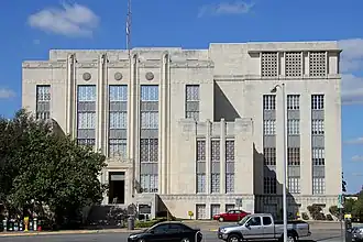
The Heman Marion Sweatt Travis County Courthouse is located in downtown Austin. The county courthouse holds civil and criminal trial courts and other functions of county government. As of 2017, the county's probate courts are in the process of being moved from the county courthouse into Austin's 1936 United States Courthouse, which was acquired by the county in 2016.[83]
Corrections
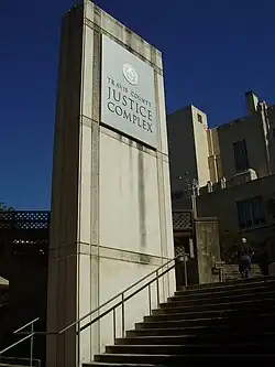
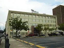
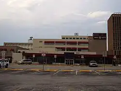
The Travis County Jail and the Travis County Criminal Justice Center are located in Downtown Austin.[84][85] The Travis County Correctional Complex is located in an unincorporated area in Travis County, next to Austin-Bergstrom International Airport.[86]
The Texas Department of Criminal Justice operates the Travis County State Jail, a state jail for men, in eastern Austin.[87]
Politics
Travis County is one of the most consistently Democratic counties in Texas, having voted for the Democratic presidential nominee all but five times since 1932. The only exceptions have been the Republican landslide years of 1952, 1956, 1972 and 1984, when Dwight Eisenhower, Richard Nixon and Ronald Reagan each won over 400 electoral votes, and 2000, when the Republican nominee was incumbent Texas Governor George W. Bush. In 2005 Travis County was the only county in Texas to vote against the Proposition 2 state constitutional amendment banning gay marriage, with slightly under 60% of voters being against it.[88]
In 2020, Travis County backed Democrat Joe Biden with nearly 72% of the vote, his strongest showing in the state and the best showing for any presidential candidate in the county since 1948. While Kamala Harris in 2024 lost some ground since 2020, her performance of 68% made Travis County the most Democratic of all Texas counties in that election. This was partly due to the Republican shift in all majority-Hispanic counties in south and west Texas, many of which held this record in the past.[89]
The county's Democratic bent is not limited to the presidential level, as all of the county-level officials are Democrats. The county is home to UT Austin, with Democrats generally doing very well in counties with universities.[90] In addition, the majority of the county is represented by Democrats in the US Congress, Texas Senate, and Texas House.
United States Congress
| Representatives | Name[91] | Party | First elected | Area(s) of Travis County represented | ||
|---|---|---|---|---|---|---|
| District 10 | Michael McCaul | Republican | 2004 | 10th | Avery Ranch, Elgin, Lago Vista, Lakeway, Pflugerville, West Lake Hills | |
| District 17 | Pete Sessions | Republican | 2020 | 3rd* | Pflugerville | |
| District 21 | Chip Roy | Republican | 2018 | 4th | Barton Creek, Oak Hill | |
| District 35 | Greg Casar | Democratic | 2022 | 2nd | East Austin, Del Valle, Manor, | |
| District 37 | Lloyd Doggett | Democratic | 1994 | 15th | West Austin, Rollingwood, Sunset Valley, West Lake Hills | |
*Pete Sessions previously represented the Dallas-based 32nd District. He was defeated by Colin Allred in the 2018 midterm elections. In 2020, he won the Central-Texas-based 17th District seat to replace outgoing Congressman Bill Flores.
Texas Senate
State Senators serve four year terms with no term limits.
| Representatives | Name[91] | Party | First elected | Area(s) of Travis County represented | |
|---|---|---|---|---|---|
| District 14 | Sarah Eckhardt | Democratic | 2020 | Austin, Elgin, Manor, Pflugerville, Rollingwood West Lake Hills | |
| District 21 | Judith Zaffirini | Democratic | 1987 | East Austin, Del Valle | |
| District 25 | Donna Campbell | Republican | 2013 | Bee Cave, Lago Vista, Lakeway | |
Texas House of Representatives
State Representatives serve two year terms with no term limits.
| Representatives | Name[91] | Party | First elected | Area(s) of Travis County represented | |
|---|---|---|---|---|---|
| District 19 | Ellen Troxclair | Republican | 2022 | Lago Vista | |
| District 46 | Sheryl Cole | Democratic | 2018 | East Austin, Elgin, Huston-Tillotson University, Manor | |
| District 47 | Vikki Goodwin | Democratic | 2018 | West Austin, Bee Cave, Lakeway | |
| District 48 | Donna Howard | Democratic | 2006 | West Austin, South Austin, Rollingwood, West Lake Hills | |
| District 49 | Gina Hinojosa | Democratic | 2016 | Central Austin, The University of Texas | |
| District 50 | James Talarico | Democratic | 2018 | Northeast Austin, Pflugerville | |
| District 51 | Lulu Flores | Democratic | 2022 | Southeast Austin, Del Valle, St Edwards University | |
In addition to Travis, the 3rd Court of Appeals hears cases from 23 other counties across Central Texas: Bastrop, Bell, Blanco, Burnet, Caldwell, Coke, Comal, Concho, Fayette, Hays, Irion, Lampasas, Lee, Llano, McColluch, Milam, Mills, Runnels, San Saba, Schleicher, Sterling, Tom Green, and Williamson.
All 24 counties in the district vote for justices. Justices serve six year terms in at-large seats with no term limits, besides a mandatory retirement age of 75 years old.[92]
Following the 2018 midterm elections, Democrats flipped the majority on the 3rd Court of Appeals.
Since 2022, all elected 3rd Court of Appeals judges are members of the Democratic Party.[93]
| Place | Name[91] | Last Election | Elected | Term Up |
|---|---|---|---|---|
| 1 | Darlene Byrne (Chief Justice) | 52.2% D | 2020 | 2026 |
| 2 | Maggie Ellis | 50.9% D | 2024 | 2030 |
| 3 | Chari L. Kelly | Uncontested | 2018 | 2030 |
| 4 | Rosa Lopez Theofanis | 52.6% D | 2022 | 2028 |
| 5 | Karin Crump | Uncontested | 2024 | 2030 |
| 6 | Gisela D. Triana | Uncontested | 2018 | 2030 |
Judges serve a 4-year term, with no term limits.
As of January 2025, all elected Travis County State District Court judges are members of the Democratic Party.
| District | Name[91] | Area of Focus | Term | Elected | Term Up |
|---|---|---|---|---|---|
| 53rd | Maria Cantú Hexsel | Civil & Family | 2nd | 2020 | 2028 |
| 98th | Sandra Avila Ramirez | Civil & Family | 1st | 2024 | 2028 |
| 126th | Aurora Martinez Jones | Civil & Family | 2nd | 2020 | 2028 |
| 147th | Cliff Brown | Criminal | 4th | 2010 | 2026 |
| 167th | Dayna Blazey | Criminal | 2nd | 2020 | 2028 |
| 200th | Jessica Mangrum | Civil & Family | 2nd | 2020 | 2028 |
| 201st | Amy Clark Meachum | Civil & Family | 4th | 2010 | 2026 |
| 250th | Karin Crump | Civil & Family | 3rd | 2014 | 2026 |
| 261st | Daniella DeSeta Lyttle | Civil & Family | 1st | 2022 | 2026 |
| 299th | Karen Sage | Criminal | 4th | 2010 | 2026 |
| 331st | Chantal Eldridge | Criminal | 2nd | 2018 | 2026 |
| 345th | Jan Soifer | Civil & Family | 3rd | 2016 | 2028 |
| 353rd | Sherine Thomas | Civil & Family | 1st | 2024 | 2028 |
| 390th | Julie Kocurek | Criminal | 7th | 1999 | 2028 |
| 403rd | Brandy Mueller | Criminal | 1st | 2022 | 2026 |
| 419th | Catherine Mauzy | Civil & Family | 2nd | 2018 | 2026 |
| 427th | Tamara Needles | Criminal | 3rd | 2016 | 2028 |
| 450th | Brad Urrutia | Criminal | 2nd | 2016 | 2028 |
| 455th | Laurie Eiserloh | Civil & Family | 1st | 2022 | 2026 |
| 459th | Maya Guerra Gamble | Civil & Family | 2nd | 2018 | 2026 |
| 460th | Selena Alvarenga | Criminal | 2nd | 2020 | 2028 |
| Year | Republican | Democratic | Third party(ies) | |||
|---|---|---|---|---|---|---|
| No. | % | No. | % | No. | % | |
| 2024 | 170,787 | 29.25% | 398,981 | 68.32% | 14,207 | 2.43% |
| 2020 | 161,337 | 26.43% | 435,860 | 71.41% | 13,152 | 2.15% |
| 2016 | 127,209 | 27.14% | 308,260 | 65.77% | 33,251 | 7.09% |
| 2012 | 140,152 | 36.21% | 232,788 | 60.14% | 14,117 | 3.65% |
| 2008 | 136,981 | 34.25% | 254,017 | 63.52% | 8,890 | 2.22% |
| 2004 | 147,885 | 42.00% | 197,235 | 56.01% | 6,993 | 1.99% |
| 2000 | 141,235 | 46.88% | 125,526 | 41.67% | 34,502 | 11.45% |
| 1996 | 98,454 | 39.97% | 128,970 | 52.36% | 18,877 | 7.66% |
| 1992 | 88,105 | 31.89% | 130,546 | 47.26% | 57,584 | 20.85% |
| 1988 | 105,915 | 44.86% | 127,783 | 54.13% | 2,386 | 1.01% |
| 1984 | 124,944 | 56.84% | 94,124 | 42.82% | 745 | 0.34% |
| 1980 | 73,151 | 45.69% | 75,028 | 46.87% | 11,914 | 7.44% |
| 1976 | 71,031 | 46.67% | 78,585 | 51.63% | 2,597 | 1.71% |
| 1972 | 70,561 | 56.30% | 54,157 | 43.21% | 611 | 0.49% |
| 1968 | 34,309 | 41.58% | 39,667 | 48.07% | 8,544 | 10.35% |
| 1964 | 19,838 | 31.02% | 44,058 | 68.89% | 62 | 0.10% |
| 1960 | 22,107 | 44.87% | 27,022 | 54.85% | 135 | 0.27% |
| 1956 | 23,551 | 53.98% | 19,982 | 45.80% | 98 | 0.22% |
| 1952 | 20,850 | 52.06% | 19,155 | 47.83% | 46 | 0.11% |
| 1948 | 5,994 | 22.03% | 19,598 | 72.03% | 1,615 | 5.94% |
| 1944 | 2,324 | 12.09% | 14,384 | 74.80% | 2,522 | 13.11% |
| 1940 | 3,128 | 15.26% | 17,300 | 84.38% | 75 | 0.37% |
| 1936 | 1,154 | 8.60% | 12,092 | 90.07% | 179 | 1.33% |
| 1932 | 1,532 | 11.45% | 11,718 | 87.60% | 126 | 0.94% |
| 1928 | 4,847 | 51.83% | 4,487 | 47.98% | 17 | 0.18% |
| 1924 | 1,909 | 19.43% | 7,573 | 77.06% | 345 | 3.51% |
| 1920 | 1,204 | 20.39% | 3,541 | 59.97% | 1,160 | 19.64% |
| 1916 | 690 | 15.47% | 3,682 | 82.54% | 89 | 2.00% |
| 1912 | 468 | 12.04% | 2,741 | 70.54% | 677 | 17.42% |
| Year | Republican | Democratic | Third party(ies) | |||
|---|---|---|---|---|---|---|
| No. | % | No. | % | No. | % | |
| 2024 | 157,203 | 27.17% | 407,210 | 70.39% | 14,128 | 2.44% |
County government
As of January 2025, all county elected officials are members of the Democratic Party.
| District | Position[91] | Name[91] | Term | Elected | Term Up |
|---|---|---|---|---|---|
| At-Large | County Judge | Andy Brown | 2nd | 2020 | 2026 |
| Precinct 1 | Commissioner | Jeff Travillion | 3rd | 2016 | 2028 |
| Precinct 2 | Commissioner | Brigid Shea | 3rd | 2016 | 2026 |
| Precinct 3 | Commissioner | Ann Howard | 2nd | 2020 | 2028 |
| Precinct 4 | Commissioner | Margaret Gómez | 8th | 1994 | 2026 |
| At-Large | District Attorney | José Garza | 2nd | 2020 | 2028 |
| At-Large | County Attorney | Delia Garza | 2nd | 2020 | 2028 |
| At-Large | District Clerk | Velva Price | 3rd | 2014[96] | 2026 |
| At-Large | County Clerk | Dyana Limon-Mercado | 1st | 2022 | 2026 |
| At-Large | Treasurer | Dolores Ortega Carter | 10th | 1986 | 2026 |
| At-Large | Sheriff | Sally Hernandez | 3rd | 2016 | 2030 |
| At-Large | Tax Assessor-Collector | Celia Israel | 1st | 2024 | 2028 |
| Precinct 1 | Constable | Tonya Nixon | 2nd | 2020 | 2028 |
| Precinct 2 | Constable | Adan Ballesteros | 5th | 2008 | 2028 |
| Precinct 3 | Constable | Stacy Suits | 3rd | 2016 | 2028 |
| Precinct 4 | Constable | George Morales III | 3rd | 2016 | 2028 |
| Precinct 5 | Constable | Carlos B. Lopez | 4th | 2012 | 2028 |
| Precinct 1 | Justice of the Peace | Yvonne Michelle Williams[97] | 4th | 2010 | 2026 |
| Precinct 2 | Justice of the Peace | Randall Slagle | 3rd | 2014 | 2026 |
| Precinct 3 | Justice of the Peace | Sylvia Holmes | 2nd | 2018 | 2026 |
| Precinct 4 | Justice of the Peace | Raúl Arturo Gonzalez | 5th | 2006 | 2026 |
| Precinct 5 | Justice of the Peace | Tanisa Jeffers | 1st | 2024 | 2026 |
| At-Large | County Court At Law #1 | Todd Wong | 3rd | 2014 | 2026 |
| At-Large | County Court At Law #2 | Eric Sheppard | 3rd | 2014 | 2026 |
| At-Large | County Court At Law #3 | Bianca Garcia | 1st | 2022 | 2026 |
| At-Large | County Court At Law #4 | Dimple Malhotra | 2nd | 2019* | 2026 |
| At-Large | County Court At Law #5 | Mary Ann Espiritu | 1st | 2022 | 2026 |
| At-Large | County Court At Law #6 | Denise Hernandez | 1st | 2022 | 2026 |
| At-Large | County Court At Law #7 | Elisabeth A. Earle | 6th | 2002 | 2026 |
| At-Large | County Court At Law #8 | Carlos H. Barrera | 5th | 2008 | 2028 |
| At-Large | County Court At Law #9 | Kim Williams | 3rd | 2016 | 2028 |
| At-Large | Probate Court** | Guy Herman | 1st | 2023* | 2026 |
| At-Large | Probate Court** | Nicholas Chu | 2nd | 2023* | 2028 |
| At-Large | Central Appraisal District, Place 1*** | Jett Hanna | 1st | 2024 | 2028 |
| At-Large | Central Appraisal District, Place 2*** | Daniel Wang | 1st | 2024 | 2028 |
| At-Large | Central Appraisal District, Place 3*** | Dick Lavine | 1st | 2024 | 2028 |
*won a special election to complete an unexpired term
**court created in 2023
***office created in 2023, vacancies filled in special elections in May 2024
Austin Community College, Board of Trustees
The board governing the Austin Community College district, which Travis County is a part of alongside Hays, Caldwell, and Blanco counties, as well as portions of Williamson, Bastrop, Guadalupe, Lee, and Fayette counties. Members are elected in nonpartisan elections and serve six year terms.
| Place | Name[91] | Term | Elected | Term Up |
|---|---|---|---|---|
| 1 | Dana Walker | 1st | 2020* | 2026 |
| 2 | Gigi Edwards Bryant | 2nd | 2014 | 2026 |
| 3 | Nan McRaven | 4th | 2002 | 2026 |
| 4 | Sean Hassan | 2nd | 2016 | 2028 |
| 5 | Manny Gonzalez | 2nd | 2022 | 2028 |
| 6 | Steve Jackobs | 1st | 2022 | 2028 |
| 7 | Sherri Taylor | 1st | 2024 | 2030 |
| 8 | Stephanie Gharakhanian | 2nd | 2018 | 2030 |
| 9 | Julie Ann Nitsch | 2nd | 2016* | 2030 |
*won a special election to complete an unexpired term
Economy
As of 2017, Travis County had a median household income of $68,350 per year, and a per capita income of $38,820 per year. 13.9% of the population lived below the poverty level.[75] The county's largest employers are governments (the State of Texas, the US Federal Government, Travis County and the City of Austin) and public education bodies. Other major employers are concentrated in industries relating to semiconductors, software engineering and healthcare.[98]
Education
K-12 education
Travis County is served by a number of public school districts; the largest is Austin Independent School District, serving most of Austin. Other districts wholly or mainly located in Travis County include Eanes ISD, Lake Travis ISD, Lago Vista ISD, Leander ISD, Del Valle ISD, Manor ISD, and Pflugerville ISD. Parts of Elgin ISD, Coupland ISD, Hutto ISD, Round Rock ISD, Marble Falls ISD, Johnson City ISD, Dripping Springs ISD and Hays Consolidated ISD also cross into Travis County.[99]
State-operated schools include:
Texas Blind, Deaf, and Orphan School was formerly in operation for black students pre-desegregation.
Colleges and universities
The largest university in Travis County is the University of Texas at Austin. Other universities include St. Edward's University, Huston–Tillotson University, and Concordia University Texas.
Under Texas law Austin Community College District (ACC) is the designated community college for most of the county. However, areas in Marble Falls ISD are zoned to Central Texas College District.[100]
Healthcare
Central Health, a hospital district, was established in 2004.[101] Brackenridge Hospital was originally built as the City-County Hospital in 1884 but Travis County ended its share of the ownership in 1907.[102] In 2017 Brackenridge was replaced by the Dell Seton Medical Center.[103]
Communities
Cities (multiple counties)
- Austin (county seat) (small parts in Hays and Williamson counties)
- Cedar Park (mostly in Williamson County)
- Elgin (mostly in Bastrop County)
- Leander (mostly in Williamson County)
- Mustang Ridge (small parts in Caldwell and Bastrop counties)
- Pflugerville (small part in Williamson County)
- Round Rock (mostly in Williamson County)
Cities
Villages
Census-designated places
Unincorporated communities
Ghost towns
- Daffan
- Decker
- Maha
- Manda
- New Katy
Austin neighborhoods
- Anderson Mill
- Four Points
- Jollyville
- Kincheonville
- Merrilltown
- Montopolis
- Oak Hill
- Onion Creek
- Pleasant Hill
- Tanglewood Forest
- Windemere
- Waters Park
See also
- Austin Bat Cave (non-profit educational org)
- List of museums in Central Texas
- National Register of Historic Places listings in Travis County, Texas
- Recorded Texas Historic Landmarks in Travis County
References
- ^ "Find a County". National Association of Counties. Archived from the original on September 7, 2021. Retrieved March 26, 2020.
- ^ Association, Texas State Historical. "The Gault Site: A Key Archaeological Discovery in Texas". Texas State Historical Association. Retrieved August 4, 2025.
- ^ Association, Texas State Historical. "Wilson-Leonard Site: A Comprehensive Archaeological Overview". Texas State Historical Association. Archived from the original on July 12, 2025. Retrieved August 4, 2025.
- ^ Hester, Thomas (1986). "The Balcones Escarpment: Early Human Populations". Geological Society of America. 6 (2). Abbott, Patrick L. and Woodruff, C. M.: 55–62. Archived from the original on October 12, 2011. Retrieved September 6, 2011.
- ^ "The Hilltop Gathering of Indigenous People Historical Marker". www.hmdb.org. Archived from the original on February 22, 2025. Retrieved August 7, 2025.
- ^ Society, Texas Archeological (2003). "The Toyah Bluff Site of Travis County, Bulletin of the Texas Archeological Society, Volume 74, 2003". Bulletin of the Texas Archeological Society.
- ^ Chipman, Donald E. (1992), Spanish Texas, 1519–1821, Austin, Texas: University of Texas Press, p. 26, ISBN 0-292-77659-4
- ^ McGraw, Joachim et.al. Teran and Mazanet 1691-1692, p.70, A Texas Legacy The Old San Antonio Road And The Caminos Reales: A Tricentennial History, 1691-1991. Texas State Department of Highways and Public Transportation. Portal of Texas History https://texashistory.unt.edu/ark:/67531/metapth1364735/
- ^ Association, Texas State Historical. "The 1709 Expedition into Texas: Isidro Félix de Espinosa and His Team". Texas State Historical Association. Archived from the original on July 12, 2025. Retrieved August 8, 2025.
- ^ Association, Texas State Historical. "History of San Juan Bautista Mission: A Gateway to Texas". Texas State Historical Association. Retrieved August 8, 2025.
- ^ Wade, Maria F. and Don E. Wade. Hard Choices: The Apache, the Spaniard, and the Local Native Groups 1700-1755, p. 165, The Native Americans of the Texas Edwards Plateau, 1582-1799. University of Texas Press, 2003
- ^ "Approximate Site Reached by the Espinosa-Olivares-Aguirre Expedition Historical Marker". www.hmdb.org. Archived from the original on May 17, 2022. Retrieved August 8, 2025.
- ^ "Approximate Location of the Missions Historical Marker". www.hmdb.org. Archived from the original on February 26, 2021. Retrieved August 8, 2025.
- ^ "The Spanish Missions in Texas". Texas Almanac. Texas State Historical Association. Retrieved September 10, 2011.
- ^ de la Teja, Jesus F. (1997). "The Colonization and Independence of Texas: A Tejano Perspective". In Rodriguez O., Jaime E.; Vincent, Kathryn (eds.). Myths, Misdeeds, and Misunderstandings: The Roots of Conflict in U.S.–Mexican Relations. Wilmington, DE: Scholarly Resources Inc. p. 88. ISBN 0-8420-2662-2.
- ^ Association, Texas State Historical. "Bastrop, Texas: A Historical Overview of the County Seat". Texas State Historical Association. Retrieved August 17, 2025.
- ^ Association, Texas State Historical. "Josiah Pugh Wilbarger: Early Settler and Texas Pioneer". Texas State Historical Association. Retrieved August 11, 2025.
- ^ Association, Texas State Historical. "Mathias Wilbarger: Pioneer Settler of Texas". Texas State Historical Association. Retrieved August 11, 2025.
- ^ Association, Texas State Historical. "Reuben Hornsby: Pioneer Soldier and Surveyor in Early Texas". Texas State Historical Association. Retrieved August 11, 2025.
- ^ Association, Texas State Historical. "Jacob M. Harrell: Pioneer Settler and Mayor of Austin". Texas State Historical Association. Retrieved August 11, 2025.
- ^ Association, Texas State Historical. "Noah Smithwick: Pioneer Blacksmith and Memoirist of Texas". Texas State Historical Association. Retrieved August 11, 2025.
- ^ a b c Smithwick, Noah. Evolution of a state, or, Recollections of old Texas days. Austin, Tex., Gammel Book Company, 1st edition, 1900
- ^ Association, Texas State Historical. "John Ferdinand Webber: Pioneer of Webberville, Texas". Texas State Historical Association. Retrieved August 11, 2025.
- ^ "Site of Fort Colorado Historical Marker". www.hmdb.org. Retrieved August 19, 2025.
- ^ a b Barkley, Mary Starr. "Austin, 1861-1870", History of Travis County and Austin, 1839-1899. Waco, Texas, Texian Press, 1963.
- ^ Iruegas, Sergio and Melinda. The Archaeology Of Blair Woods Nature Preserve Historic Fort Colorado. El Camino Real de los Tejas National Historic Trail Association, and GTI Environmental, LLC, 2021. Copies on file with Travis County Archives, Travis Audubon and Austin History Center.
- ^ a b "Dr. Circe Sturm and Dr. Craig Campbell, University of Texas at Austin, College of Liberal Arts, Department of Anthropology, Native American and Indigenous Studies. The Texas Centennial Historic Marker & Fort Colorado, Austin, Texas". www.hmdb.org. Retrieved August 19, 2025.
- ^ "Comanche Peak Historical Marker". www.hmdb.org. Retrieved August 19, 2025.
- ^ Wilbarger, John Wesley. Indian depredations in Texas. Hutchings Printing House, Austin, 2nd edition, 1890. See index listing for Travis County for tribes mentioned in Travis County.
- ^ Winfrey, Dorman H. (editor). The Indian Papers of Texas and the Southwest 1825-1916, Volume 2, p.271, p.291, Texas State Historical Assoc., 1995. See references to Waco.
- ^ Sowell, A.J. Early Settlers and Indian Fighters of Southwest Texas, Ben C. Jones & Co. Printers, 1900, p.55. For 2019 reprint p.52. See references to Waco.
- ^ Association, Texas State Historical. "The Tonkawa Indians: History, Culture, and Legacy". Texas State Historical Association. Retrieved August 19, 2025.
- ^ Prikryl, Daniel J. Fiction and Fact about the Titskanwatits, or Tonkawa, of East Central Texas. Bulletin of the Texas Archeological Society 72:63–72, 2001. Portal https://texashistory.unt.edu/ark:/67531/metapth1013930/m1/69/
- ^ Collins, Michael. Archeology of Central Texas. The Prehistory of Texas, Texas A&M Anthropology Series, p.217, Timothy K. Perttula, editor
- ^ TxDOT Tribal Histories Reports. The tribes participated with TxDOT in the research and writing of these reports. https://www.txdot.gov/business/resources/environmental/compliance-toolkits/historic-resources/tribal-histories.html
- ^ Association, Texas State Historical. "The History and Culture of the Apache Indians". Texas State Historical Association. Retrieved August 19, 2025.
- ^ Skeels, Lydia L.M. An ethnohistorical survey of Texas Indians. Office of the State Archeologist report # 22. Texas Historical Survey Committee, Austin, 1972. For an approximate distribution of the Coahuiltecan language(s) which includes Travis County see map Ethnolinguistic Distribution of Native Texas Indians, 1500 and 1776 on file at Perry-Castañeda Library (PCL) Map Collection, University of Texas. https://maps.lib.utexas.edu/maps/atlas_texas/ethnolinguistic_natives.jpg
- ^ Association, Texas State Historical. "The Coahuiltecan Indians: Culture, Displacement, and Survival". Texas State Historical Association. Retrieved August 19, 2025.
- ^ Association, Texas State Historical. "The History of Waterloo: The Birthplace of Austin, Texas". Texas State Historical Association. Archived from the original on July 12, 2025. Retrieved August 5, 2025.
- ^ Association, Texas State Historical. "Travis County: Geography, History, and Culture". Texas State Historical Association. Archived from the original on July 12, 2025. Retrieved August 5, 2025.
- ^ "Introduction". Travis County Archives. Archived from the original on June 20, 2025. Retrieved August 5, 2025.
- ^ Association, Texas State Historical. "Rafael Vázquez: A Key Figure in Mexican Military History". Texas State Historical Association. Archived from the original on July 12, 2025. Retrieved August 5, 2025.
- ^ Association, Texas State Historical. "The Historical Capitals of Texas: From Spanish Rule to Statehood". Texas State Historical Association. Archived from the original on July 12, 2025. Retrieved August 5, 2025.
- ^ Association, Texas State Historical. "Sam Houston: A Legacy of Leadership in Texas History". Texas State Historical Association. Archived from the original on March 5, 2016. Retrieved August 6, 2025.
- ^ Kerber, Lisa. Fiskville, Texas Historical Marker. Documentation and source material used in the application to the Texas Historical Commission for a historical maker for Fiskville, Travis County, Texas, marker #13095. Austin History Center, Call No. A CDROM 976.431 KE. In-library use only.
- ^ "Travis County Archives". Retrieved August 12, 2025.
- ^ Cox, Mike. The Civil War, The Battle of Bull Creek. Central Texas Tales, The History Press, 2012.
- ^ Preece, Harold. "Eagle of the Mountains: The true story of Ranger Dick Preece, who challenged Comanche and outlaw". Texas Rangers, Dec 1949. On file with the Richard Lincoln Preece Papers, UT's Dolph Briscoe Center for American History.
- ^ Clark, John, Jr. Archaeological and Archival Investigations at Fort Magruder, A Civil War Period Fortification in Austin, Travis County, Texas. Texas Department of Transportation, Austin, Texas, 1995
- ^ "Fort Magruder, C.S.A Historical Marker". www.hmdb.org. Archived from the original on October 18, 2020. Retrieved August 6, 2025.
- ^ "Texas Newspapers, C.S.A. Historical Marker". www.hmdb.org. Archived from the original on June 24, 2024. Retrieved August 6, 2025.
- ^ "Texas Confederate Woman's Home Historical Marker". www.hmdb.org. Retrieved August 6, 2025.
- ^ Association, Texas State Historical. "The History and Significance of the Texas State Cemetery". Texas State Historical Association. Archived from the original on July 12, 2025. Retrieved August 6, 2025.
- ^ "Confederate Men's Home Historical Marker". www.hmdb.org. Archived from the original on December 9, 2022. Retrieved August 6, 2025.
- ^ "Reconstruction Era in Texas: Political, Social, and Economic Changes". Archived from the original on July 12, 2025. Retrieved August 5, 2025.
- ^ Association, Texas State Historical. "The Freedmen's Bureau in Texas: A Historical Overview". Texas State Historical Association. Archived from the original on July 12, 2025. Retrieved August 5, 2025.
- ^ Association, Texas State Historical. "The Legacy of Freedmen's Settlements in Texas". Texas State Historical Association. Archived from the original on July 12, 2025. Retrieved August 5, 2025.
- ^ Association, Texas State Historical. "The Impact of the Houston and Texas Central Railroad on Austin's Development". Texas State Historical Association. Archived from the original on October 18, 2021. Retrieved August 7, 2025.
- ^ Koch, Augustus (1887), Austin, Texas in 1887. Austin, State Capital of Texas, 1887. Lithograph, 28 x 41 in. Lithographer unknown. Austin History Center, Austin Public Library., archived from the original on July 3, 2025, retrieved August 7, 2025
- ^ Rabbitt, Mary C. A Brief History of the U.S. Geological Survey, U.S. Department of the Interior/Geological Survey. https://pubs.usgs.gov/book/1986/rabbitt-brief-history/report.pdf
- ^ {{cite web | title=Austin folio, Texas |
- ^ Association, Texas State Historical. "Texas Centennial Celebration: A Historical Overview". Texas State Historical Association. Retrieved August 15, 2025.
- ^ "History of CHCs | Texas Historical Commission". thc.texas.gov. Retrieved August 15, 2025.
- ^ Texas Historical Commission, 1936 Texas Centennial Markers, Commission of Control for Texas Centennial Celebrations. https://thc.texas.gov/preserve/preservation-programs/historical-markers/help-existing-markers
- ^ "Historical Commission". www.traviscountytx.gov. Retrieved August 15, 2025.
- ^ {{cite web | title=Historical Markers |
- ^ Schools, Travis County Public (1936). "The Defender, Yearbook of Travis County Rural Schools: 1936". The Portal to Texas History. Retrieved August 15, 2025.
- ^ Travis County Engineering Department. Topographic and Road Map of Travis County, 1932. https://www.tsl.texas.gov/apps/arc/maps/maplookup/06352
- ^ "2010 Census Gazetteer Files". United States Census Bureau. August 22, 2012. Archived from the original on April 19, 2015. Retrieved May 11, 2015.
- ^ Smyrl, Vivian Elizabeth (June 15, 2010). "TRAVIS COUNTY". Handbook of Texas Online. Texas State Historical Association. Archived from the original on April 18, 2015. Retrieved April 18, 2015.
- ^ Brune, Gunnar. Springs of Texas, Texas A&M University Press, 2002
- ^ "QuickFacts: Travis County, Texas". United States Census Bureau. Archived from the original on July 22, 2025. Retrieved June 11, 2025.
- ^ "Decennial Census of Population and Housing by Decade". US Census Bureau. Archived from the original on July 6, 2022.
- ^ "Texas Almanac: Population History of Counties from 1850–2010" (PDF). Texas Almanac. Archived (PDF) from the original on October 9, 2022. Retrieved May 11, 2015.
- ^ a b "U.S. Census website". United States Census Bureau. July 1, 2018. Archived from the original on December 27, 1996. Retrieved June 8, 2019.
- ^ "Travis County, Texas". United States Census Bureau. Archived from the original on February 1, 2022. Retrieved January 30, 2022.
- ^ "Texas: 1990, Part 1" (PDF). Archived (PDF) from the original on July 3, 2024. Retrieved July 15, 2024.
- ^ "Texas: 2000" (PDF). Archived (PDF) from the original on May 9, 2024. Retrieved July 15, 2024.
- ^ "P2 Hispanic or Latino, and Not Hispanic or Latino by Race – 2010: DEC Redistricting Data (PL 94-171) - Travis County, Texas". United States Census Bureau.
- ^ "P2 Hispanic or Latino, and Not Hispanic or Latino by Race – 2020: DEC Redistricting Data (PL 94-171) - Travis County, Texas". United States Census Bureau. Archived from the original on February 1, 2022. Retrieved February 1, 2022.
- ^ "Language Map Data Center". Mla.org. April 3, 2013. Archived from the original on June 4, 2009. Retrieved July 10, 2013.
- ^ Leonhardt, David; Quealy, Kevin (June 26, 2015), "Where Same-Sex Couples Live", The New York Times, archived from the original on June 29, 2015, retrieved July 6, 2015
- ^ Goldenstein, Taylor (December 29, 2016). "Travis County gets old federal courthouse for probate court expansion". Austin American-Statesman. Archived from the original on December 6, 2017. Retrieved December 4, 2017.
- ^ "Travis County Jail (TCJ) Archived June 30, 2022, at the Wayback Machine." Travis County Sheriff's Office. Accessed September 14, 2008.
- ^ "Criminal Justice Center (CJC) Archived June 30, 2022, at the Wayback Machine." Travis County Sheriff's Office. Accessed September 14, 2008.
- ^ "Travis County Correctional Complex (TCCC) Archived June 30, 2022, at the Wayback Machine." Travis County Sheriff's Office. Accessed September 14, 2008.
- ^ "Travis County (TI) Archived 2008-08-21 at the Wayback Machine." Texas Department of Criminal Justice. Accessed September 14, 2008.
- ^ Burka, Paul (January 2006). "The M Word". Texas Monthly. Archived from the original on April 7, 2020. Retrieved April 7, 2020.
Of course, I live in Travis County, the only county to vote down Prop 2. [...] Travis voted just a tick short of 60 percent against it.
- ^ "Dave Leip's Atlas of U.S. Presidential Elections". Archived from the original on February 22, 2011. Retrieved February 26, 2025.
- ^ "Archived copy" (PDF). Archived from the original (PDF) on July 29, 2021. Retrieved February 11, 2021.
{{cite web}}: CS1 maint: archived copy as title (link) - ^ a b c d e f g h "Elected Democrats". Travis County Democratic Party. Archived from the original on March 16, 2024. Retrieved March 16, 2024.
- ^ "Texas Proposition 13, Increase Mandatory Retirement Age for State Judges Amendment (2023)". Ballotpedia. Retrieved March 16, 2024.
- ^ "Texas Third District Court of Appeals". Ballotpedia. Archived from the original on March 16, 2024. Retrieved March 16, 2024.
- ^ Leip, David. "Dave Leip's Atlas of U.S. Presidential Elections". uselectionatlas.org. Archived from the original on March 23, 2018. Retrieved March 20, 2018.
- ^ "2024 Senate Election (Official Returns)". Commonwealth of Texas by county. November 5, 2024. Archived from the original on November 25, 2024. Retrieved December 5, 2024.
- ^ "Velva Price". Ballotpedia. Retrieved March 16, 2024.
- ^ "Yvonne Williams (Texas)". Ballotpedia. Archived from the original on March 16, 2024. Retrieved March 16, 2024.
- ^ "Major Employers". Austin Chamber of Commerce. Archived from the original on April 27, 2015. Retrieved April 20, 2015.
- ^ "2020 CENSUS - SCHOOL DISTRICT REFERENCE MAP: Travis County, TX" (PDF). U.S. Census Bureau. Archived (PDF) from the original on October 9, 2022. Retrieved June 29, 2022.
- ^ Texas Education Code, Sec. 130.166. AUSTIN COMMUNITY COLLEGE DISTRICT SERVICE AREA. Sec. 130.171. CENTRAL TEXAS COLLEGE DISTRICT SERVICE AREA. Archived May 25, 2025, at the Wayback Machine.
- ^ "TRAVIS COUNTY HEALTHCARE DISTRICT dba CENTRAL HEALTH Financial Statements as of and for the Year Ended September 30, 2017 and Independent Auditors' Report" (PDF). Maxwell Locke and Richter. p. 4 (PDF p. 6/36). Archived (PDF) from the original on October 9, 2022.
- ^ "Brackenridge Hospital". Handbook of Texas. Archived from the original on October 18, 2021. Retrieved October 18, 2021.
- ^ Barnes, Michael (May 19, 2017). "Austin bids farewell to Brackenridge Hospital after 133 years". Austin American-Statesman. Archived from the original on October 18, 2021. Retrieved October 18, 2021.
External links
- Travis County Government website
- Travis County from the Handbook of Texas Online
Places adjacent to Travis County, Texas | ||||||||||||||||
|---|---|---|---|---|---|---|---|---|---|---|---|---|---|---|---|---|
| ||||||||||||||||
Municipalities and communities of , United States | ||
|---|---|---|
| Cities | | |
| Villages | ||
| CDPs |
| |
| Other communities | ||
| Ghost towns |
| |
| Footnotes | ‡This populated place also has portions in an adjacent county or counties | |
| Central city |  | ||||
|---|---|---|---|---|---|
| Satellite cities | |||||
| Other communities | |||||
| Counties |
| ||||
| Parks and preserves |
| ||||
| Geography | |||||
| Bodies of water | |||||
| Transportation | |||||