Thaneek Pura
Thaneek Pura
Thanik Pura | |
|---|---|
 | |
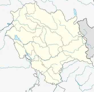 Thaneek Pura Location in Himachal Pradesh, India  Thaneek Pura Thaneek Pura (India) | |
| Coordinates: 31°49′00″N 76°08′00″E / 31.8167°N 76.1333°E | |
| Country | |
| State | Himachal Pradesh |
| District | Una |
| Elevation | 950 m (3,120 ft) |
| Time zone | UTC+5:30 (IST) |
| PIN | 177109 |
| Telephone code | 911976 |
| Website | thaneekpura |
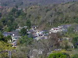
Thaneek Pura is a hill station and village (hamlet) in Chintpurni in the Una district of the state of Himachal Pradesh in India.[1] It is situated near the Chintpurni Shakta pitha Temple, which is a place of pilgrimage for Hindus. The area is surrounded by the western Himalayas in the north and east in the smaller Shiwalik (or Shivalik) range bordering the state of Punjab.
Notable sites
Temples
- Radha Krishna Temple
- Guga Zahar Veer Temple
- Mahiya Sidh Temple
- Baba Balak Naath Temple
Geography
Thaneek Pura is situated at the altitude of around 950 meters and is part of the Una district, Himachal Pradesh. It is near Bharwain, located on the Hoshiarpur-Dharmashala road. The road is part of the State Highway network.
References
- ^ "Village Code Directory: Himachal Pradesh" (PDF). Ministry of Home Affairs. Retrieved 31 December 2010.