Tempio Pausania
Tempio Pausania
Tèmpiu (Gallurese) | |
|---|---|
| Città di Tempio Pausania | |
 View of Tempio Pausania | |
 Coat of arms | |
Location of Tempio Pausania | |
 Tempio Pausania Location of Tempio Pausania in Sardinia 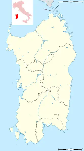 Tempio Pausania Tempio Pausania (Sardinia) | |
| Coordinates: 40°54′N 09°06′E / 40.900°N 9.100°E | |
| Country | Italy |
| Region | Sardinia |
| Province | Gallura North-East Sardinia (OT) |
| Frazioni | Bassacutena, Nuchis, San Pasquale |
| Government | |
| • Mayor | Andrea Biancareddu (Democratic Party) |
| Area | |
• Total | 210.82 km2 (81.40 sq mi) |
| Elevation | 566 m (1,857 ft) |
| Population (2025)[1] | |
• Total | 13,003 |
| • Density | 62/km2 (160/sq mi) |
| Demonym | Tempiesi |
| Time zone | UTC+1 (CET) |
| • Summer (DST) | UTC+2 (CEST) |
| Postal code | 07029 |
| Dialing code | 079 |
| Patron saint | St. Paul of Thebes |
| Saint day | August 30 |
| Website | Official website |
Tempio Pausania (Italian pronunciation: [ˈtɛmpjo pauˈzaːnja] ⓘ; Gallurese: Tèmpiu) is the capital of the province of Gallura North-East Sardinia in the autonomous region of Sardinia in Italy. It is one of I Borghi più belli d'Italia ("The most beautiful villages of Italy").[2] It has 13,003 inhabitants.[1]
History
Cultural and delegated administrative centre of the Gallura sub-region, Tempio has an ancient history. Typical granite-stone architecture of the historical centre presents many similarities with southern Corsican towns.
From 2005 to 2016 it was the co-capital of the province of Olbia-Tempio together with Olbia, with whom it is also now the co-capital of the province of Gallura North-East Sardinia.
Demographics
As of 2025, there are 13,003 people residing in Tempio Pausania, of whom 49.9% are male and 50.1% are female. Minors make up 11.6% of the population, and pensioners make up 27.0%. This compares with the Italian average of 14.9% minors and 24.7% pensioners.[1]
|
| ||||||||||||||||||||||||||||||||||||||||||||||||||||||
| Source: ISTAT[3][4] | |||||||||||||||||||||||||||||||||||||||||||||||||||||||
Climate
| Climate data for Tempio Pausania (1981–2010) | |||||||||||||
|---|---|---|---|---|---|---|---|---|---|---|---|---|---|
| Month | Jan | Feb | Mar | Apr | May | Jun | Jul | Aug | Sep | Oct | Nov | Dec | Year |
| Mean daily maximum °C (°F) | 9.0 (48.2) |
9.7 (49.5) |
12.6 (54.7) |
15.6 (60.1) |
21.2 (70.2) |
25.9 (78.6) |
30.0 (86.0) |
29.7 (85.5) |
24.6 (76.3) |
20.1 (68.2) |
13.7 (56.7) |
10.1 (50.2) |
18.5 (65.4) |
| Daily mean °C (°F) | 6.2 (43.2) |
6.5 (43.7) |
8.9 (48.0) |
11.3 (52.3) |
16.2 (61.2) |
20.3 (68.5) |
24.0 (75.2) |
24.0 (75.2) |
19.7 (67.5) |
16.0 (60.8) |
10.6 (51.1) |
7.4 (45.3) |
14.3 (57.7) |
| Mean daily minimum °C (°F) | 3.4 (38.1) |
3.3 (37.9) |
5.1 (41.2) |
6.9 (44.4) |
11.1 (52.0) |
14.6 (58.3) |
18.0 (64.4) |
18.2 (64.8) |
14.7 (58.5) |
11.8 (53.2) |
7.4 (45.3) |
4.7 (40.5) |
9.9 (49.9) |
| Average precipitation mm (inches) | 96.5 (3.80) |
74.3 (2.93) |
77.1 (3.04) |
83.6 (3.29) |
61.0 (2.40) |
27.7 (1.09) |
9.6 (0.38) |
26.1 (1.03) |
62.2 (2.45) |
88.7 (3.49) |
135.2 (5.32) |
140.0 (5.51) |
882 (34.73) |
| Source: Sistema nazionale protezione ambiente[5] | |||||||||||||
Main sights
.jpg)
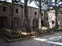
- Historical centre of the town, built in grey granite blocks (mainly 18th century); particularly Corso Matteotti, via Roma (Carrera Longa, Lu Runzatu, Lu Pultali), Piazza d'Italia (Piazza di l'Ara), Parco delle Rimembranze, Fonte Nuova (Funtana Noa) and Parco di San Lorenzo, via Mannu (ex via dei Nobili or dei Cavalieri)
- Nuraghe Maiori (Naracu Maiori)
- Nuraghe Polcu (Naracu Polcu)
- Ruins of Palace of Giudice Nino Visconti di Gallura (1200)
- San Pietro (Santu Petru) Cathedral;
- Santa Croce Church;
- Oratorio del Rosario (13th–14th century);
- Palazzo Villamarina-Pes (17th century);
- Palazzo degli Scolopi, (17th century), actually Provincial offices;
- Purgatorio (Lu Pulgatoriu) Church (17th century)
- Fonti di Rinagghju
- Monte Limbara, elevation 1,359 metres (4,459 ft), 16 kilometres (10 mi) south of the town.
Transport
Tempio Pausania has national roads with Sassari (SS 672), Olbia (SS127) and Palau (SS133). There is a railway station on the narrow gauge Sassari to Palau line, with occasional tourist train services run by Trenino Verde.
See also
References
- ^ a b c "Resident population". ISTAT.
- ^ "Sardegna" (in Italian). Retrieved 1 August 2023.
- ^ "Popolazione residente dei comuni. Censimenti dal 1861 al 1991" [Resident population of the municipalities. Censuses from 1861 to 1991] (PDF) (in Italian). ISTAT.
- ^ "Dashboard Permanent census of population and housing". ISTAT.
- ^ "Climatology of Sardinia for the thirty-year period 1981-2010". Sistema nazionale protezione ambiente. Retrieved 27 November 2024.
Sources
- Chisholm, Hugh, ed. (1911). . Encyclopædia Britannica. Vol. 26 (11th ed.). Cambridge University Press. p. 591.
 This article incorporates text from a publication now in the public domain: Herbermann, Charles, ed. (1913). "Diocese of Ampurias". Catholic Encyclopedia. New York: Robert Appleton Company.
