Takhli district
Thakli
ตาคลี | |
|---|---|
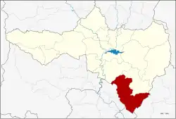 District location in Nakhon Sawan province | |
| Coordinates: 15°15′47″N 100°20′37″E / 15.26306°N 100.34361°E | |
| Country | Thailand |
| Province | Nakhon Sawan |
| Seat | Takhli |
| Area | |
• Total | 854.1 km2 (329.8 sq mi) |
| Population (2005) | |
• Total | 114,912 |
| • Density | 130/km2 (350/sq mi) |
| Time zone | UTC+7 (ICT) |
| Postal code | 60140 |
| Geocode | 6007 |
Thakhli (Thai: ตาคลี, pronounced [tāː.kʰlīː]) is the southernmost district (amphoe) of Nakhon Sawan province, Thailand.
History
The name of district originates from the tikli (polo) ground in Sang Thong, a royal novel by King Rama II. The story of Sang Thong was adapted from local folklore of Takhli, which is why many of the district's streets and public utilities are named after characters in the tale.[1]
During the Vietnam War era, Takhli was the site of a United States Air Force base. Today, it remains home to the Takhli Royal Thai Air Force Base, operated by the Royal Thai Air Force (RTAF).[2]
The establishment of the U.S. base led to Takhli becoming a well-known red-light district catering to American G.I.s. In particular, the area around Ban Takhli railway station was filled with pubs, bars, and brothels, earning it the local nickname Thanon Daeng (ถนนแดง, pronounced [tʰā.nǒn dɛ̄ːŋ], lit. 'red street'). Not all of the prostitutes were from Takhli itself; many came from nearby districts such as Taphan Hin, Bang Mun Nak, Thap Khlo, Chum Saeng, and Thap Krit. Today, these once-bustling quarters have long fallen into decline.[3]
Geography
Neighbouring districts are (from the north clockwise): Phayuha Khiri and Tak Fa of Nakhon Sawan; Nong Muang and Ban Mi of Lopburi province; In Buri of Singburi province; and Sapphaya, Mueang Chai Nat, and Manorom of Chai Nat province.
Takhli is 70 km (43.5 mi) south of Mueang Nakhon Sawan, the capital district of the province.[4]
Administration
The district is divided into 11 sub-districts (tambons), which are further subdivided into 128 villages (mubans). Takhli itself has town status (thesaban mueang) and covers part of tambon Takhli. Chong Khae is a township (thesaban tambon) and covers parts of tambons Chong Khae and Phrom Nimit. There are a further 10 tambon administrative organizations (TAO).[1]
| No. | Name | Thai name | Villages | Pop. |
|---|---|---|---|---|
| 1. | Takhli | ตาคลี | 24 | 53,322 |
| 2. | Chong Khae | ช่องแค | 12 | 9,160 |
| 3. | Chan Sen | จันเสน | 11 | 8,131 |
| 4. | Huai Hom | ห้วยหอม | 11 | 4,914 |
| 5. | Hua Wai | หัวหวาย | 14 | 9,399 |
| 6. | Nong Pho | หนองโพ | 15 | 10,519 |
| 7. | Nong Mo | หนองหม้อ | 7 | 3,862 |
| 8. | Soi Thong | สร้อยทอง | 10 | 4,618 |
| 9. | Lat Thippharot | ลาดทิพรส | 11 | 5,201 |
| 10. | Phromnimit | พรหมนิมิต | 9 | 5,786 |
See also
References
- ^ a b "อำเภอตาคลี" [Thakhli district]. rdi.nsru.ac.th (in Thai).
- ^ Glasser, Jeffrey D. (1998). The Secret Vietnam War: The United States Air Force in Thailand, 1961–1975. McFarland & Company. ISBN 0-7864-0084-6.
- ^ "กรงกรรม เปิดมุมมอง "เรณู กะหรี่ ตาคลี" จาก ศึก เรณู อีย้อย แห่ง ละครกรงกรรม โดยคนอำเภอตาคลี นครสวรรค์". Med Hub News (in Thai). 2019-04-12. Retrieved 2021-04-23.
- ^ FM 96.5 (2023-12-25). "⭕️รายการ #คุยได้คุยดี #TalkNewsAndMusics". Facebook (in Thai). Retrieved 2023-12-25.
{{cite web}}: CS1 maint: numeric names: authors list (link)
External links