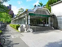
Taipower Building metro station
Taipower Building G08 台電大樓 | |||||||||||||||||||
|---|---|---|---|---|---|---|---|---|---|---|---|---|---|---|---|---|---|---|---|
 Platform | |||||||||||||||||||
| Chinese name | |||||||||||||||||||
| Traditional Chinese | 台電大樓 | ||||||||||||||||||
| Simplified Chinese | 台电大楼 | ||||||||||||||||||
| |||||||||||||||||||
| General information | |||||||||||||||||||
| Location | B1F 63-3 Sec. 3 Roosevelt Rd. Zhongzheng and Da'an, Taipei Taiwan | ||||||||||||||||||
| Operated by | Taipei Metro | ||||||||||||||||||
| Line(s) | |||||||||||||||||||
| Connections | Bus stop | ||||||||||||||||||
| Construction | |||||||||||||||||||
| Structure type | Underground | ||||||||||||||||||
| Other information | |||||||||||||||||||
| Station code | G08 | ||||||||||||||||||
| History | |||||||||||||||||||
| Opened | 11 November 1999 | ||||||||||||||||||
| Passengers | |||||||||||||||||||
| 32,676 daily (December 2024)[1] | |||||||||||||||||||
| Rank | (Ranked 52 of 119) | ||||||||||||||||||
| Services | |||||||||||||||||||
| |||||||||||||||||||
| |||||||||||||||||||
The Taipei Metro Taipower Building station is a station on the Songshan–Xindian line located on the border in Taipei, Taiwan.
Station overview

The two-level, underground station has an island platform and five exits.[2][3] Some trains from Songshan terminate here and reenter service by utilizing the pocket track south of the station.
History
During initial planning in 1980, the station was to be named Sanzong (三總), after the Tri-Service General Hospital which has since relocated to Neihu.
Station layout
| Street Level | Entrance/Exit | Entrance/Exit |
| B1 | Concourse | Lobby, information counter, automatic ticket-dispensing machines, one-way faregates |
| Restrooms(North side outside fare zone, near exit 2), Taipower Building ATM | ||
| B2 | Platform 1 | ← |
| Island platform, doors will open on the left | ||
| Platform 2 | → → | |
Select Songshan–Xindian line trains terminate here during non-rush hours.
Around the station
- Taipei Cultural Mosque
- Shida Park
- Taipei Hakka Cultural Park
See also
References
Wikimedia Commons has media related to Taipower Building Station.
- ^ "Ridership Counts". Taipei Rapid Transit Corporation. 2025-03-25.
- ^ "Route Map: Taipower Building". Taipei Rapid Transit Corporation. Archived from the original on 2010-08-08. Retrieved 2010-06-14.
- ^ "第二章 站場規劃". Department of Rapid Transit Systems. Archived from the original on 2012-03-15. Retrieved 2011-05-15.
| Stations |
| ||||||||
|---|---|---|---|---|---|---|---|---|---|
| Rolling stock |
| ||||||||
25°01′14″N 121°31′42″E / 25.020522°N 121.528325°E