Svetovrachene
Svetovrachene | |
|---|---|
Village | |
 | |
 Svetovrachene | |
| Coordinates: 42°46′54.8″N 23°23′1.64″E / 42.781889°N 23.3837889°E | |
| Country | |
| Province | Sofia City |
| Municipality | Stolichna Municipality |
| Elevation | 522 m (1,713 ft) |
| Population (2206)[1] | |
• Total | 1,430 |
| Time zone | UTC+2 (EET) |
| • Summer (DST) | UTC+3 (EEST) |
| Postal code | 1252 |
Svetovrachene (Bulgarian: Световрачене) is a village in Novi Iskar district of the Bulgarian capital Sofia, located some 12 km north of the city center. As of 2024 it has 2,206 inhabitants.[1][2]
Geography
The village is situated at an altitude of 522 m in the central part of the Sofia Valley, across on the north bank of the river Lesnovska reka shortly before its confluence with the Iskar. It falls within the continental climatic zone. The soils are alluvial.[2][3]
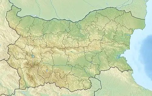
Administratively, Svetovrachene is part of the Novi Iskar district of Stolichna Municipality in the northern part of the Sofia City Province. It has a territory of 4.958 km2.[4] The closest settlements are the outskirts of the town of Novi Iskar to the north, and the villages of Podgumer to the north, Voynegovtsi to the northeast, Negovan to the southeast, and Kubratovo to the southwest.
Svetovrachene is located south of the Sofia Ring Road and lies close to the Europe motorway (A6). There is a railway used for freight traffic running along its northern outskirts, as well as a railway station. It is served by several bus lines of the Sofia Public Transport.[5]
Economy
There two chemical factories producing rubber, paints and varnishes. There are farmlands dedicated to grain, sunflower and vegetables, as well as livestock breeding.[2][3]
Culture
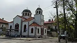
The village was first mentioned in 1450. The local school was established in 1892. There is a church dedicated to the Saints Cosmas and Damian. The local cultural center, known in Bulgarian as a chitalishte, was founded in 1925 and is named after the revolutionary Hristo Botev.[3][6]
Citations
- ^ a b "Tables of Persons Registered by Permanent Address and by Current Address". Official Site of the Civil Registration and Administrative Services (GRAO). Retrieved 16 August 2025.
- ^ a b c Geographic Dictionary of Bulgaria 1980, p. 430
- ^ a b c Encyclopaedia Bulgaria, Volume VI 1988, p. 96
- ^ "Bulgaria Guide, Svetovrachene". Retrieved 16 August 2025.
- ^ "A Map of the Republican Road Network of Bulgaria". Official Site of the Road Infrastructure Agency. Retrieved 11 August 2025.
- ^ "Chitalishte Hristo Botev-1925, Svetovrachene". Register of the Chitalishta of Bulgaria. Retrieved 16 August 2025.
References
- Георгиев (Georgiev), Владимир (Vladimir) (1988). Енциклопедия България. Том VI. С-Ти [Encyclopaedia Bulgaria. Volume VI. S-Ti] (in Bulgarian). и колектив. София (Sofia): Издателство на БАН (Bulgarian Academy of Sciences Press).
- Мичев (Michev), Николай (Nikolay); Михайлов (Mihaylov), Цветко (Tsvetko); Вапцаров (Vaptsarov), Иван (Ivan); Кираджиев (Kiradzhiev), Светлин (Svetlin) (1980). Географски речник на България [Geographic Dictionary of Bulgaria] (in Bulgarian). София (Sofia): Наука и култура (Nauka i kultura).