Tsoo-Yess River
| Tsoo-Yess River c'u•yas | |
|---|---|
 Aerial photograph of the mouth of Tsoo-Yess River on the Makah Reservation. | |
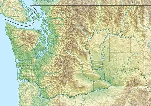 Location of the mouth of the Tsoo-Yess River in Washington | |
| Location | |
| Country | United States |
| State | Washington |
| County | Clallam |
| Physical characteristics | |
| Source | Olympic Mountains |
| • coordinates | 48°13′38″N 124°29′50″W / 48.22722°N 124.49722°W[1] |
| Mouth | Pacific Ocean |
• coordinates | 48°19′27″N 124°39′27″W / 48.32417°N 124.65750°W[1] |
• elevation | 0ft |
| Length | 14.5 miles |
The Tsoo-Yess River, sometimes called the Sooes River, is a stream on the Olympic Peninsula in the state of Washington in the United States. It originates in the northwestern Olympic Mountains and empties into the Pacific Ocean. [2] The Makah National Fish Hatchery is located approximately 2 miles (3.2 km) upstream and raises a variety of salmonid species.
Course
The Tsoo-Yess River originates in the northwestern portion of Olympic Peninsula and flows generally northwest. Its tributaries include Snag Creek, Shafter Creek, Pilchuck Creek, Thirty Cent Creek, Miller Creek, Grimes Creek, Tyler Creek, and Kallapa Creek. Its lower reach flows through the Makah Reservation. It empties into the Pacific at Tsoo-Yess Beach on Makah Bay, about a mile (1.6 km) south of the mouth of the Waatch River.[2]
See also
References
- ^ a b U.S. Geological Survey Geographic Names Information System: Sooes River
- ^ a b General course info from USGS topographic maps accessed via the "GNIS in Google Map" feature of the USGS Geographic Names Information System website.