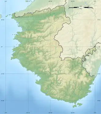
Sobietoshima
Native name: ソビエト島 | |
|---|---|
 Picture of the islet (top far right) next to Oki-no-Kuroshima (top far left) | |
 Sobietoshima  Sobietoshima | |
| Geography | |
| Location | Pacific Ocean |
| Coordinates | 33°30′31″N 135°33′08″E / 33.5087°N 135.5521°E |
| Length | 5 m (16 ft) |
| Width | 10 m (30 ft) |
| Highest elevation | 5 m (16 ft) |
| Administration | |
| Prefecture | Wakayama Prefecture |
| Town | Susami |
| District | Mizuro |
| Demographics | |
| Population | 0 |
Sobietoshima (Japanese: ソビエト島), also Sobieto (ソビエト or ソビエット) is an uninhabited islet in Wakayama Prefecture, Japan. It is famous for its unusual name resembling the Soviet Union ("sobieto" means "Soviet" in Japanese, so the name can be interpreted as "Soviet Island") and the unknown origin of the name.[1][2]
Etymology
The origin of the name of the island is unknown and subject to debate. It is believed that the name "Sobieto" predates the foundation of the Soviet Union in 1922. According to locals, the islet was named "Sobieto" by the locals since ancient times. According to Kiyoshi Taniguchi, a local in the area, the name comes from the Japanese term in Wakayama dialect for "towering shape".[3][1] It is also unknown why the islet's name was written in katakana.[4]
The islet was not officially named until August 1, 2014, when the Minister of State for Ocean Policy under former Japanese prime minister Shinzo Abe officially named the 158 uninhabited islands from 22 prefectures in Japan, including Sobietoshima. The act was made as the basis for determining the scope of Japan's territorial waters.[3][5]
Geography
Sobietoshima is a small uninhabited islet or skerry about 1 kilometer (0.62 mi) off the coast off Mirozu (見老津[6]), Susami, Wakayama in Japan. It is located south of Kii Peninsula, behind the island of Oki-no-Kuroshima, thus not visible on the coast. It is about 5 metres (16 ft) long, about 10 metres (33 ft) wide and about 5 metres (16 ft) high.[7][1][8][4]
The island can only be accessed by ferry from Mirozu port. It is used by fishermen in the area for rock fishing, although it is also known for being dangerous as waves can hit the fishermen because of its rough topography.[7][4]
In popular culture
The island is featured in an episode of the NHK program Wabi Tabi aired on May 9, 2016.[9]
See also
References
- ^ a b c "なんで「ソビエト」? 無人島の名称が話題に すさみ町見老沖". Kiiminpo. August 21, 2014. Archived from the original on August 21, 2014. Retrieved August 3, 2025.
- ^ "日本なのに「ソビエト」!?…全国158の離島に命名". TV Asahi (in Japanese). August 1, 2014. Retrieved August 3, 2025.
- ^ a b "指定されたページは見つかりませんでした。|週プレNEWS[週刊プレイボーイのニュースサイト]". Shueisha (in Japanese). August 28, 2014. Retrieved August 3, 2025.
- ^ a b c "日本には「ソビエト」という名前の「島」がある(動画)". The Huffington Post (in Japanese). August 3, 2014. Retrieved August 3, 2025.
- ^ "無人島命名で「ソビエト」「ヘソイシ」". Okinawa Times. August 2, 2014. Archived from the original on August 22, 2014. Retrieved August 3, 2025.
- ^ Mirozu fishing port
- ^ a b "和歌山に「ソビエト」? ロシアも驚く不思議スポット". The Asahi Shimbun. January 3, 2017. Archived from the original on January 3, 2017. Retrieved August 3, 2025.
- ^ "地図の散歩道:日本にソビエトという地名が誕生". Japan Map Center. November 20, 2014. Retrieved August 3, 2025.
- ^ "イノブータン王国(すさみ町)". NHK. May 6, 2016. Archived from the original on May 26, 2016. Retrieved August 3, 2025.